Tell Sabi Abyad: A Neolithic and Middle Assyrian Settlement in Syria
Site at a Glance
- Popularity
- Medium
- Country
- Syria
- Primary era
- Stone Age
- Eras represented
- Stone Age, Bronze Age, Iron Age
- Civilizations
- Assyrian
- Site type
- Settlement
- Remains
- Village
On this page16 sections
History
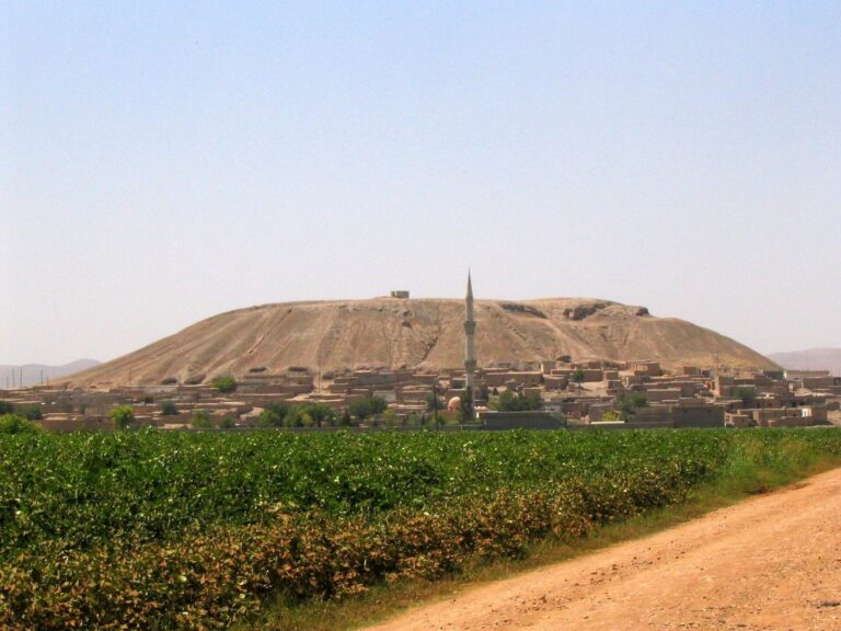
Tell Sabi Abyad is an archaeological settlement in the Balikh River valley of northern Syria, near the modern village of Hammam et-Turkman. Occupied from around 7550 BC, its four mounds preserve successive Neolithic, Halaf, and Middle Assyrian phases, with settlement shifting between them over time. The Halaf period was a prehistoric cultural period of northern Mesopotamia and nearby regions.
Neolithic and Halaf settlement
Tell Sabi Abyad II was occupied during Pre-Pottery Neolithic B, an early Neolithic phase before pottery became widespread, from approximately 7550 to 6850 BC. Pottery dated to about 6900–6800 BC, the earliest found in Syria, came from the site. By around 6700 BC, pottery was being made in quantity. Tell Sabi Abyad I had a later Neolithic sequence that continued through much of the sixth millennium BC.
The main mound’s sixth-millennium sequence includes regional phases labelled Balikh IIA, IIC, IIIA, and IIIB, marking successive settlement periods. These are dated approximately to 5700 BC, 5500–5200 BC, 5200–5100 BC, and 5100–5000 BC respectively; the last corresponds to the early Halaf period. A settlement break of perhaps 200–300 years around 5800 or 5700 BC is possible, although occupation of the main mound was broadly continuous during the sixth millennium.
Painted pottery appeared early, then seems to have gone out of use for centuries before painted designs returned around 6200 BC. The reason for the first change is uncertain. Around that time, new building forms and storage practices appeared alongside changes in pottery and projectile points, an increase in clay spindle whorls, and the use of seals to mark ownership and regulate stored goods. These developments may have been connected to the 8.2-kiloyear event, a major climatic episode around 6200 BC, but the settlement continued to be occupied.
A severe fire destroyed a village around 5200 BC. The event preserved evidence of household storage, food preparation, and administration, including sealings and counting tokens that point to an established system of record-keeping.
Middle Assyrian estate
After a long settlement hiatus, a fortified estate was established on the summit of Tell Sabi Abyad I during the Late Bronze Age. Its oldest identified feature was a large tower dated to the Mitanni period, a kingdom of northern Mesopotamia and Syria, around 1300–1230 BC. Assyrians fortified the site between 1230 and 1197 BC and dug a ditch around it. In the following phase, dated to 1196–1183 BC, the ditch gradually filled with settlement debris and buildings were altered.
The complex served as a military outpost, an administrative centre, and a station on the trade route linking Karkemish on the Euphrates with Assur, an early Assyrian capital. For much of its use, it belonged to Ilī-padâ, Assyria’s grand vizier and viceroy of Hanilgabat, whose family was related to the royal house. The estate was his country residence and a base for managing agricultural holdings. Texts naming his father, Aššur-iddin, suggest that the property may have belonged to the family and helped support a court household in the capital. The estate appears to have been abandoned and partly destroyed at the end of the 1196–1183 BC phase. Cuneiform texts show that Assyrian administrators remained in the area until the end of the twelfth century BC, as settlement declined.
Excavation and damage
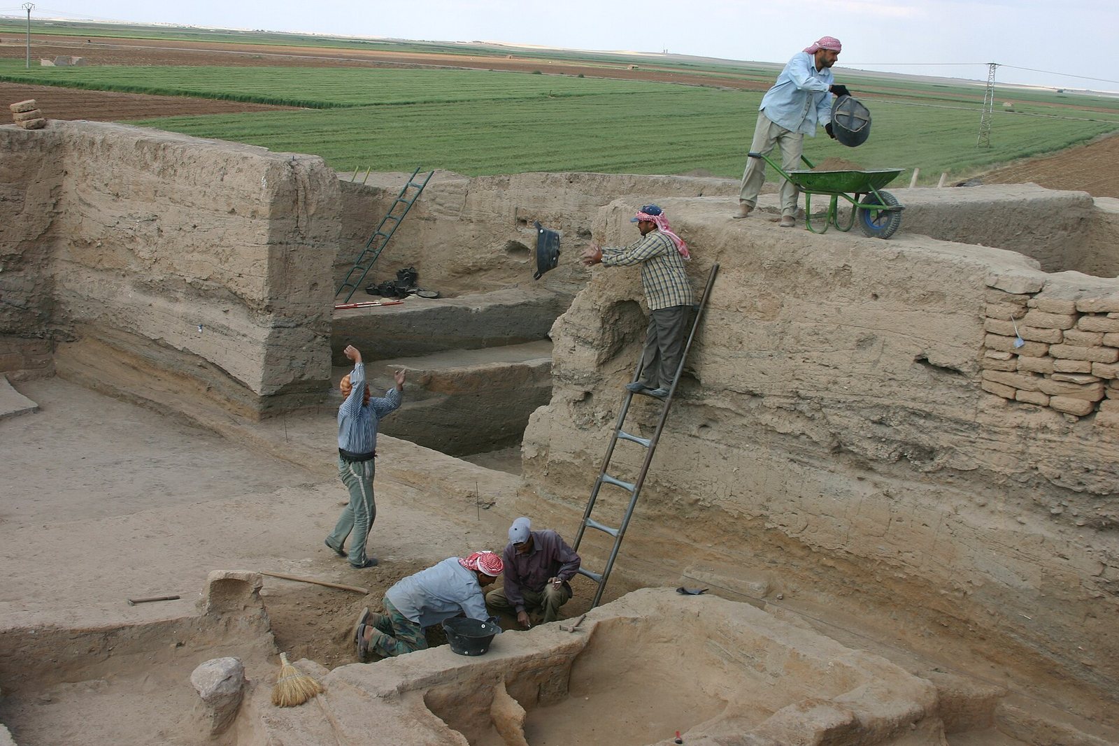
Archaeological work began with a sounding on Tell Sabi Abyad I in 1986 under Leiden University archaeologist Peter Akkermans. The first main-mound season followed in 1988, with further work in 1991–92, 1994–99, and 2001–03. Soundings on Tell Sabi Abyad III took place in 2005 and 2010. The fourth mound was surveyed, but its use as a local cemetery prevented excavation. Fieldwork ended with the outbreak of warfare.
In 2014, looters targeted the site and some archaeological storage facilities during the Syrian Civil War, and military activity caused substantial damage. More than 400 cuneiform tablets excavated from the fortress were held in the Raqqa Museum. Silicone molds had been made for their study; after the museum was looted, the molds became the only textual witnesses to the tablets. In 2017–18, the Scanning for Syria project used micro-CT scanning and digital reconstruction to create detailed images and models of the fragile molds, along with three-dimensional replicas. Encroaching development has also heavily damaged the site.
Remains
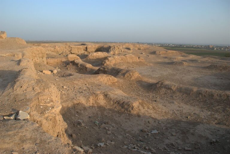
The four mounds lie roughly along a north–south line and rise from the Balikh plain. Tell Sabi Abyad I, the largest, measures about 240 by 170 metres, covers roughly 4–5 hectares, and rises around 5–10 metres above the plain. The wider site is estimated at 11 hectares, or 15–16 hectares when city walls are included; an outer town covered about 4 hectares. Windblown deposits and Balikh River floods have reshaped the surrounding ground and may have buried further settlement areas.
Settlement mounds and layers
Tell Sabi Abyad II
This mound measures approximately 75 by 123 metres and rises about 4.5 metres above its surroundings. Eight occupation layers extend from the surface to undisturbed ground. The uppermost belongs to the Ceramic Neolithic; layers 2–8 include buildings with walls made from compacted earth. Finds include flint tools, mostly fashioned from local stone, and a larger number of obsidian objects. The obsidian may have come from the volcanic region around Bingöl, though whether finished blades were brought to the settlement is uncertain.
Tell Sabi Abyad I
Excavations in the mound’s southeast distinguished eleven building and occupation layers. The lowest levels were reached only in part of the excavated area, where undisturbed ground lay about four metres below the surrounding modern fields. Layer 11 contained simple, neckless pottery vessels. Layer 3, dated to around 5100–5050 BC, followed the levelling of an upper terrace. It lay directly above layer 6 in places where buildings from the intervening layers 4 and 5 had not survived.
Early Halaf buildings
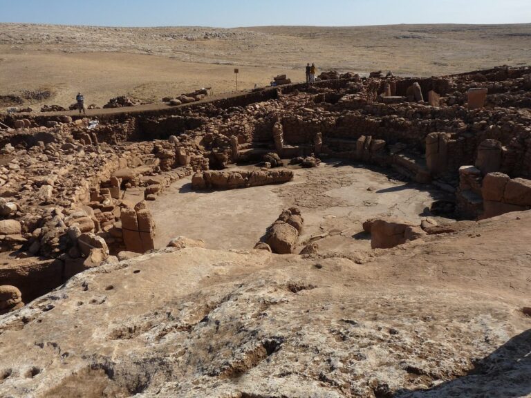
The layer 3 settlement, from the early Halaf period, was exposed across about 875 square metres. Its walls survive to heights of up to 1.5 metres. Construction took place in three stages. A substantial stone wall became part of a large building with several rooms, and a later building was erected farther south.
Neolithic buildings and storage
Storage building on the northeast side
A storage building on the northeast side of the main mound was dated by radiocarbon samples to around 6100 BC. Its ground plan was T-shaped: three parallel rooms opened at right angles onto a long room. The compacted-earth walls stand more than a metre high and have no doorways, suggesting access through the roof or through openings high in the walls. Their thickness, along with objects found above floor level among collapsed walls and charred beams, points to a second storey or an inhabited roof space.
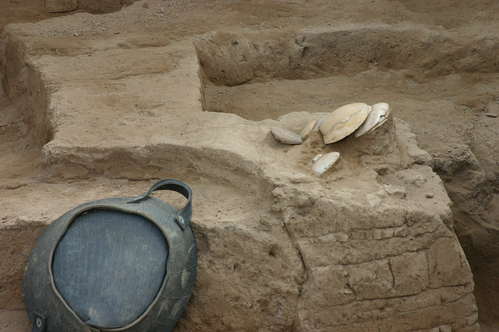
Many objects came from the building, including mortars and pestles made of basalt and other stones from outside the region. The nearest identified basalt source is about 100 kilometres away in what is now eastern Turkey. Clay sealings used to mark goods and counting tokens support the interpretation of the building as a storehouse. One room contained the skeleton of a young woman, lying on her side with her legs bent and half a mace head beneath one hand. Her burial on the floor rather than beneath it, together with the mace head, a status symbol, has been taken to suggest that she held a particular social standing.
Village buildings and household storage
The village in layer 6 was exposed across about 800 square metres on two terraces. It comprised eight large buildings with many rectangular rooms, four larger circular structures, and several ovens in and between the houses. Buildings on the slope stood about two metres below those higher on the mound, so that the upper houses’ floors were roughly level with the roofs of the lower ones. Finds indicate that people also used the roofs for activities.
The closely spaced houses covered about 90–120 square metres each. Some contained at least fifteen small rooms, usually measuring three to five square metres. Their walls were generally about 40 centimetres thick, built of compacted earth on simple foundations and usually coated with mud plaster. Some rooms connected by doorways; others appear to have been entered from above. Charred beams and fired mud bearing reed and pole impressions show how roofs were made: wooden poles crossed the walls, reed mats covered them, and a thick layer of mud sealed the surface.
Many small rooms functioned as storage spaces or grain silos. One retained a knee-high deposit of charred grain; others held storage vessels, basket remains, and numerous clay sealings that had closed containers. Grinding stones and pottery relate to food preparation. An archive-like room contained hundreds of objects, including pottery, stone bowls and axes, bone tools, and clay figures of men and women. More than 150 sealings bearing stamp impressions and small counting tokens came from this room. Across the site, excavators found more than 275 tokens and sealings, including impressions from at least 61 stamp seals. The sealings were made from local clay.
Other finds and subsistence
Pottery and personal objects
The pottery includes Dark Faced Burnished Ware, a dark, polished type, and fine wares resembling those associated with Hassuna and Samarra. Bowls and jars often have angled necks and geometric designs, sometimes with horned animals. Only about six percent of the pottery was made locally. Some vessels from the village bear black strokes of bitumen applied after firing. Chemical analysis and comparison with nearby sources indicate that the bitumen came from Zakho or Kirkuk in modern Iraq. Early pottery also includes mineral-tempered wares, made with mineral particles mixed into the clay, some of them painted. Finds from the main mound’s 1988 excavation included lip ornaments called labrets, stamp seals, and more than 1,000 unfired clay sling missiles stored in a container.
Animal and plant remains
Halaf-period animal remains point to farming based chiefly on domesticated goats, with sheep, cattle, and pigs also kept. A small number of gazelle were hunted, while evidence for hunting and fishing is limited. Poplar, willow, and ash grew in the area. Domesticated emmer wheat was the main crop, alongside einkorn wheat, barley, and flax; peas and lentils were present in smaller quantities.
Middle Assyrian estate
The fortified estate measured about 60 by 60 metres and was enclosed by a square ditch with sides of roughly 80 metres. Its principal building, oriented northeast–southwest, measured approximately 23 by 21 metres. It had eight rooms, mud-brick walls about 2.5 metres thick, and a staircase to a second floor. Domestic buildings stood within the complex. The remains also include ovens, silos, pottery, grinding stones, seals, and sealings. More than 400 cuneiform tablets, writing made by pressing wedge-shaped marks into clay, came from the estate and date to the late thirteenth and twelfth centuries BC.