Tel Mevorakh: A Multi-Period Settlement Mound in Israel
Site at a Glance
- Rating
- 3.7
- Popularity
- Very Low
- Country
- Israel
- Primary era
- Bronze Age
- Eras represented
- Bronze Age, Iron Age, Classical
- Civilizations
- Achaemenid, Israelite, Phoenician, Roman
- Site type
- Military
- Remains
- Fortified Town
On this page20 sections
History
Tel Mevorakh is a small settlement mound at Beit Hanania in Israel, near the southern bank of Nahal Taninim. Occupied through several periods from the Middle Bronze Age onward, it controlled a passage between southern and northern Canaan near the Mediterranean coast, fresh water, marshland, and the Via Maris, the major ancient coastal route linking Egypt and the southern Levant with northern Syria and Anatolia. More than 15 settlement layers accumulated on the mound, creating about 8 metres of occupation deposits, although its limited area restricted the growth of a large settlement.
Name, setting, and identification
The mound’s identification remains uncertain. Tel Mevorakh translates an earlier Arabic name meaning “Blessed Mound,” but neither name appears in ancient written sources. The site has sometimes been associated with Crocodilompolis, a settlement mentioned in fourth-century BCE texts, although that place is more commonly identified with nearby Tel Taninim. The mound lies on a flat coastal plain at the boundary of the Sharon Plain and the narrow coastal zone beside Mount Carmel. Nahal Ada is to the southwest, while the Ramat ha-Nadiv and Mount Carmel uplands rise to the northeast.
Middle and Late Bronze Ages
Tel Mevorakh had a substantial Middle Bronze Age occupation. During the early Middle Bronze IIA, a rectangular mudbrick fortress was established, perhaps as an Egyptian foundation or a local administrative outpost. Settlement spread beyond the fortress during the later Middle Bronze IIA, when residential buildings covered the mound. In Middle Bronze IIB, a high earthen rampart, a defensive embankment made mainly from compacted earth, enclosed the settlement, and a new central military fortress or garrison remained in use until the end of the period.
During the Late Bronze Age, the settlement contained a temple complex of three sanctuaries built one above another. It served as a roadside sanctuary for travellers and traders using the coastal route and stood under the authority of Tel Dor, an important coastal city. The surrounding landscape was shaped by Nahal Taninim and the Kabara Marsh, giving the small settlement a religious and strategic role despite its restricted size.
Iron Age administration
A structure dating to the late eleventh century BCE was destroyed, and a larger building was erected over it during the second half of the tenth century BCE. The later building has been interpreted as a regional administrative centre connected with Dor. The settlement may reflect a change from an earlier Phoenician affiliation to an Israelite one, although that interpretation remains debated. Its pottery included mainly local wares together with Phoenician and Cypriot imports.
Persian and Hellenistic occupation
Three settlement phases belong to the Persian period, when the eastern Mediterranean was governed by the Achaemenid Empire. The earliest phase included a large pit dating to about 450 BCE, while the middle phase, approximately 450 to 325 BCE, contained a large farm on the western side of the mound. The upper phase, dated approximately 350 to 333 BCE, involved a larger agricultural estate or administrative centre, probably protected by casemate walls. These fortifications used parallel walls with internal chambers.
A gap of about a century separated the Persian and Hellenistic occupations. The Hellenistic settlement had two construction phases, probably dating to the second century BCE. Damage from erosion, abandonment, later grave digging, and the removal of building stones affected the remains, and the site was abandoned during the Hellenistic period.
Roman, Byzantine, and later use
Under Roman and Byzantine rule, Tel Mevorakh and its surroundings belonged to the territory of Caesarea, the Mediterranean port founded by Herod the Great in the first century CE. Activity by Caesarea’s inhabitants in the surrounding landscape probably accounts for isolated pottery fragments and coins at the mound. A Roman wall on the northern slope has no securely established function. A Roman aqueduct carrying water toward Caesarea ran about 100 metres south of the mound. Built under Herod and rebuilt under Hadrian, it carried inscriptions connected with Roman legions and sculptural images.
A Roman mausoleum, a monumental tomb for an individual or family, was built in the third century CE within a cemetery on the eastern side of the mound. It probably belonged to a wealthy family. From the Crusader period through the nineteenth century, the summit served as a cemetery. The nearby Arab village of Jisr az-Zarqa used it for burials, including at least 42 excavated graves. One grave contained a silver coin associated with Amaury I, a twelfth-century Crusader king of Jerusalem, and glass plaques dating to the twelfth or thirteenth century. Four child burials in jars probably date to the mid-nineteenth century and were associated with nomadic or itinerant workers of Egyptian origin.
Excavation and investigation
Organized excavations took place during four seasons from 1973 to 1976 under the Institute of Archaeology of the Hebrew University of Jerusalem, directed by Ephraim Stern. Earlier work had exposed a Roman mausoleum in the 1920s, while pipeline construction in the 1960s revealed a tenth-century BCE shaft tomb. A rescue excavation near the mound followed in 2005, adding to the evidence for the site’s long and varied occupation.
Remains
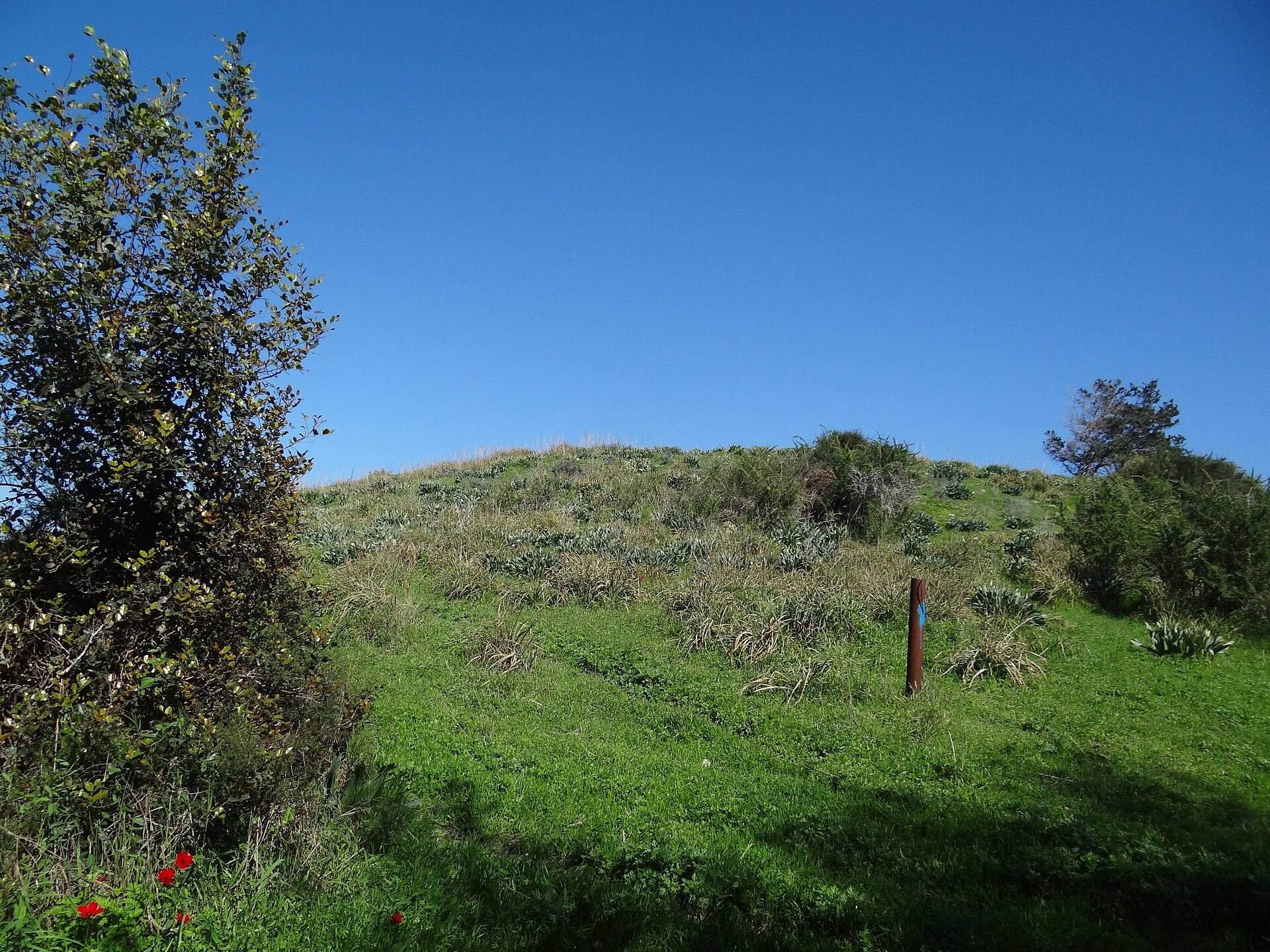
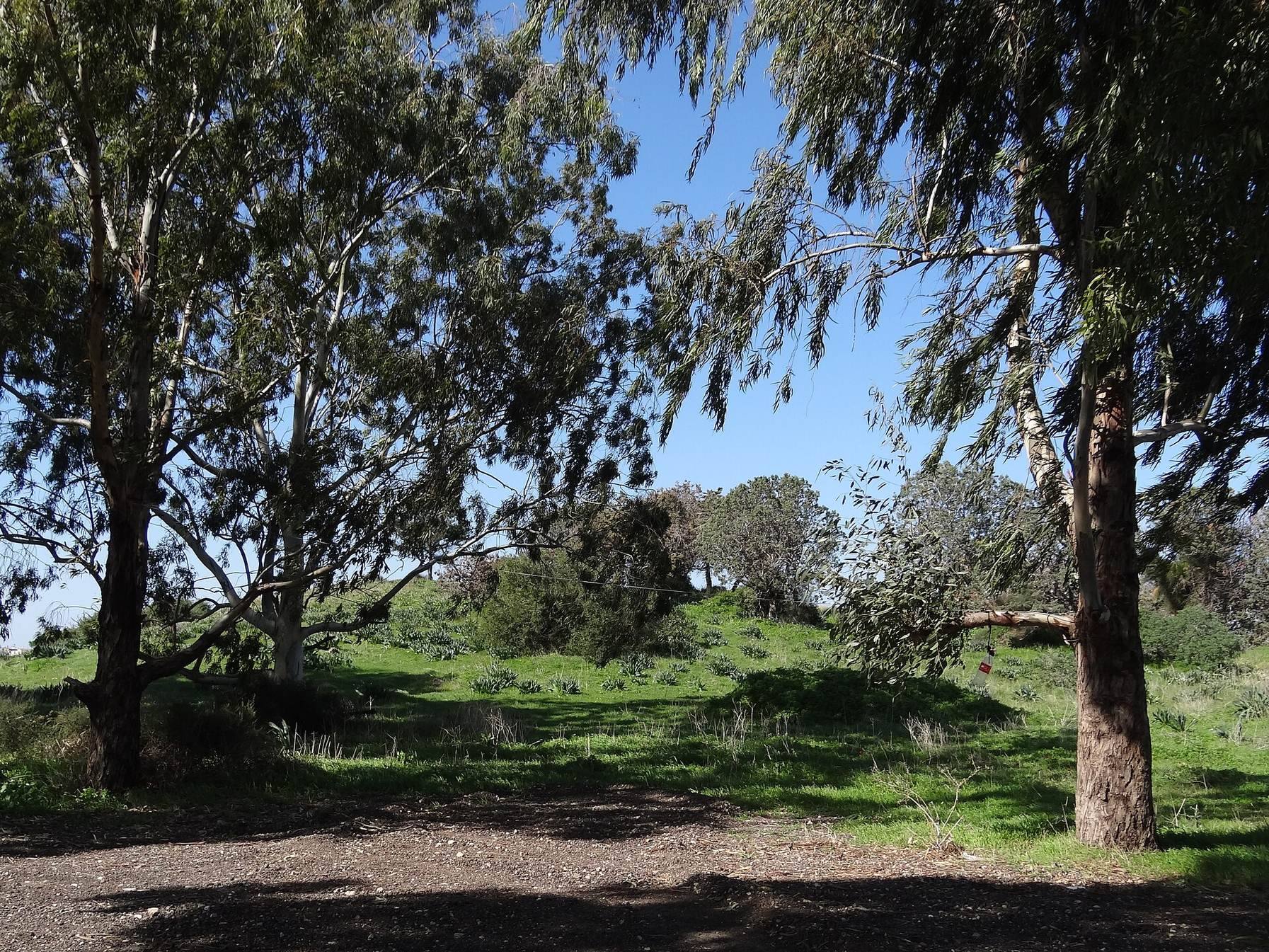
Tel Mevorakh covers less than 1 dunam, approximately 0.25 acres, and rises about 15 metres above the surrounding plain. Its natural hill is about 7 metres high, while the remaining elevation consists of accumulated settlement deposits. The mound’s physical sequence includes Middle Bronze fortifications, a Late Bronze religious complex, an Iron Age administrative building, Persian and Hellenistic structures, a Roman wall and mausoleum, and a later cemetery.
Middle Bronze fortifications
Early fortress
The earliest Middle Bronze settlement included a rectangular fortress constructed from mudbrick. Later residential buildings spread across the mound, showing the expansion of occupation beyond the original stronghold. The early settlement was not enclosed by a continuous wall.
Rampart and central garrison
During Middle Bronze IIB, the settlement gained a high earthen rampart and a central military fortress or garrison. The rampart formed a defensive embankment around the settlement, while the central installation maintained the military character of the later Middle Bronze phases.
Late Bronze temple
The Late Bronze temple was a large building containing three sanctuaries placed above one another. Its principal hall was almost completely exposed. The hall measured about 10 by 5 metres, followed an east-west orientation, and had plastered walls and a plastered floor. A platform in the northwestern corner stood about 1 metre high, measured approximately 1.5 metres by 1 metre, and was reached by five steps. An approximately 8-metre-long bench stood east of the platform, while a large circular stone in the centre of the hall may have served as a column base.
The temple yielded objects associated with ritual activity and long-distance connections. Finds included two Mitannian-style cylinder seals, a style linked to the Bronze Age cultural sphere of northern Mesopotamia and Syria, as well as cups, cymbals, glazed faience plaques, weapons, and offering bowls. Imported Cypriot pottery appeared alongside locally made vessels, jars, jugs, small jars, bowls, oil lamps, and goblets. The imported group included white-slipped bowls and tankards, ring-based vessels, and monochrome bowls. A distinctive 20-centimetre-long figurine represented a coiled serpent and is known as a bronze serpent.
Iron Age buildings and tomb
Four-room house and courtyard
The large Iron Age building from the second half of the tenth century BCE followed a four-room house plan, an arrangement of elongated spaces organized around a central courtyard or dividing area. It stood within a broad courtyard and was enclosed by an outer wall. The floor consisted of compacted chalk, and the walls were about 1.5 metres thick. Several alterations changed the building over time, and many of its bricks were later removed.
Its pottery included local household vessels, white-painted Cypriot imports, and bichrome Cypro-Phoenician pottery, a class reflecting connections between Cyprus and Phoenicia. Two finely made cooking pots were found inside the building. One carried a Paleo-Hebrew letter resembling shin, although the purpose of such marks remains uncertain.
Nearby shaft tomb
A tenth-century BCE shaft tomb near the mound contained local pottery and imports from Cyprus and Phoenicia. The vessels included red-slipped Phoenician and Cypro-Phoenician forms, together with dozens of other ceramic objects. The tomb was discovered during pipeline construction in the 1960s.
Persian and Hellenistic structures
Persian-period remains included deep pits containing ash, bones, and pottery. One pottery fragment carried seal impressions resembling Judean seal impressions. A middle-period structure occupied the western side of the mound. The upper-period building extended across the entire mound and continued beyond the excavated area. It was probably enclosed by casemate walls and may have included towers and a second storey, although only its foundations survived well enough to suggest these features.
The Hellenistic remains consist of two poorly preserved construction phases and sections of masonry rather than a complete settlement plan. Erosion, long abandonment, later Crusader and Muslim graves, and the removal of building stones affected the surviving structures.
Roman remains and the Caesarean water system
Roman wall and mausoleum
The Roman wall on the northern slope is the only clearly identified Roman or Byzantine architectural feature on the mound. On the eastern slope, the third-century Roman mausoleum was built from ashlar masonry, carefully dressed stone blocks. It contained two sculpted marble sarcophagi, stone coffins decorated with reliefs from Greek mythology. One depicts a battle between Greeks and Amazons and is displayed in the Israel Museum.
Caesarean aqueduct
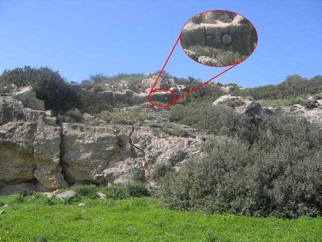
The aqueduct serving Caesarea ran south of the mound. Its surviving inscriptions refer to Legio X Fretensis, Legio VI Ferrata, Legio II Traiana Fortis, and another unidentified legion. One inscription included an insignia. Sculptural decoration on parts of the aqueduct showed Nike, the Greek personification of victory, and Atlas, the mythological figure condemned to support the heavens.
Summit cemetery
The later cemetery contained several burial forms. Some were simple cist graves cut into the soft soil, while others were deeper rectangular chambers lined with stone slabs, probably reusing Roman material. Another grave was covered with small stones. Four children were buried in ceramic jars, a form in which an infant’s body was placed inside a large vessel. The burials followed an east-west orientation, with the bodies facing south toward Mecca.
Objects associated with the graves included iron, bronze, and glass jewellery, semi-precious stones, a silver Crusader coin, and three glass plaques probably used as magical or protective objects. The cemetery remained in use from the Crusader period through the nineteenth century, adding a later funerary layer to the mound’s sequence of settlement and religious remains.