Tangchaodun City Ruins: The Tang County Seat of Puli in China
Site at a Glance
- Popularity
- Medium
- Country
- China
- Primary era
- Medieval
- Eras represented
- Medieval, Modern
- Civilizations
- Tang, Yuan
- Site type
- Settlement
- Remains
- Town
On this page22 sections
History
Tangchaodun City Ruins are the remains of Puli, a former Tang county seat in the northeastern part of Qitai town, China. Construction began in 640, during the Tang dynasty (618-907), and the city later served as an eastern strongpoint of the Beiting Protectorate, the Tang frontier administration in the region.
Foundation and Tang frontier
Puli County and Tingzhou, a Tang prefecture, were established at about the same time. Radiocarbon dating of the earliest deposits and the wall made of rammed earth, soil compacted in layers, produced a result of 596 ± 42 CE. Tang-style pottery and metal objects, the city’s scale, and its position east of Tingzhou on a route between the Dushan military post and Tingzhou also support its identification as Puli. Its size was consistent with an administrative county town and a Tang ward, a planned urban block. Comparisons with other regional cities are less certain.
In 641, Tang forces defeated Yipi Dulu Qaghan, a Turkic supreme ruler. Large numbers of migrants then began moving west, and Tingzhou introduced the commandery-and-county system, a form of territorial administration. Puli became an important eastern strongpoint of the Beiting Protectorate. Like Tingzhou, it endured repeated warfare and rebuilding during Tang conflicts with Tibetan and Turkic powers.
The city remained in use under the Gaochang Uyghurs, whose rule was centered on Gaochang in the Turfan region, as well as under the Western Liao, a Central Asian dynasty, and the Mongol-led Yuan dynasty. In the fifteenth century, as the political center shifted west, Tangchaodun and Beiting were abandoned during the period of the Eastern Chagatai Khanate, a successor polity in Central Asia.
Qing and modern changes
During the reign of the Qing emperor Qianlong (1736-1795), the abandoned city was used to keep horses. Qitai County’s town was established to its southwest. In 1933, forces led by Ma Zhongying attacked Qitai. The town’s defenders dug a military communication trench at the city wall and stationed troops there. After Ma Zhongying withdrew, local officials, fearing another attack, had about half of the central mound removed.
In 1944, after Japanese forces bombed Xi’an, local officials feared the site might draw an air attack. They removed several metres of wall, cut about a metre from the mound, and installed an anti-aircraft gun. During the Cultural Revolution, a political campaign in China from 1966 to 1976, local production-team members took soil for fertilizer; saltpeter was also made at the site, and illegal digging further damaged the ruins. In 1974, a mass meeting of about 10,000 people promoted heritage protection. Cultural-heritage authorities subsequently assigned guards and set up boundary markers.
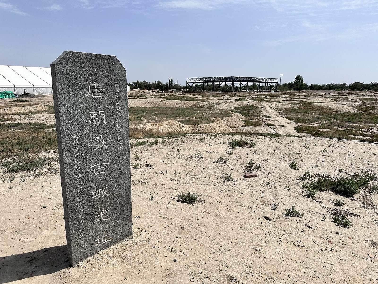
Tangchaodun entered Xinjiang’s first group of regionally protected cultural relics in 1957. Qitai County set protection boundaries and a construction-control zone in 2011, and the site became a Major Historical and Cultural Site Protected at the National Level in 2013. Surveys took place in 1958, 1972, and 1988, followed by work during the Third National Cultural Relics Survey. From 2018, Renmin University of China and the Xinjiang Institute of Cultural Relics and Archaeology carried out multi-year excavations.
Remains
City plan and enclosure
The ruins stand beside the Shuimo River, which borders the site on the east; villages lie to the north, west, and south, while urban development covers parts of the western and southern areas. The city lies on the Northern Route of the Silk Road, about 30 km west of Beiting and 40 km north of the Shichengzi Ruins. The Gurbantunggut Desert is about 20 km to the north, and the Bogda Mountains about 40 km to the south. The city has an irregular rectangular plan oriented northwest to southeast, measuring more than 300 m east to west and about 500 m north to south, with an area of roughly 160,000 square metres. Its uneven interior slopes down from north to south.
Northern wall
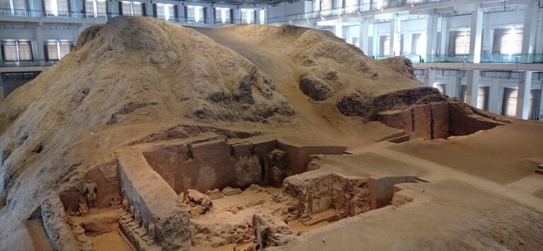
The best-preserved wall section lies on the north. It extends for about 340 m, stands roughly 4 m high, and is 6 to 8 m wide. Its rammed-earth construction consists of layers 7 to 12 cm thick. At the midpoint is a square earthen mound about 12 m across and 5 m high. It may be the remains of a defensive gate outwork, a wall tower, or a platform. Three defensive projections survive on either side of the mound.
Other surviving walls
About 80 m of the west wall remains, including two defensive projections. Part of its northern section is overlain by Qitai’s Qing-era New Manchu City. The east wall survives in foundation sections and follows bends in the Shuimo River, where erosion has cut a cliff below it. Two sections of the south wall remain, standing about 2 to 3 m high. Several pits and trenches lie inside the city, including holes made by looters.
Deposits and finds
Layers in the city’s northeast run from Western Liao and Mongol Yuan remains at the top, through the Gaochang Uyghur period, down to Tang deposits. Finds from across the site include grey-clay and sand-tempered red pottery sherds, Kaiyuan Tongbao and Chagatai silver coins, bronze mirrors, iron swords, and iron arrowheads. Buddha images, murals, pottery, and iron objects also come from the ruins.
Gaochang Uyghur bath
A bath complex in the northeastern corner dates to about the tenth to thirteenth centuries and covers roughly 400 square metres. It is partly below ground: the upper level provided usable space above the original ground surface, while the lower level contained heating spaces and flues. Its Roman-style description refers to similarities in arrangement and heating, not evidence that Romans built it. The complex includes a brick main structure, an adobe building made of sun-dried mud brick, a hearth, and two wells.
Main bath
The roughly square main structure measures about 12 m on each side and now stands from about 0.5 m to slightly over 1 m high. Its plan forms a three-by-three arrangement, with an octagonal central space and eight square spaces around it. Some lower spaces contain rectangular brick support piers resembling those used in Roman-style bath heating systems. Much of the upper structure has collapsed, while the western part of the lower structure is comparatively well preserved.
Adobe building
East of the main bath, the badly damaged adobe building measures about 13.5 m from north to south and more than 5 m from east to west. Its three rooms are arranged in a north-south line, and each has a doorway on the east. The two rooms beside the middle one also connect to the main structure.
Hearth and wells
The oval hearth lies north of the main structure. It measures a little over 2 m north to south and about 2 m east to west, with a curved roof and a surviving height under 1 m. Red bricks in staggered courses form its base, and a brick fire channel links it to the main building. Extensive ash deposits lie to its north. Wells stand northwest and northeast of the bath; the larger, to the northwest, is oval, about 3.5 m north to south and over 3 m east to west, and approximately 10 m deep. Bath finds include pottery, porcelain, iron, copper, bone and stone objects, glass, and architectural components.
East Syriac Christian monastery
The monastery occupies the northern central part of the city. Its irregular rectangular plan measures about 100 m east to west and 50 m north to south, with the main building on the west and a residential area to the east. Cross-bearing murals and a Uyghur inscription referring to the ‘religion of the Christians’ support its identification with East Syriac Christianity, a tradition historically associated with the Church of the East. The main building dates to the early tenth century, underwent several repairs over the next two centuries, and was damaged around the thirteenth century.
Main building
The rectangular main building measures about 32 m east to west and 24 m north to south. Its spaces form northern and southern groups. In each, the arrangement from west to east consists of a central hall, an altar platform, three rooms set side by side along a north-south line, and a rear corridor. The southeast part of the southern group was altered later.
Northern hall and bema
The northern central hall covers about 200 square metres and contains a bema, a raised platform used in some Eastern Christian churches. Made of adobe, it measures about 5.5 m east to west, 4 m north to south, and 2 m high. Its north and south sides are symmetrical, with a passage through the middle; seven-sided columns stand at its eastern ends. Murals and Uyghur inscriptions survive in the hall. A relatively well-preserved painting south of the eastern steps depicts a mounted saint.
Upper and lower sanctuaries
East of the bema, opposite it on the altar side, is the sanctuary, the sacred area around an altar. Its lower structure dates to the eighth century, when Xizhou was a Tang prefecture centered in the Turfan region, and remained in use into the tenth century under Gaochang Uyghur rule. It was then buried, and an upper structure was built above it. The upper room is nearly square, about 4 m on each side, and survives to about 1.5 m high. Its west wall has a central doorway, while a smaller doorway stands near the west end of the south wall. Large and small niches appear in the north and west walls, which were painted mainly with donor figures.
The lower sanctuary has a roughly T-shaped plan and a layout similar to the upper room, with an altar in the middle of its east wall. Better-preserved murals include mounted saints, figures with crosses on their chests, people in red diamond-patterned clothing, and winged angels, in a Gaochang Uyghur style. Uyghur inscriptions, Tang-style square bricks with lotus designs, and blue bricks also survive from this structure.
Eastern residential area
The residential area measures about 28 m east to west and 50 m north to south. Its southern part has two courtyards; residences and storage spaces occupy the north, and the western side connects to the main building. The northern residences have upper structures from the Western Liao and Mongol Yuan periods over lower buildings from the Gaochang Uyghur period. Finds include stone, iron, and pottery objects.
Buddhist temple
The Buddhist temple stands at the centre of the city. Built during the Tang period, it remained in use through the Gaochang Uyghur and Mongol Yuan periods. Its remains include a main building, an entrance hall to the east, and a southern hall with side rooms.
Main building
The rectangular main building faces east. Its symmetrical plan runs from east to west through a forecourt, courtyard, Buddhist hall, Buddhist platform, and underground chamber. Corridors run south, west, and north of the hall, platform, and chamber. Beyond the west wall are traces of an outer wall and two building sites. The Buddhist hall has an eastern entrance and a rectangular platform against its west wall that may have served as a base for a Buddha image. Murals survive nearby, and the north wall has a white-plaster finish with paintings. Remains of an underground chamber at the base of a stupa, a Buddhist reliquary monument, stand on a platform about 2 m above ground. Paving bricks and column bases also remain.
Entrance hall
East of the main building, the entrance hall comprises two superimposed rectangular buildings of similar plan, both made of adobe. The lower structure belongs to the middle to late Gaochang Uyghur period; the upper dates from the Western Liao to Mongol Yuan period. White plaster and coloured murals survive on parts of the upper walls. Its eastern doorway faces an east-west road almost 10 m wide at its broadest point. A building site north of the entrance hall may have served as another Buddhist hall.
Southern hall and side rooms
The southern hall and side rooms form a T-shaped plan. Five building sites have been excavated, including one at the northeast corner that adjoins the main temple building. Most belong to the Western Liao and Mongol Yuan periods, while some date to Gaochang Uyghur rule. Their walls are chiefly adobe.
Temple finds
Paper fragments in Chinese and Uyghur came from the Buddhist temple. They include part of a Chinese scroll of the Mahaparinirvana Sutra, a Buddhist scripture concerning the Buddha’s final nirvana.