The Ancient City of Stratonikeia: A Hellenistic and Roman City in Türkiye


Site at a Glance
- Rating
- 4.7
- Popularity
- Medium
- Country
- Turkey
- Primary era
- Classical
- External website
- Open
- Eras represented
- Iron Age, Classical, Medieval, Early Modern
- Civilizations
- Byzantine, Carian, Ottoman, Roman, Seleucid, Seljuk
- Site type
- City
On this page25 sections
History
The Ancient City of Stratonikeia in Türkiye was a Hellenistic city founded in the third century BC during the Seleucid period, in the territory of an older Carian settlement at present-day Eskihisar. Caria was an ancient region of southwestern Anatolia. Stratonikeia controlled important sanctuaries, developed considerable political influence, and remained an autonomous city under Roman rule before becoming a Christian bishopric and later an occupied Seljuk and Ottoman settlement.
Before the Seleucid Foundation
Human occupation in the surrounding region reaches back to the Early Bronze Age. Earlier fortifications on Kadıkulesi Hill point to settlement during the Archaic and Classical periods, while archaeological finds indicate that a Carian predecessor community occupied the area before Stratonikeia was established. The older town was called Idrias and was also associated with the name Chrysaoris.
Some scholars have identified Stratonikeia or its predecessor Idrias with Atriya, a fortified settlement mentioned in Hittite documents of the thirteenth century BC. This identification remains uncertain. The later city therefore developed on a site with a much longer history than its Seleucid foundation.
The Seleucid and Hellenistic City
Stratonikeia was founded in the third century BC under the Seleucid Empire, the Hellenistic kingdom created by Seleucus I after the division of Alexander the Great’s empire. Ancient tradition attributes the foundation to Antiochus I Soter, who is said to have named the city after Stratonike, the wife of Seleucus I and later Antiochus’s own wife. Other interpretations name Antiochus II Theos or possibly Antiochus III the Great. The precise founder is therefore disputed.
The new city incorporated nearby villages into its administrative territory and succeeded Chrysaoris. In the early Seleucid period it belonged to the Chrysaorian League, a confederation of Carian towns. Although the Stratonikeians were regarded as Macedonian rather than Carian, they were admitted because Carian towns and villages formed part of their territory.
Stratonikeia’s territory included the sanctuary of Hekate at Lagina and the sanctuary of Zeus at Panamara. Hekate was a Greek goddess associated especially with crossroads, protection, and rites of transition, while Zeus was the chief god of the Greek pantheon. The city maintained annual processions to both sanctuaries, and control of these religious centers strengthened its political and military influence.
Under the Seleucid kings, Stratonikeia received costly monumental buildings. Several years after its foundation, the Seleucids transferred the city to Rhodes. It was later taken by the Macedonians, either in 227 BC under Antigonos III Doson or during Philip V’s campaign of 201 BC. Following the Macedonian defeat at Kynoskephalai in 197 BC, the city passed to Antiochus III and was subsequently returned to Rhodes.
Independence and Regional Power
In 167 BC, Rome declared Stratonikeia a free city and ended Rhodian control. The city then sought regional predominance around the Gulf of Keramos. Its political territory extended southward through places including Themessos and Keramos, and it retained autonomy as part of the Roman province of Asia.
After the loss of Rhodian authority, Stratonikeia increased its influence through the sanctuary of Zeus Karios at Panamara. A priest from the city secured recognition for the sanctuary’s asylum rights and those of the Panamarean religious community. Stratonikeian initiatives also established a cult of Hera there, together with the Komyria festival for men and the Heraia for women.
Before the final quarter of the second century BC, Hekate had become Stratonikeia’s principal protective deity. The city’s religious focus moved from Zeus Chrysaoreus toward Hekate’s sanctuary at Lagina, although the reason for this change is unknown. Stratonikeia introduced the five-yearly Hekatesia festival, during which a procession carried the key of Hekate’s temple to the city bouleuterion, a council building. The ceremony linked the sanctuary at Lagina with the city’s political center.
War and Roman Protection
In 130 BC, Stratonikeia played a central role in the revolt led by Aristonicus. Aristonicus made his final stand at the city before being captured when Stratonikeia fell.
During the First Mithridatic War, the conflict between Rome and Mithridates VI of Pontus for control of Anatolia and Greece, Mithridates captured Stratonikeia in 88 BC. He imposed a fine, installed a garrison, and stayed in the city for a time. He married Monime, the daughter of Philopoemen, one of Stratonikeia’s principal citizens. After Roman forces recovered the city, Sulla honored its inhabitants for their loyalty, and its free-city status was confirmed in 81 BC.
In 40 BC, Parthian forces commanded by Quintus Labienus besieged Stratonikeia but failed to take it. The city’s resistance won the gratitude of Augustus and the Roman Senate. During the conflict, however, the sanctuary of Hekate at Lagina was plundered and destroyed. The following year, the Parthians attempted to seize Panamara but were said to have been stopped by the intervention of Zeus Karios.
After this reported intervention, Zeus Karios was worshipped as Zeus Panamaros, and the Panamareia festival was introduced. The procession travelled from the sanctuary to Stratonikeia, like the ceremony associated with Hekate at Lagina, and helped establish Zeus Panamaros as a city deity alongside Hekate.
Stratonikeia supported Octavian, later known as Augustus, during his conflict with Marcus Antonius, despite being in territory controlled by Antonius. In 39 BC, Octavian rewarded the city with privileges that included asylum rights for the sanctuary of Zeus Panamaros. Tiberius confirmed these privileges again in AD 22. The rebuilding of Hekate’s sanctuary at Lagina after its destruction by Labienus further reinforced the city’s relationship with Rome.
Roman and Late Antique Stratonikeia
Stratonikeia remained an autonomous city in the province of Asia during the Roman period and was listed among the free cities of Anatolia. Its coinage began after independence from Rhodes in 167 BC and continued until the reign of Gallienus, AD 253 to 268. The city was also the birthplace of Menippus, an orator whom Cicero regarded as one of the most distinguished speakers of his time.
In Late Antiquity, Stratonikeia became a Christian episcopal see, meaning the territory administered by a bishop. The bishopric was listed among the suffragans of Stauropolis until the thirteenth century. Three bishops are known from their signatures at the Councils of Chalcedon in 451, Constantinople in 692, and Nicaea in 787. The ancient bishopric later continued as a titular see of the Roman Catholic Church.
Later Settlement and Archaeology
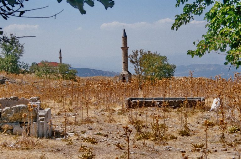
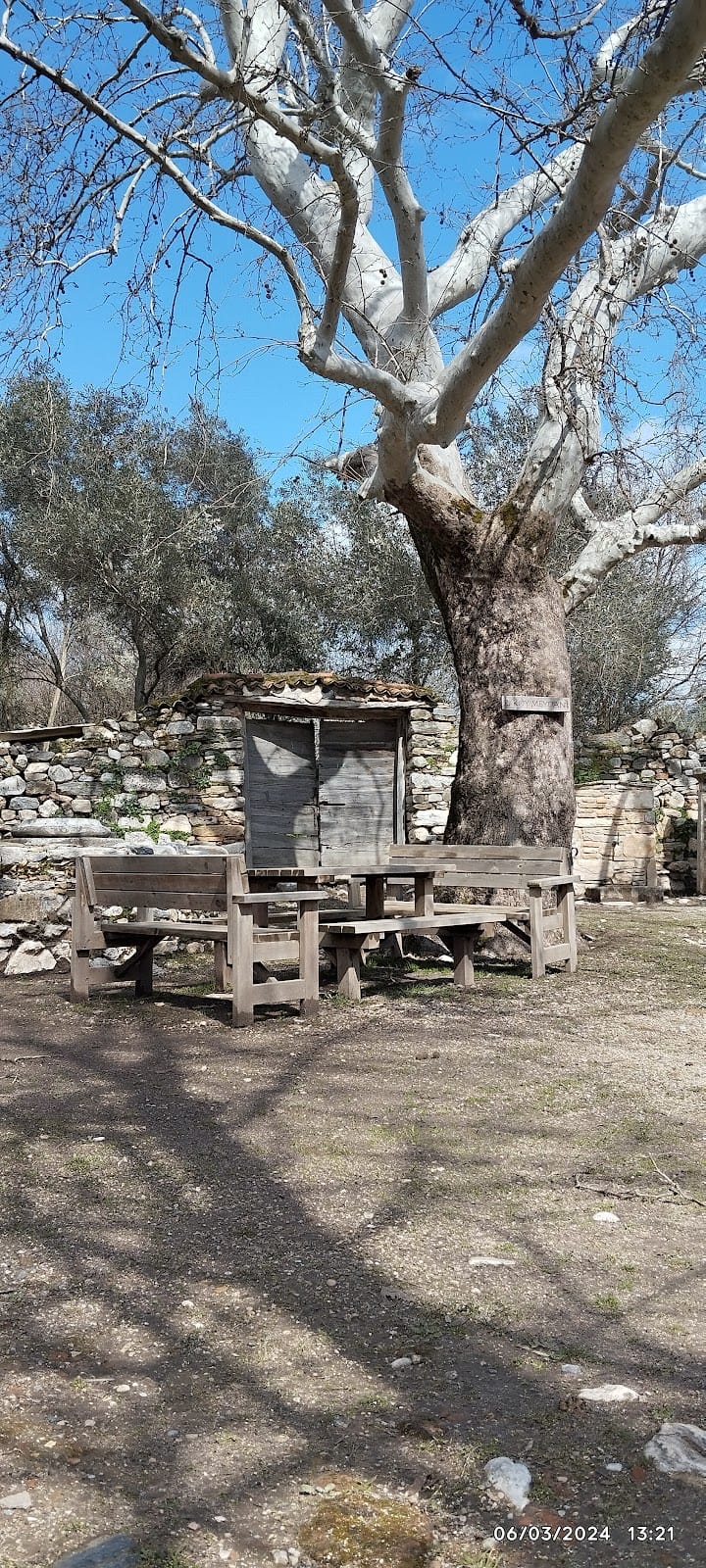
Occupation continued during the Seljuk and Ottoman periods. A Seljuk bath and the Ottoman-period Şaban Ağa Mosque show that later communities reused the ancient urban area. The modern village of Eskihisar partly overlies Stratonikeia.
Archaeological excavations have been conducted since 2008 under the direction of Bilal Söğüt of Pamukkale University. Work in 2012 included the North City Gate and its street, the bouleuterion, theatre, Roman Bath 1, West Street, the Seljuk Bath, the Erikli Church outside the city walls, and graves in the surrounding area. Surveys and measured recording also continued on Late Ottoman and Republican-period buildings.
Part of the ancient necropolis and much of the surrounding area were destroyed by an open-pit lignite mine supplying the Yatağan power plant. Excavated and reconstructed remains of the city have been restored and made publicly accessible.
Remains
Fortifications and Civic Entrance
City Walls and North Gate
Stratonikeia occupied the southern summit and slopes of Kadıkulesi Hill and was enclosed by fortifications. Only short and poorly preserved stretches of the ancient circuit wall remain visible, while earlier defenses on the hill belong to the pre-Hellenistic occupation of the site. A strong fortress stood at the northeastern corner. It was built from large ashlar blocks, regularly cut stones laid with lime mortar, and was repaired with reused architectural pieces, including inscriptions and column shafts taken from earlier buildings.
The monumental North Gate stood at the center of the northern circuit wall and marked the entrance of the road from Hekate’s sanctuary at Lagina. It had two arched gateways with a combined width of about 42.5 meters. Between them, on the side facing the city, stood a semicircular nymphaeum, a monumental fountain, with two levels of Corinthian columns and statue niches. The fountain belongs to the late Antonine or early Severan period and underwent several later repairs.
North Street and Sacred Road
An open square extended in front of the nymphaeum. From there, a broad colonnaded street, about 8.70 meters wide, continued south toward the center of the city. Its original Corinthian columns were replaced by Doric columns during repairs in the fourth and fifth centuries AD, and mosaic floors were added in the eastern portico. The road beyond the gate formed part of the city’s principal circulation system.
A sacred road began at the city gate, crossed the necropolis, and led to Hekate’s sanctuary at Lagina, about 11 kilometers away. Chamber tombs stood along the road near the entrance. The necropolis was destroyed by the lignite-mining area.
Theatre and Imperial Cult
Theatre
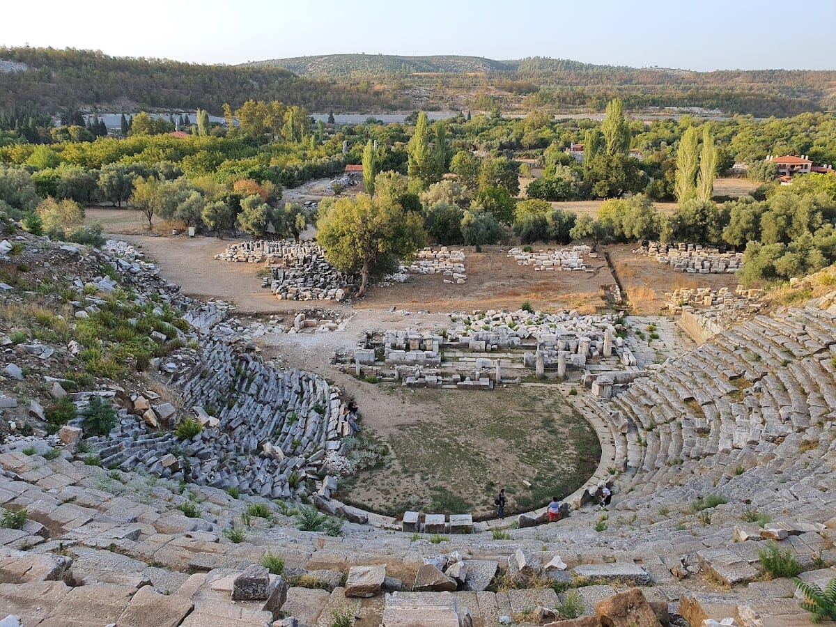
A large theatre stood south of the urban center at the northern foot of Kadıkulesi Hill. First built in the Hellenistic period, it was extensively remodeled in the early Imperial period, when its stage building was reconstructed. Further alterations took place in the second century AD, and the theatre remained in use until the fourth century. Its estimated capacity was about 10,000 to 12,000 spectators.
The cavea, or seating area, was divided by stairways into nine wedge-shaped sectors called cunei and had one horizontal passage, or diazoma, separating seating levels. Excavation exposed much of the stage building, including the stage and orchestra.
Temple of the Imperial Cult
On a hillside terrace south of the theatre stood a small peripteral temple, a building surrounded by a colonnade, in the Ionic order. It measured approximately 12.5 by 18.5 meters and faced north toward the theatre. Its architectural style and decoration date it to the early Imperial period. An inscription identifies the temple as a place dedicated to the imperial cult, the worship of Roman emperors and their families.
Educational and Political Buildings
Gymnasium
A large structure identified as the gymnasium occupied the northwestern part of the city. A gymnasium was a civic institution for education, athletic training, and physical activity. The building’s estimated overall dimensions were approximately 105 by 267 meters. Only its northern side has been excavated, where five rooms included a central semicircular chamber and rectangular rooms on either side. Columns separated this range from an open courtyard to the south.
The gymnasium was first constructed in the second quarter of the second century BC and was remodeled during the Augustan and Antonine periods. Its size and successive alterations reflect the continuing importance of educational and athletic institutions within the city.
Bouleuterion
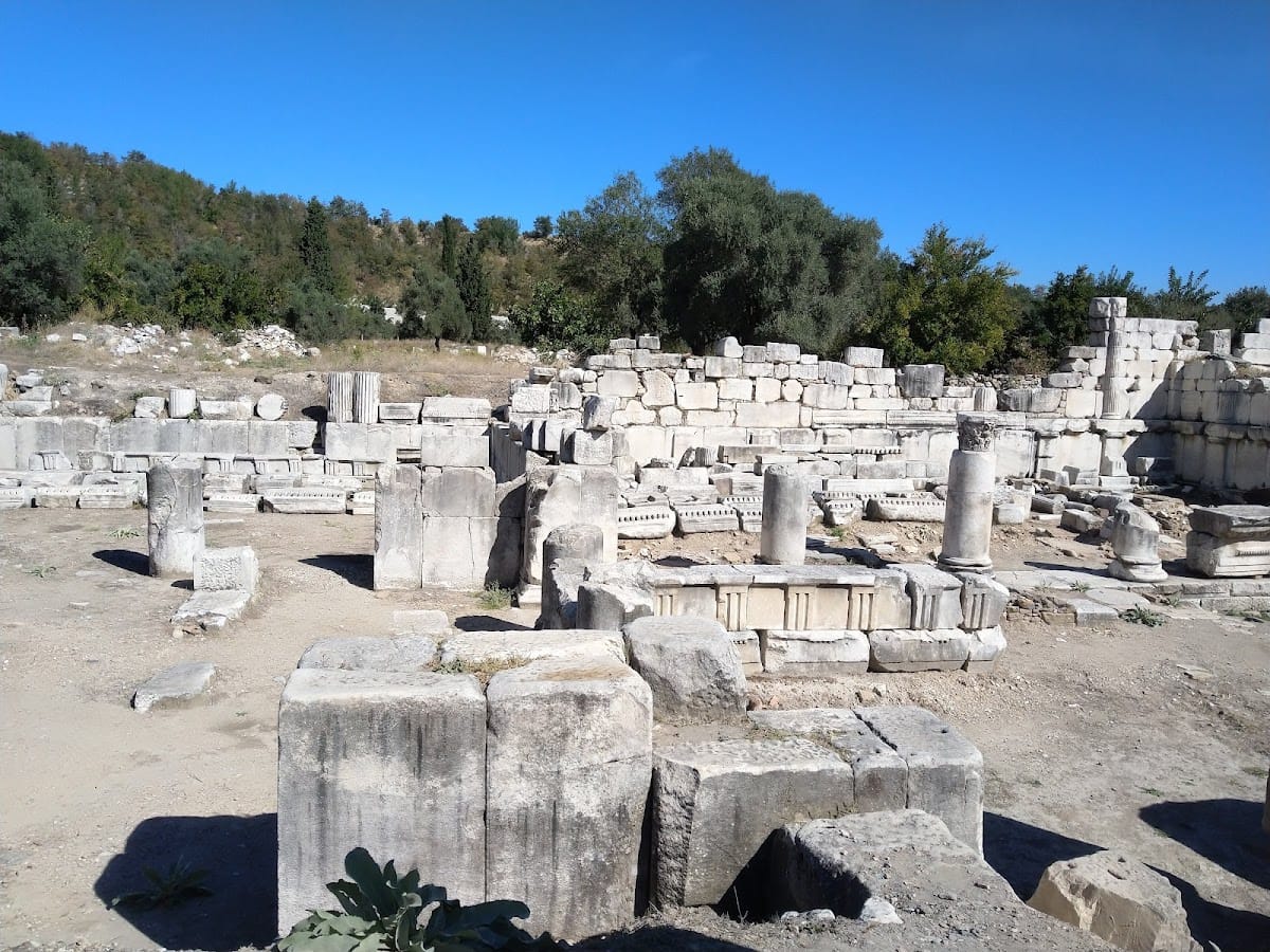
The bouleuterion stood near the center of Stratonikeia, southeast of the gymnasium. This small, theatre-like council building measures approximately 25 by 30 meters and contains semicircular seating rows with a courtyard on the east. The lower seating rows survive.
A detached gateway immediately west of the building was once interpreted as a temple of Serapis. Inscriptions found during excavation showed that this interpretation was incorrect. The bouleuterion has been dated either to the first or to the second century AD. Its north exterior wall carried Greek and Latin inscriptions, including part of the Latin text of Diocletian’s Price Edict and a Greek mnemonic poem listing the months of the year attributed to Menippus.
Streets and Urban Circulation
West Street
West Street began at a propylon on the eastern wall of the gymnasium and ran eastward past Roman Bath 1 and north of the bouleuterion. Its eastern continuation joined the street north of the bouleuterion, making it one of the principal east-west routes through the city. The propylon contained an in-situ Attic-Ionic base with its pedestal and supporting stylobate, the platform on which columns stood. Krepis blocks, which formed access steps, showed that a street approached the gateway from the east.
Excavated sections of West Street reached a marble pavement running east-west at an elevation of 497.31 meters. Much of the pavement remained well preserved, although some blocks had later been removed and reused. A sewer ran along the center, and sections of the paving had collapsed where earthquakes affected the drainage line.
The street was bordered on both sides by stylobates supporting peristases, or colonnades around an open space, together with krepis steps. Six column drums and two fallen Doric capitals on the southern stylobate were re-erected, indicating an intercolumniation of 1.30 meters. Architectural blocks found along the street include pedestal bases, fluted and plain column drums, Doric and Corinthian capitals, architraves, friezes, and cornices.
The concentration of Doric elements indicates that the latest portico arrangement used the Doric order. Vegetal and Ionic kymation decoration appears on some frieze blocks, while the blocks themselves belong to structures ranging from the Late Hellenistic to the Late Roman periods and were later moved into the street area. Cornice blocks generally date from the late Antonine and early Severan periods, although some console cornices belong to the end of the first century AD.
West Street was about 10 meters wide without its colonnades, while North Street measured 8.90 meters. Two steps of the northern stylobate survived at an elevation of 497.66 meters. In some places a second step remained, while elsewhere a third row formed the support for the portico columns. The pavement descended by 0.45 meters toward its eastern end near the bouleuterion, probably allowing wastewater to flow out of the city.
The street was originally arranged in the Corinthian order during the Roman period, then remodeled with a Doric arrangement in the Early Byzantine period and used into later centuries. Its most extensive reorganization followed the earthquake of AD 139. Roman, Byzantine, and Islamic-period objects were found together on the marble pavement. Crosses and other graffiti were cut into the pavement and stylobate, while ceramics and coins indicate prolonged circulation and use. The excavated section retained its street function rather than being converted to another known use.
Baths and Public Services
Roman Baths
Roman Bath 1, in the western part of the city, dates to the second century AD. Inscriptions refer to two additional baths at Stratonikeia, and a public latrine near the excavated bath had an estimated capacity of about 60 people.
Church and Later Rural Reuse
Erikli Church
A basilica-plan church stood about 650 meters west of the ancient city beside the old Yatağan to Milas road. Excavation identified an east-west building whose western entrance area and associated rooms are relatively well preserved. The church was used from the fifth century until the first quarter of the seventh century, after which fire and destruction led to its abandonment.
The entrance lay in the southern part of the western rooms and gave access to the western spaces and the narthex, the entrance hall. Some approach areas had stone paving, and architectural details suggest that parts of the western range may have had two stories. The church contained three east-west aisles and an additional room running parallel to them along the south. The central nave had a mosaic floor, while the side aisles were paved with brick. The better-preserved western part of the nave mosaic uses multicolored geometric designs.
A basin stood at the western end of the north aisle beside a covered channel that continued eastward through the middle of the aisle. The eastern part of the building was heavily damaged, but the surviving remains allow its plan to be reconstructed.
Objects and Later House
Excavation produced bronze hooks, chains, rings, and iron chains that were probably attached to the walls and associated with the church’s lighting. Coins came mainly from Constantinople, with additional examples from Nicomedia, Cyzicus, Antioch on the Orontes, and Thessalonica. A North African Spatheion amphora found beside the basin was not made in Anatolia. Comparable vessels were used in the sixth and seventh centuries AD. A bronze coin struck at Carthage during the reign of Justinian I, AD 527 to 565, was found at the same level. The amphora and coin probably reached the church through trade during this period.
After the church was abandoned, a house from the Beylik or Early Ottoman period was built above it. Only a small portion survives. Its walls covered parts of the church’s mosaic and brick pavements. The structure appears to have had a southern entrance, two or three rooms, interior and exterior hearths, and places for tethering animals outside, consistent with a rural domestic building.
Museum Material
The local museum at Eskihisar contains mainly Roman remains, together with earlier objects from the region. These include an Early Bronze Age spouted jug from the third millennium BC and two Submycenaean vases dated to the twelfth or eleventh century BC.