St Catherine’s Castle: A Henrician Coastal Fortification at Fowey
Site at a Glance
- Rating
- 4.4
- Popularity
- Low
- Country
- United Kingdom
- Primary era
- Early Modern
- External website
- Open
- Eras represented
- Early Modern, Modern
- Civilizations
- British, English
- Site type
- Military
- Remains
- Castle
On this page11 sections
History
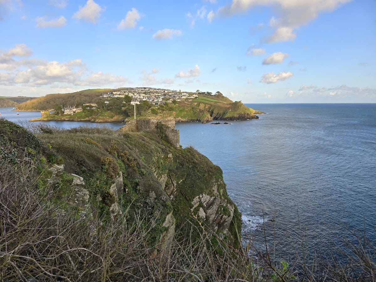
St Catherine’s Castle is a Henrician coastal fortification in the United Kingdom, built above the entrance to the Fowey estuary in Cornwall between approximately 1538 and 1540. It was constructed during Henry VIII’s coastal-defence programme, prompted by fears of invasion from France and the Holy Roman Empire, and protected Fowey Harbour, then an important trading centre.
Construction and Tudor defence
Local Cornish gentleman Thomas Treffry directed the construction. A map from 1540 described the castle as only “half-made”, while the antiquarian John Leland recorded a visit in 1542 during which Treffry hosted him. Leland noted that the work had been financed partly by Treffry and partly by the local town.
The new fortification replaced two earlier blockhouses, at Fowey and Polruan, which had guarded the river’s edge. These earlier positions were linked by a boom chain across the waterway. St Catherine’s Castle brought the defence of the harbour together at St Catherine’s Point, where the site overlooked both the sea and the estuary.
Military use and decline
The castle remained in military use for many years. During the English Civil War, the conflicts of the 1640s between supporters of King Charles I and Parliament, Royalist forces held the fortification against Parliament.
By 1684, local burgesses described the castle as ruinous. The town was still paying for its maintenance in 1786, when the fort held six cannons. It continued to serve as an artillery battery until the end of the Napoleonic Wars in 1815, the European conflicts involving Napoleonic France.
Refortification and twentieth-century service
The site was redeveloped in 1855 during the Crimean War, when renewed fears of invasion led to the refortification of the British coast. Two new artillery positions were added, but the installation soon became obsolete and had fallen out of use by the end of the nineteenth century. In 1887, it received 64-pound, 29-kilogram rifled muzzle-loading guns. These weapons, loaded from the front and fitted with spiral grooves inside their barrels, were operated by volunteer forces for training.
During the Second World War, British Southern Command returned the site to military service as a gun battery and observation post against a possible German attack. The battery was re-equipped in June 1940 and was first manned by the Royal Artillery’s 364 Coast Battery, followed later by the 379 Battery of the 557 Coast Regiment. Active operations ended in November 1943.
After 1945, the fort was decommissioned and the later wartime defences were removed. The castle was restored to its pre-war condition. English Heritage now manages the site. It is protected as a Grade II* listed building, a category identifying particularly important national architectural or historic interest, and as a scheduled monument under United Kingdom law. The designations date from 1974 and 1981 respectively. The castle also forms part of the Device Forts, the coastal forts commissioned during Henry VIII’s reign as part of England’s defences against invasion.
Remains
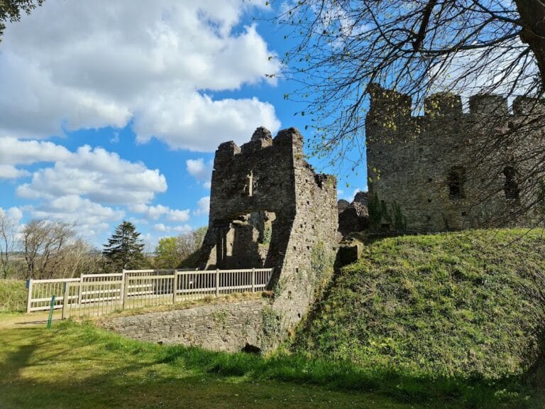
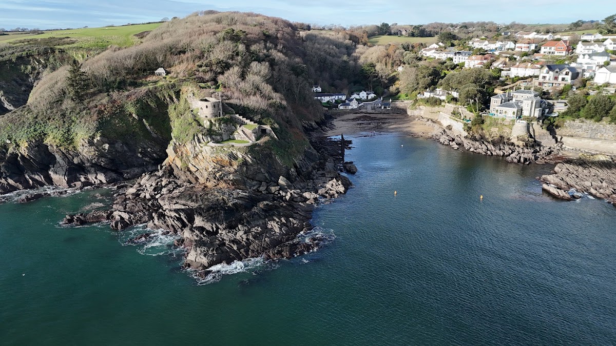
St Catherine’s Castle occupies a rocky outcrop about 8 metres above sea level, overlooking the sea and the Fowey estuary. The immediate ground is generally level, with hills to the northwest and the sea to the southwest. Cliffs and a curtain wall, a fortified wall enclosing or joining defensive positions, protect a roughly semicircular area of about 500 square metres. The surviving works combine the compact sixteenth-century blockhouse with later artillery positions cut into or built upon the rock.
Sixteenth-century blockhouse
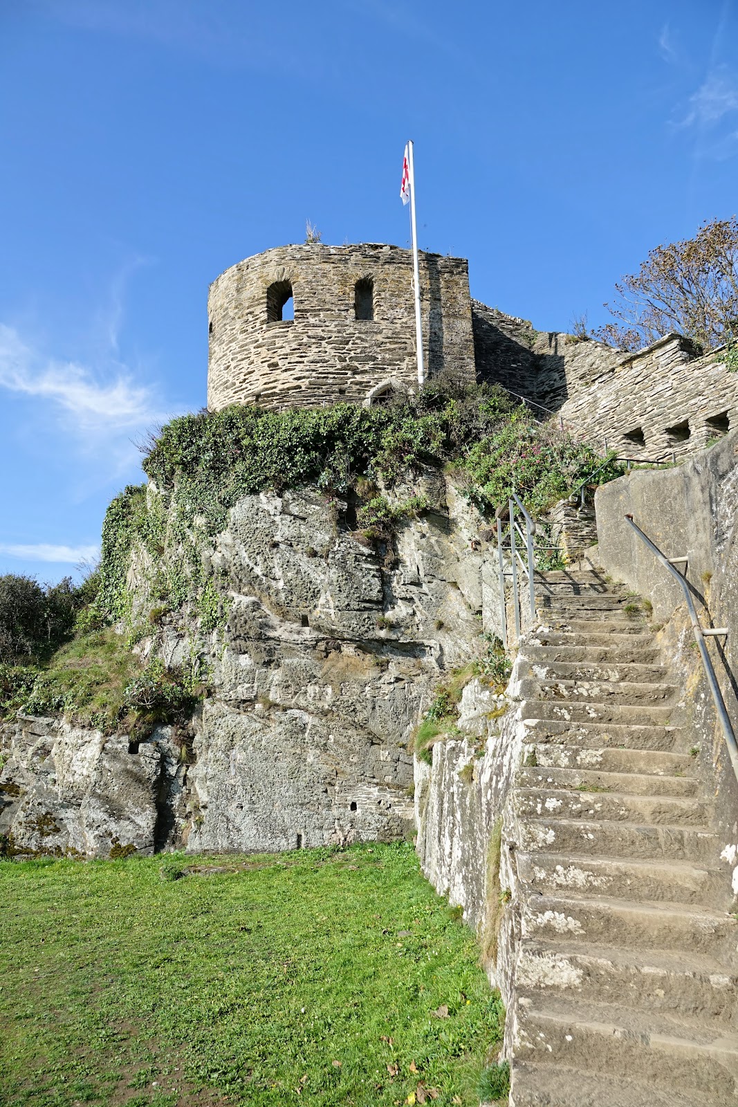
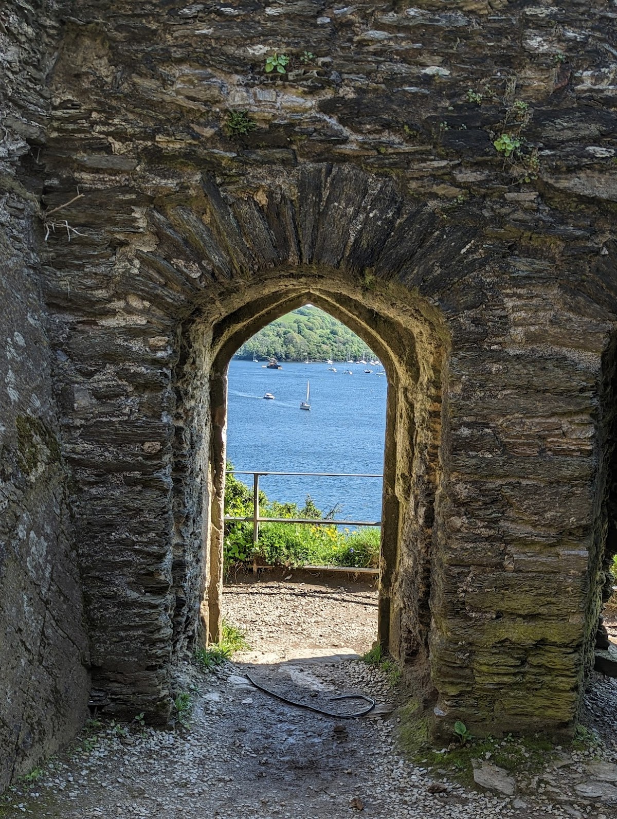
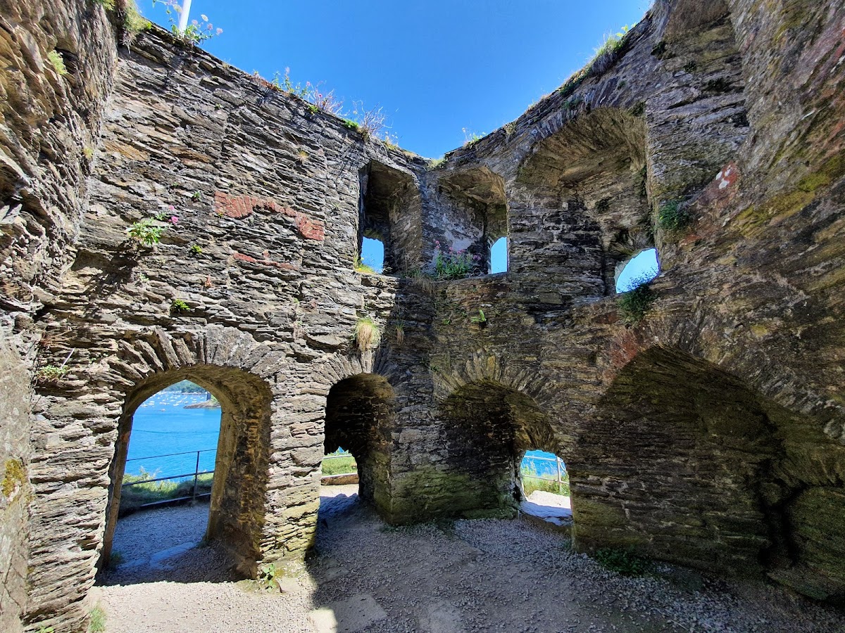
The original blockhouse is a two-storey, D-shaped stone structure measuring approximately 5 by 4.4 metres internally. Its slate-rubble walls are up to 1.35 metres thick and stand on a platform cut from the bedrock. Three semicircular gun-ports originally opened from the ground floor towards the sea and estuary, although one has since been blocked. Two further gun-ports occupied the first floor, with one now filled in, alongside smaller windows that may have accommodated small gunpowder weapons. Inside were a fireplace and chimney, a small guard chamber beside the entrance, and access to a parapet walk along the top.
Defensive enclosure
The curtain wall encloses the semicircular defensive area and contains firing slits for muskets. A rectangular bastion, a projecting defensive platform, protects the rear of the blockhouse. It measures approximately 5.7 by 3.2 metres internally, with walls about 0.75 metres thick. The original path to the blockhouse was obstructed by later construction, and the steps now leading to the building date from the nineteenth century.
Nineteenth-century artillery works
Magazine and gun platform
A flat-roofed magazine, a protected store for ammunition, was cut into the rock below the blockhouse during the nineteenth century. A gun platform was also built and includes two circular recesses for gun-carriage rails. Its granite parapet, a low protective wall along the edge of a fortification, provided cover around the position. The curtain wall was reworked during the same period and bears plaques inscribed “WD 1855.”
Second World War defences
Guns and observation position
During the Second World War, two 4.7-inch, 120-millimetre naval guns were installed in one nineteenth-century firing position and in a new position 50 metres west of the castle. A French 75-millimetre gun supplemented them. The former blockhouse controlled a minefield in the estuary below, while additional concrete defences surrounded the position. Later wartime works were removed, but recesses and marks from the Second World War defences remain visible in places along the gun platform.