Southern Wall: The Herodian Retaining Wall of the Temple Mount
Site at a Glance
- Rating
- 3.9
- Popularity
- Very Low
- Country
- Israel
- Primary era
- Classical
- Eras represented
- Classical, Medieval, Early Modern
- Civilizations
- Crusader, Fatimid, Ottoman, Roman, Umayyad
- Site type
- Religious
- Remains
- Temple
On this page12 sections
History
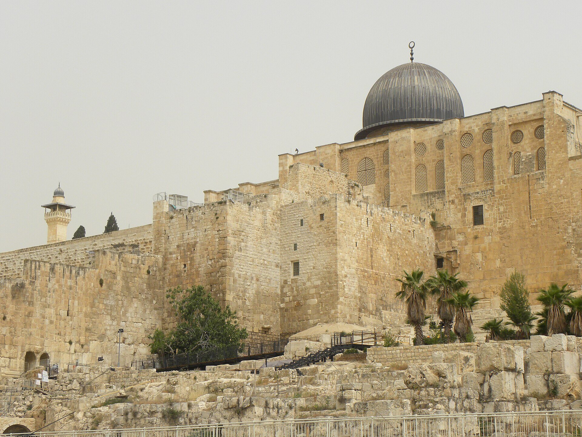
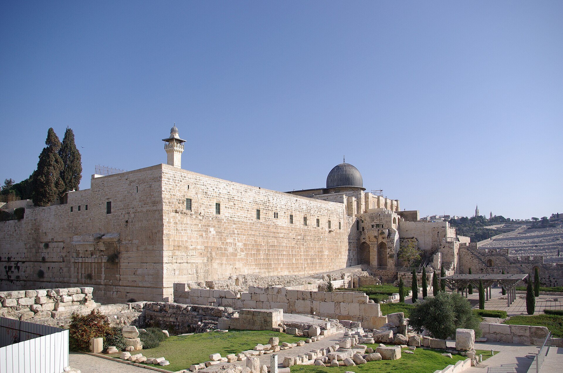
The Southern Wall is the southern retaining wall of the Temple Mount in Jerusalem, Israel. Its present alignment is generally attributed to Herod’s late Second Temple expansion of the Hasmonean Temple Mount southward onto the Ophel, the elevated area between the mount and the City of David. The Herodian extension supported the Royal Stoa, a large colonnaded public and administrative building, and created the principal southern approach to the Temple.
Herodian expansion and the Temple entrances
The wall is approximately 281 metres long and about 20 metres high. The first-century Jewish historian Josephus equated its length with one stadion, an ancient Greek unit of distance. The Huldah Gates, consisting of the western Double Gate and eastern Triple Gate, opened onto a broad monumental staircase. During the Roman period, this approach served as the principal entrance to the Temple, connecting the Temple Mount with the Pilgrims’ Road from the Pool of Siloam.
The Huldah Gates were associated with pilgrimage during Passover, Shavuot, and Sukkot. The staircase is traditionally connected with the route used by Jesus of Nazareth and other Jews of the Second Temple period. The identification of particular individuals who used it belongs to historical tradition rather than archaeological evidence.
Roman destruction and Umayyad rebuilding
Roman destruction of Jerusalem in AD 70 damaged the Huldah Gates and the Pilgrims’ Road. The Umayyads, who ruled the early Islamic caliphate from AD 661 to 750, are understood to have repaired the entrances and route for access to the newly constructed Dome of the Rock. Their building activity transformed the area outside the wall, where an administrative complex and palaces were established.
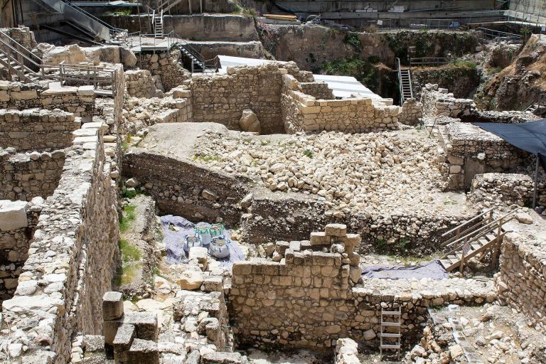
Benjamin Mazar uncovered four large palaces attributed to the Umayyad caliph al-Walid I, who ruled from AD 705 to 715. Built around open central courtyards, the palaces formed an administrative and governmental complex covering much of the area now included in the archaeological park. Remains of Fatimid fortifications and additional Umayyad residential and administrative buildings were also found in the complex outside the wall.
Ottoman reuse and modern preservation
In the sixteenth century, the Ottomans reused the outer line of Umayyad Palace 2 as part of Jerusalem’s city wall. The Ottoman wall turns north at the palace’s corner and joins the Temple Mount wall partway along the Southern Wall. An artificial opening was later made to provide access to the continuation of the archaeological park beyond the Ottoman wall.
Excavations began around the wall after 1967 under Benjamin Mazar and Meir Ben-Dov, with further work in the late 1990s by Yuval Baruch and Ronny Reich on behalf of the Israel Antiquities Authority. The western section is within the Jerusalem Archaeological Park, while the eastern section lies within the Ophel National Park under the Israel Nature and Parks Authority. A new bulge in the wall in the early twenty-first century threatened its structural integrity. Unauthorized underground work connected with Solomon’s Stables, also known as the al-Marwani Mosque, was cited or attributed as the cause. Repairs undertaken by Jordan under an agreement involving Israel, the Palestinian Authority, the Muslim Waqf, and Jordan left a lighter and smoother patch that was widely criticized as inconsistent with historical-restoration practice.
Traditions and interpretations
A later Jewish legend explains the survival of the Western Wall by saying that ordinary people built it with their own hands, while the southern, eastern, and northern walls were built by elites, rulers, or those acting under their authority and were later destroyed. This is a religious legend rather than an archaeological explanation of the Southern Wall’s history.
Yuval Baruch and Ronny Reich proposed that the Triple Gate and the street leading to it from the east may have served to bring animals and sacrificial victims into the Temple precinct, particularly during Passover. This interpretation differs from the more common view that the gates led through underground passages to the Temple platform.
Remains
The Southern Wall is built from enormous Jerusalem-stone blocks, including pale limestone, dolomite, and dolomitic limestone. Its Herodian masonry consists of finely dressed ashlar blocks, each with a finished margin around a slightly projecting central bossage. The unmortared stones fit so closely that a knife blade could scarcely be inserted between them. About thirty Herodian courses survive at the southeastern corner, descending to the natural bedrock, and the lower courses display the marginal dressing also seen in the Western Wall.
The Southern Steps
A monumental staircase approaches the wall from the south as the northernmost extension of the Pilgrims’ Road from the Pool of Siloam through the Huldah Gates. The steps toward the Double Gate are substantially intact or well preserved, while those leading toward the Triple Gate are mostly ruined. The staircase has unusually low risers, approximately 15 to 20 centimetres high, and treads about 30 to 40 centimetres deep. Alternating broad and narrow steps created a slow, deliberate ascent, and some sections have been restored to permit safe walking.
The Huldah Gates
The Triple Gate
The eastern Triple Gate contains three openings, each approximately 4.03 metres wide. Its visible form is later than Herod’s period and is commonly attributed to the Umayyad period, although it occupies the position of an entrance dating from the late Second Temple period. The only clearly visible Herodian exterior element is the lower jamb of the left-hand arch. By the early twenty-first century, the gates were blocked or sealed.
The Double Gate
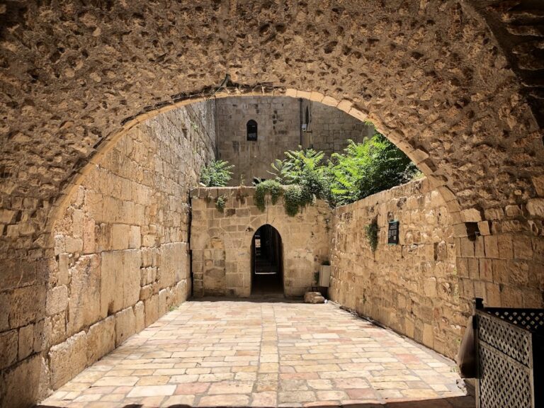
The western Double Gate lies approximately 70 metres from the Triple Gate and is largely concealed by a Crusader-period addition. About half of the right-hand arch is visible externally, with an exposed width of approximately 3.09 metres. Above the visible Herodian arch is an ornate Umayyad decorative half-arch dating from AD 661 to 750, together with the remnant of a Herodian relieving arch, an arch that redistributes the weight of masonry above an opening.
Much of the internal Herodian Double Gate survives. Pilgrims entering it continued upward through a broad, dome-shaped passage carved into the rock rather than emerging directly into an open courtyard. The passage led toward the Royal Stoa, whose west to east colonnades extended along the Southern Wall, and now leads toward the older section of the al-Aqsa Mosque. Its interior contains carved domed ceilings, columns, and ornamented domes. Two pairs of domes and their surrounding columns survive intact, decorated with vines, rosettes, flowers, and geometric designs.
Structures along the wall
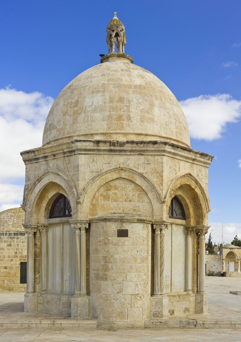
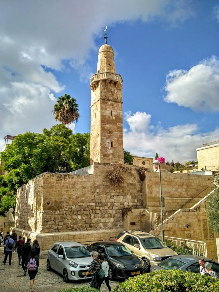
The Southern Wall forms the exterior barrier of the al-Aqsa Mosque on the west and of the underground complex known as Solomon’s Stables, or the al-Marwani Mosque, on the east. The al-Fakhariyya Minaret, the White Mosque, now used as the al-Aqsa Library, the al-Aqsa Mosque or al-Qibli Mosque, the Musalla of Omar in the eastern wing of the al-Qibli Mosque, and the Mihrab Dawud are situated along or within the Temple Mount side of the wall. A mihrab is a niche indicating the direction of prayer, while a musalla is a designated Muslim prayer space.
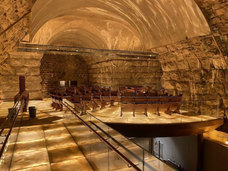
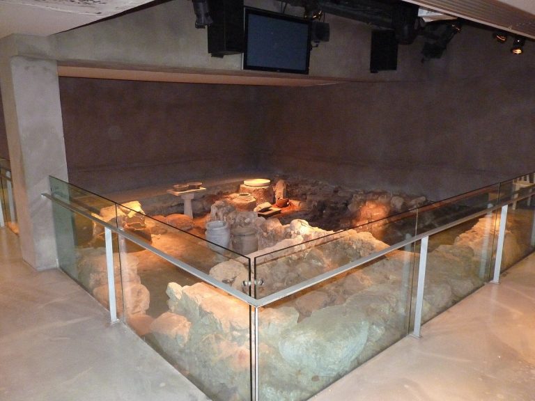
The eastern and western surroundings include the Ophel, the Southern Steps, the archaeological park, and the remains of the Umayyad administrative and palace complex. The museum known as the Davidson Center occupies the basement remains of Umayyad Palace 2 at the southwestern end of the archaeological park. Established in 2001, it presents finds from the park and its surroundings in chronological order from the Second Temple period through the end of the early Islamic period.
Reused Roman material and Umayyad remains
Near the Double Gate, a reused marble slab bears an upside-down Latin inscription from the base of a statue of the emperor Antoninus Pius, who ruled from AD 138 to 161. The statue stood in the Roman Temple of Jupiter at Aelia Capitolina, the Roman city established at Jerusalem after the Bar Kokhba revolt. The slab was later incorporated into the wall as reused building material. Its inscription identifies Titus Aelius Hadrianus Antoninus Augustus Pius and uses customary Roman abbreviations.
Outside the wall, the archaeological complex preserves remains of Umayyad residential and administrative structures of palace type, including the four complexes attributed to al-Walid I, as well as Fatimid-period fortifications. Together with the surviving Herodian masonry, the gates, the staircase, and later additions, these remains reflect the changing use of the southern approach to the Temple Mount from the Second Temple period through the early Islamic and later periods.