Western Wall Tunnel: An Underground Archaeological Complex in Jerusalem


Site at a Glance
- Rating
- 4.7
- Popularity
- Low
- Country
- Israel
- Primary era
- Classical
- External website
- Open
- Eras represented
- Iron Age, Classical, Medieval, Modern
- Civilizations
- Byzantine, Crusader, Israelite, Knights Templar, Mamluk, Roman, Umayyad
- Site type
- Religious
- Remains
- Sanctuary
On this page31 sections
History
The Western Wall Tunnel is an underground archaeological complex in Jerusalem, Israel, created through successive building phases around the Temple Mount. Its principal structures began with Herod’s enlargement of the Temple Mount in 19 BCE during the late Second Temple period, the era of the Jerusalem Temple rebuilt after the Babylonian exile and destroyed by the Romans in 70 CE. The network later incorporated Roman, Byzantine, Islamic, Crusader, Mamluk, Ottoman, and modern remains.
Herod’s Temple Mount
In 19 BCE, King Herod began enlarging the Temple Mount, approximately doubling its area by incorporating part of the northwestern hill. Four massive retaining walls supported the expanded platform, including the Western Wall. The walls and platform survived the Roman destruction of the Temple in 70 CE, although much of the ground beside them was later covered and built over.
During the Second Temple period, the Central Valley separated Jerusalem’s western residential area from the Temple Mount. A large bridge and adjoining approach structure carried movement from the valley to the Temple Mount. The approach structure later became known as Robinson’s Arch. Both were destroyed in 70 CE, while a later bridge was constructed during the Roman or early Islamic period.
Because the Western Wall was regarded as the accessible point closest to the Holy of Holies, the innermost and most sacred chamber of the Temple, it became a place of Jewish prayer after the Temple’s destruction. The wall therefore retained religious importance even as buildings and soil accumulated around it.
Burial of the Central Valley
From the thirteenth century, the Mamluks, a Muslim ruling dynasty that controlled Jerusalem, transformed the Central Valley. They built vaults and piers and raised the ground between the eastern and western hills. Earlier buildings and structures were buried, while some were reused as cisterns or storage spaces. The underground passages now occupy this buried level beneath the Mamluk construction.
Raising the valley also allowed new entrances to be formed through the western and northern sides of the Temple Mount. These included the Chain Gate, Cotton Merchants’ Gate, Iron Gate, and Gate of the Inspector. The buried streets, bridges, walls, and water installations later became part of the archaeological complex.
Investigation and excavation
British archaeologists began investigating the underground spaces in the nineteenth century. Charles Wilson discovered the feature later called Wilson’s Arch in 1864. Charles Warren examined the area from 1867 to 1870 and continued his investigations afterward. Ottoman restrictions and difficult working conditions prevented continuous, systematic excavation.
Research stopped with the outbreak of the First World War and did not resume during the British Mandate or during Jordanian rule of the Old City from 1948 to 1967. Excavation began again after the Six-Day War, when the Old City came under Israeli control.
After 1967, the Israeli Ministry of Religious Affairs began a major project to expose the Western Wall along its length. Excavation and clearance continued for almost two decades, in cooperation with the Israel Antiquities Authority. Accumulated earth and refuse were removed, revealing new evidence about the history, geography, and construction of the Temple Mount area.
The early post-1967 work was only partly supervised by the Israel Antiquities Authority and did not consistently meet modern archaeological standards. It nevertheless exposed important remains and finds. Excavation was limited to a narrow passage beside the Wall because houses in the Muslim Quarter directly abutted it. Some disused cisterns belonging to buildings above were incorporated into the complex.
The site was prepared for public visits during the 1980s. The Western Wall Heritage Foundation has managed the complex since it opened and, since 1988, has been responsible for excavation, maintenance, and renovation of the Western Wall and Western Wall Plaza. Excavation has continued, under Dan Bahat until 2007, Alexander Onn from 2007, and Haim Barbe from 2012. Investigations continue to indicate that much of the underground complex remains unknown.
The northern exit and continuing tensions
In 1996, a northern exit was opened to prevent visitors from having to retrace the route. It leads to the Via Dolorosa beneath the Ummariya Madrasah, an Islamic educational institution. Its opening produced severe political and religious unrest after the Waqf alleged that the passage threatened the Temple Mount, although the exit runs beneath the school rather than beneath the Temple Mount itself. Three days of riots caused deaths among Israeli soldiers and Palestinians.
The government kept the exit open after the unrest, with security arrangements for people returning through the Muslim Quarter. It was temporarily closed during later periods of tension, including the Second Intifada, and has generally been restricted to daytime use for security reasons. The tunnel and associated excavated spaces remain a sensitive point of interaction between Jewish and Muslim communities because of their proximity to the Temple Mount and their connection with Jewish prayer at the Western Wall.
Remains
Layout and construction
The complex begins at the northern end of the Western Wall Plaza and passes through a sequence of underground spaces from west to east before reaching the Western Wall. It then continues north in a straight line toward the Wall’s northwestern corner. The route is about 488 metres long and does not provide passage into the Temple Mount. Approximately 300 metres of the Wall’s roughly 445-metre length are exposed within the excavated route, while the open-air prayer section measures about 60 metres.
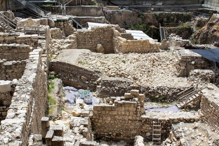
Passages, bridges, halls, medieval and Crusader remains, residential structures, cisterns, a quarry, water channels, and buried architectural elements occupy the route. These spaces were connected to form a continuous passage. The complex includes features from successive periods, including ancient water installations, streets, arches, masonry, and a ritual bath that continues to fill with water.
Water systems
Hasmonean Channel
The Hasmonean Channel at the northern end is about 80 metres long, approximately 1.2 metres wide, and up to 12 metres high. The Hasmoneans were the Jewish ruling dynasty that governed Judea before Herod. The channel is lined with original stone slabs that could be removed for maintenance and cleaning. It probably carried rainwater toward the Temple Mount and the Hasmonean citadel known as the Baris.
Herod’s expansion cut through the channel and made it unusable. He added a deep pool and a small dam to control remaining water, and the pool served soldiers stationed in the Antonia Fortress, a Herodian stronghold at the northwestern corner of the Temple Mount complex. Charles Wilson first investigated the channel in 1864, followed by Charles Warren and others. It was cleaned to form part of the route after the northern exit opened in 1996.
Struthion Pool
The Struthion Pool is a large, approximately cuboid underground cistern measuring about 15 by 53 metres. Its name means “sparrow,” referring to its relatively small dimensions compared with Jerusalem’s larger pools. It began as an open pool associated with the Hasmonean water system. During the Roman period, Hadrian covered it with two long parallel vaulted structures so that a paved surface could be built above it.
The pool collected rainwater from the gutters of buildings associated with the Roman Forum. Josephus recorded its existence in the first century and used the name Struthius. A modern dividing wall separates the pool into two parts. About three quarters can be seen from the basement of the Sisters of Zion convent, and the remaining quarter is visible from the Western Wall Tunnel. The pool was cleaned to its floor, with a wooden walkway constructed above it.
Gates, halls, and places of prayer
Warren’s Gate and the Cave Synagogue
Warren’s Gate lies about 30 metres north of Wilson’s Arch and about 46 metres from the tunnel entrance. It was the Temple Mount entrance closest to the Holy of Holies. Charles Warren discovered it after the surrounding area had been buried by the Mamluk raising of the Central Valley.
The gate may have served as a synagogue during the early Islamic period. Elhanan Reiner and Dan Bahat identified it with the “Cave Synagogue” mentioned in the Cairo Geniza, a repository of discarded Jewish manuscripts preserved in a Cairo synagogue. During the Crusader Kingdom of Jerusalem, the space was converted into a cistern by the Templars, a medieval Catholic military order, who built thick plastered walls.
In 1981, the upper part of the blocking wall was opened to investigate the cistern, but it was resealed after political unrest and concerns about separating the tunnel from the Temple Mount. The present blocking wall combines a lower section about nine centuries old with an upper section dating from recent decades. Opposite it, Rabbi Meir Yehuda Getz established a long, narrow synagogue on a raised platform in commemoration of the Cave Synagogue. The synagogue bears his name and is accessible only through the tunnel.
Herodian Hall
The Herodian Hall lies at one of the deepest levels of the complex, beneath the remains of the large bridge. Dating from the late Second Temple period, it has an irregular plan with several wings and a double square doorway resembling entrances in the Temple Mount enclosure. Its walls are built from carefully dressed ashlar blocks, and a cornice runs around parts of the room about one metre above the floor.
Attached piers and a partly preserved Corinthian capital survive in the northeastern corner. A Corinthian capital is the decorated top of a column associated with elaborate foliage. Ancient ballista stones recovered during excavation are displayed in recessed wall cases. They provide evidence of fighting during the Great Revolt, the Jewish uprising against Roman rule that began in 66 CE and ended with Roman reconquest in the first century.
Charles Warren first identified the hall and initially assigned it to the Hasmonean period. He later connected it with Herodian construction because of its large, finely dressed stones. The external corner resembles masonry at the Temple Mount, the Cave of the Patriarchs in Hebron, and the fortress at Mamre near Hebron. The stones have smooth central bosses and double marginal drafts, features associated with Herodian ashlar construction.
Two further wings were found around the hall during later excavation. The northern wall follows a meander-shaped plan, with a cistern behind it. Three Corinthian capitals remain in place in the central wing, and holes through their centres may indicate that the hall functioned as a nymphaeum, a monumental water installation or fountain display.
The hall continued in use after the Temple’s destruction and was renovated during the Byzantine period. A central standing column probably dates from that phase and supported the vaulted ceiling. The hall fell out of use after the Mamluks buried the Central Valley and built a later vault above it to support structures on the higher ground.
Quarry and Western Wall
Second Temple-period quarry
A quarry from the Second Temple period lies in the northern part of the complex near the Hasmonean Channel. Rectangular depressions in the bedrock show where large blocks were extracted, probably for the adjacent Western Wall. The quarry lies within the line of a paved street, indicating that preparation of the street was not completed.
Western Wall masonry
The Western Wall is a retaining wall of the Temple Mount, constructed during the late Second Temple period and preserved as part of the ancient enclosure. Along the tunnel, the Wall is exposed at a relatively consistent level, revealing differences in construction methods and later alterations.
The largest exposed course is known as the Great Course. Its stones rise about four metres high, and its largest block extends almost 14 metres and is estimated to weigh about 600 tons. The course probably strengthened the Temple Mount retaining walls, which were built using dry masonry, construction without mortar. The enormous stones were stabilized primarily by their weight and arrangement.
In the northern section, part of the Wall was cut directly into bedrock rather than assembled from separate blocks. The northern expansion of the Temple Mount extended beyond the original Mount Moriah and reached a higher northern hill. Builders cut the hill into a straight face and dressed it to imitate the masonry of the built Wall.
Rectangular holes at regular intervals in the Great Course probably belong to a later Byzantine storage pool in the Central Valley. Builders used the Wall as one side of the pool, but water penetrated through it. They inserted fixing stones to support an unusually thick plaster coating, about 30 centimetres deep. Plaster and fixing stones remain in place, although most of the coating was removed during excavation to expose the Wall.
Herodian street and bridge
Herodian Street
A paved street ran beside almost the entire Western Wall after Herod’s enlargement of the Temple Mount. Its exceptionally smooth paving stones measure up to about 2 by 3 metres each. The street formed part of the Temple Mount complex and provided access to western entrances. A line of shops beside the Wall probably sold offerings, sacrifices, and other goods associated with Temple worship.
Charles Warren exposed sections of the street in the nineteenth century and called it the Herodian Street. It followed the Central Valley, lying nearly 20 metres below the modern level in the southern section and rising toward the Antonia Fortress in the north. Much of its paving probably remained in place after 70 CE, when stones thrown from the Temple Mount buried it.
One exposed section is bordered by two adjacent Doric columns. A Doric column is a comparatively plain classical column type. The street was never completed in the northern hill: bedrock remained in place, the quarry was not filled, and the rock face was not fully dressed. The paving ends at a rock mass several metres high and thick, beside which paving stones intended to cover the area were found.
The date of the paving varied along the route. A continuation about 70 metres long, exposed in the archaeological garden during the 1990s, was probably laid during the 60s CE under Agrippa II, several years before the Temple’s destruction. Its unused appearance and lack of wheel-rut wear suggest that it was new when buried in 70 CE. The street continued south toward the Second Temple-period Pool of Siloam. An extension discovered in 2007 on the slopes of the City of David showed that the paved route was almost twice as long as the section previously exposed and formed a continuous axis between the Temple Mount and the southern part of Jerusalem.
Great Bridge and Wilson’s Arch
The Great Bridge provided western access to the Temple Mount on two levels. The lower route led from the paved street through a gate beneath the Temple Mount platform and then up an underground staircase. The upper route crossed the valley directly to the platform. The bridge also carried an aqueduct from the upper city into the Temple Mount.
Barclay’s Gate and Warren’s Gate formed part of the lower-level entrances. The upper level was reached across the Great Bridge above Wilson’s Arch or through Robinson’s Arch. The bridge and its approaches were destroyed in 70 CE, probably rebuilt by the Romans during the second or third century, and later buried when the Mamluks raised the valley.
Wilson’s Arch links the Great Bridge to the Western Wall, although its date remains disputed. The tunnel exposes the upper level of the Great Bridge and lower bridge piers resting on the valley floor. Shafts cut by Charles Warren in the nineteenth century remain visible.
Medieval structures
Hidden Passage
The Hidden Passage is a broad corridor beneath Chain Street beside the remains of the Great Bridge. It extends nearly 70 metres from the Central Valley to Wilson’s Arch and has a barrel vault, a continuous curved ceiling extending along the passage. Dan Bahat dates the vault to the Mamluk period, probably the fourteenth century, while Alexander Onn and Shlomit Weksler-Bdolah assign it to the Umayyad period in the seventh century.
The fifteenth-century Muslim historian and geographer Mujir al-Din called it the Hidden Passage and associated it with a tradition that King David used a concealed route from his palace near the Tower of David to the Temple Mount. Charles Warren rediscovered the corridor in the nineteenth century and established its modern name.
Crusader chapel remains
Narrow passages with slightly pointed vaults survive within the remains of the Great Bridge. Their form resembles Crusader church architecture of the twelfth century. Dan Bahat identified them as foundations of a chapel dedicated to Saint Giles. The passages are incorporated into the route, and one provides a view down to the Herodian Hall.
Mamluk madrasah
The remains of a Mamluk madrasah stand beside the Western Wall opposite the Great Course. A madrasah is an Islamic educational institution. Its deep supporting foundations form an X-shaped hall, a plan associated with Mamluk madrasahs in Jerusalem. The four sides were probably connected with teaching the four Sunni Islamic legal schools.
The eastern side abuts the Wall and contains a broad staircase leading toward it. The western side was formerly a cistern, as shown by plaster on its ceiling. It now contains a small lecture room and an electric model of the Temple Mount in the Second Temple period. The model demonstrates changes in the Central Valley by moving and raising sections, following a reconstruction method developed by Rabbi Zalman Koren.
Passages beneath the houses
Ministry of Religious Affairs Tunnel
The Ministry of Religious Affairs Tunnel is a narrow passage extending several dozen metres along the Western Wall north of the chamber opposite the Holy of Holies. It was created where excavators encountered storage spaces belonging to houses above and sought to limit disturbance to those structures.
Two openings in the floor reveal archaeological remains. One exposes Wall stones that fell during the Temple’s destruction and remained in place. The other shows part of a shop adjoining the Wall. The shop formed part of a longer line of shops that has not been fully exposed.
The passage ends at a pre-Herodian cistern from the Hasmonean period. Herod’s Western Wall cut through it and made it unusable. A rock-cut staircase and smooth, concave parapet survive from the installation. The parapet protected people crossing the valley from falling into the cistern.
Chamber opposite the Holy of Holies
A small chamber directly opposite the traditional location of the Holy of Holies lies beneath houses. It supports the buildings above and has been adapted for prayer and candle lighting. During the 1990s, water seeped through the Wall there, probably because an internal Temple Mount storage pool had risen. The leakage disappeared after the water level fell.
Northern exit
The northern exit tunnel was cut artificially for several metres through the bedrock of the northern hill to avoid privately owned property. It connects the complex with the Via Dolorosa beneath the Ummariya Madrasah. A modern wall separates the exit from the Struthion Pool, and the passage normally serves as the principal northern exit.
Later archaeological spaces
Hall of Periods
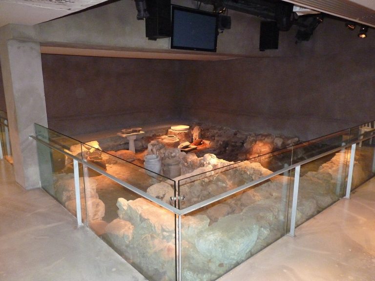
The Hall of Periods opened beside the Herodian Hall in 2009. It contains walls and finds from several historical phases. The oldest feature is First Temple-period paving crossing the bottom of the chamber, with a small number of finds dating to the tenth century BCE. Other remains preserved in place include a Second Temple-period water installation, large Roman-period walls and latrines, an Islamic wall, a Crusader pier and arch, and a Mamluk ceiling.
The space was discovered at the beginning of the post-1967 excavations but could not initially be cleared because of stability and safety concerns. A preliminary excavation was filled with foamed concrete. Later work used iron beams and thick concrete supports and proceeded from the top downward within an inverted-pyramid-shaped area, whose lower part was narrower than the upper part to reduce the risk of collapse. A gallery at approximately mid-height provides a view of the resulting tall hall.
Chain of Generations Center
The Chain of Generations Center occupies restored rooms beside the tunnel and remains associated with Second Temple, Crusader, and Mamluk structures. Designed by Eliav Nahlieli, it is a Jewish history museum with an audiovisual presentation and nine glass sculptures by Jeremy Langford.
Public khan remains
A large excavation begun in 2010 in the western part of the complex investigated the remains of a public khan from the late Crusader or Mamluk period. The structure covers several dunams and may connect the Western Wall Tunnel with the Ohel Yitzhak Synagogue near Chain Gate.