Siga: An Ancient Numidian City and Port in Algeria
Site at a Glance
- Popularity
- Medium
- Country
- Algeria
- Primary era
- Classical
- Eras represented
- Classical
- Civilizations
- Carthaginian, Roman
- Site type
- City
On this page7 sections
History
Siga was an ancient Punic-Numidian city and port in Oulhaça El Gheraba, Algeria. Punic culture was derived from Phoenician traditions and centered on Carthage. A Phoenician settlement occupied Rachgoun Island from the seventh century BCE. After it was abandoned in the fifth century BCE, a Punic-Numidian settlement grew upstream from the Tafna’s mouth. Siga developed as both a city and a harbor, known in antiquity as Portus Sigensis. The Periplus of Scylax, an ancient coastal sailing guide, lists it among Punic trading posts. Sailors first used a harbor on the islet of Acra, then established one at the river estuary.
Royal center and the Second Punic War
Siga became an important center of the Masaesyli, an ancient North African people whose kingdom occupied western Numidia. Their king, Syphax, used the city as a royal residence and one of his capitals. Positioned near the western limit of Masaesyli territory, Siga later became an important city in the Kingdom of Numidia. During the Second Punic War, the series of conflicts between Rome and Carthage, Syphax supported Carthage while Massinissa, king of the Massyli in eastern Numidia, backed Rome. Siga also hosted meetings between the Roman general Scipio Africanus and the Carthaginian leader Hasdrubal.
Massinissa defeated and captured Syphax, and western tribes were conquered and gradually incorporated into his kingdom. His victory alongside Rome in 202 BCE theoretically united the Masaesyli and Massyli kingdoms. Siga may have remained under Syphax’s son Vermina for a time; coins attributed to Vermina were issued there. The date Massinissa took control of the city is unknown, though coins are also attributed to him. After Massinissa died in 148 BCE, Siga passed to his son Micipsa, whose reign ended in 118 BCE. Coins attributed to Syphax’s successors carried the city’s name in Punic script as Shigan.
Later Numidian and Roman rule
Siga later lost importance as Iol, subsequently known as Caesarea, became the new capital. Bocchus the Younger later made Siga one of his capitals and established a mint there. Coins struck at the city are attributed to Syphax, Vermina, Massinissa, Micipsa, and Bocchus. Under Juba II and his son Ptolemy, Siga probably took an active part in trade with Iberia.
The city regained some importance under Roman rule, especially during the reigns of Septimius Severus and Caracalla. Ancient descriptions differ over its civic status. Pliny and the geographer Ptolemy call it a colonia, a community formally recognized as a Roman colony, while the Antonine Itinerary and Ravenna Cosmography describe it as a municipium, a self-governing community within the Roman system. The colony designation remains uncertain and may reflect an error by Ptolemy; Siga probably became a municipium during the second century CE. Under the Roman Empire, it belonged to western Mauretania Caesariensis, near the boundary with the North African province of Mauretania Tingitana.
Vandal and medieval periods
Vandals probably conquered and devastated Siga during their invasion of the region around 429–430 CE. Its port likely remained under Vandal control. After the Muslim conquest, a medieval city called Archgoul occupied the same site. The ancient name may have persisted in the form Rus-Siga, but references to Siga in historical documents cease during the second half of the seventh century. The present Catholic titular see of Sigus, an ecclesiastical title associated with a former diocese rather than necessarily an active local diocese, is probably linked to this location, although another ancient Sigus existed in western Numidia.
The origin of the name Siga is uncertain. One proposal connects it with an ancient Libyan form related to the Pan-Berber root agg, meaning to look down from above, perhaps describing the site’s steep position. Other suggestions relate it to words for a bull or ox, or for strength. The name may instead come from the river, called Siga in Roman times, or refer to watering and irrigation, abundant water channels, and agriculture that included olives, olive oil, grapes, and wine. Takembrit is the traditional Berber name for the location, though its meaning is unknown.
Remains
The remains of Siga extend across the left bank of the Tafna, along both riverbanks and over the hills of Bani Zhana and Ras Dchour. The site, known as Takembrit, lies a few kilometres from the river mouth and about 12 kilometres southwest of Béni Saf. At a bend in the lower valley, some ruins are visible on a flat-topped hill, while other monuments lie buried along the riverbanks. This spread of remains places the ancient settlement across both elevated ground and the river corridor.
Fortifications and urban installations
Surviving features include sections of a defensive wall and a fortified acropolis, meaning an elevated stronghold, on Ras Char. Water-management works and Roman baths are also among the archaeological remains. Together, these features attest to the fortified and urban character of the settlement, although their construction materials and detailed arrangement are not specified here.
Burial sites and finds
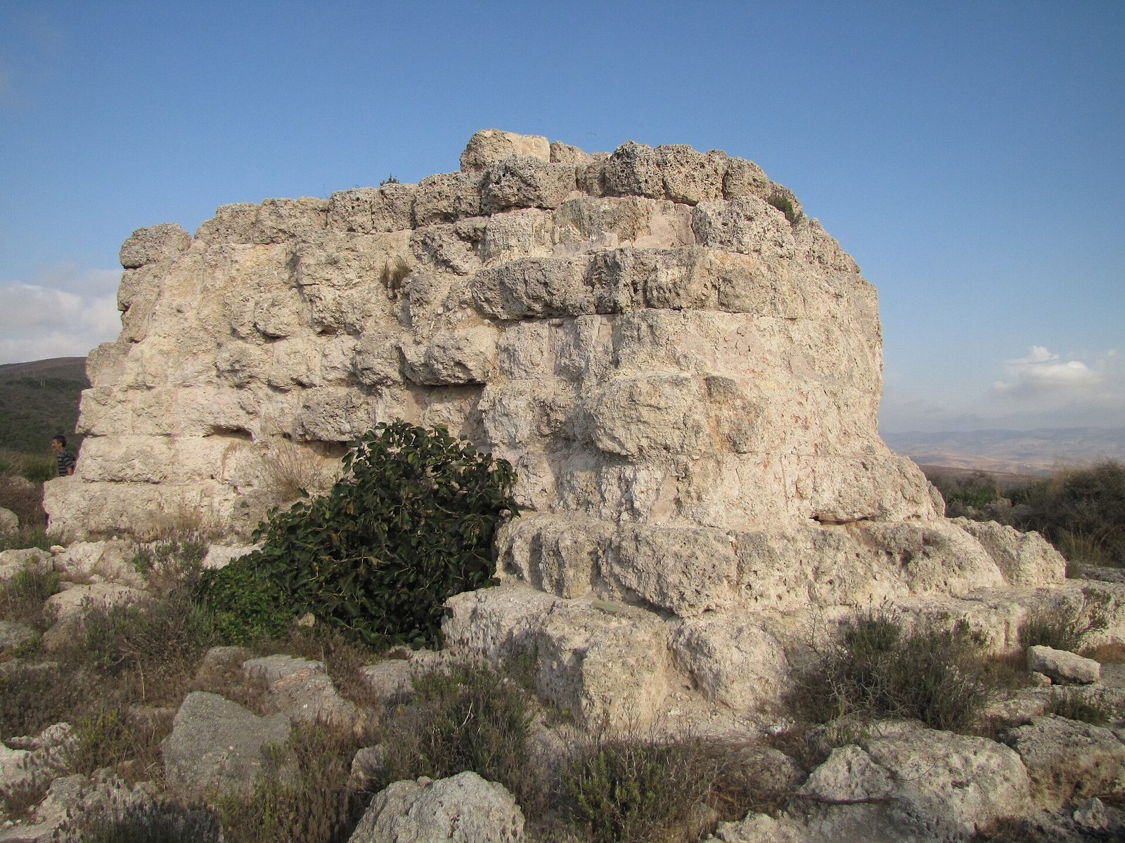
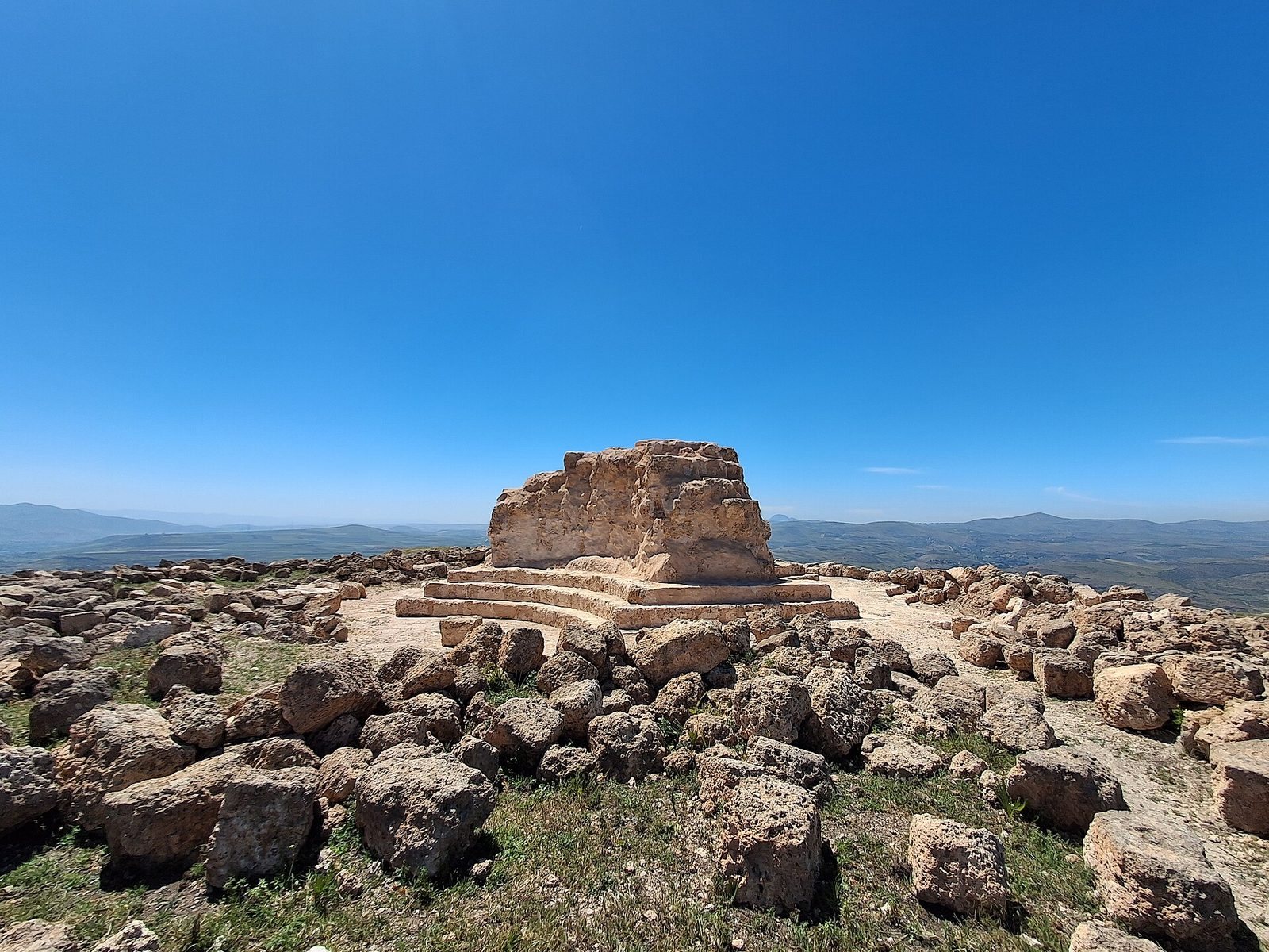
A cemetery on the plain has yielded material dating from the first to the third centuries CE, and a nearby stone milestone names the site. At Beni Rhenane, the remains of a royal Numidian mausoleum are identified as the Mausoleum of Syphax. Objects recovered through excavations at Siga are held in museums in Oran, Tlemcen, and Ain Témouchent; they include amphorae, large storage jars, and votive stelae, upright stones dedicated as offerings.