Side Ancient City: A Greek and Roman Port City in Türkiye


Site at a Glance
- Rating
- 4.7
- Popularity
- Very High
- Country
- Turkey
- Primary era
- Classical
- External website
- Open
- Eras represented
- Iron Age, Classical, Medieval
- Civilizations
- Ancient Greek, Byzantine, Roman
- Site type
- City
On this page35 sections
History
Side Ancient City is an ancient Greek-founded city in Türkiye, located on a rocky Mediterranean peninsula near the mouth of the Manavgat River. Greek settlers from Cyme in Aeolia traditionally founded Side during the seventh century BCE, although the foundation is also placed broadly in the seventh or sixth century BCE. They encountered an ethnically mixed Pamphylian population and established a settlement that retained its own indigenous language, Sidetic. Side later became part of the Hellenistic world, a period following Alexander the Great’s conquests when Greek political, artistic, and linguistic institutions spread across the eastern Mediterranean and western Asia. Under Roman rule, particularly from the first through the third centuries CE, it developed into one of the eastern Mediterranean’s wealthiest cities and an important administrative, commercial, and naval center.
Foundation and Hellenistic rule
An earlier settlement existed at Side before the arrival of the Greek colonists. The much earlier foundation date of 1405 BCE, attributed to the Christian historian Eusebius, has no historical basis. The local language, Sidetic, was related to Luwian and survives in a small number of coins and bilingual inscriptions. Greek became established after Alexander the Great took the city without resistance in 333 BCE. He left a garrison and an administrator while continuing his campaign against Persia.
After Alexander’s death, Side came under Ptolemy I Soter and was later contested by the Ptolemies and Seleucids, the ruling dynasties that emerged from the division of Alexander’s empire. Cities in the region nevertheless retained substantial independence. In 190 BCE, Side became involved in a naval battle between the fleet of Antiochus III, commanded by the Carthaginian military leader Hannibal, and the fleet of Rhodes, which was allied with Rome. Side initially supported Antiochus, then changed allegiance and concluded a treaty with Rhodes. Its cooperation with Rome and Rome’s allies helped the city secure a privileged position under the Peace of Apamea.
Side continued to maintain connections with major powers. In 147 BCE, it supported the Roman general Scipio with five warships during the Roman siege of Carthage. The city’s position in the Hellenistic world is also reflected in the education there of Antiochus VII, a Seleucid king who adopted the epithet “Sidetes.”
Commerce, piracy, and Roman incorporation
By the late second and early first centuries BCE, Side had become a major market and anchorage for Cilician pirates and a center of the Mediterranean slave trade. Roman, Seleucid, and Ptolemaic authorities tolerated this commerce because it supplied enslaved people to their empires. Rome established a stronger presence in Cilicia from 103 BCE, but early campaigns did not end the activities of pirates based in Rough Cilicia.
Pompey the Great defeated the Cilician pirates at the Battle of Coracesium in 67 BCE and relocated survivors to the lowlands. Side continued to function as a slave market and pirate haven for some time afterward. Its citizens later erected a monument and honorific statue to Pompey, apparently without punishment from the Roman Senate. Side was successively associated with the Roman districts of Cilicia Aspera, Syria-Cilicia Phoenice, and Galatia. In 25 BCE, after the death of its king Amyntas, Augustus, Rome’s first emperor, incorporated the city into the province of Galatia.
Roman prosperity
During the Roman imperial period, the era when Rome was governed by emperors beginning under Augustus, Side became a prosperous provincial administrative center. Its commercial and military fleets connected it with Egypt and other Mediterranean regions. The city exported olive oil, wine, and timber, while its prosperity and extensive public building program depended heavily on maritime commerce and the slave trade.
Side’s population during its greatest prosperity is estimated at about 40,000 to 60,000 people. The theater, baths, temples, nymphaeum, streets, agoras, library, and monumental gates were built largely during this period or financed by its wealth. The harbor also gave Side a military role. In the second half of the third century CE, it served as a supply and operations base for Roman forces involved in the Roman-Persian wars, and the city received the title “Nauarchis,” meaning “Mistress of the Fleet.”
Decline and Byzantine transformation
From the third century CE onward, Side experienced renewed piracy and attacks. It resisted an attack and siege by raiders from the Black Sea, but incursions by the Isaurians from the Taurus Mountains contributed to the city’s impoverishment. The date of the internal wall that divided the peninsula remains uncertain. It may belong to the fourth century, the seventh century, or a later period.
Side experienced a temporary revival in the fifth century CE. Buildings, including the theater, were restored, and a forum associated with the reign of the Roman emperor Arcadius was established outside the main gate. Side also became an important Christian center. Its metropolitan bishop held a senior position within the Patriarchate of Constantinople, the principal ecclesiastical institution of the Byzantine capital, and supervised fifteen bishoprics.
The spread of Christianity contributed to the abandonment or deterioration of pagan temples, baths, the nymphaeum, and other pre-Christian public buildings. Side nevertheless remained an important Byzantine settlement during part of the fifth and sixth centuries. It possessed several large churches and a hospital probably associated with the Byzantine emperor Justinian I.
Arab forces sacked and burned Side during the seventh-century Muslim conquest of Cilicia. Continuing attacks, the silting of the harbor, and the growing importance of nearby Attalia encouraged the inhabitants to move away. By approximately 900 to 1000 CE, most residents had relocated to Attalia, and Side was abandoned by the twelfth century apart from possible squatters or occasional travelers.
Abandonment and archaeological investigation
The Ottoman Empire took control of the region after the fall of the Byzantine Empire in 1453 but did not substantially reuse the ancient settlement. The modern village of Selimiye was established nearby around 1895 to 1900 by Muslim refugees from Crete. Because the ancient city remained largely undeveloped for centuries, substantial Roman and Byzantine remains survived beneath later settlement and sand.
Archaeological investigation began sporadically in the late nineteenth century after European travelers and researchers documented the ruins. Systematic excavation began in 1947 under Arif Müfid Mansel of the University of Istanbul. Mansel directed major excavations until 1973, followed by work under Jale Inan from 1974 to 1976 and Ülkü Izmirligil from 1982 to 2008. Hüseyin Sabri Alanyali led excavations from 2009 to 2019, and Feriştah Alanyali subsequently continued the work. Excavation areas remain within the modern village, including a section of the colonnaded street.
Restoration and conservation of the theater began in 1982 under Ülkü Izmirligil for the Turkish Ministry of Culture and Tourism and continued through 2008, alongside extensive work on Side’s water channels. Responsibility passed to Hüseyin Sabri Alanyali in 2009. Further work on the theater included a renovation before its reopening around 2017 and additional restoration in 2023 and 2024.
Remains
Side occupies a rocky peninsula beside the Mediterranean, with its surviving urban fabric concentrated within and around the modern settlement. Three systems shaped the ancient city: fortifications, a harbor supporting trade and communication, and a long-distance water supply. Important buildings were constructed mainly from marble transported by sea because suitable local quarries were lacking. Roman and Byzantine buildings, streets, harbors, temples, churches, houses, and buried areas extend across the peninsula, while a high sand dune covers much of the southeastern quarter.
Fortifications, gates, and harbor
Land walls and internal wall
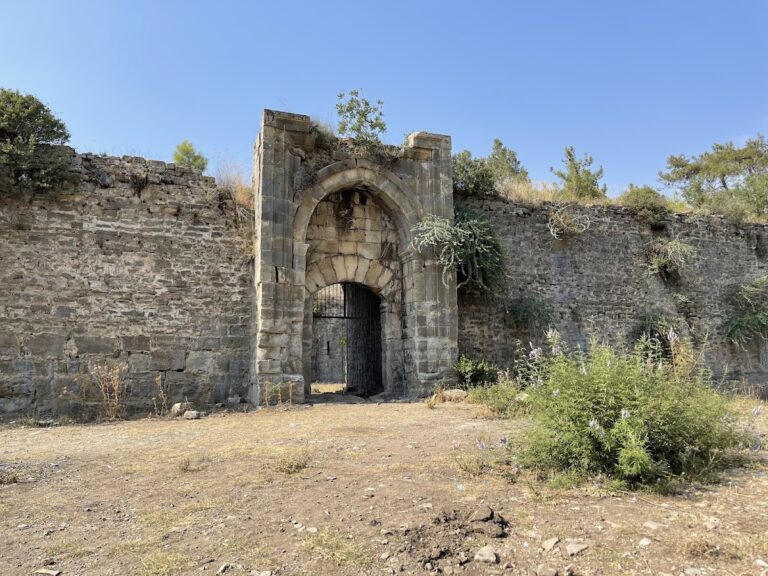
The principal land defenses formed a unified circuit of approximately one kilometer along the northern and eastern sides of the city. The circuit incorporated the land wall, the main gate, and the East Gate. The wall survives in places to its original height, while sections farther south lie beneath sand. Its outer face is built of regular ashlar masonry and carries an unusual purely ornamental cornice. On the inner face, three projecting levels create two defensive walkways.
A separate wall, conventionally called the Philippus-Attius Wall, crosses the narrowest part of the peninsula for approximately 350 meters and divides the city into two sections. It is irregularly aligned and less carefully built than the main circuit. Its construction uses reused architectural pieces, including column drums and marble blocks, together with brick and mortar. Investigation of about half its length from 2013 onward revealed a long sequence of construction and alteration extending from the early Roman to the middle Byzantine period. Its original date and purpose remain uncertain, with possible construction during fourth-century incursions by mountain tribes, during seventh-century attacks by Persian and Arab forces, or at a later time.
The sea wall along the shore is largely destroyed and was substantially modified during the Byzantine period. Erosion from the Manavgat River and wind-blown sand produced a dune several meters high over the southeastern quarter of the ancient city.
Main Gate and East Gate
The main gate consisted of a semicircular courtyard between an outer and an inner gate, with two large towers at the sides. Two stories of piers, niches, and statues surrounded the courtyard. Many architectural fragments and statues from the gate are preserved in the museum, while the gate itself survives in poor condition.
Excavated in the 1960s, the East Gate had two barrel-vaulted entrances from outside and two rectangular flanking towers. Its courtyard measured approximately 17 by 17 meters. Three further passages led into the city, and stairways connected the courtyard with the defensive walks or a terrace. Reliefs depicting swords, helmets, and cuirasses were found there and may represent captured weapons. They are displayed in the museum courtyard. The gate underwent repeated alterations and was used for private purposes during later centuries, at least until the seventh century.
Inner gate and Vespasian monument
An inner city gate stood where the principal street reached the theater. In Roman times, it formed a high vaulted arch that still rises to about 12 meters and may originally have carried an imperial quadriga statue. As the city contracted, masonry filled the arch and created a smaller gate that became the principal entrance. The surviving masonry contains numerous reused architectural elements, especially column drums.
Beside the inner gate stood a monument to Vespasian. It had been moved from another location during construction of the internal wall and reused as a fountain. A semicircular niche fed a small basin, while two aedicules, small shrine-like architectural frames, stood on either side with fluted columns and statues. Cornices and triangular pediments crowned the three principal elements. Two additional fountains stood across the street.
Harbors and maritime facilities
A large artificial harbor occupied the tip of the peninsula. Its triangular basin was protected by a mole of conglomerate blocks incorporated into the city wall. Two entrances and a lighthouse served the basin, which could accommodate approximately 25 to 30 ships moored beside the quay. A second artificial basin near the northwestern tip probably served mainly as a military harbor. Smaller anchorages, fishing facilities, docks, and shipyards were situated elsewhere along the shore.
The harbor connected Side with maritime routes to Anatolia, Cyprus, the Levant, North Africa, and Alexandria. Its repeated silting required continual cleaning and eventually contributed to the city’s decline. The harbor’s military importance is reflected in Side’s use as a Roman supply and operations base during the third-century Roman-Persian wars.
Water supply and streets
Aqueduct system
A long-distance aqueduct probably built in the second half of the second century CE brought water from the Dulamni spring in the upper Manavgat valley. The source is now covered by the Oymapinar Reservoir. Following the natural gradient for approximately 30 kilometers, the system had an average fall of 1.2 parts per thousand and a total elevation difference of only about 36 meters.
The water system included three aqueduct galleries cut into the gorge, approximately 13 kilometers of tunnels, more than twenty aqueduct bridges, vertical construction shafts, and surviving tunnel entrances. Near the city wall, a distribution structure sent one branch to the nymphaeum and another through the wall toward the theater. A large cistern there collected water for distribution to fountains and baths.
Colonnaded streets and houses
Two broad colonnaded streets led from the main gate. One ran south beside shops, a narrow water basin, and a channel beneath the marble paving. The principal avenue followed several bends toward the large square between the temples and the sea. Shops and sections of its colonnades have been excavated, while later houses cover part of its rear section.
Narrow lanes met at irregular angles between the principal streets and enclosed irregularly shaped urban blocks. Several private houses were excavated beside one lane, including a peristyle house, organized around a colonnaded courtyard, and a console house. The two-story console house has a courtyard measuring 16 by 16 meters, surrounded by rooms. These houses were connected to the drainage system along the main streets.
Agoras and civic buildings
Commercial agora and latrine
The commercial agora immediately in front of the theater formed an open square approximately 65 meters on each side. Colonnades with shallow timber roofs surrounded the space, with shops behind them. Its monumental entrance survives at foundation level, while some granite columns have been re-erected. Seven vaulted rooms stood beside the theater stage building, five opening toward the theater.
A semicircular latrine occupied the southwestern corner of the agora beside the theater’s retaining wall. It contained 24 seats, a drainage channel below them, and a separate water channel for washing. Marble revetment covered the walls, and a mosaic decorated the barrel vault. A large statue niche opened toward the agora, while low entrances provided access from both the square and the theater.
Southern square and imperial-cult hall
A second large square south of the commercial agora was connected to it by a broad paved street. The construction of the Philippus-Attius Wall partly destroyed its southern colonnade and shops, and two small gates were cut into the sea-facing corner.
Along the eastern side stood a large building with three halls. The central hall measured 26.45 by 15.20 meters, while the side halls measured approximately 19.5 by 15 meters. Its richly decorated two-story walls contained niches and tabernacles, and at least twenty oversized statues were recovered there. Arif Müfid Mansel interpreted the building as an imperial-cult hall with an adjoining library or archive, fronted by a possible civic agora. Imperial cult was the state-sponsored veneration of deified or divinely honored rulers.
Theater and performance buildings
Auditorium and supporting structure
Side’s theater is a Roman-style structure with strong Greek design influences. Its present form dates mainly from the second century CE, probably the last quarter of that century, and was built over an earlier Hellenistic theater. Two Hellenistic steps found in the lower seating area are protected beneath glass.
The auditorium, or cavea, is more than a semicircle, reflecting the earlier theater. It measures approximately 120 meters across and originally accommodated about 13,700 to 17,200 spectators. The lower seating area had about thirty rows divided into eleven wedge-shaped sections, while the upper level had approximately twenty-five rows divided into twenty-four sections.
Because the peninsula lacked a sufficiently steep natural hill, the lower seating was built against a slight slope and the upper seating was carried on a massive freestanding structure. The upper construction rises more than 15 meters in two stories and originally stood approximately two or three meters higher. Its substructures contain two levels of radial barrel vaults, with 23 vaults on each level. The lower level could be reached from the hillside.
The theater facade has two stories of arched openings and an annular passage behind it. An inner sloping barrel vault supports the seating, while internal stairways lead to a broad covered circulation passage around the top of the cavea. A horizontal passage separates the lower and upper seating areas. Multiple vaulted entrances allowed crowds to circulate through the building.
Orchestra and arena conversion
The cavea faces east-northeast. The orchestra, the performance area between the audience and stage, is semicircular and approximately 29 meters in diameter. It was enclosed by a podium 0.805 meters high, with a passage about 0.82 meters wide on top. A drain around its rim measured approximately 0.73 meters wide and 0.68 meters deep.
In the late Roman period, a massive wall approximately two meters wide was built around the orchestra and enclosed the lowest four rows of seats. This changed the performance space into an arena, probably for animal hunts and gladiatorial spectacles. The possibility that it served as a water basin for aquatic displays also remains open.
Stage building and later Christian use
The trapezoidal stage platform had a podium approximately six meters wide and stood three meters above the orchestra. The three-story stage building was about 63 meters wide and richly faced with marble. Actors reached its six-meter-deep platform through five doors.
The decorated front of the stage building had a rectilinear design with five doorways that became smaller toward the sides. Paired groups of four columns stood between the doors, with matching half-columns against the wall. A two-story colonnade and richly sculpted coffers completed the arrangement. Poorly preserved reliefs on the podium depicted scenes from Greek mythology, while first-story friezes represented episodes from the life of Dionysus, the god associated with wine, theater, and ecstatic celebration.
Nine rooms occupied the area behind the stage. The third, fifth, and seventh rooms served as passageways leading directly into the orchestra. A semicircular latrine stood at the northern end, and a forum with colonnades on all four sides and shops on three sides occupied the space behind the stage building.
In Byzantine times, a Christian chapel was added beside the stage building, creating an open-air church. Dionysian reliefs considered unsuitable for the Christian setting were removed. When the urban plan was reorganized in the fourth century, the stage building was incorporated into the city’s new defensive wall.
Temples and sculpture
Harbor temples
The two principal temples stood beside the harbor on a raised platform close to the sea. They were marble temples surrounded by colonnades, each with a walled principal room and a vestibule. The colonnades had six fluted columns on each short side and eleven on each long side. Inscriptions do not establish their exact dedications, but the larger temple toward the harbor is generally identified with Athena and the other with Apollo.
The Temple of Apollo was constructed in the second century CE. Five columns, parts of its upper architectural members, and one corner of its pediment have been re-erected. A nearby Byzantine basilica incorporated part of the temple precinct. The temples were damaged from the Byzantine period onward, and their surviving remains are fragmentary.
Other temples and religious buildings
A small temple near the theater stood on a marble podium and was probably dedicated to Dionysus before later conversion into a shop. A second small temple near the commercial agora had a circular plan, a nine-step approach, and a round central room surrounded by twelve columns. Its pyramidal roof brought the building to about 15 meters in height. It was probably dedicated to Tyche, the deity who personified fortune and the prosperity of cities.
A further temple near the main avenue had an unusual semicircular plan influenced by Syrian models. Four columns stood before a straight facade with a doorway, while a broad staircase of fourteen steps led to the platform. The vaulted interior and a bust in the pediment suggest a possible dedication to Men, a deity associated with the moon in Anatolian and eastern Mediterranean religion. A coin also attests the cult of Men at Side.
Inscriptions indicate that Side possessed other temples, an imperial-cult complex, and several synagogues. More than 400 sculptures and fragments from different city buildings include representations of gods, heroes, athletes, emperors, and prominent citizens, many copying famous Greek works. Finds from the theater, the great nymphaeum, the Vespasian monument, and the imperial-cult hall include statues of deities and athletes.
Baths and museum buildings
Agora bath
The agora bath probably dates from the fifth century CE. It stands outside the inner wall opposite the commercial agora and beside the colonnaded street. The building has been excavated and restored, and since 1962 it has housed a museum displaying Hellenistic and Roman works found at Side. These include statues recovered from the imperial-cult hall and richly decorated Roman sarcophagi. Its adjoining exercise area, or palaestra, functions as a museum garden.
Great Bath
The Great Bath on the eastern side of the southern colonnaded street was Side’s largest bath complex. It contained eight rooms, many surviving walls, and several pools, including a cold-water room measuring 12.40 by 5.40 meters. Heated rooms used hypocaust underfloor heating, in which hot air circulated beneath the floor. The complex was probably built in the third century CE and restored in the fifth or sixth century, when some doorways were blocked and a large internal wall was added.
Harbor Bath
The Harbor Bath stood beside the harbor, which later became silted. Built in the second century CE, it is the oldest known bath complex at Side. It consisted of three large rooms and several smaller ones.
Necropolis and Byzantine buildings
Necropolis
The extensive necropolis outside the land wall contains graves ranging from simple earth pits to large mausoleums. It was used mainly during the Roman imperial period and continued in use during the Byzantine period. Finds include sarcophagi, two sarcophagi decorated with Eros figures, grave altars, and fragments of a larger funerary temple complex. Most of the necropolis lies beneath dunes, with a few wall remains visible.
South Basilica
The South Basilica beside the principal temples had three aisles and measured approximately 35 by 25 meters. Its atrium was partly integrated with the earlier temple precinct. Seven vaulted niches survive in the north wall, together with several rooms at the east end. A smaller later church was inserted into the partly ruined basilica and remains largely standing.
Bishop’s basilica and baptistery
A second monumental basilica stood approximately 200 meters from the main gate beside the second colonnaded street. It probably served as the bishop’s basilica and was associated with a bishop’s palace. Its three aisles were approximately 37.5 meters long. Adjacent structures included a monumental three-room baptistery with numerous angular and semicircular wall niches, additional rooms, and a smaller church across the street. Much of the basilica reused earlier Roman architectural elements.
Third basilica and possible hospital
A third large basilica stood between the colonnaded street and the northern sea wall near the theater. Only its eastern facade survives, while heavy substructures on the declining western side remain visible from the coastal path.
A rectangular Byzantine building east of the principal colonnaded street is identified as a possible hospital. It survives in two stories and contains five adjoining barrel-vaulted rooms, some with wall frescoes. It may be the hospital established at Side by Justinian I in the sixth century.
Byzantine house
A well-preserved Byzantine house near the southern sea wall occupies an entire urban block measuring approximately 35.50 by 14.50 meters. It consists of a large forecourt and rooms covered by brick vaults.