Septempeda: A Roman Town in Picenum
Site at a Glance
- Popularity
- Medium
- Country
- Italy
- Primary era
- Classical
- Eras represented
- Classical, Medieval
- Civilizations
- Roman
- Site type
- City
On this page15 sections
History
Septempeda was a Roman town at La Pieve, east of modern San Severino Marche in Italy. Its origins are placed in the third century BC, during Rome’s conquest of Picenum, an ancient region of central Italy inhabited before Roman rule by the Piceni. Tombstones bearing the names of early soldiers, including members of the Baebia, Calpurnia, and Flavia families, reflect the settlement’s early Roman population. Septempeda may also have taken in social and commercial activity from nearby Picene villages.
Roman origins and civic status
Between the third and second centuries BC, Septempeda was organized first as a conciliabulum (a community organized around an assembly center) and later probably as a praefectura (a territory administered by Roman-appointed prefects). Around the middle of the first century BC, it likely gained the status of a municipium, a Roman town with recognized civic standing. Pliny the Elder records this rank, which is also confirmed by inscriptions, including one from the reign of Emperor Aurelian (AD 270–275).
Roman geographical records place Septempeda within a wider network of towns and roads. The Antonine Itinerary locates it on a branch of the Via Flaminia, a major Roman road linking Rome with the Adriatic. This route crossed the Apennines from Nuceria to Prolaqueum and continued toward Ancona. Another ancient record names Septempeda’s surrounding territory.
The origin of the name Septempeda is uncertain. A traditional explanation connects it with the seven hills around the town, by analogy with Rome’s seven hills. Other proposals draw on recurring associations with the number seven, including local stories about a seven-spouted fountain, a 77-arched arcade, and seven brothers.
Abandonment and the move to Monte Nero
After Gothic raids, Septempeda was abandoned in AD 545. Its inhabitants moved a few kilometres west, across the Potenza River, to the safer site of Monte Nero. Severino, the town’s last bishop, had held office from 540 until his death in 545. His remains were recovered after the incursions and transferred to Monte Nero on 23 April 590. Tradition holds that he had been buried and concealed in Septempeda’s cathedral of Santa Maria to protect his remains.
An early medieval legend links the transfer with the veneration of Severino. A document issued by Bishop Eudo in 944 records the construction of a church at the settlement that had taken the name San Severino. The name later developed through “Castle of Saint Severino” and Sanseverino to San Severino Marche.
San Severino through later centuries
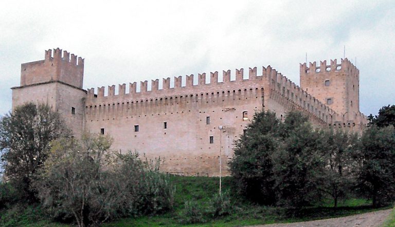
San Severino was destroyed at an uncertain date and later rebuilt. It became a free Ghibelline city, meaning that it belonged to a political faction associated with support for imperial authority. After the fall of the Duchy of Swabia, church authorities brought the town under their control. Smeduccio acquired its lordship in 1370, and the Smeducci family ruled until 1426, when San Severino returned to papal authority.
French occupation in 1797 was followed by the town’s incorporation into the Roman Republic, a short-lived state established in central Italy under French influence. In 1805 it became part of the Napoleonic Kingdom of Italy. San Severino returned to papal rule in 1814 and became part of Italy in 1860.
Archaeological investigations
Excavations in the second half of the twentieth century revealed major structural remains at Septempeda. From 2004, the Potenza Valley Survey Project at Ghent University used low-altitude aerial photography and geophysical surveys to map the town’s urban fabric. The project was directed by archaeologist Frank Vermeulen.
Remains
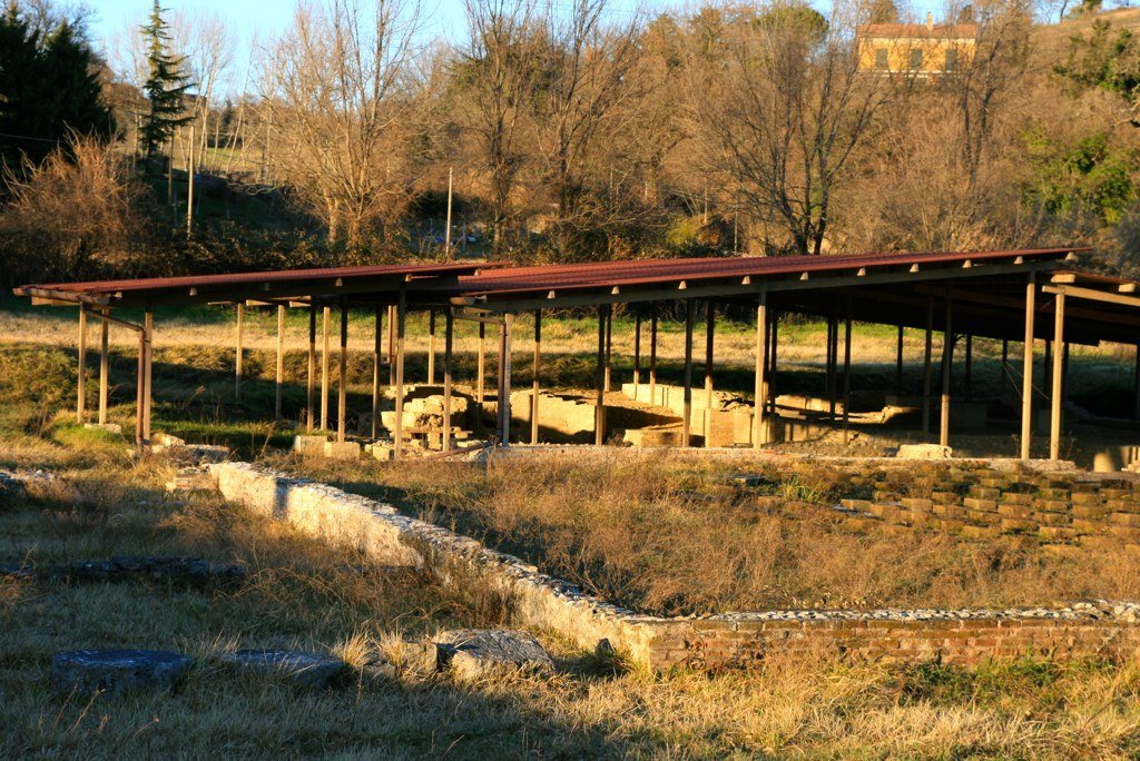
The archaeological park at La Pieve covers 12,270 square metres, while the ancient walled town occupied about 15 hectares. The site lies on the left bank of the Potenza River, roughly 40 kilometres inland from the Adriatic and at the foot of the Apennines. Now mostly farmland, the town had an irregular pentagonal plan. Its walls enclosed higher ground north of the Roman valley road and a lower area sloping gently toward the river.
Town plan and defenses
Walls and gates
Foundations of the town walls and remains of its eastern and south-western gates are visible. Excavated sections of the walls were built with opus quadratum, masonry made from squared stone blocks. The gates formed access points through the enclosure around the ancient town.
Streets and burial grounds
The mapped street plan includes several parallel streets and a principal road, the decumanus maximus, or main street of a Roman town. It follows the line of the modern valley road. Outside the walls, the road ran beside cemetery areas containing tombs from the first and second centuries AD, as well as funerary monuments that provide information about the town’s inhabitants.
Civic, industrial, and religious remains
Forum
The town’s forum, its central public and civic space, can be distinguished beside the principal road. It measured about 59 by 33 metres and was surrounded by public buildings and monuments.
Bath complex
A centrally situated bath complex included a courtyard, a portico, a pool, and heated rooms with heated floors. Many of its rooms originally had mosaic pavements. A bath building, probably close to the forum, is among the remains.
Pottery and tile production
West of the walls and north of the main road, an industrial area contained a group of kilns for producing tiles and pottery. Excavations beyond the walls also uncovered a pottery furnace and a private Roman house decorated with mosaics.
Basilica and temples
Inscriptions identify a basilica, a large civic hall, and temples dedicated to Jupiter, a major Roman god, and Feronia, an Italic goddess associated with nature and fertility. The temple of Feronia stood outside the town walls.
Cathedral of Santa Maria
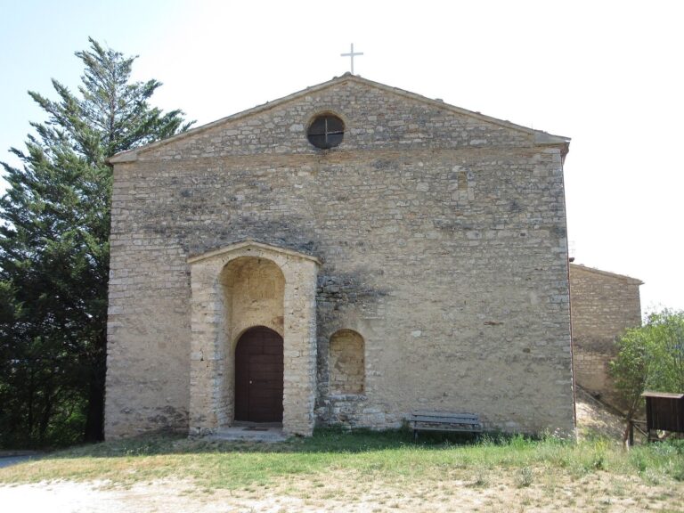
The cathedral beside the ancient walls probably originated in late Roman times. Its apse, the rounded end of the sanctuary, and its right-hand nave, the main body of the church, retain Romanesque features. Romanesque architecture is characterized by rounded arches and substantial masonry. The building was reconstructed in the thirteenth century in Gothic-Lombard style, which combines Gothic forms with Lombard and Italian traditions. Frescoes survive, and the cathedral has been restored.