Sēlpils Castle: A Medieval Fortress and Ducal Center in Latvia
Site at a Glance
- Rating
- 4.1
- Popularity
- Very Low
- Country
- Latvia
- Primary era
- Medieval
- Eras represented
- Medieval, Early Modern
- Civilizations
- Crusader, Duchy of Courland and Semigallia, Livonian Order, Polish–Lithuanian Commonwealth
- Site type
- Military
- Remains
- Castle
On this page12 sections
History
Sēlpils Castle is a fortress on the Daugava in Sēlpils parish, Latvia, whose stone phase is dated to 1373 and whose origins lie in a Selonians hillfort. The Selonians were a Baltic people associated with the historic region of Selonia. The site grew into a military and political center because it controlled river traffic, a route toward Lithuania, and a ford that emerged nearby when the water was low.
Selonian stronghold and bishopric
A wooden fortress at Sēlpils is traditionally dated to 1187. In 1208, Bishop Albert von Buxhoeveden sent crusading forces against the stronghold, which Lithuanian raiders used as a base for rest and supplies. After a siege and assault, the crusaders accepted the Selonians’ surrender and baptism. They consecrated the fortress and made it an outpost against Lithuanian attacks, while local people could also seek shelter there.
In 1218, Albert established the Diocese of Selonia-Zemgale, an ecclesiastical district governed by a bishop, with its seat at Sēlpils. Its first bishop, Bernhard II zur Lippe, lived there from 1218 to 1224. The territory was divided between the Livonian Order and the Archbishopric of Riga in 1251. Two years later, Pope Innocent IV granted Sēlpils and the rest of Selonia to the Order.
Livonian Order and ducal center
A medieval chronicle dates the stone castle to 1373, although construction in the 12th or 13th century has also been proposed. The castle later returned to the Livonian Order, a medieval military-religious order that ruled territories in Livonia. It became the seat of the Order’s local bailiff. The official was known as a vogt, an administrative and judicial officer; twelve Sēlpils vogts are recorded between 1422 and 1559. In 1540, the bailiff granted Maerthen Molne permanent use of a farm and meadow. During the wartime years of 1555–1556, the bailiff was estimated to be able to muster 30 cavalrymen.
In 1559, the Order and the Archbishopric of Riga pledged Sēlpils and other territories to Sigismund II Augustus, king of Poland and grand duke of Lithuania, in exchange for help against Muscovy, the Russian state centered on Moscow. Polish control of the castle began on 30 December. Its commander, Mikołaj Tolwiński, brought in four quarter-serpents, a type of small cannon, three double falconets, also small cannon, 24 arquebuses, or early firearms, and gunpowder in 1560. At the end of May, the Order’s master, Gotthard Kettler, met Lithuanian commander Mikołaj Radziwiłł Rudy at Sēlpils. About 14,000 Lithuanian troops arrived by the end of June to assist Kettler. In July, Kettler declined to lead an expedition against the Russians until he had resolved a dispute with Duke Magnus. Polish royal Tatar troops returning from an unsuccessful expedition arrived around the end of that month.
At the end of 1561, Kettler transferred Livonia to Sigismund II Augustus, who made him Duke of Courland and Semigallia. Selonia and Sēlpils became part of the new duchy. Kettler moved his residence from Riga to Sēlpils in late 1566, and the castle served as both a ducal residence and an administrative center for Semigallia and Selonia. After Russian forces captured Koknese in 1577, Sēlpils became a border fortress. The ducal residence moved first to Kuldīga and then, in 1578, to Jelgava.
Kettler’s will of 1587 assigned Semigallia and Selonia, with Sēlpils as their center, to his son Friedrich; his other son, Wilhelm, received Courland, centered on Kuldīga. Until Wilhelm came of age, the court was to alternate between the two castles. After the duchy was divided in 1596, Friedrich’s court settled in Jelgava. A map made by papal envoy Antonio Possevino in 1582 depicts Sēlpils as a substantial fortress with three towers.
Contested fortress and town
In 1599, Russian forces raided the district, burning five estates: Sala, Igate, Jaunmuiža, Sunākste, and another below the castle. Local peasants took refuge in the fortress. Its defenders fired on the raiders, who then moved on. In 1601, Polish grand hetman Jan Zamoyski crossed the Daugava near Sēlpils with his forces as he hurried to relieve Swedish-besieged Riga.
A town had grown beside the castle by the early 17th century. In 1621, Duke Friedrich confirmed its police regulations, which set out boundaries and roads, required Jelgava weights and measures, and established market days. During wartime, German townspeople were to be accommodated in the castle, while local Selonians, newcomers, and visitors were assigned space in the outer ward.
During the Polish-Swedish war, Sēlpils changed hands several times. In 1625, forces of Sweden’s King Gustav II Adolf besieged the castle. Its garrison numbered 20, with four men living there permanently. The commander, Gotthard von der Tinn, later estimated that he had about 30 able-bodied fighters when local refugees were included. After hostages were exchanged and negotiations continued for several hours, the defenders surrendered on 28 July. The agreement, signed by Swedish chancellor Axel Oxenstierna, allowed the inhabitants three days to leave with their possessions. The Swedes retained the castle’s furnishings, arms, and supplies.
Polish forces under Aleksander Gosiewski retook Sēlpils after a short siege in early 1626. The shortage of drinking water was the main reason for the Swedish surrender. On 30 September, Swedish forces under Jakob De la Gardie captured the castle again. The Poles demolished its walls before withdrawing toward Bauska, and the Swedes repaired the defenses. Truce talks between Sweden and Poland-Lithuania held at the castle in October failed. Polish forces burned the castle and nearby town in 1627, but both were soon rebuilt.
Destruction and later study
During the Second Northern War, a mid-17th-century conflict in northern Europe, Swedish forces sank boats loaded with stones in the Daugava near Sēlpils to impede Russian troop movements. In 1704, during the Great Northern War, a conflict in northern and eastern Europe from 1700 to 1721, combined Saxon and Russian forces besieged the castle, which held a Swedish garrison of 200. Swedish reinforcements under Adam Ludwig Lewenhaupt approached, prompting the besiegers to withdraw toward Jēkabpils. Swedish forces won a battle there on 26 July. Lewenhaupt then ordered Sēlpils Castle destroyed to prevent the enemy from fortifying it. Riga colonel Johann Adolf Klodt von Jürgensburg directed the sappers who demolished it. The work lasted more than three weeks, and the castle was blown up in August.
The castle was no longer inhabited during the 18th century. Ernst Johann von Rönne commanded the Sēlpils garrison in 1710, however, and some buildings may still have been usable. A survey and plan were made in 1827 at the commission of Marquis Paulucci, and in 1841 Sēlpils was described as a small town with a castle. During the First World War, the front crossed the area, and trenches and dugouts were cut into the castle hill.
Excavations in 1963–1965, led by Elvīra Šnore and Anna Zariņa, produced a detailed plan of the castle hill. Further work in 1980 examined the settlement and its remains. Sēlpils became a nationally significant protected cultural monument in 1998. An architectural survey of the ruins and a conservation project followed in 2022.
Remains
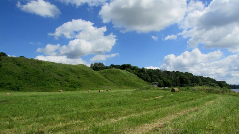
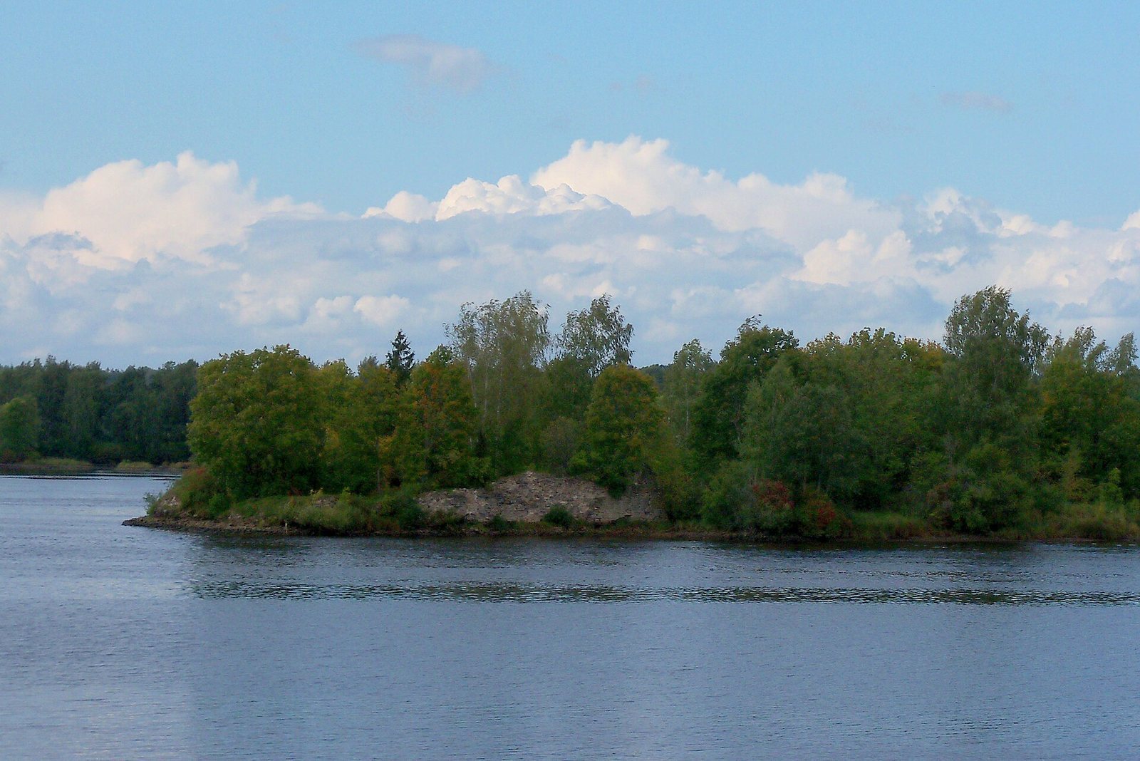
Before the Daugava reservoir was formed, the castle stood on a dolomite outcrop above the river’s steep left bank. The complex had a higher main castle to the south and a lower outer ward to the north, arranged along the natural shape of the hill and earlier defenses. The site combined the elevated position of a hill fortress with its riverside setting. The reservoir, filled in 1967, left the former castle hill as an island.
Early settlement and archaeological evidence
Remains show that people lived across the hilltop during the 10th–12th centuries, and evidence points to a major settlement there between the 10th and 13th centuries. An earlier rampart lay beneath the stone castle. Foundations include dwellings about 5 by 5 metres and service buildings roughly 3 by 3 metres. The settlement area has been estimated at about 11,000 square metres. A cultural layer containing Selonian finds dates from around the 5th century CE. Two flint arrowheads belong to the 9th millennium BCE, while other finds relate to Baltic peoples in the first millennium BCE. Excavations also uncovered the foundation of a square tower with underground passages.
Stone castle and defenses
Main walls and towers
The stone castle was built as a mantle-wall fortress, in which a tall outer wall formed the principal defense around inner buildings. Its walls, made from limestone quarried along the riverbank, averaged 1.6 metres thick and were strengthened at their base. Three square towers belonged to the 14th-century castle; two round towers were added in the 15th or 16th century to improve its defenses against firearms. The central part of the Order’s castle followed the line of earlier Selonian fortifications.
Buildings and courtyard
Buildings occupied the west, north, and northeast sides of the main castle, with a well in the courtyard. Identified spaces include the vogt’s quarters, a meeting room for the Order’s brothers, a dining hall, a dormitory, and service rooms. A chapel probably stood on the eastern side. Together, the defensive works and communal accommodation made the castle a fortress as well as a residence for the Order’s religious community.
Eastern entrance
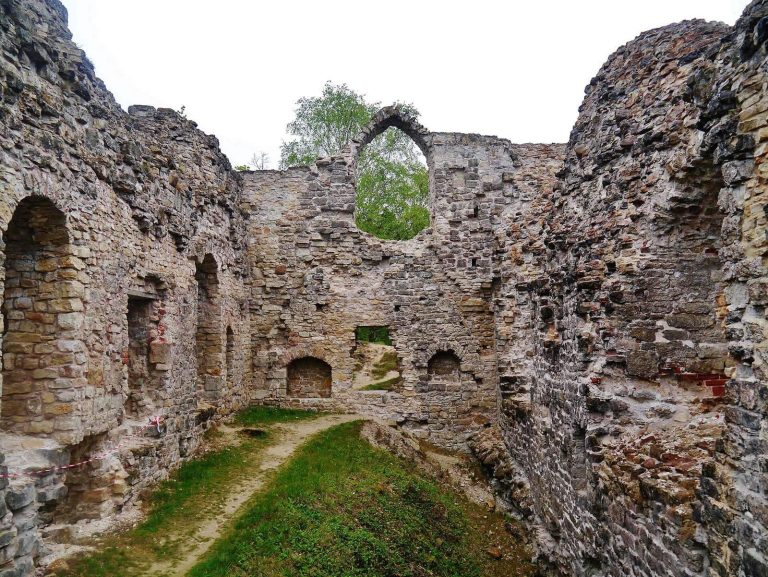
The entrance lay on the east side and projected well beyond the castle. It led through a long passage with a gently curving, vaulted ceiling. The outer-ward wall also shielded the entrance from the north. The passage is among the best-preserved parts of the ruins, which now survive only at low height.
Outer ward and later earthworks
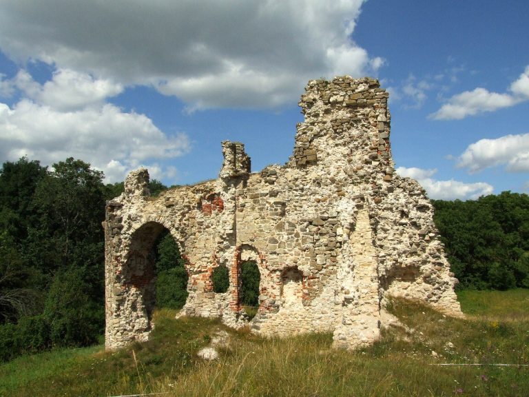
A ditch about 3.5 metres deep and 25 metres wide defended the eastern and northeastern approaches. On the western and northwestern sides, the rocky riverbank provided protection; a small stream valley guarded the southeastern, southern, and southwestern sides. In the late 16th and early 17th centuries, builders raised and leveled the hilltop, enlarged the castle, and added earthen ramparts in front of the outer ward. Coin finds date the ramparts to the late 16th century. The earthworks formed a platform about 100 metres long, 35 metres wide, and 12 metres high. Soil came from a location about 200 metres away and from a cemetery of the 14th–16th centuries, 50 metres northeast of the outer ward. The work used about 30,000 cubic metres of earth and continued intermittently for 10–15 years. A barracks for mercenaries stood at the northern end of the outer ward. A fragment of the outer-ward wall survives among the low ruins.