Schneiderberg: A Neolithic and Bronze Age Burial Mound in Germany
Site at a Glance
- Popularity
- Low
- Country
- Germany
- Primary era
- Stone Age
- Eras represented
- Stone Age, Bronze Age
- Civilizations
- Unclassified
- Site type
- Burial
- Remains
- Burial Mound
On this page19 sections
History
Schneiderberg is a prehistoric burial mound in northern Baalberge, Germany, used for burials from the Neolithic into the Early Bronze Age. The communities associated with it are classified by archaeologists as the Baalberger culture (3900–3400 BCE), Walternienburg culture (3350–3100 BCE), Globular Amphora culture (3100–2650 BCE), Corded Ware communities (2800–2050 BCE), and Unetice culture (2300–1550 BCE). These culture names describe recurring archaeological evidence and do not necessarily reflect the names people used for themselves.
Prehistoric burials and settlement
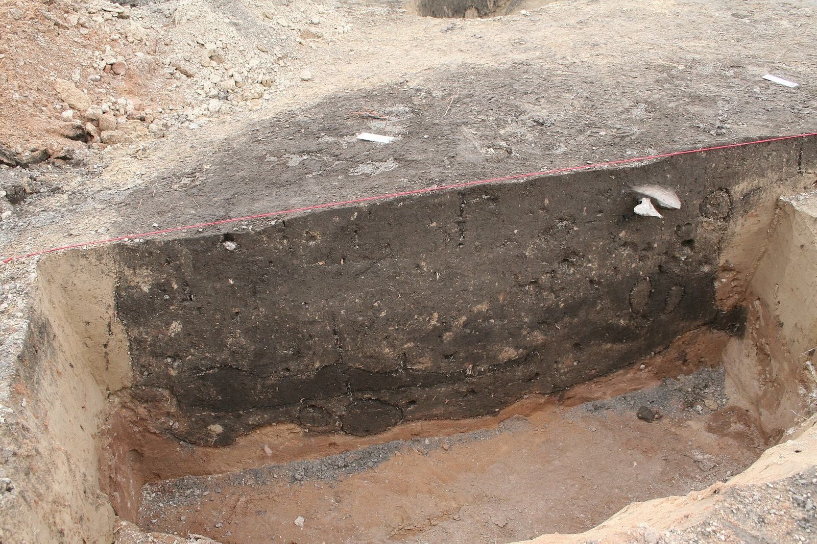
A settlement dating to the Late Bronze Age and Early Iron Age lay east and southeast of the mound. Finds came from several plots and fields, including one a few metres southeast of Schneiderberg. In autumn 1989, further traces were found about 120 metres east of the mound. Archaeologists excavated there from February to September 1990, with a shorter investigation in 1991. The excavated area probably belonged to a larger settlement.
In 2012, a rescue excavation examined settlement remains nearer the mound during house construction. Together, the investigations show that settlement activity extended across several locations around Schneiderberg. The 1990 excavation was led by Karin Wagner; Andreas Neubert published its results in the late 1990s. U. Trebstein led the 2012 work, published by Caroline Janick in 2021.
The mound’s name and early study
In 1710, historian Johann Christoph Bekmann referred to two mounds as the Baals-Berge, probably meaning Schneiderberg and the now-destroyed Lange Berg. He proposed that the name might invoke Baal, a deity worshipped in parts of the ancient Near East, or a word for a boundary post, with the mounds serving as markers. Paul Höfer later rejected those explanations and suggested that the name’s first element might derive from old words meaning evil, bad, or harmful, perhaps reflecting the mounds’ association with ancient burials.
Höfer noted that records from the tenth century use the settlement name Balberg. Since the surrounding landscape is flat, he considered it unlikely that the word for mountains referred to a natural hill, and suggested instead that the burial mounds gave the settlement its name. The name Schneiderberg appears in the Baalberge church chronicle in 1742, after Bekmann’s description.
Excavation and the Baalberger culture
The Bernburg Antiquities Association carried out an extensive excavation in 1901 under its chairman, Ferdinand Kälber. Prehistorian Paul Höfer took part and wrote the main detailed report. A survey marker on the summit restricted the work to separate trenches, leaving the central grave only partly excavated. Two vessels from that grave belonged to a pottery tradition the excavators had not previously recognized. Schneiderberg consequently became the findspot from which the Baalberger culture took its name.
As more examples came to light, archaeologists reconsidered how to classify the pottery. Höfer initially linked it to the Bernburg culture, while noting similarities to Funnel Beaker pottery and the lack of its characteristic decoration. In 1922, Paul Kupka compared material from 43 findspots, noting recurring vessel forms, limited decoration, and burials of uncremated bodies. He connected the pottery with what was then called pile-dwelling pottery of the Michelsberg culture.
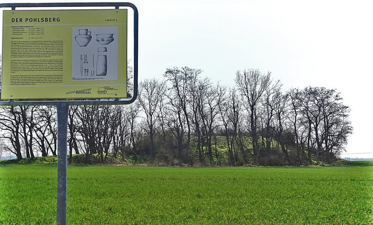
In 1925, Nils Niklasson recognized Baalberger pottery as a distinct type, drawing on finds from Schneiderberg and the Pohlsberg near Latdorf, but did not define a separate culture. Working with Niklasson from 1929, Paul Grimm developed the classification further. His 1937 study used material from 163 findspots to propose internal divisions and a relative chronology. Later work by Joachim Preuß, Jan Lichardus, and Johannes Müller substantially revised those proposals.
Modern archaeological work
In March 1997, work on a walking path cut into the mound and brought up a broken flint blade. The local monument-protection authority halted the work and required the mound’s previous shape to be restored. Separate investigations have examined both the nearby settlement and the mound itself, including geophysical surveys in 1993 and a broader study in 2024 using seismic and electrical methods, core drilling, and radiocarbon dating.
Remains
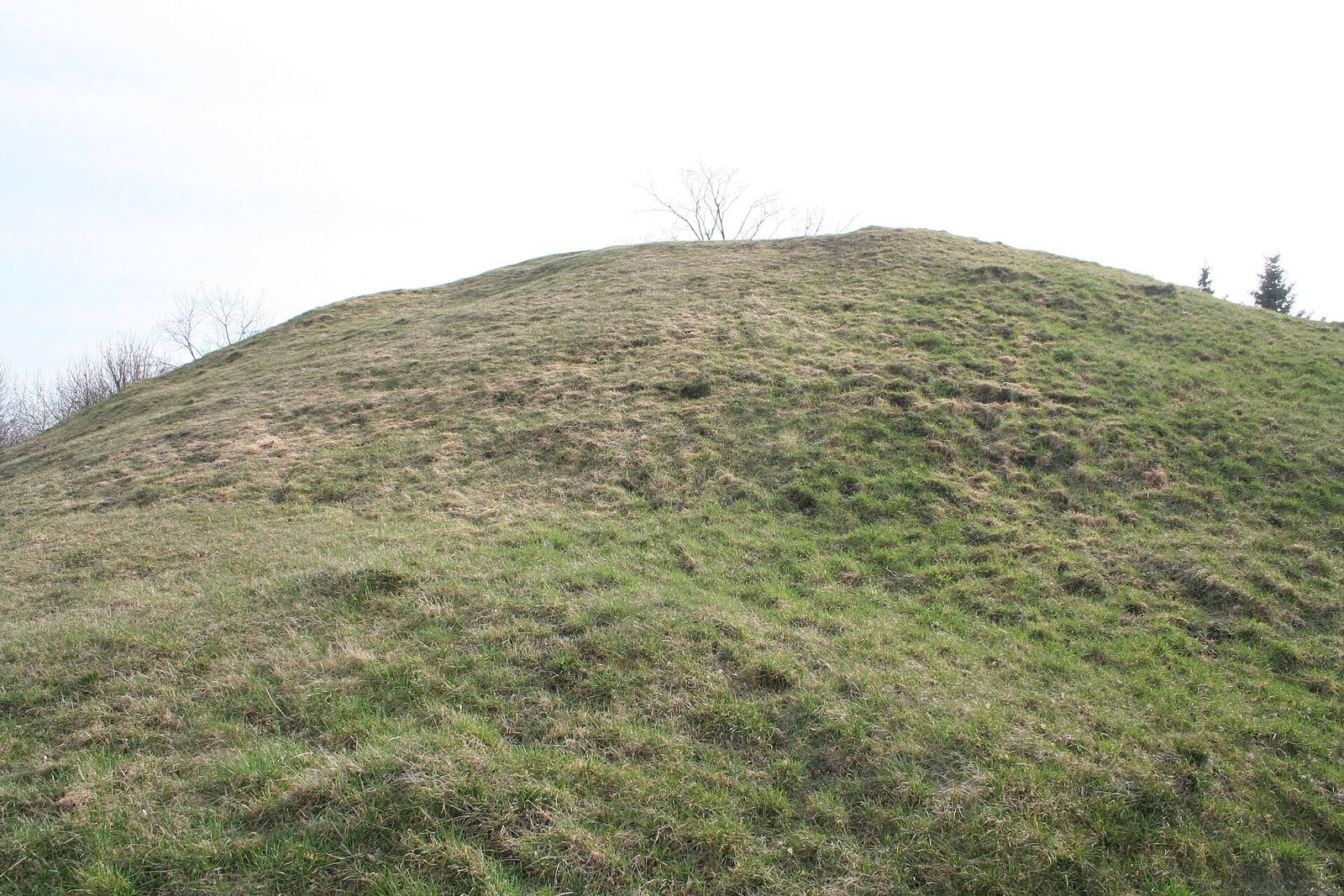
The earth-covered mound contains graves at several depths and positions, from a central chamber at ground level to stone cists higher within the mound and one partway up its western slope. Its summit forms a flattened plateau, while an original encircling ditch and the later grave chambers reflect different stages in the monument’s development.
The mound and its surface
Profile and construction
Schneiderberg stands 5.57 metres high and measures 133 metres around its circumference. Its flattened top is about 8 metres across, with a slight rise on the eastern side where a modern survey marker stands. A ditch once encircled the mound; in the nineteenth century it was filled with earth taken from the north side. Trenches from the 1901 excavation were backfilled, and the mound’s exterior was returned to its earlier shape.
Geophysical work in 2024 indicates that the mound was probably enlarged substantially in the Early Bronze Age. The original mound containing the Neolithic graves is estimated to have been less than 2 metres high. The 1993 survey indicated the central burial chamber and, less clearly, the trenches from the 1901 excavation. The 2024 investigation used seismic surveys, electrical-resistance imaging and electromagnetic induction, methods for mapping buried features, as well as core drilling and radiocarbon dating.
Surface finds and memorials
Two sherds of Walternienburg pottery came from the mound’s northwest side. A stone commemorating Baalberge’s thousandth anniversary was erected on the mound in 1958. Finds from the mound are now held at Bernburg Castle Museum.
Neolithic graves
Central burial chamber
The central grave lies at ground level and is oriented approximately east–west. Its stone-lined chamber measures 1.50 metres long, 0.80 metres wide, and 0.80 metres high. Wall slabs about 0.25 metres thick enclose a packed-earth floor. The cover slab was about 0.30 metres thick and is estimated to have measured 3 metres by 2.30 metres, projecting roughly 50 centimetres beyond the walls on each side.
Because the survey marker stood above part of the grave, excavators opened its western half and broke away one corner of the cover slab to enter. The burial left poorly preserved bone fragments. Two vessels accompanied it: a jug 16 centimetres high and a cup 7.5 centimetres high. Both have three-part profiles, a sharply defined angle between belly and shoulder, and a cylindrical neck.
Eastern two-section grave
About 30 centimetres above ground level, east of the central chamber, is a second stone-lined grave oriented approximately north–south. Its sandstone cover slab measured 2.63 by 1.32 by 0.50 metres and was estimated to weigh between 2,050 and 3,000 kilograms. Trapezoidal slabs formed the long walls. The eastern slab measured 1.90 metres long and 1.05 metres high at its north end, tapering to 0.85 metres at the south; the western slab was 2.05 metres long and 0.95 metres high at the north, tapering to 0.60 metres at the south. Their thicknesses were 22 and 37 centimetres.
Two thin, clay-smeared slabs formed the southern end. Large stones stood against the outer wall faces, with gaps filled by stones stacked without mortar. The chamber was 0.75 metres high and divided by a 10-centimetre-thick cross-slab set 0.75 metres from its north end. The two short ends provided access to the separate burial sections. After the excavation, the municipality removed the cover slab and reused it for a Bismarck memorial stone, inaugurated at the village church in 1902. The memorial was demolished in 1953, and the stone was sunk at the site of the local bodywork factory.
Poorly preserved skeletal remains came from the northern section. Its main object was a two-part cup, 15.5 centimetres high, with a low, sharp angle and an upper diameter of 14.8 centimetres. Its handle was 5 centimetres wide. Decoration includes upright triangles, arched cuts, and three grooves near the rim. Höfer assigned the cup to the Bernburg culture; it belongs to the Walternienburg culture. A broken ground-flint chisel, 4.6 centimetres long and rectangular in cross-section, was also recovered. Höfer suggested it may have broken while the grave slabs were being worked.
A semicircular, 50-centimetre-wide opening through the dividing slab led to the southern section, which measured 1.35 metres long and 0.70 metres wide. Its poorly preserved skeletal remains lay with two Globular Amphorae. The larger vessel is 33 centimetres high and 105 centimetres around, with zigzags and a diamond pattern on its neck, and latticework and diagonal strokes on its shoulder. The smaller is 20 centimetres high and 66 centimetres around, with a 7.7-centimetre-wide mouth. Its decoration combines a diamond pattern on the neck with dots, a horizontal line, and vertical strokes on the shoulder. Barley found inside had been stored there by a hamster.
Western stone cist
Halfway up the mound’s western slope, 50 centimetres beneath the surface and 2.50 metres below the summit, excavators found a small stone cist, a grave built from stone slabs. Made of oolitic limestone, a rock formed from small rounded grains, it was oriented roughly northeast–southwest. It measured 1.05 metres long, 0.70 metres wide at the southwest end and 0.60 metres at the northeast, and 0.50 metres high. Its wall slabs were 5, 7, and 8 centimetres thick; two cover slabs measured 5 and 7 centimetres thick, and another slab formed the floor.
The grave held a comparatively well-preserved skeleton in a crouched position, with the body drawn up on its right side. The person faced south, with the face turned east and the head resting on a flat stone. A loop-handled cup, 15.5 centimetres high and marked with rows of lines on its neck, stood in front of the face; a large flint knife lay inside it. A second cup, 10.8 centimetres high and decorated with cord impressions on its neck, stood near the feet at the northeast corner.
Early Bronze Age graves
Upper and middle levels
Unetice graves clustered around the mound’s middle, above and slightly west of the central chamber, in three layers. The upper layer, 0.75 to 1 metre below the summit, comprised three stone cists. The largest cover slab measured 1 metre long, 0.75 metres wide, and 0.25 metres thick; the other two slabs measured 0.75 by 0.50 metres. About 1.50 metres below the summit, six more cists lay beneath the plateau and to its south. A few pottery sherds came from these disturbed burials.
Northwestern paired chambers
The deepest layer lay 2.50 metres below the summit beneath thick stone packing. At least four chambers, and perhaps five, formed a group oriented northwest–southeast. Two similar graves stood side by side in its northwest part. The northeastern chamber measured 2 metres long, 0.98 metres wide, and 0.70 metres high; extra slabs narrowed its interior to 0.67 metres. A cross-slab separated a small entrance chamber from a 1.50-metre-long burial chamber. A poorly preserved person lay on the right side, facing west with the face turned south.
The grave immediately southwest shared a long wall and a 0.25-metre-thick cover slab with its neighbour. It measured 1.75 metres long, 0.80 metres wide, and between 0.60 and 0.70 metres high. Unspecified skeletal remains survived, along with a small piece of bronze.
Southeastern chamber
A separate chamber southeast of the paired graves measured 1.50 metres long, 1.38 metres wide at the northeast end, and 1.08 metres wide at the southwest. Its recorded object was an Early Bronze Age cup with a low-set handle and smoothly rounded changes in profile.
Far southeastern chamber
Farther southeast, a north-northeast to south-southwest chamber measured 2.90 metres long, 0.80 metres wide, and 0.50 metres high. Its oolitic-limestone cover slab was only 2.5 to 3 centimetres thick. Oak remains inside probably came from a ceiling plank. At the south end, five sharpened oak posts, each about 50 centimetres high and 20 centimetres thick, were fixed in clay and may have supported the cover or plank. Burial remains included a broken lower jaw with well-preserved teeth. Two Early Bronze Age Period I daggers lay near the centre of the cover slab. The smaller survives as a 7.4-centimetre blade fragment with three rivets and no handle; the larger is 30 centimetres long, with six rivets, a rung-like handle, and an oval pommel.
Southward post row
A second row of wooden posts set in clay lay 1.50 metres south of the southeastern chamber. It probably belonged to another grave chamber, which was not investigated in detail.