Schloss Herrenberg: The Former Palatine Castle of Herrenberg, Germany


Site at a Glance
- Rating
- 4.7
- Popularity
- Low
- Country
- Germany
- Primary era
- Medieval
- Eras represented
- Medieval
- Civilizations
- Holy Roman Empire
- Site type
- Military
- Remains
- Castle
On this page14 sections
History
Schloss Herrenberg is a former castle in Germany, located on the Schlossberg in Herrenberg, in the present-day district of Böblingen, Baden-Württemberg. It was first mentioned in 1220 as a palatine castle, a high-status fortified residence associated with the Counts Palatine of Tübingen. The hill had a much older history of settlement and activity, with traces linked to hunters, Celts, Romans, and Alamanni.
The Tübingen Palatine Castle
On 28 March 1228, Palatine Count Rudolf II recorded an exchange of property with a monastery on Lake Constance at the castle. During the rule of the Tübingen palatine counts Rudolf I and Rudolf II, the Alamannic settlements of Reistingen and Mühlhausen in the Ammer valley were moved within a short period to Herrenberg’s western slope. The new settlement was established as a fortified town, and the castle became part of a continuous defensive enclosure connected with it.
Württemberg Administration
In 1382, the palatine family sold the property to Count Eberhard II of Württemberg. The former court residence then came under the administration of the Württemberg chief bailiff, a senior territorial official who governed a district for its ruler. Count Ludwig I of Württemberg later assigned the castle as a widow’s residence for his wife, Mechthild. This arrangement ended after she received Böblingen Castle instead.
The castle’s position on a sandstone cap caused subsidence and structural damage. The deterioration became severe enough that one of its towers was demolished in 1470. At the end of the seventeenth century, the reigning Duke of Württemberg used Schloss Herrenberg as a hunting residence during boar and wolf hunts in the Schönbuch. The hill was difficult to reach, however, and he later selected a residence in the bailiwick instead.
Fire, Earthquake, and Demolition
The castle, the collegiate church, and the deanery were the only buildings to survive Herrenberg’s town fire of 1635. After the fire, the castle ceased to be the official seat of the chief bailiffs, who conducted their business in the bailiwick’s administrative building. Castle keepers continued to live at the property.
An earthquake in 1733 caused the castle to sink by approximately half a metre. The associated landslide also damaged the market square and houses in the town. As the property became increasingly dilapidated, local interest declined and the princes chose not to renovate it. King Friedrich I of Württemberg sold the castle for demolition in 1807. Several townspeople and nearby residents expressed interest, and the demolition was compensated through the value of the recovered stone together with an additional payment of 135 gulden.
Ownership and Commemoration
In February 1819, the Hofkameralamt, the government office responsible for a ruler’s financial and landed property affairs, sold the castle site for 100 gulden. The area was later owned for a time by Stadtschultheiss Kayser of Stuttgart, a chief municipal official, who sold the entire property in the second half of 1837 to Carl Ludwig Ruthardt, the previous owner’s brother.
Oak and lime trees were planted on the Kanonenbuckel in 1841 to mark the twenty-fifth anniversary of King Wilhelm I’s reign. The remaining ruins and surrounding land were sold to the city of Herrenberg for 500 gulden in 1865. The damaged tower stump was repaired and converted into a lookout tower in 1880, repaired again in 1896, and equipped with a panoramic map showing the view toward the Swabian Alb in 1897. Neo-Gothic gates were added to the castle walls in 1912.
Twentieth-Century Damage and Reconstruction
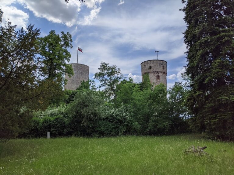
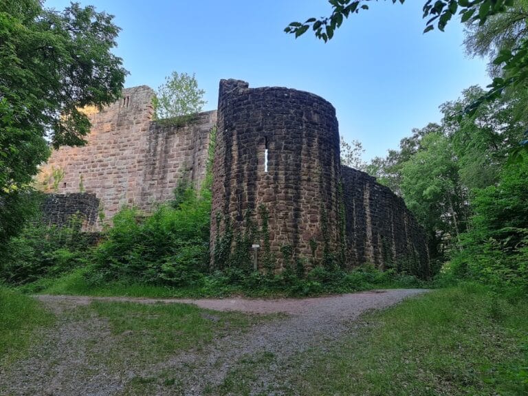
Bomb hits and artillery fire severely damaged the ruins in 1945. A public donation campaign begun in 1957 supported reconstruction of the western tower, which was completed two years later. A restaurant called the Schlosskeller was built at the same time, incorporating part of the former castle cellar. The former castle now survives as ruins, wall remains, and cellar spaces, together with remains of the western outer defensive enclosure and the Schlossbergturm, which incorporates the stump of the former powder tower.
Remains
The castle buildings were arranged in an almost oval plan on a plateau near the summit of the Schlossberg, following the shape of the mountain spur. The main castle was enclosed by a strong shield wall and a ring wall. It measured approximately 64 metres from east to west and 36 metres from north to south. Including the outer defensive enclosure and a projecting bastion, the entire complex measured about 92 metres east to west and 44 metres north to south. Stone came from nearby quarries, while the timber was obtained from the area that later became the town forest.
Castle Plateau and Defensive Works
Main Castle
Approximately eight metres of elevation separated the western entrance to the outer enclosure from the large courtyard of the main castle. A staircase and a small courtyard near the western tower bridged this difference in height. The surviving walls preserve the form of a castle organized around an elevated inner area, while the western outer enclosure formed part of the defensive works beyond the principal wall.
Western Outer Enclosure
The surviving western zwinger, an outer fortified enclosure beyond the principal castle wall, belonged to the castle’s outer defenses. The walls also retain the Neo-Gothic gates installed in 1912. A bastion, a projecting defensive work designed to cover approaches, formed part of the larger complex measured around the main castle.
Schlossbergturm and Cellar
Schlossbergturm
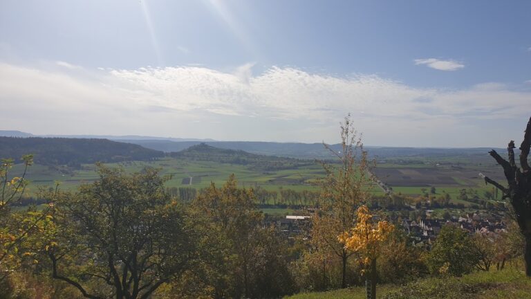
The Schlossbergturm stands on the stump of the former powder tower. Beneath it, a circular dungeon lined with masonry extends deep into the hill. The tower includes a viewing platform. Herrenberg lies below on the Schlossberg in the Korngäu, or Upper Gäu. The view west is obstructed by the Heckengäu, while the Schönbuch limits the view east; toward the southeast and south, the view reaches in the direction of the Swabian Alb.
Castle Cellar
Part of the old castle cellar was adapted for the Schlosskeller restaurant in 1957. A separate room in the cellar complex is used for events. The cellar forms one of the surviving physical elements of the former castle and remains incorporated into the later building.
Evidence for the Lost Castle
The former castle’s appearance and layout are represented by written descriptions, six small drawings, sections, engravings, paintings, an imprecise fortification plan, and a cadastral map. Together with the surviving walls, tower remains, outer enclosure, and cellar, these records provide evidence for a complex that underwent repeated changes before its partial demolition and later reconstruction.
Nearby sites