Ruine Göskon: An Earthwork Castle in Switzerland


Site at a Glance
- Rating
- 3.6
- Popularity
- Very Low
- Country
- Switzerland
- Primary era
- Medieval
- Eras represented
- Medieval
- Civilizations
- Holy Roman Empire
- Site type
- Military
- Remains
- Castle
On this page11 sections
History
Ruine Göskon is an earthwork castle in Switzerland, at Obergösgen in the canton of Solothurn, whose origins probably reach back to the Iron Age, the period when iron became a major material for tools and weapons in Europe. Its medieval development began with a ninth- or tenth-century earthwork and continued with a fortified tower built after 1200. The castle was the ancestral seat of the Freiherren von Göskon and controlled a site beside the Aare waterway.
Early refuge and medieval fortification
The refuge was probably of Iron Age origin. Five refuges were identified in the surrounding area, but Obergösgen was the only one beside water and was described as unique of its type in Switzerland. A ninth- or tenth-century earthwork formed the first phase of the site’s documented historical sequence. A later square tower was inserted into this earlier defensive work, creating a simple castle centered on a fortified keep, the main tower of a medieval castle.
The Göskon family appears in written records from the twelfth century. In 1229, Gerhart I., a lord of the family, sought permission to build a castle on the rock at Bötzach. Niedergösgen Castle was erected there in 1229 and 1230. The family name gradually shifted to the new foundation: Bötzach became Niedergösgen and, after the property passed to another lineage after 1383, Falkenstein.
Lordship on the Aare
After Niedergösgen Castle was built, the older ancestral castle at Obergösgen was sold. Later owners included the noblemen and knights of Rubiswyl, Stoffeln, and Hallwyl. No surviving deed expressly calls Obergösgen Castle a possession of the Freiherren von Gösskon, but its connection with the family is regarded as certain through the associated place-name, church rights, and lordship.
The Göskon family repeatedly held the patronage of the Obergösgen church. Church patronage, or the right to appoint a parish priest and enjoy related ecclesiastical privileges, remained associated with the family, while Niedergösgen had no village church and stayed attached to Stüsslingen until 1838. Obergösgen also retained a blood court under Solothurn rule. This high criminal court could impose severe penalties, including death, and its gallows probably stood at Galgenhölzli opposite the castle.
The castle’s position beside the Aare probably influenced its construction. The lordship held rights over wrecks and goods stranded on the river, as well as responsibility for escorting ships. These rights were still specifically listed among the possessions of Göskon when the lordship was sold in 1458.
Overlapping medieval allegiances
Gerhart I. occupied a complex political position. The Göskon castles lay in the Buchsgau, and the family appeared as vassals of the counts of Frohburg. At the same time, Gerhart served as castellan-advocate of Olsberg and the Schönenwerd foundation for the Habsburgs. A castellan-advocate was a lay official who protected and represented a religious institution and managed its secular interests.
By about 1394, the Göskon lordship extended to settlements on both banks of the Aare. Around 1380, the territory was held as a pledge by the Habsburg dukes Leopold and Albrecht. The castle itself remained inhabited for roughly 150 years after the Göskon family moved away. Konrad von Stoffeln inherited it from his nephew Johann von Rubiswyl, and it later formed part of the marriage settlement of Anna von Stoffeln and Rudolf von Hallwyl between 1373 and 1380. Rudolf’s long-term residence at Obergösgen is uncertain. After he acquired Neu-Wartburg near Olten in 1379, the documentary record of Obergösgen Castle falls silent.
Demolition and rediscovery
The castle survived both the earthquake of 1356 and the Gugler War of 1375, a military campaign in which the Gugler mercenaries raided parts of the region. Solothurn acquired the Göskon lordship in 1458 and in 1471 gave the ruins to the city of Aarau for demolition. The stones were carried by raft to Aarau and used in the construction of the city church. Solothurn also transferred relics associated with Saint Mauritius, a Christian martyr traditionally linked with the Theban Legion, including a vertebra, an arm, and 37 other fragments attributed to the legion.
After demolition, the remaining undermined foundations gradually collapsed, and vegetation covered the ruin. A 1766 map of the canton of Solothurn mistakenly identified it as Burg Hagnau, taking its name from a hamlet on the opposite side of the Aare. The documentary record is sparse, and the earlier claim that the castle had never appeared in records was challenged when a deed from 1380, preserved in the Aargau State Archives, was published. Initial investigations began in 1903. Excavation and conservation in 1986 and 1987, including partial reconstruction, clarified the sequence from the early earthwork to the later tower fortification.
Remains
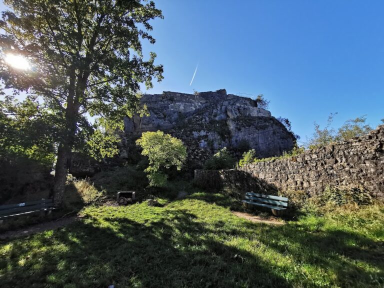
Ruine Göskon stands at about 392 metres above sea level between Obergösgen and Niedergösgen, beside the Aare Canal. The castle occupied a sharply projecting peninsula that once reached directly into the Aare and rose about 20 metres above the water. River erosion removed much of the eastern flank, leaving the undercut and one-sided collapse visible in the form of the ruin. After the river was redirected farther south around 1870, the former river arm became marshland and the erosion stopped.
Peninsula and defensive earthworks
On the landward side, three outer banks and ditches originally protected the castle. These earthworks were destroyed when the Aare Canal was constructed around 1914. The position therefore preserves evidence of both the former water setting and the landward defenses, although the later canal works altered the surrounding ground.
Surviving masonry
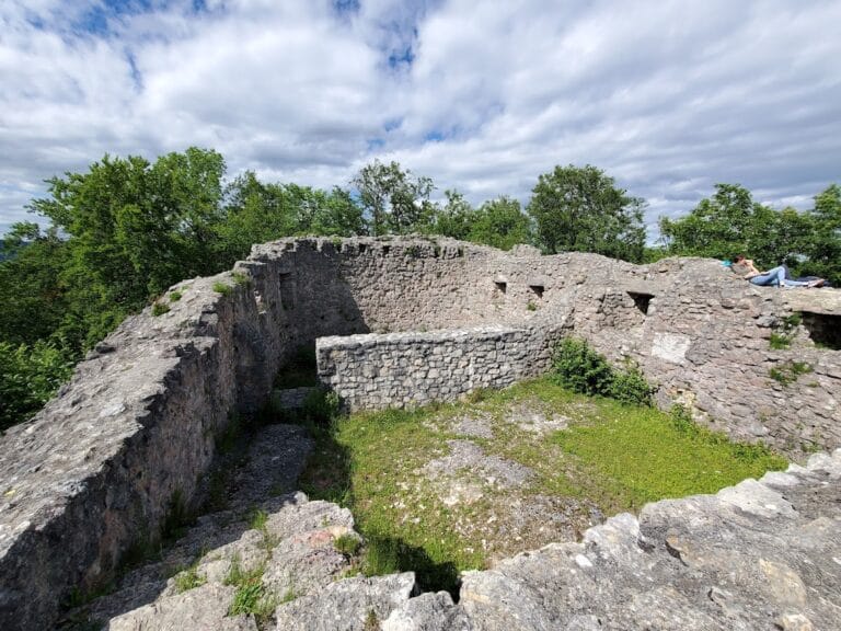
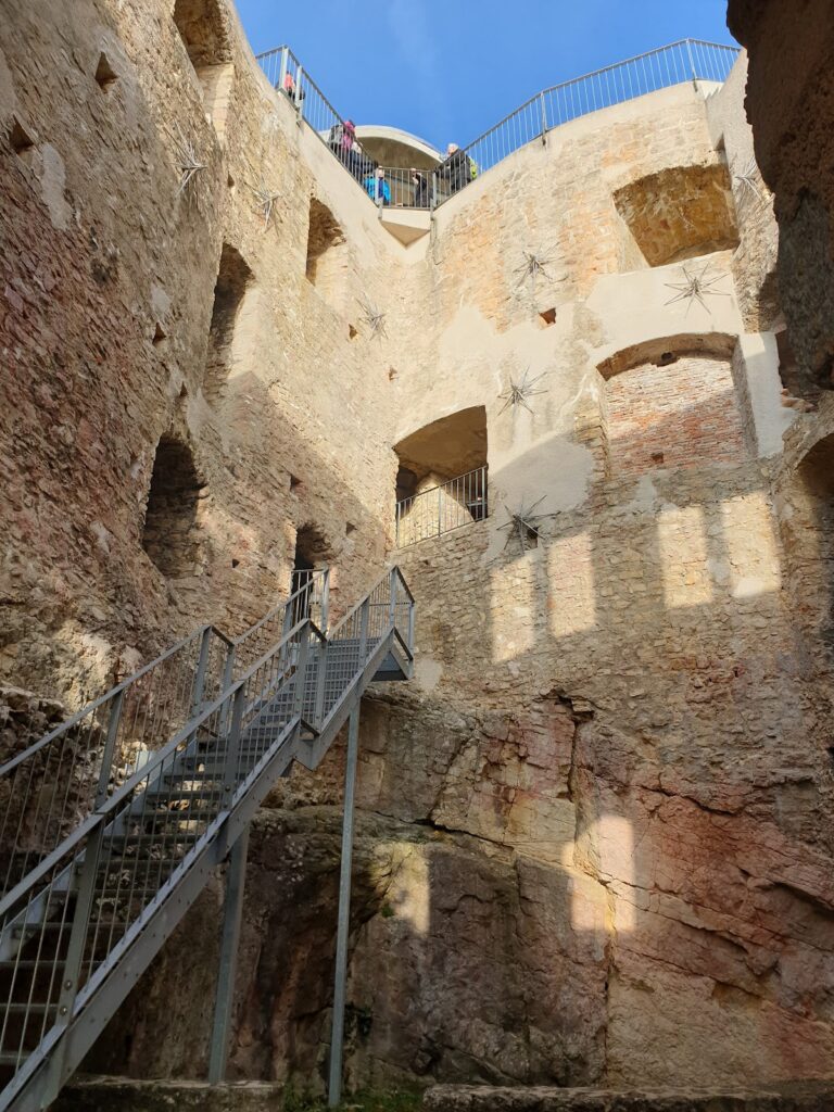
River erosion and weathering of the underlying ground severely weakened the masonry. The entire southern wall collapsed, while the eastern side wall remained projecting without support. Three walls survive, forming a massive shape compared in descriptions of the ruin to the back and sides of an armchair. Their surviving height ranges from four to six metres, and the partial reconstruction carried out in 1986 and 1987 helped stabilize and interpret the remains.
Square tower and interior
The tower was built into the earlier earthwork. It had a square plan measuring about nine metres externally, with an internal clear width of three metres and walls approximately three metres thick. Its foundations were set on firm gravel, and the massive masonry indicates a probable height of two or three storeys. Inside stood a water cistern lined with blocks of calcareous tuff, a pale porous stone.
Simple keep arrangement
The castle consisted solely of the keep. The small mound left no room for later expansion, making the site an example of a simple original keep arrangement that either remained unexpanded or was abandoned at an early stage. The tower and mound consequently represent the principal surviving architectural relationship at Obergösgen.
Archaeological finds
Archaeological material from the site includes Bronze Age pottery and several Roman finds. A Neolithic arrowhead was discovered near the ruin around 1954. During construction of a later road near the refuge, workers built a 13-metre-high embankment over the Stegbach. On the opposite side of the stream, within the projecting plateau, they encountered several early Germanic graves.
Nearby sites