Ronneburg Castle: A Medieval Territorial Fortress and Renaissance Residence in Germany


Site at a Glance
- Rating
- 4.6
- Popularity
- Medium
- Country
- Germany
- Primary era
- Medieval
- External website
- Open
- Eras represented
- Medieval, Early Modern
- Civilizations
- Holy Roman Empire
- Site type
- Military
- Remains
- Castle
On this page22 sections
History
Ronneburg Castle is a hilltop fortress in Germany, near Altwiedermus in the Main-Kinzig district of Hesse. Probably founded in the thirteenth century as a territorial fortress of the Archbishopric of Mainz, it later became a Renaissance residence of the Ysenburg-Büdingen-Ronneburg line. Built on a steep basalt cone above the Fallbach Valley, the castle helped protect judicial districts and forest territories while overseeing important routes, including the Hohe Straße, also known as the Reffenstraße.
Origins and Mainz control
The castle’s precise foundation date remains uncertain. The earliest surviving reference comes from a charter dated either 1231 or 1258, in which a member of the Rüdigheim family described himself as a Burgmann, a castle official or resident, of “de Roneburg.” The fortification may have existed earlier, perhaps during the conflicts involving the Staufer dynasty in the Wetterau before the death of Konrad IV. The names Raneberg and Roneberg may derive from the Old High German word Rone, meaning a fallen tree, and could preserve a memory of an earlier palisaded stronghold.
Ronneburg lay within the Mainz-controlled court of Langendiebach, a judicial and administrative district. The archbishopric was an ecclesiastical principality of the Holy Roman Empire, so its fortresses served both military and governmental purposes. From Ronneburg, Mainz secured territories and woods along the lower Kinzig and maintained a position near routes crossing the surrounding countryside.
After the Büdingen family became extinct before 1247, possession passed to the von Hohenlohe family rather than directly to the Ysenburg heirs. Gottfried III of Hohenlohe-Brauneck sold the castle to the Archbishopric of Mainz in 1313. From 1327 it was pledged to the Knights of Rockenberg, who enlarged the fortification. Mainz resumed direct control between 1339 and 1356, after which the castle was pledged to Hartmut VI and Frank VIII of Cronberg for 18,000 small gold florins.
Fourteenth- and fifteenth-century expansion
The Cronberg family retained Ronneburg until 1407 and undertook further building work, including the chapel bay of the hall building. The castle was pledged again from 1424, this time to the counts of Hanau. These successive arrangements illustrate the changing control of a fortress that remained tied to territorial administration, feudal grants, and the protection of Mainz interests.
In 1476 Archbishop Diether of Ysenburg transferred Ronneburg to his brother, Count Ludwig II of Ysenburg-Büdingen, probably in connection with the Mainz Collegiate Feud, a conflict over the control and political influence of the Mainz archbishopric. Ludwig’s death in 1511 was followed by a succession dispute among his three sons, which disturbed the Büdingen territory from 1517. In 1523 the castle passed to Philipp von Ysenburg-Büdingen, who established the Ysenburg-Büdingen-Ronneburg collateral line, a branch of the wider comital family separated from its principal line through inheritance.
Renaissance residence
Ronneburg reached its greatest importance in the sixteenth century as the residence of the Ysenburg-Büdingen-Ronneburg counts. Major rebuilding took place chiefly around 1540, followed by further work around 1570 and from 1576. Under Count Heinrich, additional alterations brought the residence to its final period of prosperity. The medieval fortress was consequently reshaped into a noble residence while retaining its defensive enclosure and principal fortified structures.
Philipp was succeeded by his son Anton, whose fifteen children included Georg, Heinrich, and Wolfgang. Georg and Heinrich ruled successively. Wolfgang later built Kelsterbach Castle, and Georg and Heinrich were sometimes styled counts of Isenburg-Büdingen-Kelsterbach. Heinrich died in 1601 without preserving the line, and Wolfgang Ernst I of Ysenburg-Büdingen in Birstein claimed the inheritance. He took Ronneburg by force as a reverted fief, although Heinrich’s widow continued to live there for a time.
Fire, war, and administrative decline
In 1621, a fire caused by the burgrave’s carelessness destroyed substantial parts of the castle, including the New Bower and the Upper Gate Building. The disaster ended the complex’s use as a dowager’s residence. During the Thirty Years’ War, the major European conflict of 1618 to 1648 that devastated much of the Holy Roman Empire, Croatian cavalry troops plundered the damaged and vacant castle in 1634. Repairs began only after the war, and the New Bower was not restored to its former height.
Ronneburg also lost its administrative function. The castle had been associated with the Langendiebach court, later called the Ysenburg office of Ronneburg. The office was enlarged in 1645 to include the Selbold court, but its administrative center moved to Langenselbold in 1698. By the end of the seventeenth century, Ronneburg was no longer the seat of the local court and office.
Refuge, manufacture, and religious community
From 1700, the Calvinist Ysenburg-Büdingen rulers permitted Protestant exiles to settle at the castle. Ronneburg also sheltered Jews, Roma, and other socially marginalized people, with some residents practicing crafts within the complex. The Swiss mystic Ursula Meyer held 156 discussions there between 1715 and 1719. By the end of the eighteenth century, a manufactory producing wool goods was operating at the castle.
In 1736, Count Nikolaus Ludwig von Zinzendorf and his Herrnhut Brethren community moved into Ronneburg. The Moravian Brethren were a Protestant movement associated with the religious community formed under Zinzendorf’s leadership. The castle became a widely visited Protestant pilgrimage site, but the community soon outgrew the available space and founded the nearby settlement of Herrnhaag. From 1750, many settlers emigrated to America and other countries.
Under later tenants, the castle continued to house marginalized groups. Its large resident population led to a temporary change in status during an administrative reform in 1821, when Ronneburg became an independent municipality without its own territory. That arrangement was revoked in 1829. Storm damage and general deterioration then contributed to a decline in the population during the middle of the nineteenth century.
Demolition, preservation, and museum use
In 1838, the authorities promoted the demolition of buildings in the outer bailey. Their poor condition was given as the reason, although the measure also appears to have been connected with the authorities’ hostility toward unwanted inhabitants. Building materials were sold, and further demolition sales followed in 1870. The last resident left in 1885.
The castle began to regain recognition as a monument around 1900. Heinrich Wagner’s 1890 study of the art monuments of the Büdingen district helped draw attention to Ronneburg, while visits by youth movements and hiking associations increased its public prominence. Formal monument protection followed in 1905.
The architect and historian Peter Nieß made important contributions to the study of the castle’s building history and published a comprehensive investigation in 1936. Friedrich Wilhelm zu Ysenburg und Büdingen and his successor Otto Friedrich zu Ysenburg und Büdingen supported preservation and research. A castle museum opened in 1952, and the Marstall became a restaurant in 1967. A 1988 sponsorship agreement arranged continuing structural and museum care between the owner and the Friends of Ronneburg association.
Wolfgang Ernst zu Ysenburg und Büdingen sold Ronneburg Castle to Forfin GmbH in June 2004. The company’s managing director and sole shareholder was Joachim Benedikt Freiherr von Herman auf Wain, a cousin of the seller’s wife. The complex now functions as a museum, restaurant, and falconry center. The core castle is used mainly as a museum, while the outer bailey contains the restaurant. Its preserved medieval and early-modern fabric continues to make it a prominent regional historic monument.
Remains
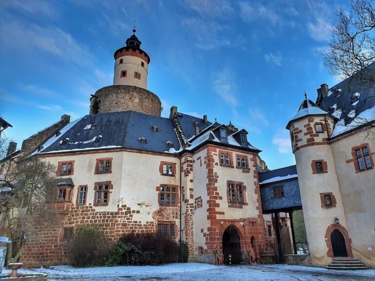
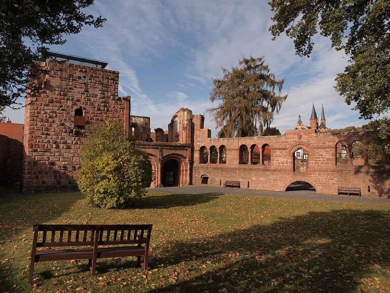
Ronneburg occupies the summit of a basalt cone about 237 meters above sea level, approximately 77 meters above the Fallbach Valley. Fertile farmland extends to the southwest, while the wooded Am Steinkopf rises to about 269 meters to the east. The castle’s position was connected to the historic trade routes through the valley. The complex is organized around a rectangular core castle enclosed by a substantial quarry-stone curtain wall, with an extensive outer bailey extending south and east.
Core castle
Keep
The 32-meter-high keep has a circular plan slightly more than eight meters across. Its consistent masonry up to the roof structure probably belongs to the earliest building phase. The original pointed-arched entrance opens from the courtyard at the third-floor level, roughly ten meters above the ground. The two floors below were used as dungeons and could be reached only from above through a fear hole, an opening in the vault that allowed entry into the lower chamber.
A stair tower with a spiral staircase provided a later side entrance, probably added in the fifteenth century. The staircase contains 57 steps and begins on the third floor above a three-armed arch. The present windows were inserted in 1581, when the lower levels were being considered for residential use. Between 1576 and 1581, the keep received its distinctive Renaissance roof structure, designed by Joris Robin of Ypres.
Above the closed fifth floor, a balustraded gallery stands about 25 meters above ground. Small gabled projections interrupt it in the four principal directions. An ashlar dome rises above the gallery and ends in a lantern. This arrangement reflects contemporary Italian domed roof lanterns and forms an outstanding Renaissance architectural feature in Hesse.
Hall building
The hall building, or Palas, occupies the western side of the core castle and retains an essentially medieval plan. It measures about 25 by 11.5 meters and extends across the full width of the western enclosure. Its southern side connects directly with the battlement leading toward the upper gate. The building contains a vaulted cellar, large residential and court rooms, and a kitchen installed during the Renaissance.
An earlier large hall was later divided into a smaller hall and kitchen. Fifteenth-century half-timbered walls survive on the middle floor, while the upper floor was extensively renewed after the 1621 fire. Medieval fabric remains there mainly in the stone architectural elements. A central stair tower was added in the fifteenth century, and a half-timbered structure over the cellar entrance dates from 1555.
On the courtyard façade, a polygonal sandstone bay window with cross-frame windows was built during the last third of the fourteenth century. It formed the apse, or rounded sanctuary end, of a Gothic chapel. The chapel bay reflects the period when the hall building was adapted for both residence and religious use.
Backhouse and Old Building
The Backhouse stands immediately north of the hall building, between it and the Old Building. It dates from the sixteenth century and has a substantial Renaissance gable. A late-medieval shell tower belonging to the kennel, a fortified intermediate enclosure between defensive walls, was enlarged to serve as a stair tower when the Backhouse was extended.
The Old Building occupies the area between the New Bower, the hall building, and the Backhouse. Its core probably dates from the fifteenth century. A courtyard portal bears the date 1572, and three Renaissance windows were probably inserted later. On the field-facing side, older masonry contains a covered embrasure, an opening for weapons in a defensive wall, dating from the middle of the sixteenth century, together with a blocked light niche for a privy.
New Bower
The New Bower, also called the New Residential Building, was begun in 1573 on the northeast side of the core castle. Its construction followed the 1572 marriage of Count Heinrich von Ysenburg-Ronneburg and Countess Elisabeth von Gleichen-Tonna. The courtyard side incorporates the very thick fourteenth-century defensive wall. Beneath the left bay window, a portal dated 1537 leads to the pharmacy.
The four-story building is approximately 32.5 meters long and just under nine meters wide. Two tall oriels, projecting bay windows that enlarge the interior space, dominate its courtyard façade. The left oriel has blind tracery and the builders’ coats of arms. The right oriel has mirrored ashlar blocks arranged in a checkerboard pattern, an important example of Renaissance stonework. Its uppermost level was rebuilt after the 1621 fire and now carries a sundial.
Between the oriels, a portal bears the arms of Ysenburg and Gleichen, while a foundation stone carries the date 1573. The ground-floor pharmacy appears in earlier inventories, and the upper levels contained large apartments. The lower principal chamber has two cross-ribbed vaults decorated with floral motifs. The next principal chamber contains wall paintings of Saint Christopher, David and Goliath, Solomon’s Judgment, and Cain and Abel.
The biblical scenes are accompanied by a Renaissance castle landscape based on printed fifteenth-century model sheets. A wall inscription states that peace is preferable to war because victory is uncertain. Each floor had a privy beside the passage to the Old Building, and each apartment consisted of a heated chamber and a sleeping chamber. Inventories place Count Heinrich’s apartment on the first upper floor and his wife’s and other relatives’ apartments on the second. The additional quarters on the third floor were heavily altered by the fire.
Gates, well house, and defensive enclosure
Zinzendorf Building
The Zinzendorf Building incorporates the innermost gatehouse and preserves several phases of construction. Its outer archway dates from 1570 but rests on fourteenth-century corner ashlar. The passage has a groined vault, formed by the intersection of two barrel vaults, with remnants of Renaissance painting. The inner archway bears the date 1541 and retains late-medieval side walls whose imposts may belong to the oldest surviving parts of the castle.
The present building replaced an older gatehouse in 1570. Its courtyard façade carries a richly decorated oriel with blind tracery and the arms of Count Heinrich von Ysenburg-Ronneburg and his first wife, Maria von Rappoltstein. A foundation stone on the adjoining stair building is dated 1570. The hall above the gatehouse, probably first used as a large living room, became the New Church of the resident religious community in the eighteenth century and is now known as Zinzendorf Hall. Rectangular, Gothicizing vaulted oriels with ribbed vaults survive on both its courtyard and exterior sides.
Fountain House and well
The third gatehouse, later called the Fountain House, probably originated in the fourteenth century, when an additional entrance was placed before the core castle. The outline of the original gate remains visible in the former moat on the north side. Its simply profiled pointed arch dates from the late fifteenth century, and an armorial stone inserted in 1523 replaced an earlier window.
The Fountain House probably carried equipment for a drawbridge. The approach ramp was renewed in 1565, and masonry projects about 2.5 meters in front of the gate. The vault above the passage was added later, together with a masonry connection across part of the projecting structure. A strong round tower southwest of the gate is older than the present entrance, and part of its masonry was removed to adapt it to the gatehouse. When the building north of the passage became the well house in the sixteenth century, its guardroom moved to the ground floor of this tower.
The well house began as a guardroom. A triangular bay was added north of the gate in 1529, and part of it was removed in 1550 to connect a battlement. During the middle of the sixteenth century, a deep well was cut into the building. Its surviving upper section is 96 meters deep, with water reached at 84 meters, while the original shaft extended to 125 meters.
The upper lining consists of ashlar blocks carrying pincer holes and masons’ marks. The well room opens from the gate passage, and a manually operated wooden turning wheel from the sixteenth century survives behind it. Creating the well required the removal of part of the masonry and the entire intermediate ceiling of the former upper guardroom.
Outer gate and kennel
The outermost gate of the core castle is a pointed-arched entrance with a small single-story gatehouse, now used as the museum ticket office. Above it, an armorial stone shows the arms of Philipp von Ysenburg-Büdingen and Amalie von Rieneck beside the date 1527. The kennel enclosed the hall building on its southern and western sides in the late fourteenth or early fifteenth century. It originally had three semicircular shell towers, with the northern tower later heightened to become the Backhouse stair tower. The original third gatehouse was probably built during the same period.
Outer bailey
Walls and northern defenses
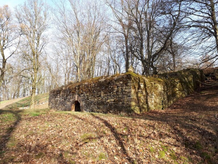
The large outer bailey spreads south and east of the core castle and was constructed during the residential phase between 1538 and 1555. Its northern side faced the principal direction of attack and therefore has a high quarry-stone wall with surviving battlements and alternating covered and open embrasures. The covered openings allowed defenders to fire at attackers close to the base of the wall.
Other surviving features include a pointed triangular bay near the gate, a pointed-arched sally port dated 1540, an aborter bay, and the later link between the outer and core castles. The northern section was particularly strongly fortified. A round tower called the Zyngel stands at the end of the defensive wall and contains embrasures for hooked rifles and small artillery, allowing fire across the flanks. The nearby sally port’s date, 1540, indicates the period in which this wall section and tower were probably built.
Marstall and Band House
The elongated Marstall is the largest-looking building in the outer bailey. Pointed-arched portals dated 1549 and 1551 indicate its original construction period. Its upper floor was removed after 1838 during a demolition sale and reconstructed in 1964. The building’s historical fabric is therefore most evident on the ground floor, where remnants of plaster survive. It now houses the castle restaurant.
The Band House stands near the center of the outer bailey and retains a large vaulted cellar. It was originally a wine storehouse. Barbara von Wertheim laid its foundation stone in 1554, and a second stone at the cellar entrance bears the date 1555. The original upper floor was destroyed in the 1621 fire, rebuilt in 1654, and sold for demolition in 1870. Its present relatively shallow roof dates from 1905. A monument beside the building commemorates Peter Nieß.
Outer-bailey gate
The outer-bailey gate once rose two upper stories above the wall and carried Renaissance gables. Those upper parts were demolished in 1870, although a remnant of the stair survives near the Marstall. The exterior pointed-arched entrance bears an armorial stone dated 1538, and the left gate leaf is dated 1539. The courtyard side has a broader arch dated 1539.
The gate retains wooden turning leaves, a wicket gate, iron fittings, and a decorative lock. Its basalt quarry-stone masonry preserves areas of plaster, while sandstone was used for selected surrounds and for two embrasures beside the entrance. The gate had no drawbridge. Rooms beside it included a guardroom to the southeast, formerly linked to the upper stories by a spiral staircase. Basket-arched portals appear in the passages, and the passage leading to the guardroom bears the date 1542. Basket-arched window surrounds are an unusual feature of sixteenth-century architecture.
Witches’ Tower and southwest tower
The semicircular tower stump southwest of the Marstall is known as the Witches’ Tower. Its name appears in connection with a woman accused of witchcraft who was imprisoned there in 1599. Dates on a pointed-arched basement portal and an external embrasure indicate construction in 1550 and 1549. Only the basement served as a prison, while the upper level formed a defensive platform.
A round tower protected the southwest corner of the outer bailey. It was built between 1546 and 1549. Its pointed-arched portal dates from 1548, and the adjoining western wall was completed in 1549. A foundation stone dated 1546, later installed on the upper floor, records that Count Georg laid the first stone on 18 August 1546. The external spiral staircase was added in 1905 with reused steps from a staircase in the Backhouse.
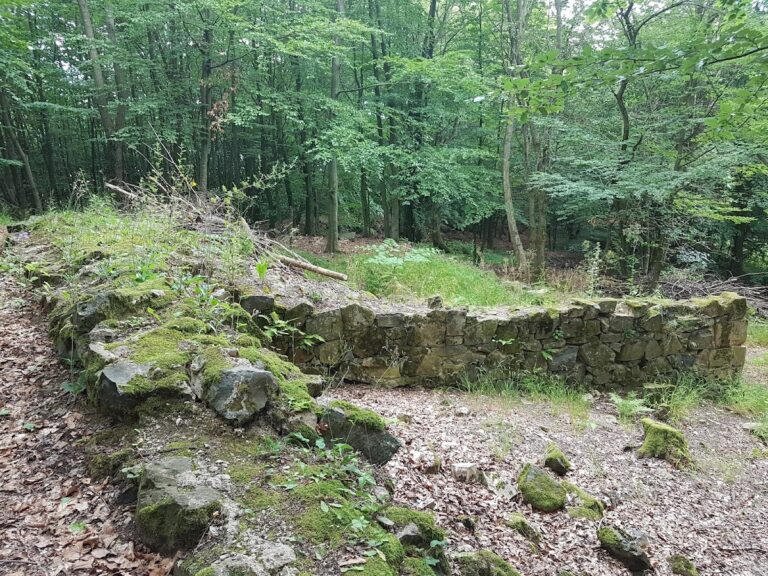
The upper part of the keep is reached by a wooden staircase, and the gallery around it contains viewing instruments. Across the complex, the core enclosure, outer bailey, gates, towers, residential buildings, service structures, and defensive walls retain a legible arrangement shaped by successive medieval and early-modern building phases.