Hardeck Castle Ruins: A Medieval Hill Castle in Germany

Site at a Glance
- Rating
- 4.5
- Popularity
- Very Low
- Country
- Germany
- Primary era
- Medieval
- Eras represented
- Medieval
- Civilizations
- Holy Roman Empire
- Site type
- Military
- Remains
- Castle
On this page7 sections
History
Hardeck Castle Ruins, also known as Burgstall Hardegg, are the remains of a former noble hill castle near Büdingen in Germany. Probably built in the 10th or 11th century, the castle was constructed from basalt and sandstone by builders whose identities are unknown. It occupied a strategic position near roads leading from the Main plain toward the Vogelsberg.
Medieval origins and lordship
Hardeck first appears in writing in 1289, in a reference to land toward Hardeck. The Counts of Hardeck, named in a 1543 agreement that dissolved Langenselbold Abbey, cannot be reliably identified as the castle’s builders or residents. On 11 May 1362, Burghard von Hardeck, an imperial court judge, issued a ruling in favor of the Hanau family. In 1367, Heinrich von Ysenburg and his wife, Adelheid von Hanau-Münzenberg, pledged Haus Hardeck as security for a debt of 1,450 gulden owed to Ulrich von Hanau.
Administrative use and abandonment
The castle was still the seat of an Amtmann, an official who managed an administrative district for a higher authority, in 1405. In 1464, the last Amtmann, Eckart Riedesel, moved to Büdingen. Hardeck consequently ceased to serve as an official residence, and by 1471 it was uninhabited and deteriorating.
Supplying the hilltop with water was a continuing difficulty. Water had to be collected from a spring below the hill and carried about 2 kilometres to the castle. Some buildings may have remained in use after the castle stopped serving as an administrative residence. Nikolaus Ludwig von Zinzendorf, a Moravian count who lived at the nearby Herrnhaag religious settlement from 1738 to 1748, is said to have written his will “in” Hardeck.
Demolition and the road network
After the Seven Years’ War of 1756–1763, the castle was reportedly demolished by Austrian forces in either 1794 or 1796. The demolition was probably ordered by Franz Anton Freiherr von Elsnitz, who later became an Austrian major general. Its building material was reportedly reused in road construction.
The medieval long-distance road Antsanvia, known on this section as the Reffenstraße, passed within sight of Hardeck. The castle originally had visual contact with Ronneburg and Glauburg, and later with Büdingen Castle. Together, these fortified sites helped secure routes running from the Main plain toward the Vogelsberg. Hardeck lies in the Büdingen municipal area, within the Lorbach cadastral territory, in woodland between Calbach and Lorbach and between Orleshausen and Diebach am Haag. The surrounding basalt hill may have influenced the name Hardeck.
Remains
Hardeck occupies the northern of two hilltops at an elevation of about 296 metres above sea level. Its lightly east-west-oriented oval outer rampart has a circumference of approximately 340 metres and encloses about 8,660 square metres. Inside it, a ditch has a circumference of roughly 290 metres at its base, while the inner rampart encloses more than 2,800 square metres and has a circumference of about 200 metres. The forest now prevents the complex from being viewed as a whole, while the visible remains consist chiefly of earthworks, fragments of walls, house remains, and foundations.
Ramparts and ditch
The ditch is particularly well preserved and reaches approximately 7 to 9 metres in depth on parts of the northern side. There, the inner rampart rises obliquely along a slope about 16 metres long from the ditch bottom and reaches up to 9 metres in height. On the southern side, the rampart is as much as 11 metres wide and rises about 5 metres. At its broadest northern point, the two rampart crests are approximately 25 metres apart.
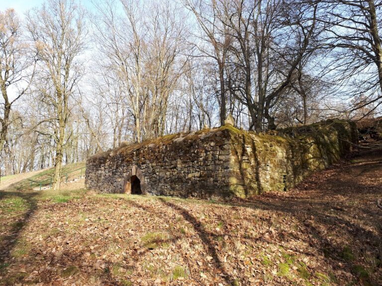
The enclosing castle wall survives mainly as a rampart, with superficial stone remains visible in places along the inner rampart. Finds from the eastern section indicate that a tower once stood within the wall line. Several surviving ruins also belong to buildings formerly attached to the northern part of the wall, although these fragmentary remains provide little evidence for the castle’s original size or appearance.
Interior buildings and foundations
A raised area inside the castle probably marks the position of the former palas, the principal residential and representative building of a medieval castle. About 20 metres east of the present path into the castle, in the southern section within the castle-wall area, are the foundations of a probably round tower. This may have been the Bergfried, the principal fortified tower of a German medieval castle, intended chiefly for defense rather than permanent residence.
Fragments of pottery and glazed ceramic were found around the probable round tower. Together with the remaining foundations, wall fragments, ramparts, and ditch, these finds preserve evidence of the castle’s construction and occupation, even though the surviving fabric offers only a limited indication of its former appearance.