Caelius Mons: A Late Roman Frontier Fort at Kellmünz
Site at a Glance
- Popularity
- Medium
- Country
- Germany
- Primary era
- Classical
- Eras represented
- Classical, Modern
- Civilizations
- German, Roman
- Site type
- Military
- Remains
- Fort
On this page18 sections
History
Caelius Mons was a Roman fort at Kellmünz an der Iller in Germany, built in the late third century as part of the frontier system of Raetia Secunda. It guarded the lower Iller valley and helped secure Rome’s border against raids by the Alamanni, a confederation of Germanic peoples.
Frontier and construction
The fort stood about halfway along a roughly 70-kilometre stretch of the Iller between Cambodunum, modern Kempten, and Guntia, modern Günzburg. It lay between the fort at Kempten-Burghalde to the south and a fortified outpost at Finningen to the north. Its garrison relayed messages and monitored the frontier; it may also have watched a bridge over the river. An ancient itinerary lists a north-south route through Kellmünz, although the road’s course and its links to the local network remain uncertain.
Following repeated Alamannic incursions and the failure of Rome’s older Upper Germanic-Raetian frontier around AD 300, a new chain of smaller forts was established from Lake Constance to the Iller under Emperor Probus. Caelius Mons probably belonged to a later fort-building program under Diocletian and his co-ruler Maximian. Their Tetrarchy was a system of shared imperial rule. The fort was occupied from about AD 297. Two coins minted in 296-297, found beneath a mortar floor in a construction-camp building, provide the earliest possible evidence for its building.
Fire, rebuilding, and the garrison
A major fire damaged buildings at the fort around AD 300-303. Its cause is unknown; accident, natural forces, or fighting may have been responsible. Rebuilding followed and continued at least until AD 310. A coin hoard dated to AD 308 was found outside the fort, but it cannot be linked to the fire. Its burial may have coincided with a brief expansion of the territory controlled by Maxentius, who held power from 306 to 312, during his joint rule with Constantine in the second Tetrarchy.
Rebuilding included a large hall, completed around AD 310. During the first half of the fourth century, it probably hosted official receptions and legal proceedings, including meetings with Alamannic envoys. It may also have served as a gathering place for escorts accompanying envoys on their onward journey to the imperial residence at Milan.
The late Roman register Notitia Dignitatum, a list of civilian and military offices, names the garrison as the Cohors III Herculea Pannoniorum, or Third Pannonian Cohort of Hercules. This Pannonian frontier unit was commanded by a tribune. Its title may indicate that it was raised during the Tetrarchy and served under Maximian, whose epithet was Herculius. The register was compiled around 420-425 and describes the forces of its own time, so it does not establish that the unit was based at Kellmünz from the fort’s foundation. Deployments in Raetia continued to change during the later fifth century. The cohort may have remained at Kellmünz until about 430 and probably consisted largely of Germanic soldiers.
Withdrawal and medieval reuse
Stamped Argonne sigillata, a type of fine Roman pottery, indicates that settlement continued into the first decades of the fifth century. The regular army may have left Caelio around 430, although many forts on the Danube-Iller-Rhine frontier were occupied only into the early fifth century.
During the Migration Period, the Kellmünz area came under the Alamannic Alaholfings, a ruling family. The fort was abandoned at the end of the sixth century, and settlement resumed in the area only in the ninth or tenth century. Between 980 and 990, the Alaholfing lordship of Bechthold passed to Hermann, Duke of Swabia. It was held by the last Alaholfing and passed through Gerberga, daughter of Conrad, King of Burgundy, and wife of Hermann III. In the Middle Ages, stone from the fort was gradually dismantled and reused in nearby buildings.
The ancient name is recorded as Caelio in the Notitia Dignitatum. It derives from Caelius, the name of one of Rome’s seven hills, and may also have influenced the modern place name.
Rediscovery and archaeological work
Roman walls came to light during construction of Kellmünz’s first public water supply in the mid-nineteenth century. From 1901 to 1913, local merchant Roman Linder and his three sons excavated substantial stretches of the fortifications, with advice from archaeologist Paul Reinecke. Some recovered architectural pieces were sold to the Bavarian National Museum to help finance the work. Linder’s eldest son, Johann, later published several articles on late Roman Kellmünz.
Interpretations of the site changed as research progressed. In 1917, Eduard Anthes regarded it as a fortified town, citing its irregular plan and a presumed settlement from the middle imperial period. In 1957, Hans-Jörg Kellner argued that the fort had also housed civilians alongside the garrison. In 1959, N. Walke examined the north tower beside the east gate shortly before road construction destroyed it.
The University of Munich excavated the site from 1986 to 1993 for the Bavarian Academy of Sciences’ Commission for Late Roman Studies, under the direction of Michael Mackensen. The work examined extensive sections of the defenses, including the main gate and towers on the east and northwest walls, as well as parts of the largely built-over interior. In 1987, excavators partly uncovered the south tower beside the east gate, which had been heavily damaged by a sunken track and stone robbing. Excavations ended in 1995, when the Kellmünz Archaeological Park was established and surviving remains were conserved. A rescue excavation followed at the northeast corner tower in 2001. The fort and associated archaeological features are protected under Bavarian law.
Remains
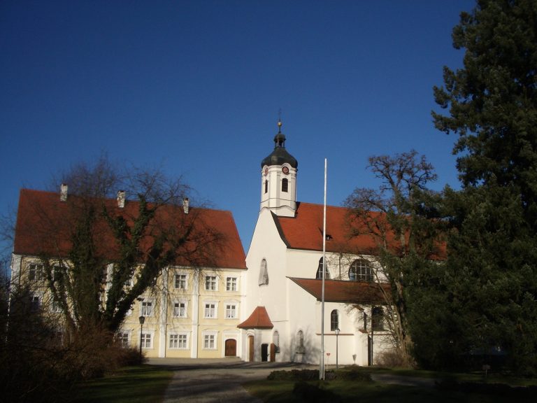
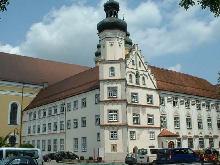
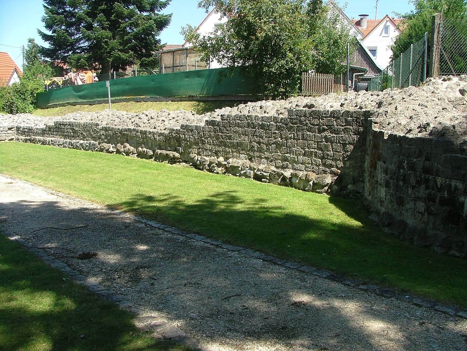
The fort occupied a plateau of sand about 35 metres above the Iller. Its roughly square, polygonal layout adapted to the terrain, with a long eastern side and a short western side above a steep slope. The remains lie in the western part of Kellmünz’s town centre, which is now largely built over. Foundations and some towers survive, with parts of the defenses conserved above ground. The Catholic church of St Martin stands at the former southeast corner.
Setting and defenses
Plan and walls
The fort enclosed about 0.86 hectares, measuring approximately 101.5 by 98.5 metres. Its east wall was about 112 metres long, while the north and south walls measured about 60 and 64 metres. The south wall turned northwest at a 45-degree angle; the north wall ran southwest at about 20 degrees, leaving a west wall only around 25 metres long. The northwest and southwest corners were set back and bevelled, and the north side projected outward at an obtuse angle.
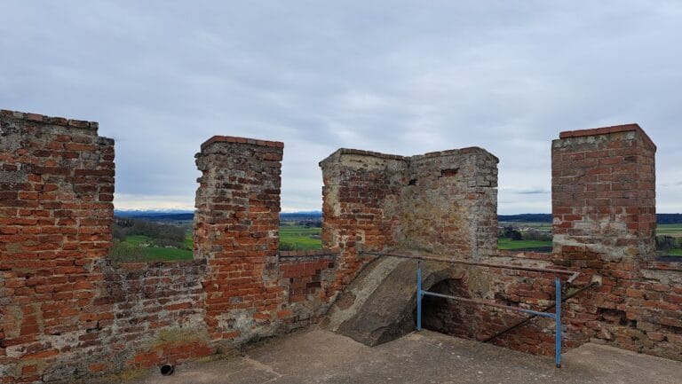
The outer defensive wall may originally have stood about seven to eight metres high and carried battlements. Its core consisted of a concrete-like mixture of sand, stone, and burnt lime, faced with layers of rubble stone. Excavation exposed parts of the core to a height of two or three courses. Reused stone formed much of the lower eastern foundations. The east wall, sometimes called the shield wall, was about 3.6 metres thick. The north and south walls were approximately 1.85 metres thick, and the northwest wall about 1.5 metres. A small secondary gate passed through the south wall.
East approach and main gate
Two ditches protected the eastern approach. The inner ditch was V-shaped, about five to six metres wide and 2.5 metres deep; the outer ditch had a flat bottom and was about six metres wide. The inner ditch continued in front of the gate but narrowed there. The outer ditch may also have narrowed at that point.
The east gate had a passage, an upper guardroom, and a path along the top of the wall. Two semicircular towers projected about eight metres beyond the wall. The main wall ran between them, with a second wall 2.5 metres in front; cross-walls joined the two and supported the inner sides of the towers. The passage, probably roofed only in part, led to an offset, angled chamber about 3.6 metres wide and eight metres deep, which could be closed at both ends. The double-leaf outer gate may also have had a portcullis, a gate lowered vertically into place.
Wall towers
Fourteen intermediate towers reinforced the defenses. They may have stood about 12 to 15 metres high and had tiled roofs. Most had semicircular plans and projected well beyond the wall; the towers at the eastern corners were three-quarter-round. The northeast tower, T1, and southeast tower, T4, had semicircular recesses in their foundations.
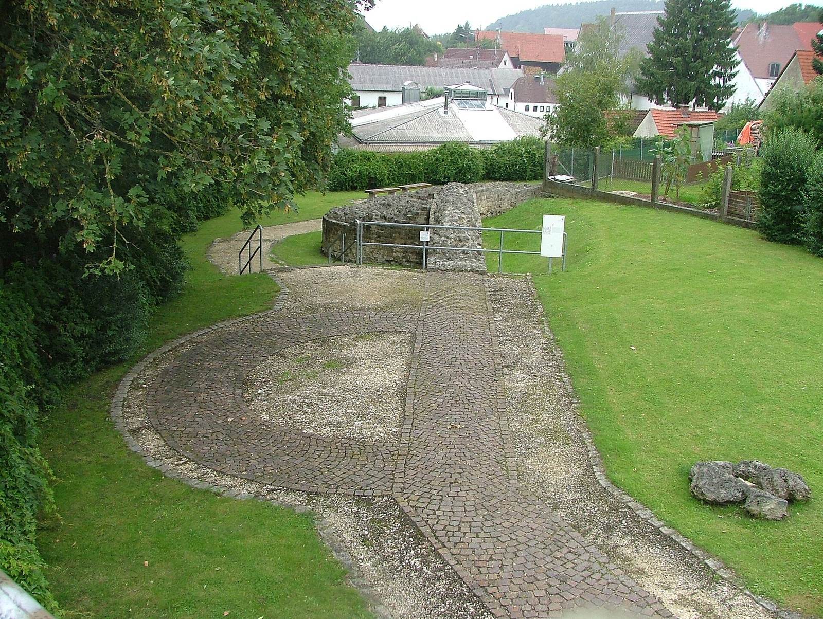
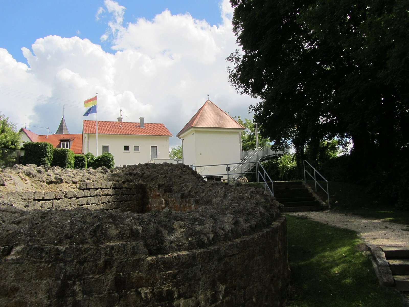
Tower T7 on the west side was rectangular, probably to address structural problems on the eroded slope, and has been described as buttress-like. The wall stood back from the edge and ran diagonally from T8 through T7 to the south wall. T9 and T10, with outer diameters of about 7.3 and 7.8 metres, stood about 20.5 metres apart. Tower T5 measured 4.20 by 5.25 metres and shared their foundation and upper-wall construction. T9, T10, and the stretch of wall between them have been exposed and conserved in the archaeological park. T7 has been rebuilt and plastered.
Interior buildings
Roads and central buildings
A main road about 3.6 metres wide led straight inward from the east gate and set the alignment for other roads, which probably formed a regular grid. A stone headquarters building, called a principia, probably stood near the centre where the main road ended at a T-junction. It may also have contained a praetorium, or commander’s residence.
Construction camp and barracks
Before the fort was built, timber-framed buildings occupied the plateau as a construction camp. They may have housed army detachments working on the fort. One building had a Y-shaped underfloor heating channel, and two nearly unworn bronze coins lay beneath its mortar floor. A V-shaped ditch about 4.5 metres wide protected the camp on the east.
Near the gate, a timber-framed building measuring about 6.85 by 26 metres had a latrine and a mortar floor. It may have been a tiled barrack divided into about five rooms, each occupied by a group of soldiers. A thick deposit of burnt material was found in its officer area and at other points in the fort. Two nearby hearths, aligned northwest to southeast, may have belonged to another barrack.
Hall
The single-aisled hall measured about 26 by 14 metres and stood parallel to the east wall. Its single main interior space had a channel-heating system, which distributed heat through passages beneath the floor. A columned porch stood at the front, and the building had a gabled roof and a semicircular apse, or sanctuary-like end. Coloured paving near St Martin’s church marks its south-facing foundations.
Occupation evidence and reused stone
Layers and finds
Occupation layers from around AD 300 survived within the area of a former cemetery. Finds from the middle and later fourth century and the early fifth century indicate continued activity. Stamped examples of Argonne fine pottery help place this later occupation within the Roman period.
Architectural pieces
Pieces of middle-imperial-period architecture were incorporated into the late Roman masonry, including sections used in towers on the east wall. They include column shafts and bases, column and pilaster capitals, and marble statues cut down to fit their later use. The architectural pieces were made of marble, tuff, and Jurassic limestone. They may have come from the cemetery of a wealthy estate at Kellmünz or nearby rather than from Kempten. The pieces are now in the State Archaeological Collection in Munich, while casts are held at Kellmünz.
Conserved wall fabric
The west wall and two rounded towers were restored and conserved for the archaeological park. The lower masonry is original Roman work. Small tuff blocks added to some upper courses in 1993-1994 form part of the later repair.