Rocca a Mare: Venetian Harbor Fortress in Heraklion, Greece
Site at a Glance
- Popularity
- Very High
- Country
- Greece
- Primary era
- Early Modern
- Eras represented
- Early Modern, Modern
- Civilizations
- Egyptian, Greek, Ottoman, Venetian
- Site type
- Military
- Remains
- Fort
On this page16 sections
History
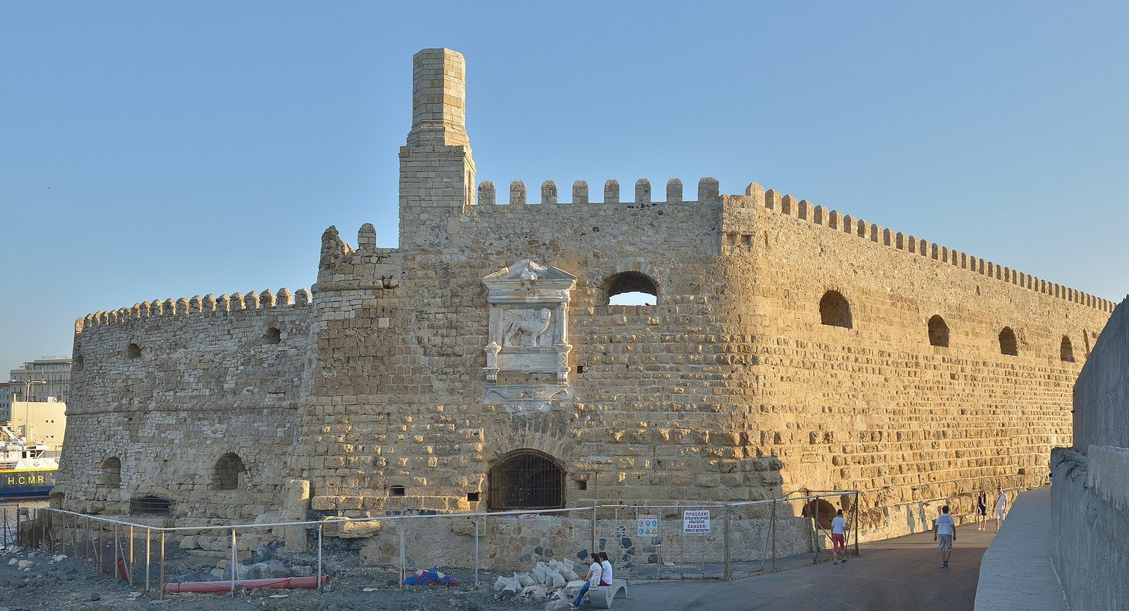
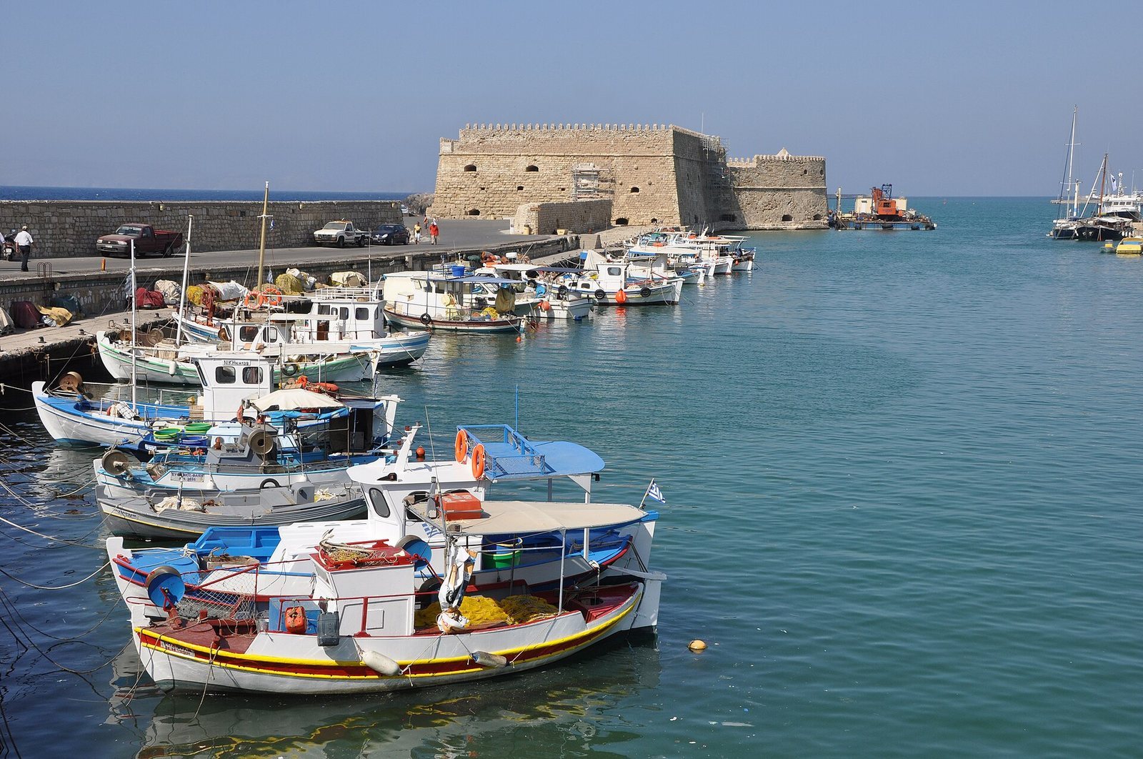
Rocca a Mare is a Venetian fortress at the entrance to Heraklion’s harbor in Greece. The Venetian Republic built the present fortress between 1523 and 1540 to defend the harbor, where it formed part of a defensive system with Palaiokastro Castle.
Early towers and Venetian rule
The harbor entrance may have been fortified during Arab rule in the ninth or tenth century. After Arab settlers conquered Crete in 825, they founded El Khandak, the settlement later known as Candia, and fortified its harbor entrance. A tower associated with the site is also linked to the Byzantine Empire, the eastern continuation of the Roman Empire. After Byzantine forces under Nikephoros Phokas reconquered Crete around 961–962, a tower was attributed to the site and called Castellum Comunis. The existence and origins of any pre-Venetian tower remain uncertain.
After Venice secured Crete in 1208–1209, its officials adapted an earlier tower to store food and house troops. An earthquake in 1303 badly damaged the tower, prompting repairs or reconstruction; Genoese builders have been credited with that work. The Venetian tower, also called Torre del Castello, suffered further earthquake damage in the early sixteenth century. In 1462, the Venetian Senate approved a program to strengthen Candia’s defenses.
Rebuilding for artillery and the sea
In 1523, officials judged the old tower inadequate against firearms and ordered it demolished and replaced by a stronger fortress. Its designer is uncertain. The project has been associated with Venetian engineers Antonio Saracini and Giovanni da Como, while Michele Sanmicheli, an Italian architect known for military fortifications, has also been proposed. Construction continued until 1540 and was interrupted during winters by bad weather.
The sea repeatedly damaged the new defenses. Venetians strengthened the northwest side with large blocks and protective outer stonework, but the northern harbor barrier partly collapsed in 1552. Gianmatteo Bembo proposed extending and rebuilding it to reduce wave damage and harbor silting. By September 1556, two rows of blocks weighing eight to ten tons each had nearly rebuilt the barrier; metal ties and lead joined the blocks. Serious damage returned by 1558. In 1566, military engineer Giulio Savorgnan proposed an outer wall that sloped toward the sea, while storms continued to shift the barrier stones.
During roof work in 1570, a large breach opened in the harbor barrier and could not be repaired. By the end of the century, the barrier was nearly destroyed, the fortress walls were cracked, and the undermined foundations allowed seawater to reach the freshwater cistern on the north side. A replacement barrier was soon swept away, and Venice provided substantial funds for further repairs.
Siege, Ottoman rule, and later alterations
During the Ottoman Empire’s 21-year siege of Candia, from 1648 to 1669, the fortress played a limited part in the defense. Near the siege’s end, Ottoman guns at Tripiti and siege engines at Sabbionara neutralized its firepower, allowing Ottoman forces to control the harbor. Candia surrendered in 1669.
After the conquest, the Ottomans repaired cannon damage, built a mosque inside the fortress for Admiral Kaplan Mustafa Pasha, a senior official, and used the building as a prison. The Ottoman travel writer Evliya Çelebi recorded the names Su Kalasi and Su Kulesi, meaning “fortress of the sea” and “tower of the sea.” The name Koules derives from a Turkish word for fortress and is also associated with “fortress of the sea.” Ottoman repairs continued: after part of the northwest side collapsed in 1719, it was repaired alongside other harbor works at a cost of 5,000 kuruş, an Ottoman currency unit.
An Ottoman-period minaret stood on the roof. It was damaged during nineteenth-century Cretan revolts and partly restored. Under Egyptian administration of Crete from 1830 to 1840, a separate lighthouse was built at the fortress’s northeast corner. The Ottomans also constructed the smaller Little Koules on the eastern harbor barrier. It was demolished in 1936 during urban expansion, together with part of the Venetian city walls.
Modern repairs and restoration
In the early twentieth century, buildings for a lighthouse keeper and sea scouts were added to the roof, and electricity poles and a crane were installed around 1920. Extending the harbor barrier improved the fortress’s stability after the sea had undermined it again. Bombing during the Second World War destroyed the crane and lighthouse. The lighthouse was rebuilt and remained in operation until its renovation in 1960, when its concrete supports were removed.
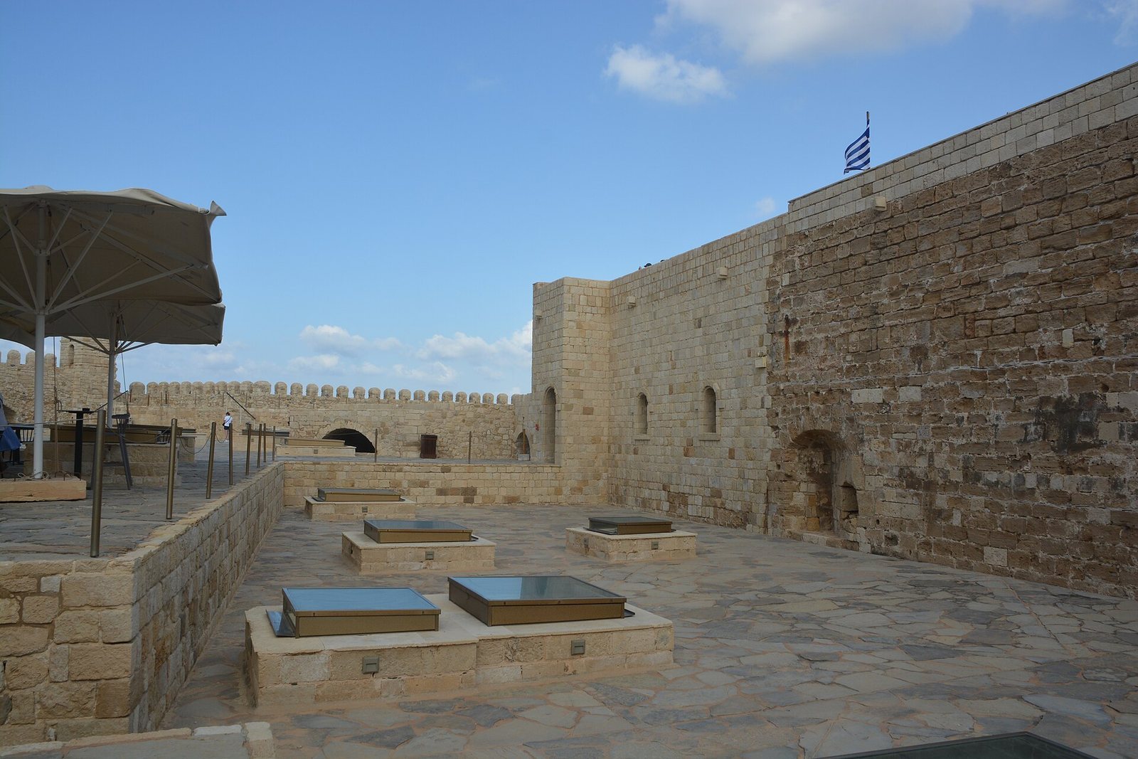
Restoration began in 1959 under Greek archaeologist Stylianos Alexiou. The work replaced deteriorating Ottoman battlements and removed later additions. Further work in 1972–1975 adapted the fortress as a monument, renewing roof gunports, adding a raised perimeter walkway and parapets around the light wells, and altering interior spaces. In 1989, the Greek government called for restoration of the surviving structures and, where possible, reconstruction of lost parts of the old city. In 2000, the south side of the fortress was supported after the sea had hollowed it out.
Remains
The two-storey fortress stands at the northern end of the old harbor’s western breakwater. The harbor occupied a natural cove, with rocks and reefs enclosing its northern side. Rocca a Mare covers about 3,600 square metres and has a roughly square plan with a large semicircular projection to the east. Its massive walls are built from stone that included material brought from Dia and Fraskia, as well as Cretan stone and sandstone quarried inland.
Fortress structure and internal arrangement
Plan and foundations
The walls measure 8.7 metres thick on the east, west, and northeast sides, and about 7 metres on the north. Interior walls range from 1.4 to 3 metres thick. Builders formed the underwater foundation by filling old ships and boats with stones and sinking them. The stones came from Dia and Fraskia. By November 1530, about 16 metres of foundation had been laid, and work on the outer walls was under way.
Entrances and circulation
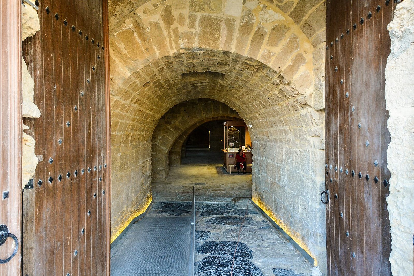
The main entrance lies on the west, at the end of the breakwater. A smaller entrance on the northeast leads to a semicircular harbor barrier, while a third faces the harbor on the south. From the western entrance, a gently descending corridor, 10.5 metres long and 3 metres wide, passes through three defensive doors. It then widens to 7 metres and divides: one passage runs north toward a secondary door, and the other leads east to the semicircular projection.
A staircase and an inclined ramp connect the two floors. The ramp allowed cannons and ammunition to be hauled to the upper level. An opening on the east also enabled supplies to be loaded from the harbor directly onto the roof.
Storage floor
The ground floor slopes slightly, with its western side lower than its eastern side, and lies 1.36 to 1.74 metres above sea level. It contains 26 rooms used chiefly for storing food and ammunition, as well as prison cells, and includes a large water cistern. Broad openings in the vaulted ceiling admit light and air.
Upper floor and defenses
The upper floor contained rooms for officers, an oven, a mill, and a small church. It is arranged around a large courtyard, enclosed by a parapet that formed the firing level. The floor is 10.4 metres above sea level except at the southwest corner, where it is 8.7 metres above sea level. The parapet has two levels, with its western and southwestern sections higher than the northern side.
Gunports on the three seaward sides were intended to defend the harbor. In 1630, 18 large guns stood on the ground floor and 25 guns of varying sizes were on the upper level.
Stone reliefs
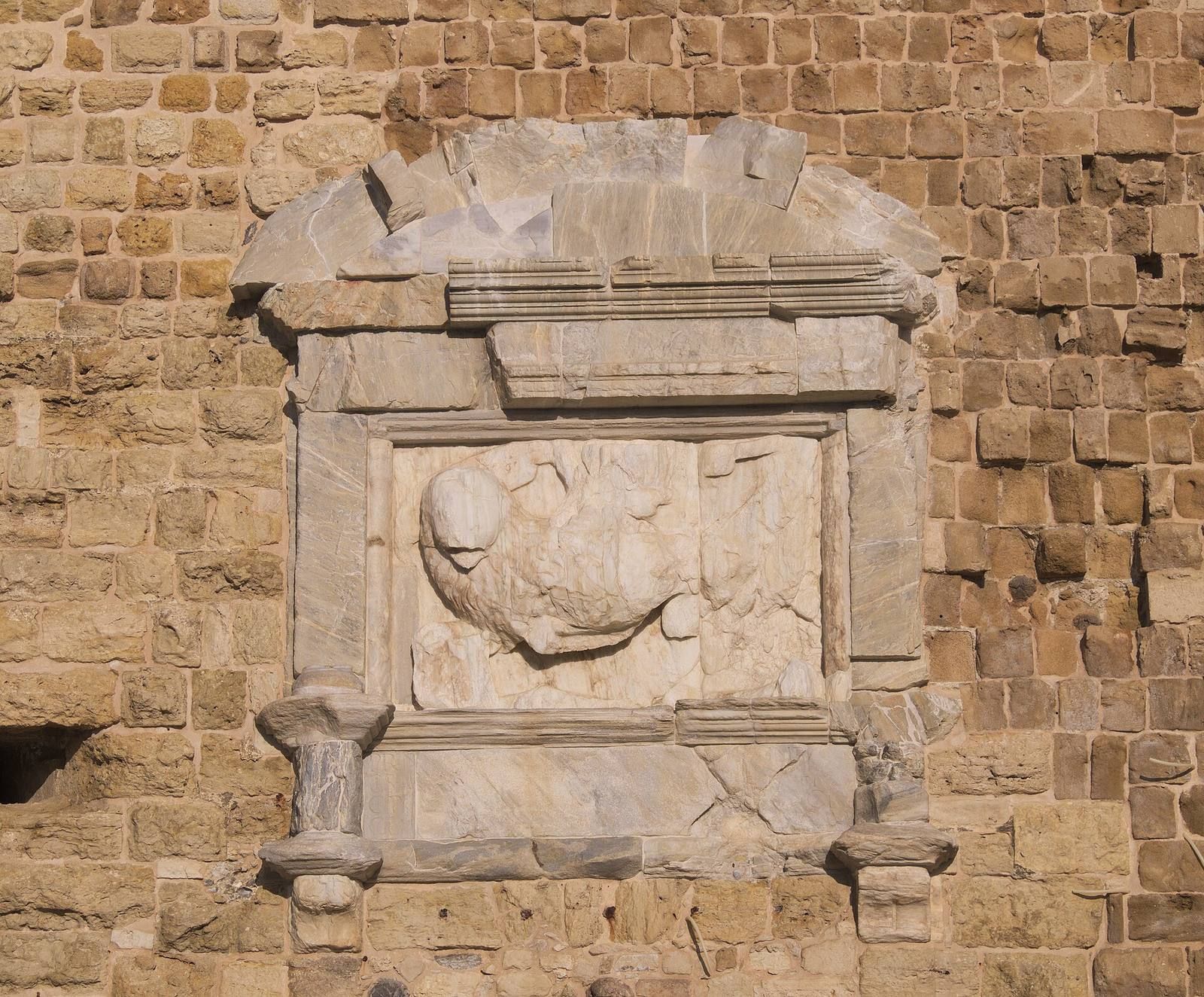
Marble reliefs of the winged Lion of Saint Mark were set into the northeast, west, and south sides. The surviving reliefs are damaged. A relief remains in place on the north face, with its face erased.
Other harbor features and finds
Lighthouse
A lighthouse tower stands at the fortress’s northeast corner. Concrete supports were added to it, and after wartime destruction the lighthouse was rebuilt. Its supports were removed during renovation.
City wall
The road leading to Rocca a Mare formerly formed part of the city wall. Sections of that wall survive.
Recovered artillery
Cannons and cannonballs recovered from Heraklion harbor basin are displayed inside the fortress.