Rila Fortress: The Medieval Stronghold of Rylsk, Russia
Site at a Glance
- Popularity
- Medium
- Country
- Russia
- Primary era
- Early Modern
- Eras represented
- Iron Age, Classical, Medieval, Early Modern, Modern
- Civilizations
- Grand Duchy of Lithuania, Kievan Rus, Russian
- Site type
- Military
- Remains
- Citadel
On this page17 sections
History
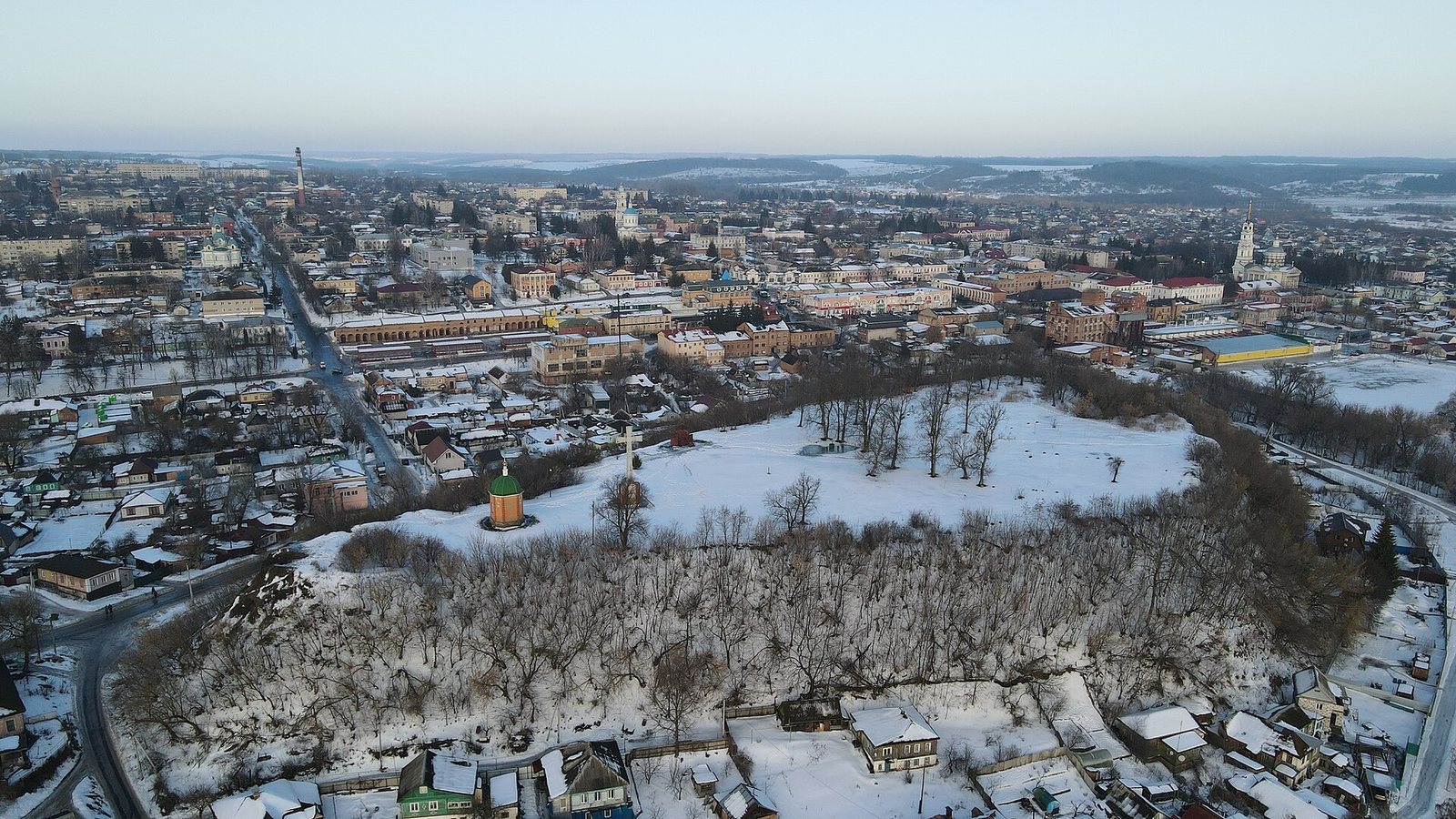
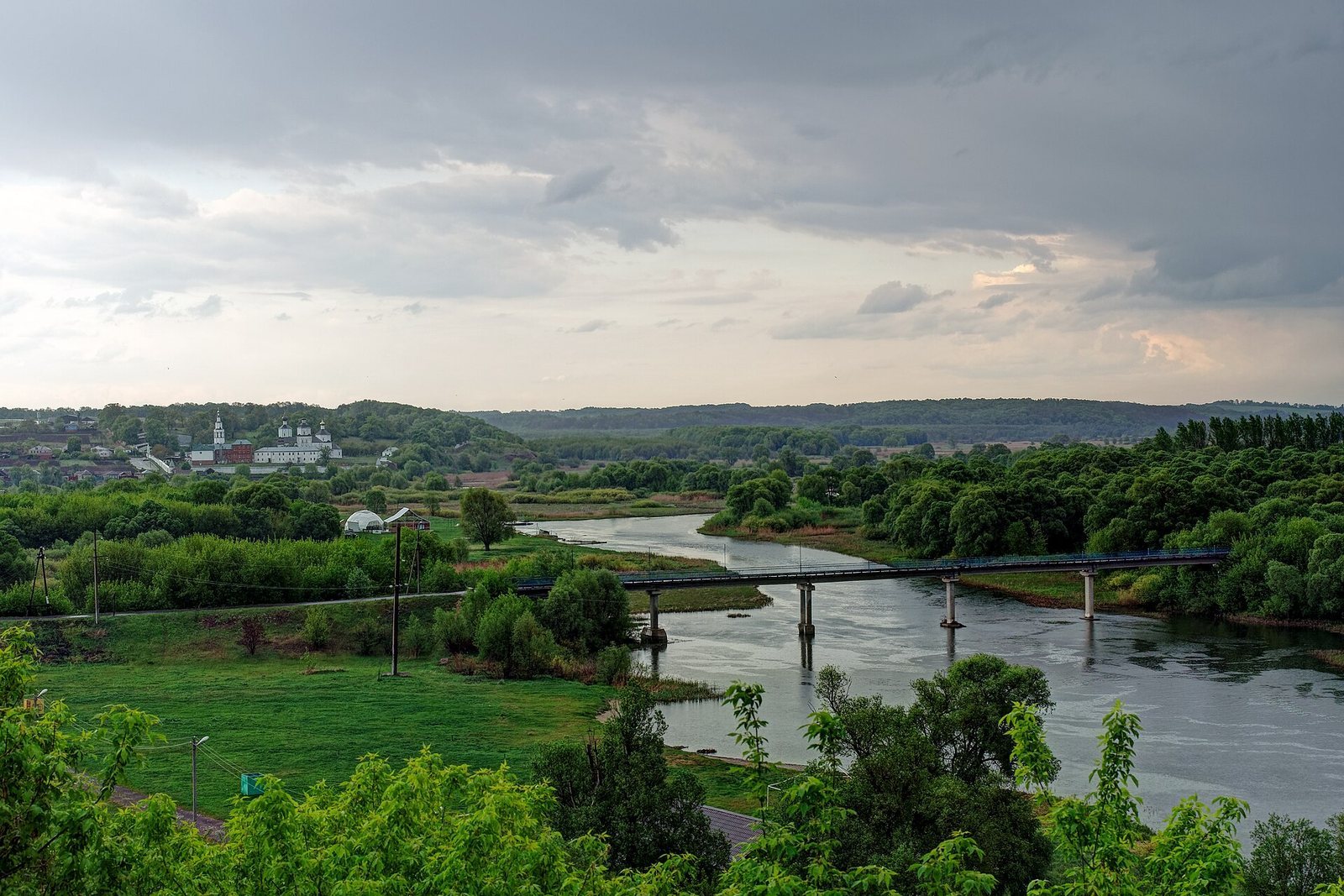
Rila Fortress was the fortified center of Rylsk on Ivan Rylsky Hill in Russia, where the Dublyanka River meets the Seym. The hill’s occupation reaches back to the sixth–fourth centuries BCE, while Rylsk took shape as a town in the late tenth or early eleventh century, during the medieval Rus era. It later served as a principality center and an important frontier stronghold.
Early occupation and the rise of Rylsk
Later settlement layers contain material associated with the Kolochin, Volyntsevo, and Romny archaeological cultures. Slavic settlement on the hill is dated to the late seventh or early eighth century. Finds indicate bronze-casting skills and connections with distant regions. On the basis of the hill’s terrain, archaeologist M. V. Frolov proposed that Romny-period defenses may have formed two or three lines, perhaps enclosing a settlement with early urban characteristics. Ninth- and tenth-century pottery led him to interpret the period as a transition toward Old Russian culture, though continuity between the two phases remains uncertain.
Rylsk developed after the Severian lands became part of the Old Russian state. The town is first named in the Hypatian Chronicle in 1152. It belonged initially to the Principality of Novgorod-Seversk and ranked second among the towns of the Kursk territorial district. In the 1160s, it became the center of its own principality. During the twelfth century, a military retinue departed from Rylsk for Prince Igor Sviatoslavich’s campaign against the Cumans, a Turkic-speaking steppe people. The expedition is recounted in The Tale of Igor’s Campaign, a medieval literary work.
Medieval warfare and changing rule
The Mongol invasion devastated Rylsk in 1240, but the town soon recovered. The surrounding area was the only part of the Central Black Earth region where settled life continued from the devastation of the invasion until the sixteenth century. Rylsk came under the Grand Duchy of Lithuania, a medieval eastern European state, in the mid-to-late fourteenth century.
In 1500, Rylsk passed to the Russian state amid Prince Vasily Shemyachich’s transfer to the service of Grand Prince Ivan III. The precise basis of Shemyachich’s claim is uncertain, as is whether the town changed hands without fighting. In 1501, Horde Khan Sheikh Ahmed, allied with Lithuania’s Grand Duke Alexander Jagiellon, captured Rylsk. A truce in 1503 confirmed the town as part of the Russian state. Rylsk probably helped repel a Crimean Tatar and Lithuanian attack in the winter of 1514–1515. In 1560, Crimean forces besieged the fortress and devastated the settlement outside it.
Frontier fortress and decline
In the sixteenth and seventeenth centuries, Rylsk guarded a strategic frontier, with Lithuania to the west and the Wild Fields, the steppe frontier south of settled Russian lands, to the south. It formed part of Russia’s southern defenses against Crimean Tatar raids. In 1605, tsarist commanders failed to capture the town, which had pledged allegiance to False Dmitry I, a claimant to the Russian throne during the Time of Troubles, an era of political crisis and conflict in the early seventeenth century.
During the Time of Troubles, Rylsk lost nearly all its civilian population, leaving mainly service personnel. In 1625–1626, its outer settlement had 19 households, alongside nine households of bobyls, land-poor or landless people. The fortress held 12 artillery pieces in the 1630s. By the late seventeenth century, Russian borders had shifted south and west, diminishing Rylsk’s strategic value. It lost its importance as a fortress town after the Battle of Poltava, a major engagement in the Great Northern War.
In 1718, three oak towers, part of the fortress walls, and a deteriorated ammunition cellar remained. The outer settlement’s rampart and ditch were partly ruined and needed rebuilding. The fortress was destroyed during the eighteenth century.
Archaeological investigations took place in 1910, 1928, 1946 and 1947, the 1960s, 1979, 1984–1986, and 1989–1994. Ivan Rylsky Hill was designated an archaeological reserve in 1962 and has federal-level cultural heritage status. A chapel was built on the hill in 2003–2005.
Remains
The ruined site occupies a high riverside promontory at the meeting of the Dublyanka and Seym. Its fortified layout comprised an inner fortress and an outer settlement, the latter divided into upper and lower parts. The hill also held two churches near the fortress walls: one dedicated to Saint John of Rila and Saint Nicholas Cathedral.
Early settlement remains
Ancient dwellings
Remains from the sixth–fourth centuries BCE include storage pits and a dwelling with wooden walls coated in clay. Two stone-built hearths stood inside the house, and several similar hearths were found outside it.
Late first-millennium dwellings
Three sunken timber-framed dwellings date to the late first millennium CE. Each had a clay oven, and one also contained a kiln used to fire pottery.
Burial and cremation remains
A burial identified as that of a Khazar woman warrior contained human bones, part of a horse skull, and a complete dog skull. Nearby cremation remains included burned bones, charcoal, small white and yellow beads, and fragments of pottery associated with the Saltovo archaeological culture. The cremation may have been connected with a funerary feast, though that interpretation is uncertain.
Old Russian and later medieval remains
Buildings and evidence for a church
Deposits dated from the eleventh century to the first half of the thirteenth contain oven foundations and the foundation of a stone building. Flat, broad plinth bricks and ceramic floor tiles point to a church nearby. M. V. Frolov attributed it to craftsmen from Chernihiv and proposed a date in the late twelfth or early thirteenth century.
Fourteenth- and fifteenth-century dwellings
Excavations uncovered two sunken buildings dated to the first half of the fourteenth century and an above-ground building from around the turn of the fourteenth and fifteenth centuries.
Fortifications
Inner fortress
The inner fortress had oak walls reaching up to six metres in height and nine towers. By 1678, its timber stockade, built on an earthen embankment, had three gates and six blind towers, meaning towers without a passage through them. A concealed passage ran from the Hidden Tower down to the river. Named towers included the Resurrection, St. Paraskeva, Ivan’s, and Torture towers, as well as the Hidden Tower.
Resurrection Tower
The six-sided Resurrection Tower served as a passage tower and rose more than 15 metres. It held a signal bell weighing nine and a half poods, a traditional Russian unit of weight. Two metres away stood a smaller, four-sided tower, five metres high, with a passage gate and no upper section.
Outer settlement defenses
An earthen rampart and moat enclosed the outer settlement. Its five towers were unfinished, and four had passageways. Named towers included the Alexis, Putivl, Most Pure, and Elijah towers.
Artillery and firearms
One fortress inventory listed five copper and 25 iron guns, 20 wall guns, firearms used from defensive positions, and two signal bells. The 1718 armament comprised 13 cannon and 20 wall guns.
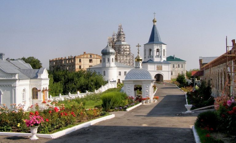
A chapel dedicated to Saint John of Rila now stands on the hill.