The Châteliers Gallic Rampart: Fortification of an Iron Age Settlement
Site at a Glance
- Popularity
- Very Low
- Country
- France
- Primary era
- Iron Age
- Eras represented
- Bronze Age, Iron Age, Modern
- Civilizations
- Celtic, French
- Site type
- City
On this page9 sections
History
The Châteliers Gallic Rampart is the eastern fortification of an Iron Age oppidum, or fortified settlement, on the Châteliers plateau in Amboise, France. Its later enlargement enclosed a settlement covering at least 52 hectares. The archaeological richness of the site suggests that it may have been the capital of the Turones, a Gallic people whose territory included the region around present-day Tours. By the twenty-first century, it had been identified as the largest and best-organized Gallic settlement of the Turones known.
Prehistoric and Iron Age Development
The plateau has been occupied since the Neolithic. At its western tip, a north–south rampart, probably built in the Bronze Age or earlier, enclosed about 8 hectares. A separate fortification was later constructed farther east. Its earliest identified core may date to La Tène A or B1, earlier phases of the European Iron Age, but its extent and original defensive role remain uncertain. During La Tène D, a later phase, the eastern rampart was substantially raised and widened, enclosing the large settlement.
In the first century BC, the oppidum supported craft work including pottery-making, butchery and ironworking, alongside religious activity associated with a building and votive deposits. Tanneries may also have operated there, and the settlement may have had a political role. These possibilities, together with its archaeological richness, underpin the suggestion that it served as a centre of the Turones.
Abandonment and Agricultural Use
From the middle of the third century AD, people progressively left the oppidum for a new Amboise in the Loire valley below. By the Middle Ages, the plateau was used for agriculture. The rampart was partly levelled and covered with soil. Vines were cultivated across the settlement, including on the rampart, by the mid-seventeenth century. Ploughing and vineyard maintenance contributed to erosion.
Vine-growing ended in the final two decades of the nineteenth century as phylloxera, an insect pest that damages grapevines, spread through the region. Uprooting vines and attempts to plant them again led to accidental archaeological discoveries.
Historical Accounts and Archaeological Research
A twelfth-century chronicle attributed to a monk of Marmoutier, a medieval abbey near Tours, described a Roman camp and a plateau-wide fortification as works of Julius Caesar. Maps by René Siette in 1619 and Dubuisson-Aubenay in 1646 marked the eastern rampart and its ditch. Dubuisson-Aubenay also noted a local tradition that the plateau had been the site of an early Amboise, an idea later partly supported by archaeological evidence. Eighteenth-century drawings by Pierre Beaumesnil appear to have followed the chronicle’s account.
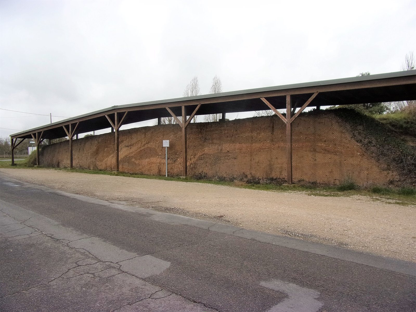
Construction of an access road cut through the southern half of the rampart in 1978, providing a section that became central to archaeological understanding of the fortification. An assessment at the plateau’s northeastern end in 2016–2017 showed that the rampart extended farther north than previously thought, revising its estimated length from 450–500 metres to about 800 metres. The ramparts and ditches were classified as historic monuments in 1986, and the plateau became part of the UNESCO World Heritage property “The Loire Valley between Sully-sur-Loire and Chalonnes” in 2000. A three-year collective research project, Ambacia, began in 2024 to bring together findings from investigations and coordinate further study.
Remains
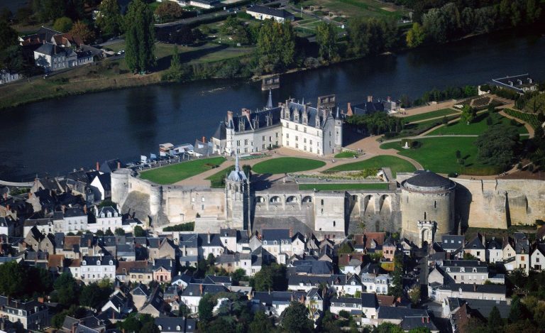
The oppidum occupies a plateau formed by the meeting of the Loire and Amasse rivers. Underlain by Turonian limestone, it averages about 100 metres in elevation and stands roughly 50 metres above the Loire valley. A meander of the Amasse narrows the plateau to the south. The eastern rampart runs almost straight from north to south, nearly closing off the plateau’s eastern side.
The Rampart
At its fullest extent, the rampart is about 800 metres long and measures 25–30 metres across at its base. It now stands about 4 metres high and may originally have reached about 10 metres. Its earliest identified core is an earthen bank roughly 10 metres wide at the base, containing charcoal. Upright green-wood stakes may have reinforced its eastern, outer face. This core was observed in the 1978 section, but investigations elsewhere have produced conflicting results about how far it extended.
During La Tène D, repeated additions of earth and stone widened and raised the bank, producing a roughly triangular profile. The number of building stages is unknown, but their layers remain visible in the surviving section. Some additions contain pebbles, apparently brought from the Loire or Amasse valleys, since the plateau has no natural pebble deposits. Fragments of Dressel 1-A amphorae, a type of Roman transport jar, in one of the later layers help date the rampart’s final raising.
The Outer Ditch
A ditch borders the rampart on its eastern, outer side. It has a flat bottom and a trapezoidal cross-section, with sloping sides. Farther north it follows the natural dry valley of Malvau, which opens toward the Loire valley. Visual estimates put its average width at about 40 metres and its depth at about 3 metres. In the northern section examined in 2016–2017, its original dimensions were estimated at 22 metres wide and about 5 metres deep. The ditch gradually filled after its upkeep ended in Antiquity and was largely filled in modern times.
Settlement Remains
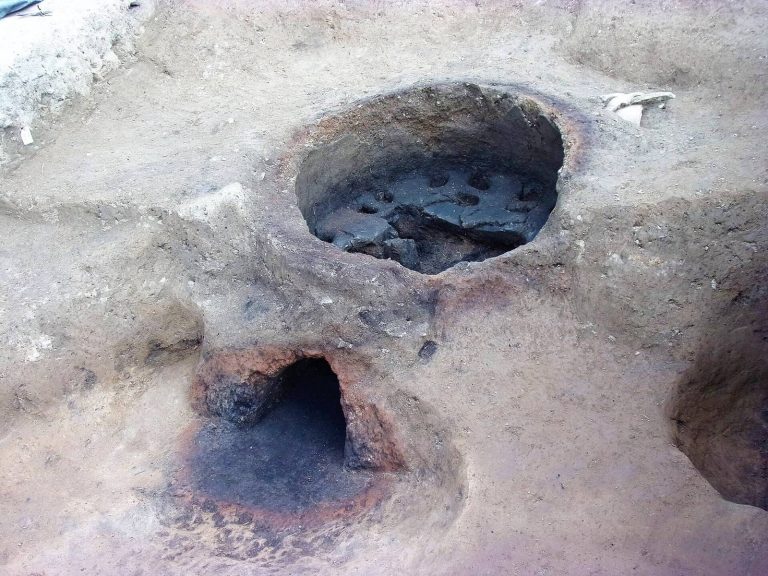
Archaeological remains across the oppidum include dwellings built of wood and/or earth, wells, a pottery workshop, and evidence of butchery and ironworking. A religious building and votive deposits also form part of the site’s remains. In the northern part of the settlement, a compacted-earth surface covers a Bronze Age pit containing vessels and cremated bones. This is the only structure from that period identified in this part of the plateau.
Soil Cover and Exposed Section
A soil deposit about 30–80 centimetres thick covers the plateau, including the rampart, and seals its archaeological layers. It may have helped cultivation or partly levelled irregular ground along the plateau’s edges. In the exposed rampart section, material from the partly levelled bank was displaced westward, leaving construction layers visible but disturbed. The 1978 road cut exposes this section. Mesh supports its northern face, and a shelter built in 1986 protects it from the weather.