Qatna: An Ancient Kingdom and Royal City in Syria


Site at a Glance
- Rating
- 4.4
- Popularity
- Very Low
- Country
- Syria
- Primary era
- Bronze Age
- Eras represented
- Bronze Age, Iron Age
- Civilizations
- Unclassified
- Site type
- City
On this page20 sections
History
Qatna was an ancient city and kingdom in Syria, identified with the archaeological tell of Tell al-Mishrifeh about 18 kilometres northeast of Homs. It became an important political and commercial center during the second millennium BCE and remained inhabited through much of the first millennium BCE. The kingdom was established around 2000 BCE by an Amorite royal dynasty, while the city’s successive Bronze Age phases developed within the wider political world of Syria and the ancient Near East.
Early settlement and urban growth
The central part of the upper city was first occupied during the Late Chalcolithic IV period, around 3300 to 3000 BCE. This settlement was short-lived, and its purpose is uncertain. After several centuries of interruption, Qatna was reoccupied around 2800 BCE during Early Bronze Age III.
During Early Bronze Age IV, Qatna continued to expand while many other Syrian urban centers experienced disruption. Its circular settlement covered approximately 20 to 25 hectares and contained dense housing together with large installations for storing and processing grain. Numerous smaller settlements surrounded the city. Qatna may at this stage have been a center of the Ib’al federation or the seat of one of its rulers.
A kingdom was established at Qatna around 2000 BCE. During Middle Bronze Age I, the city grew to approximately 110 hectares and drew people from many surrounding settlements. Its position between the Syrian steppe, the Mediterranean, Mesopotamia, Anatolia, and Egypt encouraged long-distance trade and gave its rulers influence over a broad regional network. Agriculture and pastoralism initially formed the main economic base, while commercial exchange became increasingly important during the Late Bronze Age.
The Middle Bronze Age kingdom
The earliest secure references to Qatna come from the Middle Bronze Age archives of Mari, where the city appears as Qatanum. Proposed identifications with Gudadanum or Ga-da-nu in the archives of Ebla and with Qedem in the Egyptian Story of Sinuhe remain debated.
Qatna was predominantly Amorite, meaning that its ruling dynasty belonged to West Semitic-speaking populations who established kingdoms in Syria and Mesopotamia during the early second millennium BCE. Hurrian groups became an important part of the population during the fifteenth century BCE and influenced the city’s written language. Arameans, another group of Semitic-speaking populations who formed states in Syria during the first millennium BCE, were associated with the later reoccupation of the site.
Qatna maintained close relations with Mari but repeatedly competed with Yamhad, whose capital was Aleppo. During the reign of Amut-pi’el I, Qatna allied with Yahdun-Lim of Mari and attacked the Yamhadite city of Tuba. Under Išḫi-Addu, Qatna reached the height of its Middle Bronze Age power. Its territory extended from the upper Orontes valley to Qadesh, with Palmyra as its easternmost city and Hazor among its southern dependencies.
Išḫi-Addu was allied with Shamshi-Adad I, the ruler who created the Kingdom of Upper Mesopotamia and conquered Mari, where he installed his son Yasmah-Adad. The alliance was strengthened around 1782 BCE when Išḫi-Addu’s daughter married Yasmah-Adad. Shamshi-Adad also sent military assistance to Qatna during a major internal rebellion, although his troops avoided direct war with Yamhad.
Išḫi-Addu died before Qatna was again mentioned in the Mari archives around 1772 BCE. His son Amut-pi’el II succeeded him. After Shamshi-Adad I died, the rise of Yarim-Lim I of Yamhad forced Qatna to acknowledge Yamhad’s superior regional position, although Qatna continued to conduct its own diplomacy and pursue independent political ambitions.
Decline and Late Bronze Age rule
Qatna’s economic position weakened as Yamhad gained control of the principal routes between the Mediterranean and Mesopotamia. During the reign of Yarim-Lim III, Yamhad defeated Qatna in the late seventeenth century BCE. Qatna’s political and commercial importance declined further around 1600 BCE.
During the sixteenth century BCE, Qatna became a vassal of Mitanni, a Hurrian-led kingdom that dominated northern Syria and Upper Mesopotamia. The city retained some autonomy into the fourteenth century BCE. Egyptian rulers, including Thutmose III and Amenhotep II, campaigned in the region. Thutmose III established vassal ties with Qatna and was associated with an archery contest involving its king.
Qatna’s political status during the fourteenth century BCE is uncertain. Some interpretations place it within the kingdom of Nuhašše, while others treat Qatna and Nuhašše as separate realms. King Idanda ruled Qatna during the period of Hittite expansion. The Hittites were an Anatolian power that extended its control into Syria and contested the region with Mitanni and Egypt. A Hittite military official demanded that Idanda strengthen the city’s defenses.
Around 1340 BCE, Tushratta may have invaded Qatna and burned the royal palace. Qatna was later attacked and sacked during the campaigns of Šuppiluliuma I, the Hittite king whose conquests extended Hittite control across northern Syria. The city was not destroyed entirely at the first stage, but its population was deported or displaced and its political system collapsed.
Akizzi, who succeeded Idanda, appealed to the Egyptian pharaoh Akhenaten for military assistance. He declared loyalty to Egypt, organized or joined an anti-Hittite coalition, and requested Egyptian troops. In an Amarna letter, Akizzi described the Hittite attack and the plundering of Qatna. The final sack took place after the destruction of the palace and before Akhenaten’s death around 1334 BCE. Akizzi was the last known king of Qatna.
The destruction of the royal palace ended Qatna’s former political importance. Other palaces were abandoned, the southern palace was converted into a pottery workshop, and the lower-city palace was replaced by two walled courtyards. The settlement was greatly reduced, and later occupation was interrupted until the late tenth or early ninth century BCE.
Iron Age settlement and abandonment
Qatna was reoccupied in the late tenth or early ninth century BCE, although its name during this phase is unknown. It probably lay within the sphere of Palistin and under the control of Hamath. By the eighth century BCE, the settlement had expanded into a local administrative center of the Aramaean kingdom of Hamath.
Assyrian forces probably destroyed Qatna’s official buildings during the campaigns of Sargon II, who annexed the region in 720 BCE. The settlement continued as a much smaller village during Iron Age III and was abandoned in the mid-sixth century BCE. It appears to have been largely unoccupied during the Classical period.
Excavation and archaeological research
A modern village was established within the ancient site during the mid-nineteenth century. Houses built over the palace damaged some remains but also protected parts of the ruins beneath them. In 1982, the Syrian Directorate-General of Antiquities and Museums moved the inhabitants to a new village beside the tell, allowing archaeological research to proceed across the ancient settlement.
Archaeological work began under Robert du Mesnil du Buisson in 1924 and continued annually from 1927 to 1929. Syrian surveys and surface excavations resumed in 1994 under Michel Al-Maqdissi. A Syrian-Italian-German project began in 1999 under Al-Maqdissi, Daniele Morandi Bonacossi, and Peter Pfälzner, and was reorganized in 2004 into Syrian, Syrian-German, and Syrian-Italian missions.
Excavation concentrated on the upper city. By 2006, about five percent of the total site had been investigated, including the western and eastern sectors of the royal palace, the acropolis summit, and the lower-city palace. Excavations stopped in 2011 because of the Syrian Civil War. The discovery in 2002 of King Idanda’s archive was one of the most important results. Approximately 63 to 67 clay tablets, written in Akkadian and Hurrian, concern political intelligence, the Hittite threat, and local administration. Conservation and restoration of the royal palace began in 2004.
Remains
City plan and fortifications
Qatna was founded on a limestone plateau beside the central Zorat wadi, a seasonal watercourse and one of three north-flowing tributaries of the Orontes. The surrounding region extended approximately 26 kilometres from north to south and 19 kilometres from east to west and contained at least 24 or 25 satellite settlements, especially along the Mydan and Slik wadis.
The early city of Early Bronze Age IV had a circular plan and covered approximately 20 to 25 hectares. In later phases, this upper city became the acropolis, the elevated or central fortified part of an ancient city, while a much larger rectangular lower city developed around it. During the Middle Bronze Age, the urban area covered approximately 110 hectares, with the lower city occupying about 70 hectares.
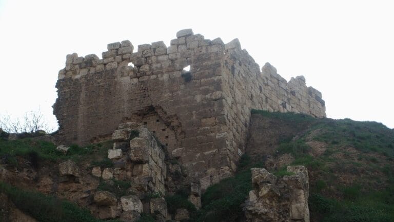
Substantial earthen ramparts and defensive walls enclosed the settlement. The surviving ramparts reach approximately 15 to 20 metres in height and have bases approximately 60 to 90 metres wide. Four principal gates pierced the roughly square enclosure. One of them is identified in a tablet as the “city gate of the palace.” The walls used local earth and stone, with foundations cut into the limestone. White limestone and black basalt orthostats, or upright facing stones, reinforced the entrances, including one documented entrance approximately four metres wide. An artificial ditch ran along the front of parts of the fortifications.
Qatna developed beside Mishrifeh Lake, which probably received water from springs and the surrounding wadi system. When the fortifications were built, their northern and western sections extended into the lake, dividing it into a smaller inner lake and a larger outer reservoir. These water bodies probably served the city, its animals, agricultural fields, and nearby settlements.
Acropolis buildings
Central Representative Unit
Building 8, also called the Central Representative Unit, dates to the transition between the third and second millennia BCE. Its preserved walls are approximately 7.5 metres high and four metres thick. The building was abandoned in the late Middle Bronze Age II, around 1800 to 1600 BCE. Its function remains uncertain, but its monumental position on the acropolis summit and the discovery of two royal statues suggest that it may have been an earlier royal palace. A concrete water tower built in the 1970s destroyed its eastern and northern walls.
Royal palace
The royal palace occupied the northern part of the acropolis and covered approximately 16,000 square metres. Its northeastern section and northwestern wing had two stories, and the first story contained at least 80 rooms. The palace was constructed above an earlier necropolis, and its formal architectural character remained relatively consistent through successive occupations until its destruction around 1340 BCE.
The Central Representative Unit of the palace consisted of Halls A, B, and C, whose roofs were probably carried by large cedar beams. Hall C measured approximately 39 by 39 metres and was supported by four wooden pillars set about 12 metres apart. It probably served as a communal banquet and assembly hall. Hall B measured approximately 46 by 14.6 metres and may have supported governmental activities such as supervising production, reviewing goods, and keeping accounts. Hall A measured approximately 41 by 20 metres, stood above the Royal Hypogeum, and was associated with ritual activity.
Hall C was formerly interpreted as the temple of Belet-Ekallim, also called Ninegal. Inventories of offerings to Belet-Ekallim were found there, although the interpretation of the hall’s religious function remains uncertain. Room F has variously been understood as a shrine of Ašera, a bathroom, or a palace shrine for sacred stones called betyles. None of these interpretations is conclusive.
The palace’s throne-room walls were approximately nine metres thick, an unusual feature in ancient Near Eastern architecture. Wall paintings combined Aegean motifs, including palm trees and dolphins, with local imagery such as turtles and crabs. Qatna’s art followed a regional hybrid style. Its distinctive volute motif had a single long-lobed crown with dotted pendants branching from the upper volute.
Southern palace
The southern palace stood immediately south of the royal palace and contained at least 20 rooms with concrete floors. It is heavily damaged, making its construction date uncertain. After the royal palace was destroyed, the building was replaced by a pottery-production workshop.
Eastern Palace
The Eastern Palace stood east of the royal palace in the upper city. It was built during Middle Bronze Age II by enlarging earlier Northern and Southern Buildings and adding two wings around Court I. Room E used terracing and deep foundation trenches to reconcile differences in ground level.
The completed palace had at least 27 rooms and a large pebbled courtyard measuring approximately 17 by 10 metres. Rooms A and C served as entrances. Room P may have been a metalworking area because it contained repeated floor repairs, traces of kilns, and metal fragments. Its elongated plan, asymmetry, tripartite reception arrangement, and peripheral courtyard reflect western Syrian palatial traditions. The Eastern Palace was abandoned during the transition between the Middle and Late Bronze Ages, probably because of structural weakness and the reorganization of the upper city when the royal palace was built.
Lower-city palace
The lower-city palace stood in the northern part of the lower city and was built during the sixteenth century BCE. It contained at least 60 rooms. Its elongated plan included several small courtyards. After the palace was abandoned, two adjoining walled courtyards occupied the site.
Burial complexes
Middle Bronze Age necropolis
The Middle Bronze Age necropolis lay near the northern edge of the upper city and was partly built over when the royal palace was constructed. It included simple brick-bordered graves, burials associated with cooking vessels, and rock-cut shaft tombs, which were entered through vertical or sloping shafts. Tombs I, II, III, and V were among its principal shaft burials.
Tomb IV
Tomb IV was discovered by Robert du Mesnil du Buisson during excavations in the 1920s. It is a multi-chambered shaft tomb, the only burial of this type known at Qatna. Its date is disputed. Du Mesnil du Buisson assigned it to approximately 2500 to 2400 BCE, while Claude Frédéric-Armand Schaeffer dated it to approximately 2200 to 1900 BCE.
The tomb contained the remains of about 40 people, approximately 300 pottery vessels, weapons, ornaments, Egyptian faience, and carnelian beads. These objects indicate an elite or royal burial and show the range of materials circulating at Qatna.
Royal Hypogeum
The Royal Hypogeum, or Tomb VI, is an underground burial complex cut into bedrock approximately 12 metres beneath the northern part of the royal palace. Four chambers connect to Hall A through a corridor about 40 metres long. Four doors divide the corridor before it turns east and ends near an antechamber approximately five metres below the corridor floor. A wooden stair provided access to the lower level.
The hypogeum was used for approximately 350 years and contained people of both sexes and different ages. At least 19 to 24 individuals were recovered. Its chambers, corridor, antechamber, offerings, and repeated deposits reflect primary burials, secondary burials in which remains were transferred after an earlier interment, and later collective deposits.
The main chamber contained vessels and bowls associated with food and drink offerings, benches, and animal bones left from ritual meals. A side chamber held a wooden bench and symbolic offering bowls. Another chamber contained the principal burial, including the only complete anatomically articulated skeleton in the complex. A further chamber served as a secondary burial area with human and animal bones and additional offering vessels.
The tomb contained textiles dyed royal purple, gold and glass beads, ivory, amber objects, jewelry, cylinder seals, Egyptian stone vessels, and other high-quality objects. Finds included approximately 90 amber beads and a lion-head vessel. Scarabs were modified with local motifs and covered with gold. Two gold beads appear to have been imported from Egypt, while most of the jewelry was locally produced.
Older objects were deliberately retained as dynastic heirlooms. These included basalt ancestor statues, Egyptian vessels more than a millennium old, and cylinder seals associated with long-deceased rulers such as Išḫi-Addu. The arrangement of the burial complex and the four columns in its main chamber corresponded conceptually to the palace halls above. The funerary practice known as kispu, in which living family members provided food and drink to deceased ancestors, connected royal legitimacy, ancestor worship, and ritual meals at Qatna.
Tomb VII
Tomb VII lies beneath the northwestern wing of the royal palace. It consists of an antechamber and a double chamber with a kidney-shaped plan. At least 79 individuals were found inside. Peter Pfälzner interpreted it as a place where remains removed from the Royal Hypogeum were reburied or stored when space was required for later interments.
The tomb was cut into limestone bedrock and has irregular, hand-worked chambers with fissures, chisel marks, and sediment deposits. Its archaeological deposits included commingled human and animal bones, pottery fragments, stone vessels, and material from several depositional phases. Simple Ware bowls and jars, together with fragments of stone vessels, indicate local ceramic production and elite grave goods.
Production, art, and external connections
A large pottery-production area occupied the acropolis during the Middle and Late Bronze Ages. It preserved evidence for several stages of manufacture and has been described as one of the largest and most complete installations known for mass pottery production in second-millennium BCE Syria.
Royal statues and textiles provide evidence for local courtly dress. One Qatanean king was represented wearing ankle-length clothing, a shawl with a thick rope-like hem, a short beard, and a broad-band headdress. A basalt statue found in 2002 in a refuse pit dated to Late Bronze Age I shows a person wearing a typical Syrian coat and may be associated with the royal court.
Qatna’s material remains include locally made and imported ceramics, including Cypriot pottery, as well as basalt, calcite, amber, carnelian, lapis lazuli, ivory, textiles, and Egyptian objects. An Egyptian sphinx representing Ita, a daughter of Amenemhat II, was found in debris from a Late Bronze Age palace, although the date of its arrival at Qatna is uncertain. Other Egyptian-related finds included a vessel bearing the name of Senusret I and another bearing the name of Ahmose-Nefertari.
A cylinder seal bearing the name of Išḫi-Addu was found at the site. A seal bearing the name of Amenhotep IV came from a room in the northwestern palace and provides evidence for contact between Qatna and Egypt. Iron Age reoccupation produced three basalt human-head sculptures, probably dating to the mid-ninth century BCE, together with large buildings used for residence and manufacturing. The later eighth-century settlement included houses, public buildings, storage areas, and administrative facilities.