Qarshi Bridge: A Historic Shaybanid Crossing in Uzbekistan
Site at a Glance
- Rating
- 5
- Popularity
- Very Low
- Country
- Uzbekistan
- Primary era
- Early Modern
- Eras represented
- Early Modern, Modern
- Civilizations
- Russian
- Site type
- Infrastructure
- Remains
- Bridge
On this page10 sections
History
Qarshi Bridge is a historic crossing over the Qashqadaryo River in Qarshi, Uzbekistan, built under Shaybanid rule in 1583 in the Persian architectural tradition. It connected two parts of the city and became one of Qarshi’s symbols, as well as one of the oldest and largest surviving bridges of its type in Central Asia.
From an earlier crossing to the Shaybanid bridge
The site was already crossed in the fifteenth century. That earlier bridge could be used only on foot, whereas the structure built in 1583 allowed horses and horse-drawn carts to pass. The principal initiator was Abdullah Khan II, a Shaybanid ruler and major patron of urban development. At the time, Nasaf, the former name of Qarshi, was an important city in the Shaybanid state, and the new bridge formed part of efforts to develop it as a commercial center.
Pedestrians and caravans used the bridge on routes linking Transoxiana, Iran, Arabia, China, India, Europe, and Rus. A caravanserai, a roadside establishment where traveling merchants and caravans could lodge, store goods, and rest, supported this movement. The bridge became a stopping place for Qarshi’s merchants and helped shape the city’s commercial identity.
Attributions, repairs, and changing surroundings
The bridge is also associated with Amir Temur, the Central Asian conqueror and founder of the Timurid dynasty. That attribution cannot apply to the present structure because Temur died in 1405, well before its construction. He may, however, have built an earlier bridge at the same location. That predecessor may later have been destroyed by natural forces or deliberately removed before the Shaybanid bridge was built.
By the 1860s, the area around the crossing included ten caravanserais, a large bazaar, teahouses, bathhouses, and gardens. A large garden established near the bridge by Amir Temur is said to have survived into the present. During the Russian imperial and Soviet periods, the bridge was unofficially called Nikolaevsky Bridge, after Nicholas II. Other names include Amir Temur Bridge and Shaybani Bridge, while Qashqadaryo Bridge is the official name used on the heritage list.
The broad riverbed and strong current required repeated repairs and improvements. In 1914, the bridge was renovated and extended at both ends, and guard towers were added. Those towers were demolished in the 1970s because their condition posed a structural danger and they interfered with freight traffic. Some associated additions were rebuilt in 2005. A further restoration took place in 2016, after which the surrounding area was developed as a recreation zone. The bridge is protected by the state and appears on Uzbekistan’s national list of immovable tangible cultural-heritage properties.
Remains
Bridge structure
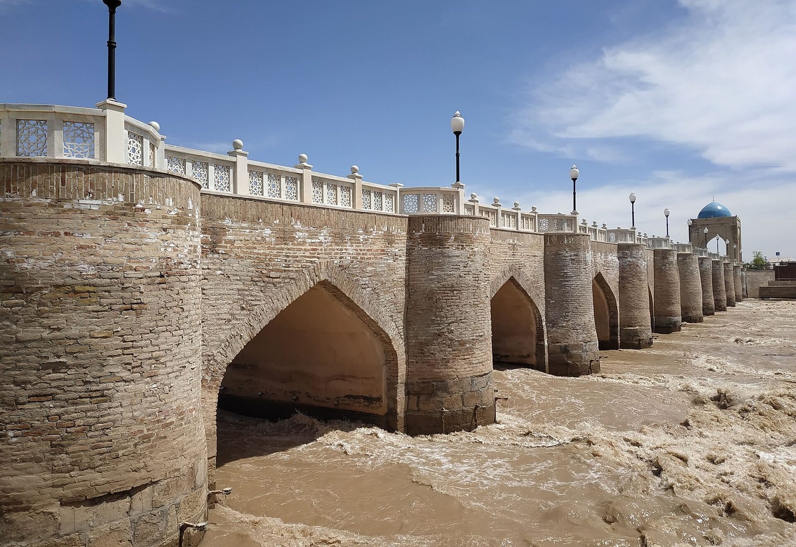
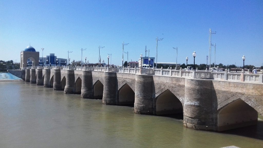
Qarshi Bridge crosses the broadest and most full-flowing section of the Qashqadaryo River. It is now a pedestrian and bicycle bridge, while motor vehicles use a modern road bridge several dozen metres to the east. The historic structure is approximately 122 metres long and 8.2 metres wide. Its roadway stands about 5.3 metres above the riverbed, with a mid-span clearance of approximately 5.35 metres.
Arches and piers
The bridge is built predominantly of brick, with stone used in parts of the structure. Twelve substantial piers support broad, low arches, and the piers widen toward their bases. Between the arches, cylindrical tower-like buttresses reinforce both sides. These are about 4 metres in diameter, with lower sections faced in regularly shaped stone slabs and upper sections made of fired brick. Large arches in a Persian and Islamic style mark both ends. The evenly spaced supports, continuous arch lines, and gently curved upper surface reflect successive rebuilding while giving the structure a strong and stable form.
Access features and inscriptions
Staircases were built on both sides of the bridge. Inscriptions were placed on brick slabs associated with the renovated piers at the river’s edges, preserving evidence of later work on the structure.
River setting and associated works
Modern river infrastructure
A modern road bridge runs parallel to the historic crossing several dozen metres to the east. A small dam for regulating the river’s water flow is also located several dozen metres in that direction.
Embankments and park
Modern embankments styled after older architecture line both riverbanks around the bridge, together with a large park. These later works form the present physical setting of the historic crossing.