Pont Vieux: A Roman Bridge-Aqueduct in Toulouse
Site at a Glance
- Rating
- 4.6
- Popularity
- Medium
- Country
- France
- Primary era
- Classical
- Eras represented
- Classical
- Civilizations
- Roman
- Site type
- Infrastructure
- Remains
- Aqueduct
On this page7 sections
History
Pont Vieux is an ancient bridge-aqueduct in Toulouse, France, built by the Gallo-Romans at the beginning of the first century AD to cross the Garonne and supply water to Tolosa, the Roman-period city on the site of present-day Toulouse. The system collected spring water on the left bank, carried it through an underground channel, and then continued above ground toward the city centre on the right bank.
Roman construction and water supply
Several springs in the Lardenne area fed the aqueduct. Water first travelled underground to a water tower, after which the channel emerged and extended for several kilometres before crossing the Garonne. It reached the area of the present Place Rouaix, where the water entered the city’s distribution system. The structure could carry 30,000 cubic metres of water per day.
Medieval use and replacement
Floods repeatedly damaged the river crossing, and the aqueduct eventually ceased to function as a water supply. The bridge itself remained in use throughout the Middle Ages and was the only crossing of the Garonne at Toulouse until the third quarter of the twelfth century. From that period, the Pont de la Daurade, built farther downstream, gradually replaced it. Pont Vieux was progressively abandoned, and repairs ended from the close of the fifteenth century.
Later traditions and archaeological rediscovery
From around the end of the fifteenth century, a tradition attributed the bridge to a fifth-century Visigothic queen. The Visigoths were a Germanic people who established a kingdom in parts of the former Western Roman Empire, including southwestern Gaul. This tradition produced the names Pont de la Reine Pédauque and Aqueduc de la Reine Pédauque. Pédauque was a legendary queen whose name was linked to the expression “goose foot.” The name Pont Vieux distinguished the structure from the Pont de la Daurade.
The remains gradually disappeared, and the last pier, known as the Rocher de Carnaval, was demolished in 1949. Some river remains can still be seen offshore from the Prairie des Filtres when the Garonne is at low water. The aqueduct was studied by the abbé Georges Baccrabère during the 1960s. Municipal works near Bellefontaine metro station in June 2013 uncovered part of the Roman underground channel, while an archaeological assessment identified a 540-metre section in the park of Toulouse-Jean-Jaurès University.
Remains
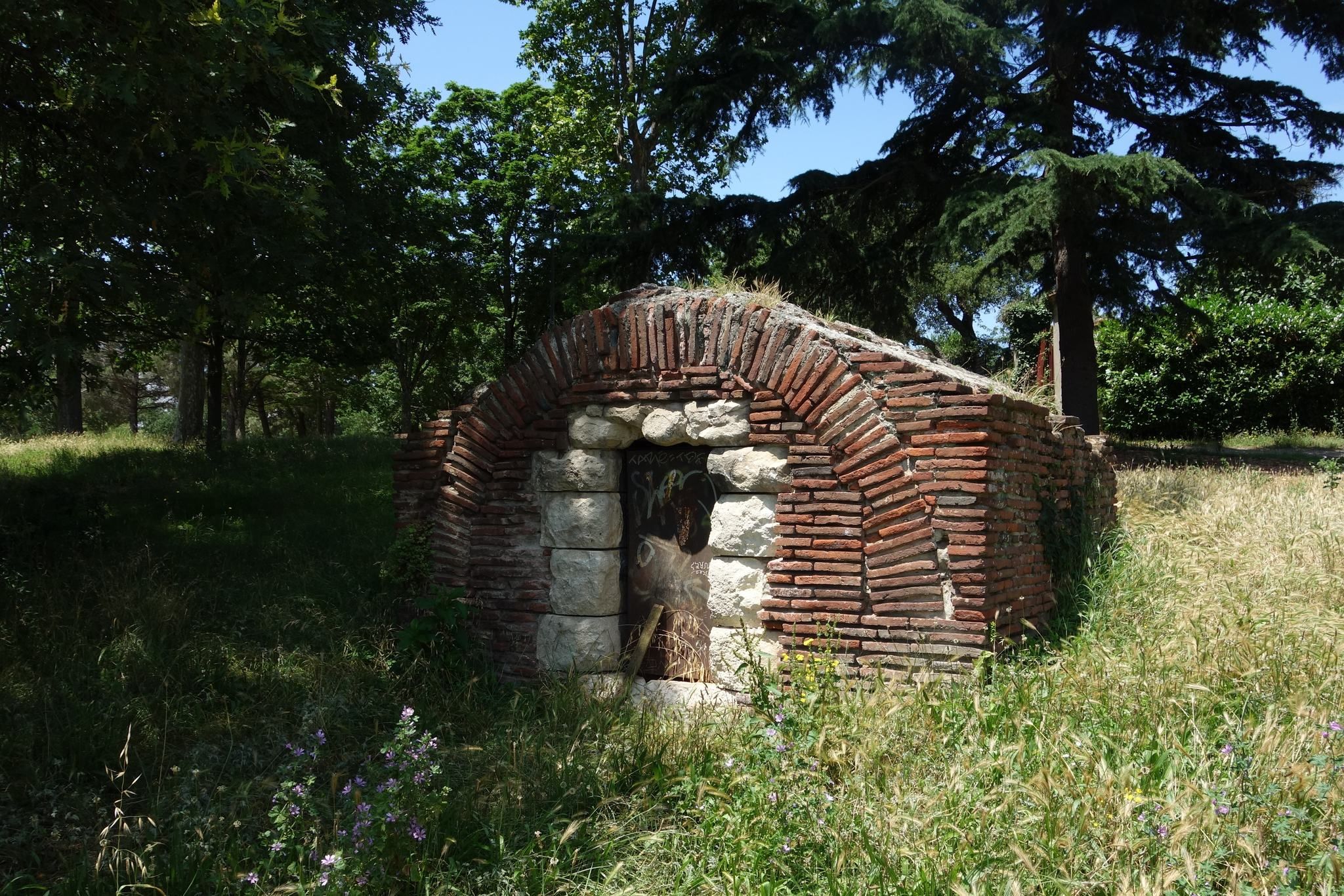
Pont Vieux survives as buried and excavated sections of a masonry water system, together with remains of its river crossing. The aqueduct combined underground channels with an elevated course carried on piers, while its crossing over the Garonne required a structure rising approximately five metres above the present-day Saint-Cyprien district.
Landward aqueduct and reservoirs
The first section was an underground channel built with lime mortar and crushed roof tile. It measured about 0.65 metres wide and 0.44 metres high. From the first terraces of the Garonne, it reached the Cépière district, emerged from the ground, and turned 90 degrees eastward. Its route followed the lines of the present-day Route de Saint-Simon, Rue de Cugnaux, and Rue des Teinturiers. About fifteen arches were excavated along Rue de Cugnaux during the nineteenth century. Between Cépière and Place Rouaix, the elevated section rested on 517 piers that supported the water channel. On the right bank, the aqueduct reached the descent to the fish market, where water was held in a first reservoir, then continued to Place Rouaix and a second reservoir that distributed it toward the city’s principal roads.
Garonne crossing
The bridge-aqueduct was built in stone and brick. A seventeenth-century description recorded brick pier foundations in the river and proposed that the crossing continued on piers and arches in the manner of a bridge. The same description mentioned an arcade preserved in the house of Sieur Raché, built roughly from brick and stone, and characterized the structure as either Roman or Gothic. The river remains, including the last pier known as the Rocher de Carnaval, are visible at low water, while buried sections of the channel and excavated parts of the aqueduct preserve evidence of its former course.