Pont d’Aël: A Roman Aqueduct Bridge in Italy


Site at a Glance
- Rating
- 4.6
- Popularity
- Medium
- Country
- Italy
- Primary era
- Classical
- External website
- Open
- Eras represented
- Classical
- Civilizations
- Roman
- Site type
- Infrastructure
- Remains
- Bridge
On this page8 sections
History
Pont d’Aël is a Roman aqueduct bridge in Italy, at the entrance to the Cogne Valley near Aymavilles. Built in 3 BC after the foundation of Augusta Prætoria Salassorum, the Roman colony at modern Aosta, it carried water for irrigation and for washing iron ore from Cogne. It was not an ore-transport route or part of Aosta’s urban drinking-water supply, which came from the Buthier. The water may also have served drinking needs in nearby rural areas.
Roman construction and use
The aqueduct extended for approximately 6 km. Its irrigation network watered about 200 hectares of fertile land west of Aosta, positioned 50 to 150 metres above the Dora Baltea. Water was also diverted along the route to an ore-washing facility probably located near Aymavilles. The supply began at the Grand Eyvia, 2.9 km upstream from Pont d’Aël, and descended through the Cogne Valley by gravity.
Roman engineers used open channels with an average gradient of 6.6 per mille. The steep landscape and exceptionally hard rock made underground qanats, gently sloping tunnels used to convey water, impractical. Instead, the aqueduct followed the valley slopes and crossed the Grand Eyvia at the gorge’s only possible crossing point.
A large inscription on the bridge’s north side identifies the person who paid for the work. Caius Avillius Caimus of Padua, one of the lessees of nearby mines, financed the bridge from his own funds in 3 BC. The centrally placed word PRIVATVM, meaning private, gives particular emphasis to the character of the project.
Recognition and investigation
Emanuele Filiberto Pingone, a sixteenth-century historian and antiquarian, produced the first known description and sketch of Pont d’Aël in 1550. Images made by Baron de Malzen in 1826 and Édouard Aubert in 1860 already showed the bridge in its present form. Excavations at one end and measurements made in 1864 were later incorporated into Piero Barocelli’s archaeological work of 1930.
Mathias Döring completed the first full survey and documentation in 1996. His work established the aqueduct’s irrigation and ore-washing functions and demonstrated the survival of the ancient water channel. Restoration was subsequently initiated after Laurent Viérin, leader of the Union Valdôtaine Progressiste group, raised the matter in the Regional Council.
Pont d’Aël is included within the Site of Community Importance IT1205030, a European conservation designation for areas recognized for habitats or species of conservation value. The protected area covers 183 hectares, including the Grand Eyvia gorge, its rare local microclimate, and the surrounding xerothermic, or warm and dry, environment.
Remains
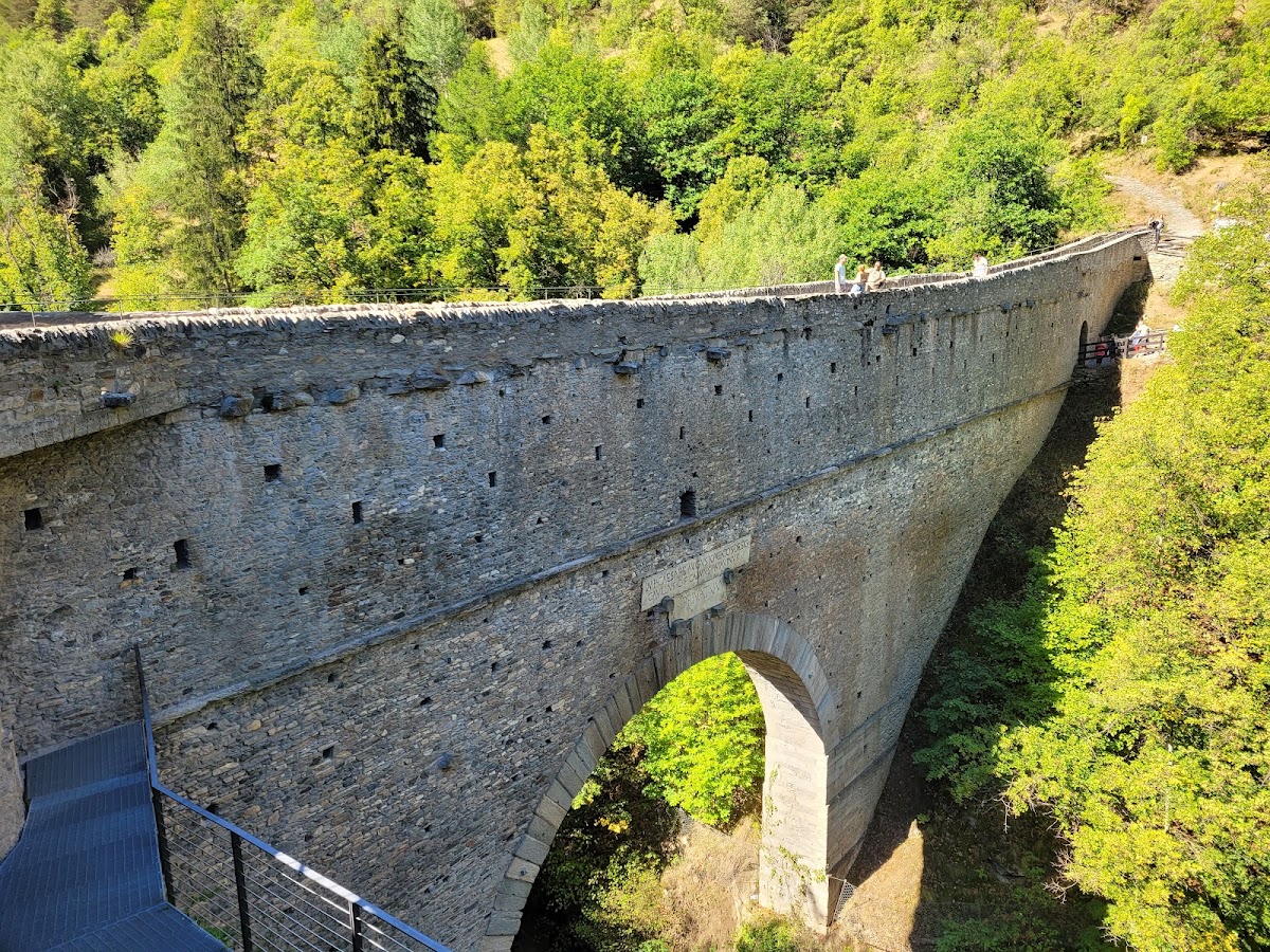
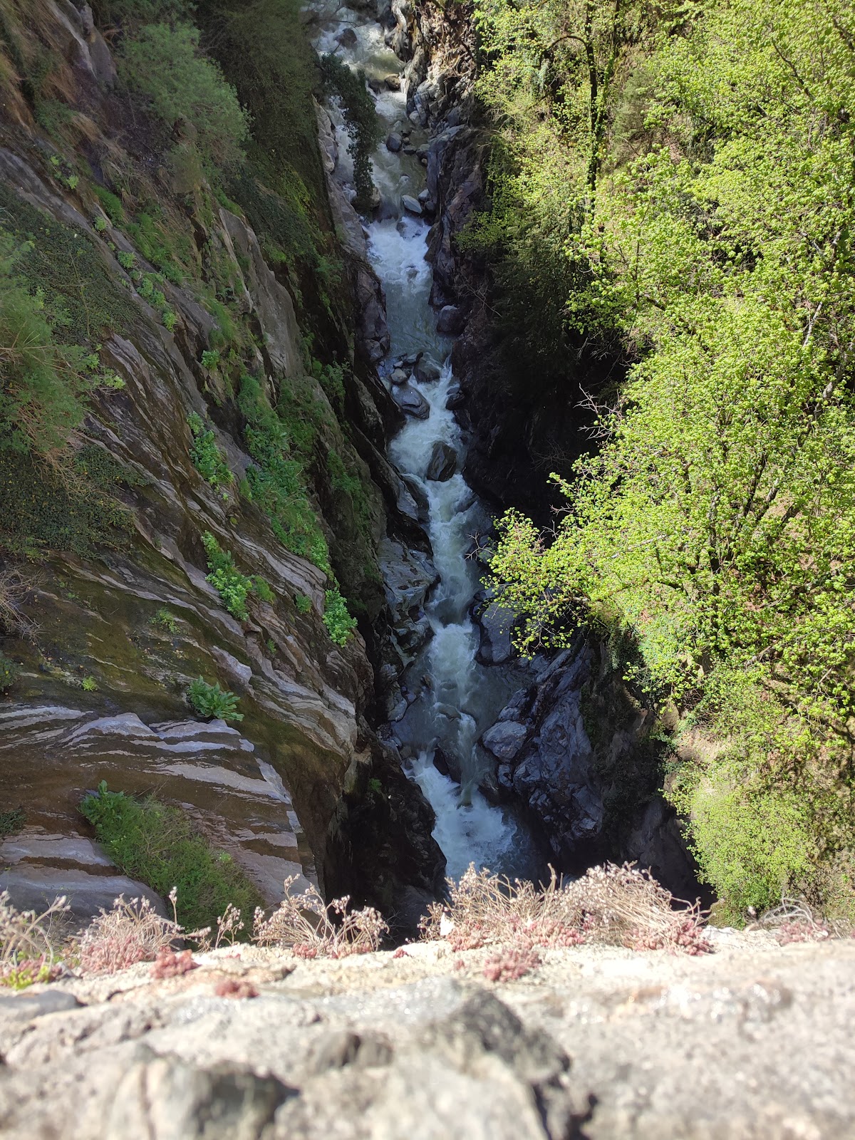
Pont d’Aël crosses the Grand Eyvia in a gorge about 12 metres wide and 66 metres deep at the bridge, within a ravine approximately 4 km long and up to 150 metres deep. The stone structure is 60.46 metres long and 2.26 metres wide. Its single arch spans 14.24 metres and consists of a wedge-stone vault reinforced by one rib. The bridge probably originally had three levels and reached a total height of 22.15 metres.
Bridge interior and water channel
Control corridor
The lower level contains a 50.35-metre-long control corridor, 3.88 metres high. Two rows of small windows run along each side. The lower row lit the floor, while the upper row lit the ceiling, allowing a bridge keeper to identify leaks caused by frost damage in the masonry.
Ancient water channel
The former water channel occupied the level above the corridor. It was approximately 1.90 metres high and 1 metre wide. Its position is established by its elevation, surviving wall lines, and a western gallery adjoining the bridge. The channel now carries a hiking path. A probable open walkway occupied the third level, with the channel and walkway forming part of the longer aqueduct.
Aqueduct route through the Cogne Valley
Along the steep valley slopes, the aqueduct was cut as a half-gallery, a channel carved partly into a rock face and open on one side. The channel was 1.20 metres wide. This method left a parapet of natural rock as much as 3 metres high on the valley side and allowed construction to proceed from several visible points at once without driving a complete tunnel through the hard stone.
On flatter ground, the route crossed terraces 2 to 4 metres wide. There the water ran through a rectangular masonry channel covered with slabs. The approach to Pont d’Aël included approximately 2.25 km of sloping ground and 0.65 km of rocky terrain. Buildings and agricultural land prevent investigation of the continuation below the bridge, while the aqueduct’s downstream end remains uncertain and may have reached the irrigation area around present-day Aymavilles. The ore-washing installation was probably nearby, although its exact position has not been established.