Pierre aux Moines: A Misidentified Neolithic Megalith in Clamart
Site at a Glance
- Popularity
- Medium
- Country
- France
- Primary era
- Unclassified
- Eras represented
- Unclassified
- Civilizations
- Unclassified
- Site type
- Civic
- Remains
- Megalithic Monument
On this page8 sections
History
The Pierre aux Moines is the name attached to a Neolithic megalith in Meudon Forest, in Clamart, France. The Neolithic, the later part of the Stone Age associated with farming and settled communities, is the period attributed to the monument. Its history is complicated by the later confusion of this stone with the Pierre de Chalais. The upright stone visible today is considered to be the Pierre de Chalais, while the authentic Pierre aux Moines had disappeared.
Early maps and the two stones
A 1708 map places the Pierre aux Moines at the meeting of the former Carré aux Pièges and Vieux Cimetière roads. A map made in 1723 shows it at the same crossroads, while locating the Pierre de Chalais near the Étang de la Garenne, at the spot later assigned to the Pierre aux Moines. On a 1780 map, the woodland name Bois de la Pierre aux Moines remains, but the stone itself is not marked; the Pierre de Chalais is still shown.
Nineteenth-century investigations and later changes
Around 1850, physician Eugène Robert excavated a stone between the Garenne and Justice crossroads, then locally called by both names. The work yielded pottery fragments and traces of charcoal. In 1865, Robert referred to a Pierre aux Moines near the Fontaine des Lins. Vacquer, deputy curator at the Musée Carnavalet, drew the monument in 1875.
After woodland clearance in 1893 made the site more accessible, Marcellin Berthelot brought the monument to the French Academy of Sciences on July 24 and began further excavation. Louis Capitan and d’Ault du Mesnil continued the work in 1894. In 1895, the visible stone was classified as a French historic monument under the name Pierre aux Moines, formalizing the mistaken identification. The former crossroads disappeared when Avenue Claude-Trébignaud was built through its location around 1960.
Remains
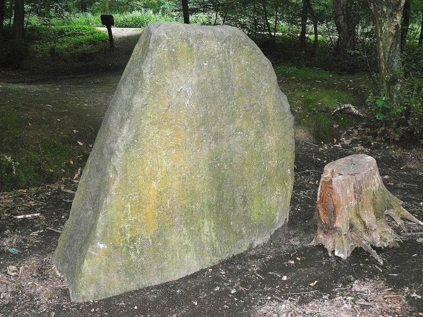
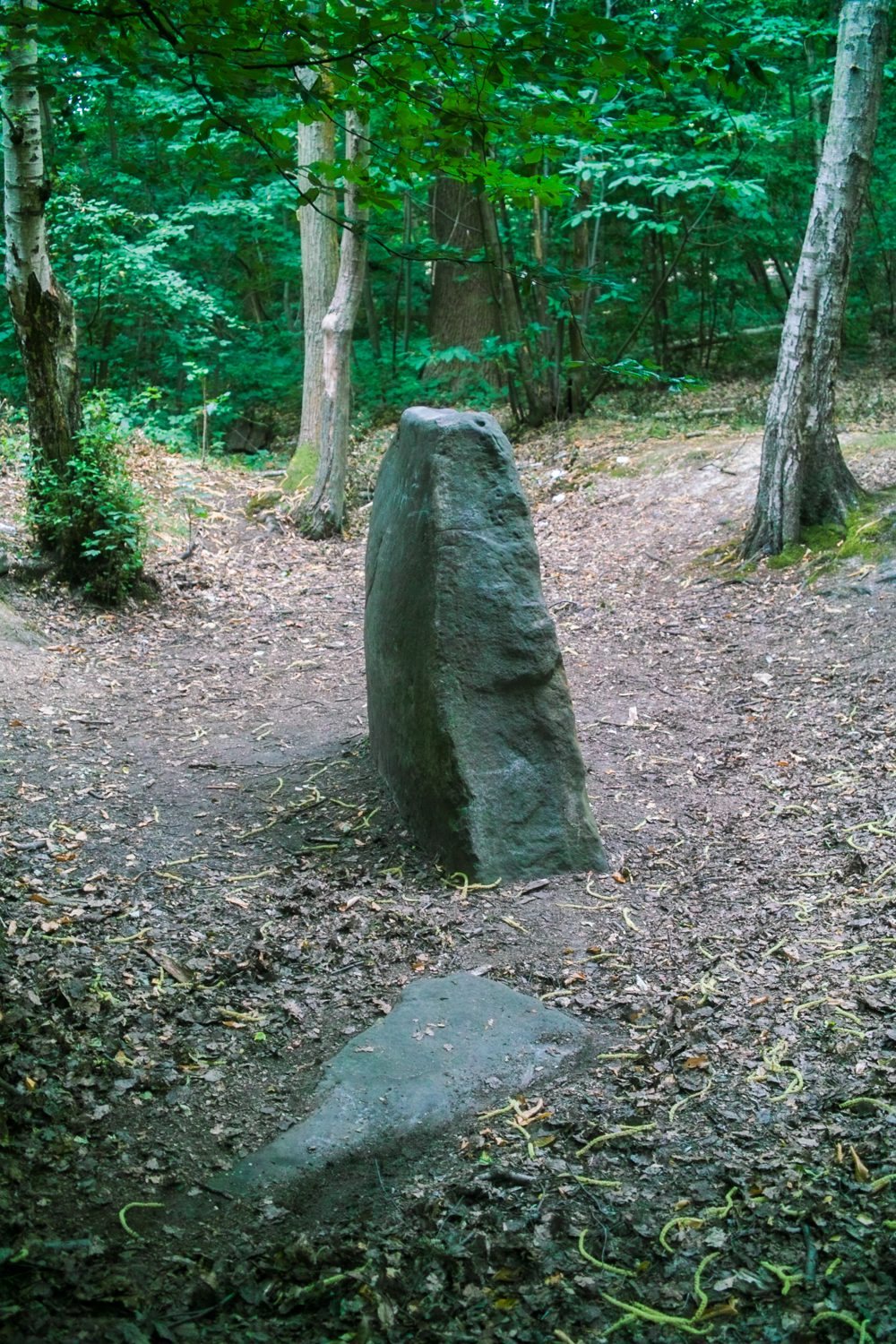
The remains described at the site comprise an upright sandstone block and several slabs nearby. The main stone is set into the ground, and a carved U-shaped mark survives on one side.
Stone and surrounding slabs
Main stone
The upright block is made of Fontainebleau sandstone and has a flat surface. It stands 2.20 m high, measures 2.10 m wide at its base and 0.70 m at the top, and narrows in thickness from 0.55 m at the base to 0.28 m at the top. It extends 0.25 m below ground. Its slightly flattened upper surface may reflect centuries of use for sharpening knives. The stone is commonly classed as a menhir, or standing stone. Paul de Mortillet proposed instead that it could be part of a dolmen, a megalithic tomb, or a covered passage, a long, roofed funerary structure.
Nearby slabs
A nearby sandstone slab measures 1.85 by 1.60 m and averages 0.42 m in thickness. Two other slabs are 1.40 m and 1.58 m long. Excavations in 1894 brought three additional slabs to light.
Carving and interpretation
A U-shaped engraving on the stone’s north-northeast-facing side measures 0.26 m high and 0.21 m wide. It may represent a collar motif depicting a funerary goddess.