Archaeological Site of Philippi: A Macedonian and Roman City in Greece


Site at a Glance
- Rating
- 4.8
- Popularity
- Medium
- Country
- Greece
- Primary era
- Classical
- External website
- Open
- Eras represented
- Classical, Medieval
- Civilizations
- Ancient Greek, Byzantine, Kingdom of Macedon, Roman
- Site type
- City
On this page30 sections
History
Archaeological Site of Philippi is the remains of a Macedonian-founded city in Greece, established by Philip II in 356 BCE on the site of the earlier Thasian colony of Crenides. Built to control the gold and silver resources of Mount Pangaion and to guard the route between Amphipolis and Neapolis, Philippi later became a Roman colony and an important centre of early Christianity.
Crenides and the Macedonian Foundation
Colonists from Thasos established Crenides around 360–359 BCE in a region rich in agricultural products, timber, and precious metals. The settlement stood beside the marshes of the Drama plain, close to routes connecting the interior with the Aegean coast. Its short period of existence is difficult to separate archaeologically from the earliest Macedonian phase.
Philip II fortified the settlement, brought in additional colonists, and partially drained the adjoining marshes. After new gold deposits were found near Asyla, he established a mint at Philippi. The mines were probably exhausted relatively quickly, and the city’s prosperity subsequently depended more heavily on agriculture and the resources of its broad territory.
Philippi retained a degree of autonomy within the Macedonian kingdom. It had its own calendar and political institutions, including an assembly, a council house, a treasury, an eponymous priest, an archon, and other magistrates. The city was fully incorporated into the Macedonian kingdom during the reign of Philip V or his successor, Perseus.
Roman Expansion and the Via Egnatia
After Rome defeated the Antigonid kingdom in 168 BCE, Macedonia was divided into four administrative regions. Amphipolis, rather than Philippi, became the capital of eastern Macedonia, but Philippi continued to have a modest urban population and retained its strategic position.
The construction of the Via Egnatia through the city in the second century BCE strengthened that position. This major Roman road across the Balkans linked the Adriatic region with the Aegean and Constantinople, while also connecting Philippi’s territory with the port of Neapolis. The road helped Philippi develop as a regional centre despite its subordinate administrative status.
In October 42 BCE, the plain west of Philippi became the setting for the Battle of Philippi. Mark Antony and Octavian, Julius Caesar’s heir, defeated Marcus Junius Brutus and Gaius Cassius Longinus, the principal opponents of Caesar’s successors. The battle was a decisive turning point for Roman power and transformed Philippi’s future.
After the victory, Philippi was refounded as the Roman colony Colonia Victrix Philippensium and settled with veterans, probably including soldiers of Legio XXVIII. In 30 BCE, Octavian reorganized the colony and settled additional Italian veterans and a praetorian cohort. It was then known as Colonia Iulia Philippensis and, after January 27 BCE, as Colonia Augusta Iulia Philippensis.
The colony received the ius Italicum, a Roman legal privilege that treated colonial land as equivalent to land in Italy for specified civic and property rights. Its Roman citizens belonged to the Voltinia tribe, and the territory was probably divided into regular agricultural allotments for colonists. Philippi consequently became a Latin administrative and economic enclave within a predominantly Greek and Thracian region.
The Roman Colony
Roman Philippi developed into a financial, administrative, and artistic centre. Its wealth came from its extensive agricultural territory, its position on the Via Egnatia, its connection with Neapolis, and local mineral and agricultural resources. The scale of its public buildings was considerable in relation to the city’s relatively small urban area.
The colony was governed by annually elected magistrates and a council of decurions, the local elite who formed the civic council. Its two chief magistrates were the duumviri. The quinquennial duumviri also replenished the council, while a quaestor managed municipal finances. From the second century CE, an irenarch was responsible for policing.
Religious life included an imperial cult devoted to deified emperors. Priests served the deified Julius, Augustus, Claudius, Vespasian, and Antoninus Pius, while priestesses served the deified Livia. Six freedmen formed the college of the seviri Augustales. During the reign of Marcus Aurelius, imperial curators were appointed several times to address financial difficulties, probably intensified by major urban construction.
Paul and the Growth of Christianity
The Apostle Paul, an early Christian missionary active in the eastern Mediterranean, visited Philippi around 49–50 CE during his second missionary journey. He travelled with Silas and Timothy, and possibly with Luke. Paul preached in the city and baptized Lydia, a seller of purple textiles, outside its walls. He is traditionally regarded as the founder of the Christian community at Philippi and reportedly returned in 56 and 57.
Philippi became an important early Christian centre. A letter sent by Polycarp of Smyrna to the Philippian community around 160 CE, later funerary inscriptions, and other evidence reflect the growth of Christianity. The city’s association with Paul also supported a Christian pilgrimage tradition that influenced the construction and development of its later churches.
The first securely dated Christian building at Philippi was the Basilica of Paul, built around 343–344 CE and associated with Bishop Porphyrios, who attended the Council of Serdica. From the fourth to the sixth century, several monumental churches were constructed, including the Octagon and Basilicas A, B, C, and D, as well as churches in the eastern and south-eastern necropolises.
Late Roman and Byzantine Transformation
Late Roman and early Byzantine Philippi remained strategically important because it controlled the route between Constantinople and Thessaloniki. As instability increased in the Balkans, the city’s fortifications were strengthened. In 473, Ostrogothic forces under Theodoric Strabo besieged Philippi, failed to take it, and burned the settlements around the city.
Slavic invasions, the disruption of Macedonia’s agricultural economy, and probably the Plague of Justinian in 547 weakened Philippi. A major earthquake around 620 caused extensive destruction. The lower city was gradually abandoned, and Philippi survived mainly as a smaller fortified settlement centred on the acropolis.
During the seventh century, parts of the former urban centre were reused for reduced domestic, agricultural, and funerary activities. The city became a kastron, a village associated with a fortified acropolis. Byzantine, Bulgarian, Latin, and Serbian occupations or claims followed at different times. Byzantine officials and military forces were again present by the first half of the ninth century, after a possible Bulgarian occupation around 838.
Emperor Nikephoros II Phokas rebuilt the acropolis fortifications and part of the city around 969. In 1077, Bishop Basil Kartzimopoulos restored part of the inner defences, possibly in response to the threat of the Pechenegs. Around 1150, the geographer Al-Idrisi described Philippi as a centre of commerce and wine production, although the surviving remains indicate a much smaller fortified settlement.
After the Fourth Crusade and the capture of Constantinople in 1204, Philippi was occupied successively by the short-lived Latin kingdom of Thessaloniki, the Despotate of Epirus, the Empire of Nicaea, and the Serbs. In 1354, the Byzantine claimant Matthew Kantakouzenos was captured there by the Serbs. The area came under Ottoman control in 1372.
The date of Philippi’s final abandonment is unknown. By the sixteenth century, when Pierre Belon visited, the city lay in ruins and its stones were being quarried. The name Philippi survived in nearby settlements, including the former Turkish village of Filibedjik.
Excavation and Protection
Nineteenth-century travellers and scholars described the ruins before systematic excavation began in 1914. Work by the French School at Athens was interrupted by the First World War, resumed in 1920, and continued until 1938. Greek archaeological institutions and the Aristotle University of Thessaloniki resumed investigations after the Second World War.
Major campaigns between 1958 and 1978 exposed the episcopal quarter, the Octagon, private houses, and churches near and east of the city. Later work included renewed investigation of the so-called House of the Beasts, topographical and geophysical surveys between 2000 and 2004, and continuing excavations by the Greek Archaeological Service, the Aristotle University of Thessaloniki, and the French School at Athens. Finds are kept in the Philippi Archaeological Museum.
The archaeological site was inscribed on the UNESCO World Heritage List in 2016 under criteria (iii) and (iv). The inscription recognizes Philippi as exceptional evidence for the incorporation of regions into the Roman Empire and for the establishment and development of early Christianity. The property covers 87.545 hectares and has a 176.291-hectare buffer zone. It receives the highest level of protection under Greek antiquities legislation.
Remains
The walled city occupies a natural terrace at the foot of an acropolis beside the marshes of the Drama plain. The acropolis rises to nearly 300 metres and forms a long, conical rocky hill of grey marble. Fractured stone appears white, and ancient quarrying removed marble for buildings and fortifications. The city’s physical remains extend across the terrace, the acropolis, the forum area, and the surrounding necropolises.
Walls and Gates
Fortifications
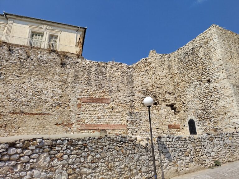
The fortification circuit forms an approximately truncated rectangle about 3.5 kilometres in perimeter. It is oriented almost exactly according to the cardinal directions. The northern side follows the acropolis ridge, while the other sides are generally straight, with several eastern deviations resembling the stepped projections of Greek fortifications.
The walls contain several construction phases and continued to be reused into the Byzantine period. The earliest Macedonian foundations are best preserved on the acropolis, where parts of the first course were cut directly into the rock. Excavations near the theatre revealed Hellenistic ashlar masonry, and a Greek inscription records work by the Macedonian officials Pythodoros and Isagoras, perhaps during the reign of Philip V.
City Gates
Two monumental gates carried the principal road through Philippi. The Gate of Neapolis stood on the eastern side, while the Gate of Crenides occupied the western side. A smaller gate opened towards the plain and marsh, and another served the acropolis fortress. The acropolis gate was largely replaced by Byzantine construction.
Late antique repairs used irregular small rubble, reused architectural blocks, and horizontal brick courses set in thick mortar. Two internal walls strengthened the acropolis defences. A poorly preserved outer defensive wall, known as a proteichisma, may represent an additional sixth-century restoration.
Theatre and Cult Areas
Theatre
The theatre was built against the lower slope of the acropolis, about 200 metres from the principal road. It faces the plain on a south-south-eastern orientation. Its western side follows the city wall, and a buttress connects the wall with the theatre. Similar masonry suggests that the two structures were built during the same period.
Excavations in 1914 and between 1921 and 1924 exposed the orchestra and the lateral entrances, or parodoi. The original orchestra may have been circular, with a radius of approximately 10.8 metres. The eastern entrance may have measured 25.65 metres and the western one 24.17 metres. Damage to the surviving seating prevents reconstruction of its original Hellenistic arrangement.
The Greek theatre was enlarged for Roman performances. Builders added a stage building and vaulted access corridors. The surviving remains of the stage wall form a roughly 40-metre-long rubble structure with fragments of red-marble columns and traces of five doors. The central door was 2.10 metres wide, while the others measured 1.60 metres.
In the second century, the stage wall was decorated with motifs comparable to those used in theatres in Asia Minor. During the mid-third century, the building was adapted for venationes, or animal-hunting spectacles. The stage and lowest seats were removed, an underground passage was created for animals, and the orchestra was enlarged to a radius of 12.40 metres.
The enlarged orchestra was enclosed by a 1.10-metre wall topped by a 0.90-metre marble balustrade, represented by six surviving blocks. Reliefs of Nemesis, Mars, and Nike decorate the western passage. Greek dedicatory inscriptions connect these features with a priest of Nemesis and an association of hunting enthusiasts.
Rock Sanctuaries
Rock surfaces around the acropolis and its quarries carry religious carvings, niches, inscriptions, and graffiti. They include about ninety representations of Diana, forty unidentified female figures, seven mounted figures dedicated to the Thracian deity Dominus Rincaleus, five representations of Jupiter, two of Minerva, three of Cybele, and three lunar crescents.
West of the theatre, a list of members of the college of Silvanus is carved into the rock near the remains of a large sanctuary possibly dedicated to that deity. Another sanctuary occupied an artificial terrace about 40 by 10 metres and was dedicated to Egyptian gods. Inscriptions refer to Isis, Serapis, and the triad Horus, Apollo, and Harpocrates. A terracotta statuette of Telesphorus suggests, but does not prove, an association with healing.
Macedonian Tomb
A Macedonian underground tomb, later interpreted as a Hellenistic heroon, lies between the cathedral church and its baptistery. A heroon was a shrine or temple dedicated to a hero, often a founder or exceptionally honoured dead person. The tomb’s square enclosure survives as three steps of a stone crepis above a vaulted burial chamber.
The rectangular chamber has five wall niches intended for funerary urns and a votive table in the north-eastern corner. The tomb was robbed in antiquity, although its entrance door remained intact. The niches contained traces of ash and bone. A central cist held an undisturbed burial of a young adult or child wearing rich gold jewellery, including an oak-leaf crown, a diadem with Isiac insignia, and a pendant. An inscription identifies the deceased as Euèphenès, son of Exèkéstos.
Dating to the second century BCE, the tomb occupied an unusual position within the Hellenistic city, possibly near the agora. Its temple-like superstructure and surrounding sacred enclosure support its interpretation as a heroon, perhaps commemorating the city’s founding hero.
Forum and Commercial Quarter
Roman Forum
The Roman forum occupied two terraces near the centre of Philippi, slightly east of the probable Greek agora. The modern national road later crossed the area along the route of the Via Egnatia, limiting archaeological investigation. The forum covered approximately 148.5 by 80 metres, including a central paved space about 100 by 50 metres surrounded on three sides by colonnaded buildings.
The upper terrace stood about 8–9 metres above the Via Egnatia and about 12 metres above the lower terrace. The complex was first laid out during the reign of Claudius, between 41 and 54 CE, above an earlier Hellenistic level. The 9-metre-wide decumanus maximus, the principal east-west street, crossed the forum and was closed by monumental gates.
The lower terrace contained a public square, shops, a meeting hall for the decurions, an orators’ platform, and a temple of the imperial cult and the Genius of the colony. A Corinthian temple with two columns in antis stood on the eastern side. An inscription in its cella dates its completion to 175 CE. Nearby were a four-room building of uncertain function and the city library, identified by a fragmentary architrave inscription.
The western side contained the curia, a colonnaded meeting hall measuring about 35 by 7.6 metres, probably a civic basilica, and the colony’s archive building, or tabularium. At the centre of the northern side, an orators’ platform stood between two small temples and two monumental fountains. Each fountain had a basin measuring approximately 22 by 3 metres.
The lower terrace was substantially remodelled in the second century under Marcus Aurelius. Earlier buildings were demolished, partly covered, and reconstructed, while a monument associated with priestesses of Livia was retained. The square was raised and levelled with a southern fill supported by a 1.35-metre-thick wall reinforced by the cross-walls of shops along the lower Street of Commerce.
Stairs and ramps connected the two terraces with the Via Egnatia and the Street of Commerce. The commercial zone was moved south of the remodelled forum, where aligned shops and a market were built.
Upper Terrace
The upper terrace was bounded on the south by the Via Egnatia and less clearly on the north by the quarry face of the acropolis. It may have been about 40 metres wide. Its identification as a Capitolium, a temple to Jupiter, Juno, and Minerva, remains possible rather than certain. Numerous dedications to Jupiter Optimus Maximus support the hypothesis.
A small temple at the western end of the terrace measured approximately 8.19 by 12.40 metres. Its date is disputed. Some excavators assigned it to the third or second century BCE, while another interpretation places it in the imperial period. Its podium was later converted into a cistern.
The terrace was extensively altered when Basilica A was constructed. Only large steps and the substructure of the small temple remain visible. By the late fourth or early fifth century, the terrace may have lost its sacred function and received a bath complex, represented by a heated room and perhaps a cistern.
Market and Palaestra
The market, or macellum, and the palaestra, an exercise and training complex, lay south of the Street of Commerce below the forum. Much of both was demolished when Basilica B was built, but parts of their plans and reused decorative elements survive.
Excavated in 1935, the market was arranged around a large courtyard surrounded by shops. Access from the Street of Commerce passed through a vestibule and portico. An inscription states that the aediles financed a standard measuring table and regulated weights and measures, including bronze weights produced from fines and confiscations.
The palaestra occupied two city blocks, approximately 75 by 58 metres. Its central exercise space measured about 59 by 13.50 metres and was probably covered with sand. A colonnade surrounded it, while a semicircular stepped meeting room provided seating for an audience. A large latrine, approximately 14 by 5.50 metres, accommodated forty-two people and opened towards both the exercise area and the street to the south.
Water Supply
Philippi’s water system included a Roman aqueduct more than 7 kilometres long, probably in use until the sixth century. It collected water from a karstic spring to the north-west, followed the flank of Mount Lekani, crossed the city wall, and fed a distribution basin at the foot of the acropolis.
One section crosses the northern acropolis wall and continues for more than 50 metres through a Byzantine wall over 2 metres thick. Another underground section, found between Kephalari and Philippi, measures 44.5 metres. Its carefully built channel has a profile of about 0.80 by 1.20 metres and dates to the second century.
Christian Complexes
Basilica of Paul
The Basilica of Paul was a rectangular building about 27 metres long and 12 metres wide. It occupied part of a city block south of Roman baths and directly beside the Macedonian tomb. Its eastern end had a flattened apse, and a single nave was separated from a narthex, or entrance hall.
The church contained mosaic pavements. One room had four geometric panels, while another had six panels decorated with peacocks. An inscription in the pavement names Bishop Porphyrios and dates the building to around 343–344 CE.
Octagon Complex
The Octagon was built over the Basilica of Paul during the first half of the fifth century, perhaps around 400, while remaining attached to the Macedonian tomb. Its name comes from an interior octagonal colonnade. The first phase probably had a timber roof and included a narthex and an atrium with a monumental fountain, or nymphaeum.
During a second phase in the first half of the sixth century, perhaps under Justinian, the church was rebuilt with an enlarged eastern apse, a domed central space, and passage-like areas on the south and east. The complex included a baptistery, two ambons, and extensive episcopal and liturgical annexes.
Episcopal Quarter
The episcopal quarter north of the Octagon occupied three former city blocks between the Via Egnatia and the Street of Commerce and closed two streets. Its western block has an uncertain function. The central block contained liturgical facilities and a baptistery supplied by former Roman baths, while the eastern block held storage jars and wine presses used to support clergy and the poor.
A long northern portico connected the Via Egnatia with the atrium and narthex. A southern exedral entrance opened onto the Street of Commerce. The monumental entrances and possible accommodation for pilgrims have been interpreted as evidence of a martyrial cult and pilgrimage, although the identity of the commemorated martyr remains uncertain.
The Macedonian tomb remained beside the Octagon and received hundreds of small coins through the sixth century, indicating continued ritual attention. Interpretations differ over whether it was a cenotaph associated with Paul, a burial place for a local martyr, or a monument linked to a tradition that Paul was martyred at Philippi. A cenotaph is a commemorative tomb that does not contain the person’s body.
Basilica A
Basilica A occupied the upper forum terrace on the site of the former Capitolium and reused many earlier architectural elements. Probably built around 500 CE, it had a Latin-cross plan with a transept, a cross-arm extending across the church’s main axis, together with a narthex and a peristyle atrium. A monumental semicircular porch provided access to the terrace. The relationship between the porch and the Via Egnatia below is unknown, and a 2.5-metre difference separates the street pavement from the final step.
A small chapel dating to the tenth or eleventh century stood south of the atrium. Beneath it, a subterranean room discovered in 1878 contained badly dated frescoes depicting an episode from Paul’s life. The room has traditionally been identified as Paul’s prison, but it has also been interpreted as a Roman cistern later converted into a crypt.
Basilica B
Basilica B was built south of the forum in the middle of the sixth century over the demolished market and palaestra. It was among the earliest Balkan examples of a domed basilica. Large ashlar piers directly supported domes on pendentives, while rubble walls were reinforced by horizontal stone bands and brick courses.
The building may never have been completed because its dome collapsed, although the collapse could instead have resulted from a later earthquake, possibly the earthquake of 620. The lack of a courtyard over the former palaestra provides stronger evidence that construction remained unfinished.
Basilica C
Basilica C, also called the Museum Basilica, was built in the sixth century on the lower slopes of the acropolis, north-west of the upper forum terrace. It was discovered in 1963 during construction of the archaeological museum, which was consequently moved to another location.
Its first phase lacked a transept. A second phase in the middle of the sixth century added a transept-like structure and altered the liturgical furnishings.
Basilica D
Basilica D stood about 200 metres west of the forum, south of the Via Egnatia. It is known from wall foundations, reused architectural elements, and geophysical survey. The church appears to have had an atrium, a monumental porch, and a basilical plan broadly comparable to those of Basilicas A and C. Its dimensions may have been approximately 80 by 30 metres, while the sanctuary and apse remain unexamined.
Necropolis Churches
An extra-mural basilica stood in the eastern necropolis and may have begun in the late fourth or early fifth century. Five intact vaulted tombs were excavated nearby in 2002. Their funerary material, including a coin of Arcadius, supports a date around the transition from the fourth to the fifth century.
The Basilica of the Pavlidis Field was a second cemetery church in the south-eastern necropolis. It had three naves and a preceding peristyle. Tombs of ecclesiastical dignitaries dating from the fifth and sixth centuries were associated with the building.
Later Reuse and Surviving Materials
Philippi’s reduced later settlement reused earlier buildings and construction materials. The former civic basilica was divided into rooms, the eastern forum portico became stables, and a lime kiln was installed in the archive building to recycle architectural debris. Small chapels and intra-mural cemeteries were established among the ruins of the major basilicas.
The site retains inscriptions, mosaic pavements, opus sectile floors made from cut pieces of stone arranged in geometric or figurative designs, reused architectural blocks, and other elements in their original positions. Some stones were incorporated into later buildings. Modern interventions have generally consisted of archaeological investigation, protection, and reversible conservation measures.
Nearby sites