Petinesca: A Celtic Fortified Settlement and Roman Regional Center in Switzerland
Site at a Glance
- Popularity
- Low
- Country
- Switzerland
- Primary era
- Classical
- Eras represented
- Iron Age, Classical
- Civilizations
- Celtic, Roman
- Site type
- City
On this page16 sections
History
Petinesca is an archaeological site in Studen, in the canton of Bern, Switzerland, where a Celtic fortified settlement and a later Roman settlement served as a regional center from the second century BC into the fourth century AD.
Celtic settlement and Roman beginnings
The site first developed as a Celtic fortified settlement. Around the turn of the era, a Roman settlement grew mostly beyond its enclosed area. A continuous occupation linking the two phases is considered probable, but has not been established. The Roman community retained the name Petinesca, which is probably Celtic and may refer to Petinius, a ruler associated with the settlement’s founding.
Road junction and regional role
Petinesca’s Roman importance rested in part on its position where routes met. It appears in two Roman route records, the Itinerarium Antonini and the Tabula Peutingeriana. One road connected Basel and Augusta Raurica with Bern, crossing the route between Windisch and Avenches by way of Solothurn. Other roads linked Avenches through Murten, Kerzers, and Kallnach with Solothurn and Windisch. Branches ran toward Augusta Raurica and the Rhine through Taubenloch Gorge and over the Pierre Pertuis Pass, while another crossed the Seeland near Witzwil between Lakes Neuchâtel and Murten.
The settlement also supported the upkeep and security of a major regional route. The road between Avenches and Solothurn carried the cursus publicus, Rome’s organized state transport and communications service.
Later Roman occupation and archaeological investigation
Roman occupation continued into the fourth century AD, while the temple precinct remained in use until around the middle of that century. In 1656, historian Jean-Baptiste Plantin identified Suden with Petinesca. Finds became more frequent in the late eighteenth century, and the cantonal government began excavations in the first half of the nineteenth century. The Pro Petinesca historical society undertook systematic investigations around the turn of the twentieth century, followed by further excavations by the state labor service in the second half of the 1930s. Work from 1937 to 1939 exposed the temple precinct; later investigations revised some interpretations of those excavations.
The canton of Bern has owned the site since 2009, and Petinesca is protected as a cultural property of national significance in Switzerland.
Remains
The remains occupy the west-to-east Jensberg sandstone ridge, which reaches 611 m above sea level, and extend along its eastern and southeastern edges above the Alte Aare valley, at about 431 m. The ridge’s sandstone contains mica and glauconite, with layers of marl. Celtic fortifications and Roman settlement areas occupy different parts of this landscape. Roman remains include the Unterdorf, Vorderberg, Oberdorf/Ried, Wydenpark, and the Gumpboden temple precinct. A former gravel pit and later landfill disturbed or divided some areas. The old Aare channel, navigable in antiquity, has since silted up at Studen.
Celtic enclosure and Roman road center
Western rampart
The Celtic enclosure covered about 35 hectares. Its best-preserved fortification is the western rampart, an earthwork strengthened with timber and a dry-stone wall. Investigated in 1898, it protected the settlement. Steep natural slopes defended the northern, southern, and eastern sides; wooden fences probably added to these defenses, and traces of terraces for them remain visible. Celtic material from the region also includes numerous La Tène metal objects, from an Iron Age culture associated with Celtic peoples, recovered in old channels of the Zihl between Port and Schwadernau. These objects were probably offerings to the river.
Roadside center and lodging station
The Roman settlement’s central area lay along present-day Rebenweg, where a road running northwest to southeast crossed the route between Windisch and Avenches. Its early imperial buildings were made of timber. A Roman lodging station measured about 50 by 60 m and contained many rooms, including a five-room bath suite with underfloor heating and a bakery. On its northwest side, water and drainage features included a tunnel, channels, collection points, and settling basins. Finds from the complex include pottery, jewelry, toilet equipment, keys, tools, a bronze tap for mixing water, and a fitting from a cart pole. Coins range in date from about AD 14 to 285. Dwellings stood immediately to its east and south.
Gate and fortified road station
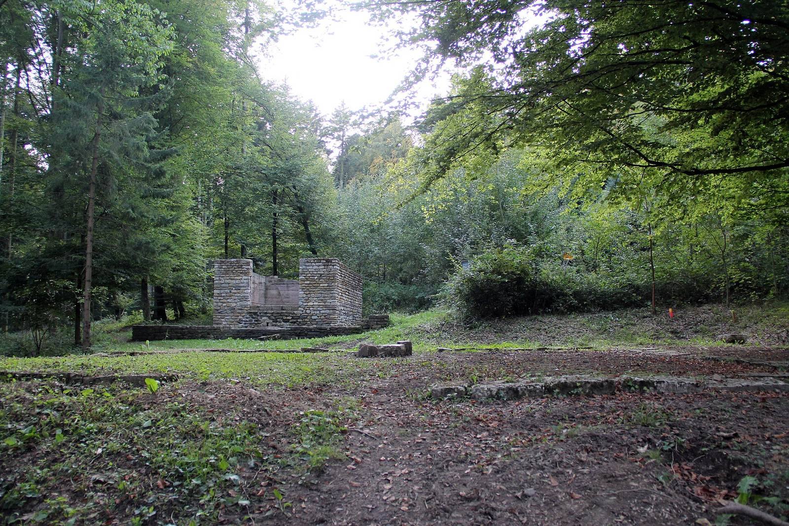
A third-century gate had a passage 3.60 m wide and a square tower measuring about 13 m on each side. In the fourth century, the gate and tower became part of a fortified road station that included accommodation rooms. Finds include tools, spearheads, and a coin of Gratian, Roman emperor from AD 367 to 383. The gate has been conserved and partly reconstructed.
Residential and craft areas
Vorderberg
Excavations across 3,800 m² at Vorderberg revealed two timber-building phases followed by two phases of stone construction. The earliest timber phase, dated by coins and fine Roman pottery of Drag. 29 form, belongs to the reigns of Augustus and Tiberius. It included repeated rebuilding among as many as four houses. A second timber phase began late in Nero’s reign or early under the Flavian emperors and continued to the end of the first century. Its buildings had wider foundation beams and more substantial construction, with large quantities of wall daub. The settlement’s alignment and pattern remained consistent.
The later stone phases comprised six buildings dating from the late first or early second century to the end of the third century. Three wells, up to 12 m deep, date between the first and third centuries; they were abandoned and filled during the third century. Animal remains point to leatherworking. A first-century pit relates to sheep-skin processing, while material from the wells indicates goat-leather production in the third century. Workers specializing in fine leather were active around the turn of the era. Animals came from nearby rural estates, including a luxurious villa at Port.
Oberdorf/Ried
Oberdorf/Ried lies about 50 m above Vorderberg and about 50 m below Gumpboden. One temple with a surrounding passage is securely identified here; other building traces belong to the settlement. Surveys in 2017 identified buried Roman buildings on both sides of a path along the slope, some partly investigated earlier. Finds include pottery, glass and metal fragments, bones, and four coins minted between AD 119 and 184.
Riverfront structures and burial grounds
Wydenpark
Near the old river course at Wydenpark, remains include a bridge, a road, and an embankment reinforced with wooden piles and substantial timber structures. The embankment followed a road up to 7 m wide, part of which was exposed. Graves, including some with well-preserved skeletons, lay parallel to it. Excavations also indicate that a Roman harbor, or at least a fortified landing place, stood beside the former Aare channel.
Six second-century burials were excavated at Wydenpark: one infant burial, four burials of adult men aged 30 to 50, and one cremation. The adult burials were unusual for the period. The cremation took place at the burial site, and the skeleton was not fully burned; it probably belonged to a man in the same age group.
Keltenweg cemetery
At Keltenweg 1/3, a north-south Roman road ran beside a cemetery of 52 graves. Three were child burials, and 44 contained cremation deposits. Grave goods, including South Gaulish fine tableware of Drag. 18 and Drag. 27 forms, date the burials to the second half of the first century.
Temple precinct at Gumpboden
The Gumpboden precinct occupies a rounded terrace about 100 m above the remains at Unterdorf. Its 1.4-hectare enclosure was roughly trapezoidal, measuring about 200 by 70 m, and was bounded by a sacred wall. Entrances on the northeastern, southeastern, and southwestern sides were 1.55 to 1.80 m wide; part of the southeastern wall survives.
The precinct contained seven larger, east-facing temples and two smaller shrines. Six of the larger buildings formed two groups of three Gallo-Roman temples, each with a central shrine surrounded by a passage; a further temple stood between the groups. Two smaller shrines lay to the sides. A two-storey building at the northern end may have housed priests. A boulder and a well may also have had ritual uses, while the northeastern part may have served as a sacred grove.
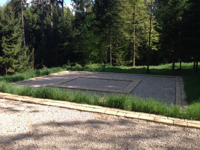
Small objects of religious character found at the precinct include bells, small spoons, and decorative metal plates, alongside brooches and coins dating from the first to fourth centuries. Medieval removal of building materials affected the remains, and architectural fragments thought to come from Petinesca have been identified in the Church of St Stephen at Biel-Mett. Conservation and partial reconstruction have shaped the present layout. In 2012, marker stones traced wall lines and marl stones marked temple interiors; earlier markings from 1937 to 1939 were retained where possible, so the presentation varies across the precinct. Finds from Petinesca are kept and displayed at the New Museum Biel.