Oreanda-Isar Fortress: A Medieval Stronghold in Crimea
Site at a Glance
- Popularity
- Very Low
- Country
- Ukraine
- Primary era
- Medieval
- Eras represented
- Medieval
- Civilizations
- Byzantine
- Site type
- Military
- Remains
- Fortified Town
On this page9 sections
History
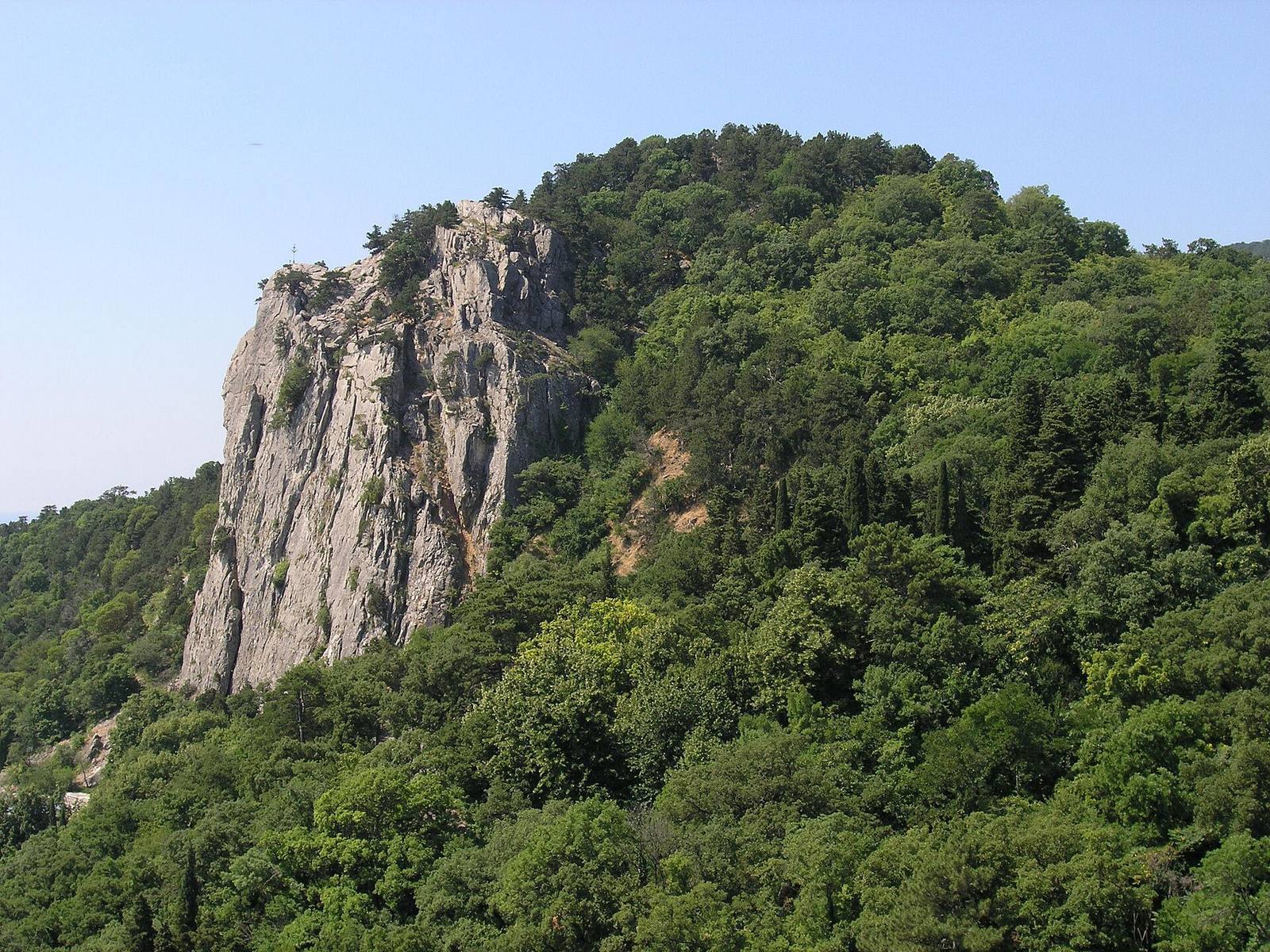
Oreanda-Isar Fortress is a fortified settlement on the summit of Cross Mountain in Lower Oreanda, in the Yalta area of Crimea, Ukraine. It is generally dated to the 10th–13th centuries, with a stated foundation in the 10th century, although an alternative chronology places it between the 8th and 15th centuries. Its position near an ancient road linking Gaspra and Livadia may have allowed it to control movement along the route.
Early fortifications and medieval occupation
The earliest wall phase may date to the 6th–8th centuries. These defenses enclosed a settlement that was destroyed by fire in the 10th century. New walls were then built over the earlier remains in the 11th century and remained in use until the 13th century.
The settlement may have housed 200–300 people. Its fortifications and position beside the road formed part of a small hilltop community whose occupation continued through the medieval period.
Rediscovery and archaeological study
The naturalist and explorer Peter Simon Pallas made the first recorded notice of the ruins. In 1837, the Crimea scholar Peter Koeppen published an account of the southern coast and Tauric Mountains that largely repeated Pallas’s description. The fortress appeared on an archaeological map in 1933. A 1935 study called it Greek-Gothic, an older label referring to Greek and Gothic cultural traditions, while a 1942 study assigned it to the Roman period, the era of Roman imperial presence and influence.
Exploratory excavations took place in 1968, and their conclusions were brought together in a 1974 study and a book on the medieval fortresses of Crimea’s southern coast. The Crimean regional executive committee, a regional Soviet administrative body, declared the fortress a regional historical monument in decisions dated 1969 and 1980.
Remains
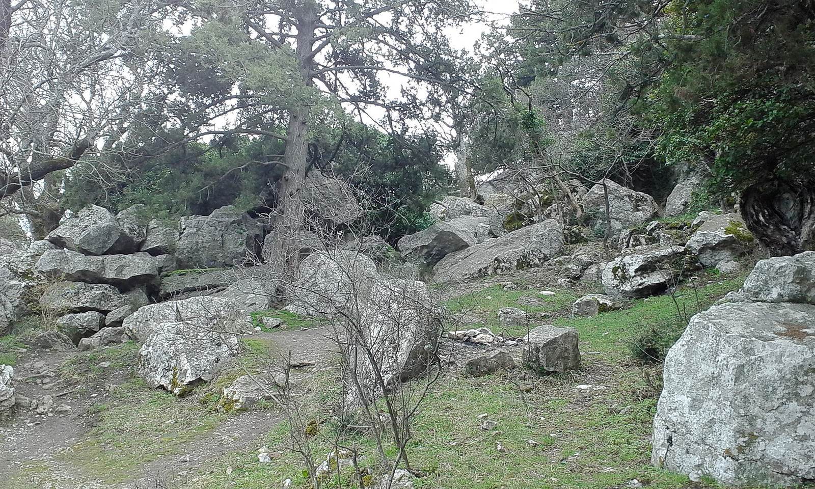
The fortress occupies the dome-shaped summit of Cross Mountain, which rises to 204 m. Cliffs form its northeastern, eastern, and southeastern boundaries, while the steep southern slope is strewn with rock fragments. Within this natural setting, the settlement combined masonry defenses with small buildings laid out across the summit.
Walls and entrance
The enclosure measures about 100 by 85 m and covers approximately 0.52 hectares, with a perimeter of 380 m. Walls protected 240 m of that perimeter, while steep cliffs defended the rest; low stone walls also blocked possible approaches through gullies. The walls are 2–3 m thick and survive to 2.5 m high. They consist of irregular stone set mainly in clay mortar, with lime mortar in some places. The earlier sections used large limestone blocks, while later walling was made from smaller stones.
The entrance lay in the north wall, reached by a road suitable for wheeled vehicles. Beyond the first gate, a walled defensive approach of about 100 m² led to a second gate, 2 m wide. A steep ascent of 30 m from this gate reached the main settlement and was protected by another defensive barrier. A stairway beginning at a small pedestrian gate beside the first entrance provided an alternative way upward.
Settlement and buildings
Dwellings and lanes
More than 30 small dwellings stood irregularly on level platforms cut down to bedrock. The lanes between them were no more than 1 m wide.
Structures near the walls
A utility building near the fortifications contained large storage jars and may have served as a storeroom. Remains of a chapel and slab graves were also found nearby. The graves may postdate the destruction of the walls, but they cannot be earlier than the 13th century.
Possible church
At the mountain’s highest point, the foundation of a building measuring 8 by 13 m was uncovered. It has been tentatively identified as a church.