Niihari Gunga Ruins: An Ancient District Government Complex in Japan

Site at a Glance
- Rating
- 3.6
- Popularity
- Very Low
- Country
- Japan
- Primary era
- Medieval
- External website
- Open
- Eras represented
- Medieval
- Civilizations
- Yamato
- Site type
- Civic
On this page11 sections
History
The Niihari Gunga ruins in Chikusei, Japan, are the remains of an eighth-century district government complex built during the Nara to Heian periods under Japan’s centralized Ritsuryo system. A gunga was the administrative center of an ancient district, with official buildings and storehouses for tax goods. Niihari belonged to the former province of Hitachi, and its officials were regarded as descendants of the earlier Niihari kuni no miyatsuko lineage, a hereditary local ruling family.
Creation of the district administration
The complex was established after the Taika Reforms, seventh-century political changes that helped create centralized imperial government in Japan. The Ritsuryo system divided provinces into districts and provided them with standardized administrative facilities. The arrangement of the buildings at Niihari is considered suitable for the offices of district officials operating within this system.
Fire and the end of the district
An entry dated November 19, 817, records that 13 permanent granaries in Niihari District burned. The eastern warehouse area contains fire remains associated with this event. Carbonized rice recovered from the site supports the interpretation of a major conflagration, which is thought to have contributed to the abolition of ancient Niihari District in Hitachi Province. The record states that 9,990 koku, a historical measure of rice and other grain, were consumed.
Excavation and protection
The ruins were excavated in 1941 and again between 1943 and 1949. These investigations were the first in Japan to confirm the remains of an ancient district government complex as such. The site was designated a National Historic Site of Japan in 1968.
Remains
The ruins lie in the Kogori area of present-day Chikusei, about 200 to 300 meters north of the Niihari Temple ruins. The archaeological remains extend across an area of approximately 300 by 300 meters. Fifty-two building remains were identified in four groups: 25 buildings to the north, nine to the west, 13 to the east, and four to the south. A further isolated building was found away from the eastern group in 1949.
Administrative and warehouse areas
Western administrative compound
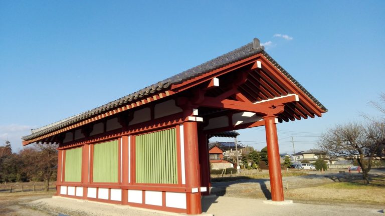
The western group is interpreted as the administrative compound. Its nine buildings included a main hall with side halls arranged in a U-shaped plan, forming the principal government office area.
Northern, eastern, and southern warehouses
The northern and southern groups are interpreted as warehouse areas. The 13 buildings in the eastern group also served as warehouses and are thought to have stored tax rice. Their fire remains, together with the large quantity of carbonized rice recovered nearby, connect this part of the complex with the destruction recorded in 817.
Construction and surviving evidence
Building foundations
Standard warehouses measured approximately 12 by 9 meters and stood in regularly spaced rows of three or four buildings. Several larger buildings measured about 44 by 12 meters. Their foundations lie 20 to 30 centimeters beneath the present cultivated soil. Foundation stones have been lost or displaced from their original positions.
Surface finds and present condition
Roof tiles, earthenware sherds, roof-tile fragments, and iron nails were found on or near the surface, particularly around the site’s periphery. These materials accompany the buried building remains and help identify the character of the complex. The excavated area was backfilled, and the ruins now occupy an open field.