Neisse Fortress: A Historic Frontier Fortress in Nysa, Poland


Site at a Glance
- Rating
- 4.6
- Popularity
- Low
- Country
- Poland
- Primary era
- Early Modern
- External website
- Open
- Eras represented
- Medieval, Early Modern, Modern
- Civilizations
- Habsburg, Holy Roman Empire, Kingdom of Bohemia
- Site type
- Military
- Remains
- Fort
On this page24 sections
History
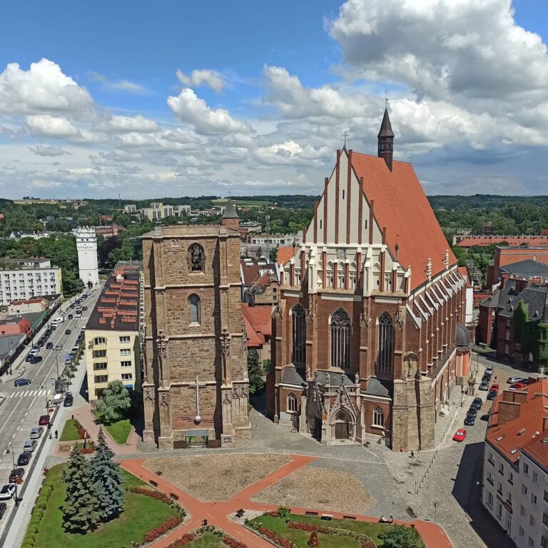
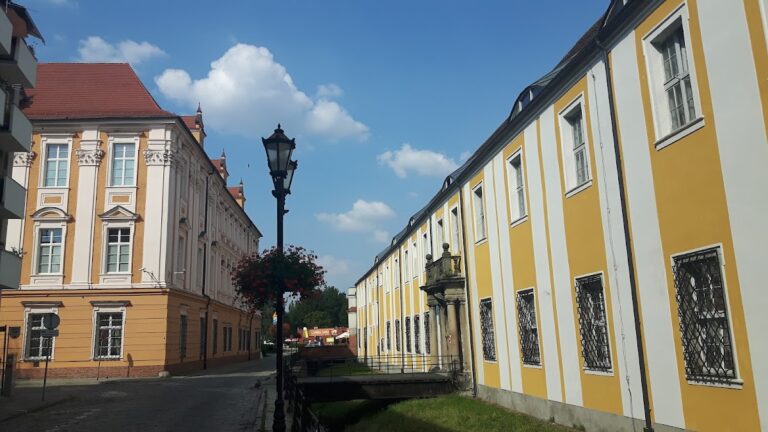
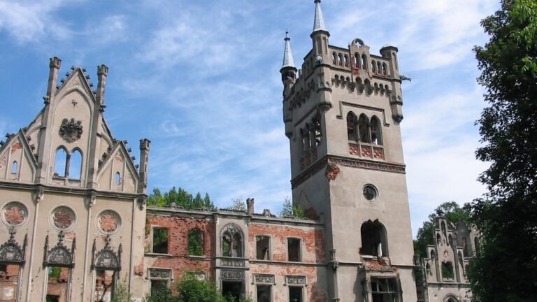
Neisse Fortress is a historic system of fortifications in Nysa, Poland, built and expanded by medieval rulers, the Habsburgs, and Prussia from the thirteenth century onward. Most surviving structures date from the eighteenth century and were modernized during the nineteenth century. The fortress protected the Silesian town of Neisse, the historical German name of Nysa, and became a Prussian frontier stronghold after the conquest of 1741.
Medieval foundations
The earliest timber-and-earth defenses around Neisse were constructed in the second half of the thirteenth century. They were destroyed in 1284 during the conflict between Bishop Thomas II and Henry IV Probus, Duke of Wroclaw, then rebuilt six years later. Before 1259, a bishop’s court stood within the oldest town defenses. A branch of the Biala Glucholaska River separated the residence from the town and served as a moat for both. The court was later fortified and linked with the town defenses, and by 1282 the episcopal seat was being called a castle.
The New Town received its first masonry walls in the second half of the fourteenth century under Bishop Przecław of Pogorzela. The separately fortified Old Town, now the Srednia Wies district, had a looser and more irregular plan and was probably protected by an earth rampart and palisade. The medieval walls defended the New Town during the Hussite Wars, a series of fifteenth-century religious and political conflicts centered in Bohemia.
In March 1428, Hussite forces commanded by Prokop defeated the army of Bishop Conrad of Wroclaw and his allies. They plundered and burned the weakly defended Old Town and damaged the New Town with artillery fire, but they did not enter it. During the sixteenth century, fears of Ottoman attacks led to further improvements, including bastions in the forewall and artillery loopholes in the Wroclaw Gate Tower. The St. James Gate was built in or shortly before 1596 in the Wroclaw Suburb and was later known as Cow Gate.
Habsburg bastion defenses
Neisse’s first early-modern fortifications were built in 1594, when the town belonged to the Habsburg-held Kingdom of Bohemia. The design was prepared by Johanes Schneider of Lindau at the request of Andreas von Jerin, Bishop of Wroclaw. From 1643, the defenses were rebuilt according to the Old Dutch school of fortification, which emphasized flanking fire along the faces of walls and ramparts. The system grew to ten bastions and enclosed the town with ramparts and a water-filled moat. Modernization continued until the beginning of the eighteenth century.
The medieval walls were repaired in the early eighteenth century, even though the town was already surrounded by bastion defenses. They were almost completely dismantled during the second half of the nineteenth century and the first years of the twentieth century. Their surviving towers, wall fragments, and episcopal-castle remains now form an earlier layer within the later fortress landscape.
Prussian transformation
The Prussian army captured the Habsburg fortifications during its second siege of Neisse in 1741, after the first siege had failed. The resulting peace settlement made Neisse a Prussian town near the Habsburg frontier. Frederick II, the king of Prussia also known as Frederick the Great, decided to turn it into a fortified camp protecting the new Prussian province of Silesia between the Moravian Gate and the Golden Mountains.
Under Frederick II’s supervision, the Dutch military engineer Cornelius von Walrawe rebuilt the lower defenses around the town. Upper fortifications were constructed on the opposite bank of the river, creating the military settlement of Friedrichsstadt, now the Radoszyn district. The Cardinal and Capuchin Redoubts were built on opposite riverbanks, while Fort Prussia was established on the hills north of the Neisse Kłodzka.
Construction between 1742 and 1756 added the two lateral wings of the upper fortifications and Fort Prussia with its inner Jerusalem ramparts. Water Fort, although part of this eighteenth-century system, had been built by the Austrians in 1741. A dry moat extended from Fort Prussia. These defenses withstood a heavy Austrian bombardment in 1758, when Austrian troops failed to capture Neisse.
The outer Jerusalem Ramparts were built between 1767 and 1791 to designs by Lefevre and von Castillon. Fort Prussia received additional counter-mine galleries, underground passages intended to detect or destroy attacking tunnels, and three fleches, small detached fieldworks formed largely from earth. The High Ramparts were then constructed as the final major stage of the eighteenth-century works. The fortress also included arrangements for flooding the town if necessary.
Siege, modernization, and decline
At the beginning of the nineteenth century, Neisse was regarded as one of Europe’s strongest fortresses. Napoleon I’s forces besieged it for 114 days in 1807, subjecting the town to intensive heavy-artillery fire that left only five houses standing. The defenders surrendered on 3 June because relief was not expected and ammunition and food were running out. The besiegers took possession on 16 June.
Damage to the earthworks and masonry was repaired between 1809 and 1812, followed by smaller alterations between 1839 and 1849. During the second half of the nineteenth century, the fortress was reshaped as a Neo-Prussian defensive system. Between 1865 and 1888, outlying forts I, II, III, and A, B, and C were developed, the High Ramparts were modernized, a railway fortification complex was built, and Fort Prussia was reconstructed.
The widespread use of more effective rifled artillery gradually made the fortress obsolete. A decree of 1889 ordered its complete disarmament. The main guardhouse was removed in 1895, and Neisse lost its fortress status in 1903. The defenses were increasingly adapted for civilian purposes, including gasworks, warehouses, and prisons, while some structures were demolished.
Further conversions followed. An officers’ casino was installed in the Capuchin Redoubt in 1910, Water Fort became an ammunition store, and the Jerusalem Redoubt housed an isolation ward for a military reserve hospital. Fort Prussia became a military-equipment store in 1914. During the First World War, parts of the former fortress served as prisoner-of-war camps, including one that held Charles de Gaulle. During the Silesian Uprisings, insurgents were detained in Earth Fort in 1921.
The Railway Ramparts became a park in 1918, while their casemates were used as warehouses. Between 1926 and 1934, part of the inner Jerusalem Ramparts was demolished, and forts I, II, and III were converted into weapons and ammunition stores. During the Second World War, Neisse contained a branch camp of Gross-Rosen. Near the end of the war, the town was again declared a fortress, but the Red Army captured it in 1945, ending its history as a Prussian and German fortress.
Conservation and present condition
Long postwar neglect caused damage, but the fortress remains in relatively good condition and can still be read across the landscape. A local branch of the Society of Friends of Fortifications has worked for several years to care for the complex. Fragmented ownership and the continued economic use of some buildings complicate conservation.
Nysa Municipality has restored selected parts of the fortress. Water Fort was reconstructed and renovated, while St. Hedwig’s Bastion was adapted as a cultural, service, and commercial center with an information point and exhibition route. In 2021, the High Ramparts were landscaped and given walking paths. Historical battle reenactments, including the Battle of Neisse, continue to take place.
Remains
Neisse Fortress occupies about 80 hectares within properties covering approximately 230 hectares. Around 50 to 60 percent of the fortress as it existed at the beginning of the twentieth century survives. The complex combines medieval masonry, eighteenth-century earth-and-stone defenses, nineteenth-century forts, protected casemates, moats, ramparts, and later military buildings.
Medieval town defenses
Walls and gates
The medieval New Town defenses formed a closed, roughly quadrilateral circuit with rounded corners and numerous towers. A forewall, doubled in some places, and a moat supplied by the Neisse Kłodzka and Biala Glucholaska rivers strengthened the enclosure. Bridges, probably drawbridges, linked the town with the surrounding defenses. The four principal gates were the Wroclaw Gate to the north, the Ziebice Gate to the west, the Fraternal Gate to the southwest, and the Customs Gate to the south. Each had a high defensive tower.
Wroclaw and Ziebice Gate Towers
The Wroclaw Gate Tower dates from the fourteenth century and stands beside a surviving section of stone town wall. Its present crown combines decorative and defensive purposes. Above the artillery loopholes is a Mannerist attic containing numerous ornamental elements. The Gothic Ziebice Gate Tower was rebuilt and heightened several times, yet retains its original stylistic character. Its upper termination is formed by a crenellated parapet.
Episcopal castle remains
The strongly fortified episcopal court, which existed from 1260 to 1842, survives in part as a residential tower, a Gothic bastion, and a fragment of defensive wall. These remains preserve the connection between the medieval episcopal residence and the town’s wider defensive system.
Eighteenth-century forts and redoubts
St. Hedwig’s Bastion
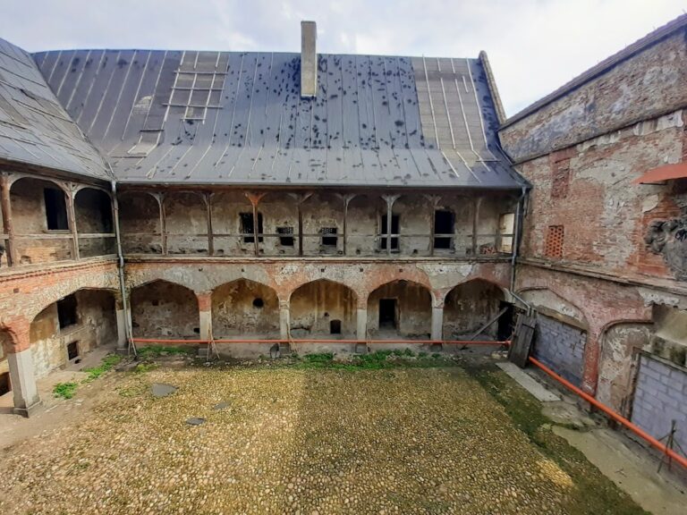
St. Hedwig’s Bastion stands by Piastowska Street and was originally one of the ten Habsburg bastions. A building, probably used to store artillery equipment, occupied its courtyard until 1758. The Prussians rebuilt the bastion between 1771 and 1774, creating the surviving two-storey stone-and-brick casemates, vaulted protected rooms, around a pentagonal courtyard. An exterior earth embankment partly covers the structure.
During the Prussian period the bastion was officially called Bastion X. It contained an ammunition-preparation laboratory in 1807, held several hundred French prisoners in 1870, and served as Barracks No. 9 from 1878 to 1887. After the First World War it passed into private ownership. Major renovation was completed on 10 May 2008, and the bastion now accommodates cultural and service uses.
Water Fort
Water Fort, also known as Fort Blockhaus, was built by the Austrians in 1741 as a simple palisaded redoubt surrounded by water in front of the main defenses. The Prussians rebuilt it in 1745 as a lunette-shaped water fort. Württemberg troops serving with Napoleon captured and destroyed it in 1807, after which Captain Schultz directed its reconstruction in 1809. Its final major rebuilding, in 1878 to 1880, produced a single-rampart fort for infantry and artillery.
Water Fort became an ammunition store in 1910 and was extensively renovated and reconstructed in 2008. It was supported by the New Flesch and the now-vanished provisional Work B. Together these works defended the low ground between the fort and the eastern edge of the defenses, where the fortress’s grain mills, powder stores, and armament works stood. The complex lies in the municipal park and is used by the local Scout organization and the Nysa Cultural Center.
Capuchin and Cardinal Redoubts
The Capuchin and Cardinal Redoubts were built as twin works between 1743 and 1746 to cover the western defenses, Friedrichsstadt, and the left-bank ramparts. The Capuchin Redoubt stood on the left bank of the Neisse Kłodzka. It was gradually demolished after the High Ramparts began replacing it in 1820. Two nearly complete sides, two half-sides, and the officers’ casino built in 1910 survive, while the earthworks were leveled. The overgrown site is unused.
The Cardinal Redoubt stands on the right bank. It has a square plan and a circular courtyard surrounded by casemates, with walls and vaulted rooms covered by earth ramparts. A moat once formed an island in the river before being filled in. The redoubt is in better technical condition than the Capuchin Redoubt, although its marshy setting contributed to its neglect.
Fort Prussia
Fort Prussia was built on hills north of the Neisse Kłodzka to control ground from which the town could be shelled. Construction began between 1743 and 1745. About twenty years later, its counter-mine galleries were expanded and three fleches, named Le Grand, Lefevre, and Diericke, were added. Later nineteenth-century work altered the ramparts and combat slopes.
The principal rampart plan forms a five-pointed star. Inside it is a pentagonal, two-storey casemate structure covered by earth. The outer works included a dry moat and five ravelins, projecting works placed before a fortress curtain or gate. Pommern, Halberstadt, and Mark were bastion-shaped, while Magdeburg and Westfalen were tenaille-shaped. Five counterguards also formed part of the defenses, and four sides had counter-mine galleries.
The fort contained three wells. The main courtyard well was 25 to 32 metres deep; another stood behind the gorge of the Pommern Ravelin, and a third lay in front of the right face of Ostra I. A monumental water tower built in front of the entrance during the First World War destroyed adjoining earthworks. During the interwar period, the lower part of the fort held a memorial hall for Neisse residents killed in the war, while a viewing terrace was also provided.
Fort Prussia has undergone partial repair and structural stabilization in the twenty-first century, including the removal of substantial tree growth. A surfaced pedestrian and cycle path now passes through the dry moat surrounding the fort.
Nineteenth-century railway defenses
Forts I, II, and III
Fort I began as a provisional work in 1865 and 1866 and became a permanent fort in the early 1870s to protect the railway. Like Fort II, it has a quadrilateral lunette plan with a concave rear wall, four caponiers projecting into the dry moat, and barracks and service casemates beneath the ramparts. It had no counter-mine galleries. A bridge formerly crossed the moat, while an earth causeway now provides access. From 1934, the fort served as social facilities for the Neisse garrison and was later used by the military.
Fort II, also called Regulicki Fort, was built as a provisional work in 1865 and 1866 and rebuilt as a permanent railway fort between 1871 and 1873. It shares Fort I’s general quadrilateral lunette form and four caponiers. Located approximately 250 metres northwest of Fort I, it became a military-equipment store in 1934 and continued in that role for many postwar years.
Fort III was built in the 1860s, made permanent between 1875 and 1878, and enlarged from 1881 to 1883. Its quadrilateral lunette plan is closed at the rear by a low, angled gorge rampart that flanks the entrance. A water-filled moat once connected by bridge to the covered way, a protected passage along the outer edge of a moat. A causeway now occupies that position. The entrance cuts through the gorge rampart and is protected by a guard blockhouse.
Fort III is a single-rampart infantry and artillery fort that formerly held about 35 guns. A courtyard building beneath an earth embankment provided barracks and storage. From 1934 it was used as a weapons and ammunition store and remains in warehouse use.
Railway Ramparts
The Railway Ramparts were built in 1875 after the railway station moved to the right bank and the former eastern outer defenses were demolished. The system included a riverside counterguard rampart strengthened by a Gorge Battery, railway tracks crossing the defenses, a lock supplying water to the moat, eastern bastions VIII to XI with three curtains, and southern bastions VII and VIII whose curtain was crossed by the railway.
Artillery and infantry embankments, shelters, traverses, casemates, a covered way, and places of arms stood behind an outer moat. The riverside ramparts were demolished between 1910 and 1921. The principal bastion line survives as a deteriorated and partly built-over strip of parkland. Bolesław Śmiały Street follows a former fortress road, beside which an earth-covered ammunition store survives. Barracks casemates became warehouses and service facilities after the First World War.
Jerusalem and high ramparts
Outer Jerusalem Ramparts
The outer Jerusalem Ramparts extend from the western counterguard of Fort Prussia along Otmuchowska Street. Built mainly through earth shaping and embankments between 1767 and 1774, they were redesigned in the 1870s and 1880s to strengthen the left flank of the upper fortifications.
The system included Rabbit Redoubt, a polygonal independent redoubt with an earth rampart, infantry and artillery positions, guard and barracks casemates, ammunition stores, firing galleries, and a well. Other works included the Park Traverse, an artificially lengthened and raised hill reaching 32 metres; the High Traverse, which protected the High Battery; and the High Battery itself, with infantry positions below, artillery positions above, two courtyards, two-storey barracks casemates, shelter and storage casemates, and a room containing a well. The Low Battery was a simple rampart facing the floodplain, with one of two earth-covered ammunition stores surviving. The outer Jerusalem Gate no longer stands.
Inner Jerusalem Ramparts
The inner Jerusalem Ramparts ran from the Jerusalem Redoubt along Ujejskiego and Mieczysława I streets to the river at the upper lock. Built between 1742 and 1756 and enlarged in 1790 and 1864, they lost importance after 1888 and were largely demolished during the 1920s and 1930s. The Jerusalem Redoubt and its southern rampart, which meets the flood-control embankments, survive.
The Jerusalem Redoubt was built in the 1740s to protect Friedrichsstadt from the west. It consisted of a rampart with a dry moat, partly water-filled in the lower riverside section, and two independent strengthening works. Barracks for a military hospital were added during the Prussian-French War of 1870 and 1871. After the First World War the redoubt was used for economic purposes, and after the Second World War it was converted into a sports stadium.
High Ramparts and Brickmaker’s Gate
The High Ramparts extend approximately 1,200 metres near Słowiańska Street. They consist of five bastions and four curtains and were built between 1774 and 1791, then enlarged during the 1860s. The system included the High Ramparts, the Brickmaker’s Sconce, and the Grodkow Sconce, built in 1786. The Grodkow Bastion was largely demolished in 1929, leaving its left flank.
The works reused and rebuilt the former Chapel and Capuchin Redoubts as the Chapel Bastion, Place d’Armes Bastion, Regulicki Bastion, Moravian Bastion, and Grodkow Bastion. They protected the Zawodzie suburb beyond the older Capuchin Ramparts. The Brickmaker’s Gate is the only surviving gate in the High Ramparts. It cuts through the curtain rampart and contains guard casemates and sentry recesses. A fortress road on the town side served ammunition and powder stores on both sides.
Approximately 85 percent of the original extent of the High Ramparts survives in generally good condition. Former private use caused damage at the gate, including alterations, removal of cast-iron lettering, unauthorized garden divisions, and demolition of some ammunition stores for apartment construction. The area was landscaped and provided with walking paths in 2021.
Counterguards and later landscape
The Prussian tenaille-shaped counterguards were built between 1742 and 1745 from the area of present-day Jagiellońska Street through the area between Mickiewicza and Żwirki i Wigury streets to the municipal park. They strengthened the Austrian fortification belt. The system had three rings: an inner ring on the former covered way, with ravelins before the curtains and counterguards before the bastions; a second ring of tenaille-shaped counterguards reinforced by redans and lunettes and protected by an outer moat; and a third covered way with places of arms and independent fleches. Deformed sections of the outer tenailles and remnants of the Prudnik and Biala Fleches survive.
The New Flesch was built in 1849 beside an artificial pond constructed in 1839. It protected a powder mill between the pond and the Biala River channel. The small triangular lunette had an earth rampart around its courtyard, no casemates on the front, a low rear wall, and a small central building. A moat connected to the pond surrounded it. After being incorporated into the park in 1935, the work gradually became indistinct and now appears mainly as a regular mound.