Namioka Castle: A Kitabatake Stronghold in Japan

Site at a Glance
- Rating
- 3.7
- Popularity
- Low
- Country
- Japan
- Primary era
- Medieval
- External website
- Open
- Eras represented
- Medieval
- Civilizations
- Ashikaga shogunate
- Site type
- Military
- Remains
- Castle
On this page17 sections
History
Namioka Castle was a Japanese stronghold in Namioka, Aomori City, Japan, associated with the Namioka-Kitabatake branch of the Kitabatake family and probably constructed in the 1460s. It was also known as Namioka Gosho, with gosho referring to the residence or governing seat of a powerful lord. The castle became the family’s political and residential center in Tsugaru, a region of northern Japan whose control was contested during the Muromachi period, when the Ashikaga shogunate dominated Japanese politics.
Early associations and the Kitabatake return
The site may have been occupied as early as the latter half of the twelfth century, possibly in connection with the Tsugaru-Ando clan. A later tradition places an earlier Namioka Castle at Tengu-daira, southeast of the present site. A Kitabatake leader is said to have established that base to support the revival of the Southern Court, one of the two rival imperial courts during the fourteenth-century Nanboku-chō conflict.
That earlier castle was dismantled on the orders of Ashikaga Yoshimitsu after the Meitoku Settlement, which ended the division between the Northern and Southern Imperial Courts. The Kitabatake family was then moved back to Hienuki. It returned to Namioka in the early Kyotoku era with support from the Nanbu clan and following a decision by Ashikaga Yoshimasa, the eighth Ashikaga shogun.
The present castle is attributed to Kitabatake Akiyoshi, the fourth-generation leader of the Namioka branch. Proposed construction dates include the Chōroku period from 1457 to 1460, the Ōnin period from 1467 to 1469, and the Bunmei period from 1469 to 1487. The Ōnin-period date is generally regarded as the most likely, while Aomori City places construction in the 1460s.
Political center in Tsugaru
After the Kitabatake family entered the Muromachi period, the Nanbu clan appointed it to govern the six districts of Tsugaru. Conflict with the Nanbu-affiliated Akita clan contributed to the region’s division during the Tenbun period, from 1532 to 1555. The Kitabatake family consequently remained a local landholding power centered on Namioka.
The extent of the family’s influence is reflected in the territories associated with Namioka Tomonaga. They included approximately 2,800 chō in Inaka District, 2,000 chō in Okaho District, and a holding in the Numa area assessed at 1,000 kan. A chō measured land area, while a kan represented assessed value in medieval land administration. Among the three powers that divided Tsugaru, the Namioka, Daikōji, and Ōura houses, the Namioka branch was regarded as particularly prominent.
The family’s decline began with the Kawara Gosho conflict in 1562. Kitabatake Tomonobu of Kawara Gosho was killed by Namioka Tomoyuki of Namioka Gosho. The Namioka clan was later eliminated by Ōura Tamenobu, who became known as Tsugaru Tamenobu after establishing control over Tsugaru.
Fall and later history
Namioka Castle fell in 1578, when Ōura Tamenobu attacked from three directions and the Kitabatake defenders abandoned the stronghold. Kitabatake Akimura was captured and later committed suicide at a temple in Nishine. Another chronology places the fall in 1590, when Tamenobu attacked the castle officials Narayama Kenbai and Minami Uhyōe. They were serving as district magistrates after the castle’s administration had been transferred from Ishikawa Castle, but the 1578 date is generally considered more credible.
Following the fall, a magistrate’s office was temporarily established in the East Residence. Fukushi Yasaburō later lived in the Sarugaku Residence as castle guard, an official responsible for holding and supervising a castle for its lord.
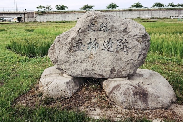
By 1876, the moats had been converted into rice paddies. Other parts of the former castle were used for vegetable fields, a cherry-planted park, a village, and apple orchards. A stone monument commemorating the former Kitabatake castle was erected in the Inner Residence in August 1882. Its inscription was based on characters written in 1880 by Imperial Prince Arisugawa Taruhito.
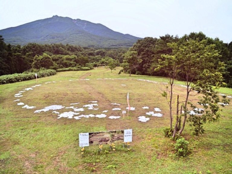
Excavations began in 1977 and recovered approximately 50,000 artifacts while revealing wells, moats, earthen ramparts, and other structural remains. The ruins were designated a National Historic Site on 10 February 1940, becoming the first such designation in Aomori Prefecture. After an error was identified in 1988, the designated area was corrected from 215,800 square meters to 136,123 square meters, and the corrected area received additional designation on 7 March 1989. Namioka Castle was selected as one of the Continued Top 100 Japanese Castles in 2017.
Remains
Namioka Castle occupied a long, narrow area across Gosho, Hayashimoto, and Matsumoto. The broader site measures approximately 1,200 meters from east to west and 600 meters from north to south, while the principal range is described as about 940 meters east to west and 245 meters north to south. The castle stood at the southern end of a hill extending northeast, on a fluvial terrace associated with the Namioka River. The Namioka and Shōheidzu rivers ran below steep southern cliffs, providing both a natural defensive edge and a water source.
Setting and defensive layout
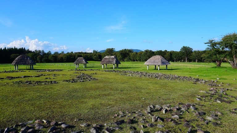
Eight fan-shaped fortified enclosures extended from east to west. They were the New Residence, East Residence, Sarugaku Residence, North Residence, Inner Residence, West Residence, Kengyō Residence, and an unnamed residence. Moats separated the enclosures, generally measuring 10 to 30 meters wide. Some were double moats, with sections reaching about 20 meters in width and 5 meters in depth. The moats connected directly with the Namioka River, and the associated settlement used a street grid modeled on Kyoto.
A former reservoir called Namioka Cape is traditionally associated with the area. A bridge leading toward it was known as the Seven-Day Bridge. The enclosures were defended primarily by timber palisades and earthen ramparts, defensive banks formed from compacted soil. Excavated wells, moats, ramparts, and other structural traces show how the residences and water defenses were arranged across the terrace.
Eastern residences
New Residence
Constructed in 1524, the New Residence lay east of the East Residence and south of the present prefectural road. A southern cliff and a western ditch helped define it, while an outer moat about 4 to 5 meters wide may also have supplied water. The enclosure is thought to have housed retainers connected with the Tsugaru district magistracy established to assist in governing Namioka.
East Residence
The East Residence formed part of the castle’s outer defenses. A water moat approximately 20 meters wide lay to its north, while a cliff marked its southern side. Its widest area measured about 120 meters from east to west and 70 meters from north to south. The main gate was probably positioned between the New and East Residences.
Sarugaku Residence
The Sarugaku Residence stood south of the East Residence and east of the Inner Residence. Its widest area measured approximately 80 meters by 80 meters. Double moats bordered it to the west and north, and a cliff lay to the east. Its name reflects the performance of sarugaku, a medieval tradition involving music, dance, and dramatic performance.
Central and western enclosures
North Residence
The North Residence occupied the central part of the castle and was its largest enclosure, measuring approximately 200 meters east to west and 100 meters north to south. Double moats surrounded it, with an earthen division between them, and earthen ramparts enclosed the area. Retainers’ residences also stood within this enclosure.
Inner Residence
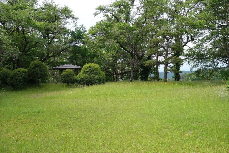
The Inner Residence was probably the principal enclosure and contained the castle lord’s residence. It measured approximately 120 meters from east to west and 85 meters from north to south, standing about 35.9 meters above its surroundings. Its main gate was on the south side, while a rear entrance to the north connected with the earthen ramparts. The former Kitabatake Castle Monument stands within this enclosure.
West Residence
The West Residence lay to the west of the Inner Residence and extended approximately 150 meters from north to south. Its east-to-west dimensions are given as about 80, 100, and 18 meters in different sections. Double moats separated it from the North and Kengyō Residences, with an earthen bank between the two moats.
Kengyō Residence
The Kengyō Residence, also called the Kengyō Estate, stood west of the West Residence. It measured approximately 80 meters from east to west and 180 meters from north to south. A double moat bordered its eastern side, while moats also surrounded its other sides. The name preserves the historical title kengyō, associated with a senior official or the head of an institution.
Unnamed Residence
The unnamed residence was a narrow enclosure extending from east to west. Its moat was approximately 10 meters wide and formed part of the castle’s outer moat system.
Excavated materials and surviving monument
Excavations have produced ancient and medieval pottery, household goods, ritual mirrors, and coins from the Tang, Northern Song, and Ming periods. Large quantities of Ming celadon, white porcelain, and blue-and-white porcelain were also recovered, together with swords, animal bones, tableware, cooking implements, farming tools, weapons, and religious objects. These finds illuminate the domestic, agricultural, military, commercial, and ritual activities associated with the castle.
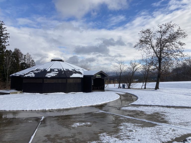
The former Kitabatake Castle Monument in the Inner Residence bears six characters meaning “Monument to the Former Kitabatake Castle” on its front. Its reverse carries an inscription composed from text selected by Sasaki Takayuki and written by Kanai no Yasunori. The present site consists of ruins, with approximately 30 percent excavated. A museum known as the Medieval Museum stands at Namioka Castle and displays artifacts recovered from the site.