Nagahama Castle: A Sengoku Naval Fortress in Japan


Site at a Glance
- Rating
- 4.1
- Popularity
- Low
- Country
- Japan
- Primary era
- Early Modern
- External website
- Open
- Eras represented
- Medieval, Early Modern
- Civilizations
- Later Hōjō
- Site type
- Military
- Remains
- Castle
On this page9 sections
History
Nagahama Castle, also known as Omosu Castle, was a Sengoku-period castle in Japan, located in present-day Numazu, Shizuoka. Built and strengthened by the Late Hōjō clan during the sixteenth century, it served as a coastal fortress and naval base on Uchiura Bay, an important military harbor during the Hōjō-Takeda conflict.
Early fortification and local administration
The castle stood in the Nagahama and Omosu areas of former Izu Province. From the late fifteenth century, western Izu villages were direct holdings of the Hōjō clan after Hōjō Sōun established Hōjō control there. Hōjō-appointed officials supervised local landholders. The Tsuchiya family controlled Omosu and influenced Nagahama, while the Ōkawa family held the village headman’s position at Nagahama. Ōkawa Hyōgo appears in a Hōjō document as a local commoner rather than a samurai.
Nagahama also served as a transportation center because it occupied a position on Suruga Bay. The castle’s earliest phase remains uncertain, but its layout and excavated material indicate that a small fortification probably stood there between the latter half of the fifteenth century and the first half of the sixteenth century. Its construction was probably connected with the Tsuchiya family of Omosu.
The Hōjō-Takeda conflict
The area acquired greater strategic value after relations deteriorated between the Takeda and Hōjō clans, two regional military houses that had previously been allied. In 1579, Takeda Katsuyori built Sanmaibashi Castle at Numazu, near the boundary between their territories. Hōjō Ujimasa then strengthened castles guarding Izu, including Nagahama and Shishihama, to control a coastal route. Forces could land from Suruga Bay and advance toward Nirayama Castle.
The earliest known document directly linked to Nagahama Castle dates from November 7, 1579. Hōjō official Andō Ryōsei, who also administered western Izu, ordered villagers from nearby Kishō to provide labor for a ship-mooring facility at Nagahama. The order shows that the Hōjō administration treated the Nagahama-Omosu area as a military harbor.
Preparations were made in December 1579 to station Kajiwara Kagemune, the Hōjō naval commander, at Nagahama. A military chronicle compiled in the early Edo period states that Kajiwara and five other naval commanders lived at Omosu Bay west of the castle and built ten warships there. Kajiwara had come from Kii Province and had been recruited as a leading Hōjō commander. His introduction of large warships called atakebune into the Hōjō navy, together with his successes against the Satomi clan, helped explain his assignment to Suruga Bay.
A large naval engagement later called the Battle of Suruga Bay took place offshore from Senbonhama in April 1580. Its outcome is uncertain, and Hōjō and Takeda forces continued a standoff with repeated smaller clashes across Suruga Bay until the Takeda clan was destroyed in March 1582.
Decline and abandonment
After the Takeda defeat, Tokugawa Ieyasu became ruler of Suruga and remained generally friendly with the Hōjō, apart from a brief interruption. Nagahama consequently lost its position as a major military stronghold. Kajiwara Kagemune may already have left Omosu by then, and he acquired a residence in Odawara in 1583.
During Toyotomi Hideyoshi’s attack on the Hōjō in 1590, Nagahama functioned as a branch castle of Nirayama Castle and received a garrison. The local notable apparently known as Ōkawa Hyōgo was ordered to defend it. The castle’s specific response to the invasion is uncertain, and it was probably abandoned around the time Nirayama Castle surrendered. By about 1590, it had ceased to function as a castle.
Investigation and preservation
The site became a villa area in 1937, but that use declined after 1965. Fallen trees and dense vegetation contributed to deterioration, while surrounding development threatened the earthworks. Numazu conducted a detailed distribution survey in 1985, clarifying the castle plan after years of neglect.
After the remains were assessed as nationally well preserved, Numazu applied for national designation in 1987. Nagahama Castle became a National Historic Site in 1988, a Japanese legal designation for places judged nationally important for their historical or archaeological value. The protected area was extended in 2002 after an investigation of another enclosure.
By 1991, salt damage was weathering the tuff-based substrate and affecting the earthworks. Numazu acquired land for preservation between fiscal years 1991 and 1994, with further acquisition between fiscal years 2003 and 2006. Preservation and presentation works based on plans prepared in 1997 and 1998 began in 2001 and were completed in fiscal year 2014. They included slope reinforcement, landscaping, guidance plazas on the Nagahama and Omosu sides, and an area for displaying the archaeological remains.
Remains
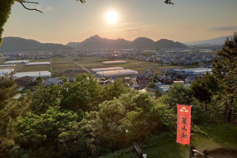
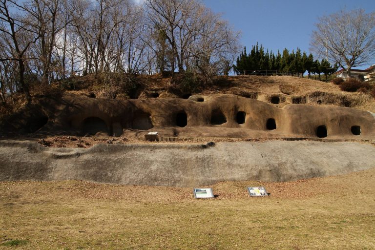
Nagahama Castle occupies the tip of a headland projecting into Uchiura Bay, at the end of a ridge extending northwest from Mount Hottanjō. Known locally as Shiroyama, the headland rises about 30 to 33 meters above sea level, with its highest point at approximately 34 meters. The Nagahama and Omosu districts meet in the castle area.
Headland layout and enclosures
The castle is a small hill fort roughly 100 meters long that follows the contours of the headland. Its principal enclosures and smaller terraces form an L-shaped arrangement. Earthworks occupy the landward side, while dry moats separate the enclosures, and cut stone faced vulnerable sections of the ramparts. The approach to the innermost enclosure followed a zigzag route through the Second and Third Enclosures, passing through gates between them.
The First Enclosure occupies the highest ground, at about 34 meters above sea level, and covers 591.01 square meters. Earthworks survive along its northwestern, southern, and southeastern sides. The Second Enclosure is the largest, covering 665 square meters. It is rectangular, measuring approximately 30 meters from north to south and 15 meters from east to west, with earthworks 3 to 5 meters wide along its southern and western sides.
Excavations carried out from fiscal year 1985 through fiscal year 2010 identified about 200 postholes in the Second Enclosure. These belonged to six post-built structures and one pit-like post-built structure. The Third Enclosure has shrine land on its northern side, with earthworks along its southern and southeastern sides. The Fourth Enclosure covers 147 square meters. Smaller enclosures include A, B, C, and D, measuring 119, 81, 192, and 37 square meters respectively, while Enclosures E through P and another additional enclosure have also been identified.
Tower site and defensive moats
A tower site lies between the First and Second Enclosures. Three successive rebuilding phases were identified at this location, extending from the seaward side toward the northwest. Southwest of the tower site, a dry moat has an inverted-trapezoidal box profile. Its exposed length is 6.3 meters, its upper width is 3.2 meters, its lower width is 2.1 meters, and its depth is 1.6 meters. The side slope is approximately 67 degrees.
Enclosures, crosswise separating moats, earthworks, and dry moats survive as ruins. Their present condition and presentation were shaped by the former villa use, vegetation growth, salt weathering, and later preservation works.
Naval anchorage and changing shoreline
The castle faced Uchiura Bay, the innermost part of Suruga Bay. Nagai Cape to the west and Awashima to the north sheltered the surrounding water from wind and waves. The seabed is only several meters deep immediately offshore but reaches about 15 meters at a distance of 15 meters, creating conditions suitable for anchorage.
The Hōjō naval force used atakebune, heavily built warships often protected by substantial wooden screens. The military chronicle describes vessels with an upper deck for 50 warriors, paulownia-board side protection intended to resist matchlock fire, 25 oars on each side, and a cannon at the bow. Fifty sailors occupied the lower deck. Small fast boats, reportedly adapted from local fishermen’s boats, provided speed and enabled crews to approach enemy ships quickly for boarding.
The surrounding terrain has changed substantially since the late Meiji period, the era of imperial rule from 1868 to 1912. Citrus cultivation began around Uchiura during the later part of that era, and land reclamation, including work near Nagahama Castle, altered the original shoreline and terrain.