The So-Called Hannibal Wall: A Roman Military Position in Switzerland
Site at a Glance
- Popularity
- Low
- Country
- Switzerland
- Primary era
- Classical
- Eras represented
- Classical
- Civilizations
- Roman
- Site type
- Military
- Remains
- Fort
On this page7 sections
History
Roman military network
The So-called Hannibal Wall near Liddes, Switzerland, is the remains of a Roman fortified military position occupied during the last two-thirds of the first century BCE. Its strategic setting helped the Romans monitor routes through the Alps, and the position appears to have formed part of a wider defensive network.
Roman campaigns in the Aosta Valley between 35 and 25 BCE aimed to subdue the Salassi, a Celtic people of the region, and secure the Great and Little St. Bernard passes. These operations may explain the construction of high-altitude positions like this one. Around ten sites between Valais and the Aosta Valley are thought to have formed a network, with positions within sight of one another.
The site could oversee the eastern side of the Val d’Entremont and the main Great St. Bernard route through the valley, as well as crossings near Pointe de Barasson and the Col de Menouve, Col de Moline, and Col d’Annibal. Investigations from 2009 to 2016 indicate that Roman auxiliary troops, forces recruited outside Rome’s citizen legions, occupied the position seasonally. They may have included Celts serving Rome, and the huts and shelters point to a garrison of around one hundred soldiers at times. Celtic groups in central Valais and Chablais were probably under Roman control after the Battle of Octodurum in 57 BCE; people from Valais may have supplied troops for Roman campaigns.
The name and its interpretation
The name “Hannibal Wall” comes from local oral tradition and was first written down in 1983. Hannibal, the Carthaginian commander who crossed the Alps in 218 BCE, was not present at this site. The name therefore preserves a local tradition rather than an account of the position’s Roman history.
Structures understood as a wall were marked on the Orsières sheet of the Siegfried map in 1878. Archaeological work between 2009 and 2016 clarified the site’s Roman occupation and produced evidence that includes a Celtic inscription.
Remains
Enclosure and setting
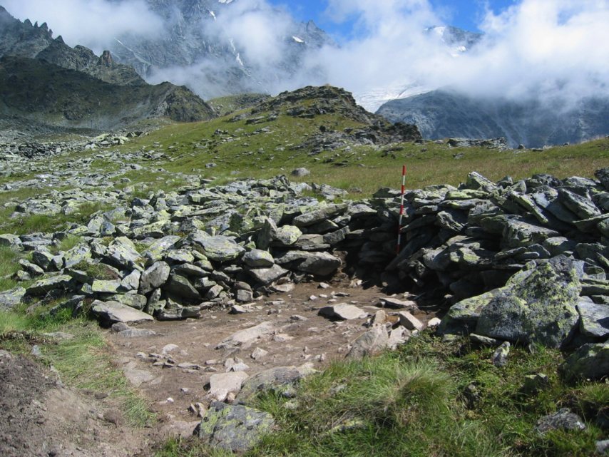
The position stands at 2,643 m on a high saddle between the western slope of Pointe de Boveire (3,212 m) and Pointe de Toules (2,726 m), west of Petit Combin (3,668 m). A steep slope beyond the summit of Pointe de Toules forms a boundary of the fortified area. Its principal feature is a monumental dry-stone wall, nearly 270 m long, which encloses an area of about 3,500 m².
Huts, shelters, and finds
Excavations exposed huts and shelters within the position. Finds dated to 50–15 BCE include local pottery and shoe nails from Roman soldiers’ footwear. The evidence may make this the highest-altitude site in Europe with traces of habitation from that period.
Celtic inscription
A two-line inscription is carved on a stone in a small rock shelter. Its letter forms belong to the second phase of the Lepontic alphabet, an ancient Alpine writing system used for Celtic languages, dated from the fourth century BCE to the first half of the first century CE. The inscription’s form is consistent with occupation of the position in the second half of the first century BCE. The upper line has been transcribed as “poenino” and interpreted as a reference to Poeninus; the lower, “ieuiseu,” remains undeciphered and may be an epithet of the deity. A pre-Roman shrine to Poeninus is said to have stood at the Great St. Bernard pass. Livy, the Roman historian, described Poeninus as an indigenous Alpine mountain god, not a Punic deity associated with Hannibal.