Mouchli Castle: A Byzantine Frontier Fortress in Greece


Site at a Glance
- Rating
- 4.4
- Popularity
- Very Low
- Country
- Greece
- Primary era
- Medieval
- External website
- Open
- Eras represented
- Medieval
- Civilizations
- Byzantine
- Site type
- Military
- Remains
- Fortified Town
On this page7 sections
History
Mouchli Castle is a Byzantine medieval fortress and settlement in Greece, built in the 1290s after the fall of Nikli. It stood on the frontier between the Frankish Principality of Achaea, a western European crusader state in the Peloponnese, and the Byzantine Despotate of Mystras, whose territories were administered from Mystras under a ruler known as the Despot. The castle protected the settlement of Mouchli and controlled the road toward Mystras and other major cities.
Foundation and frontier role
Mouchli was constructed after Nikli fell, under the Byzantine general Andronikos Asan. Its name may have developed from a corruption of Nikli or may have come from the Church of the Virgin of Mouchli. From the fourteenth century, the settlement also controlled routes leading from Argos and Nafplio, Corinth, Skorta, and Messenia. This position made Mouchli the northern point of control for Mystras and obstructed the unification of the Frankish territories in the eastern and western Peloponnese.
After the destruction or fall of Nikli, Mouchli became the seat of the Bishopric of Nikli, also called the Bishopric of Morea. A bishopric was the territory administered by a bishop. In 1314, Agioi Theodoroi was a dependency of the Vrontochion Monastery of Mystras. This dependency, known as a subordinate religious property, connected the settlement with one of Mystras’s important monasteries.
Fourteenth-century prominence
During the fourteenth century, Mouchli developed into a powerful town with limited autonomy. It became the most important city in central Peloponnese and the seat of the Byzantine lords of Arcadia. The town also experienced notable activity in the arts and letters. The painter Digenis is identified as its best-known artistic representative.
Ottoman conquest and abandonment
Ottoman forces conquered Mouchli around 1460. The town surrendered after several days, either because its defenders were too few or through an agreement involving its governor, Demetrios Asanes. Mehmed II, the Ottoman sultan who had captured Constantinople in 1453 and completed the conquest of the remaining Byzantine territories in the Peloponnese during the 1460s, is said to have burned the town and castle.
Another tradition holds that Mehmed II left an Ottoman garrison at Mouchli. The settlement then gradually declined, while remaining an important Ottoman military base until 1469, when it was destroyed. After the conquest, inhabitants moved progressively to smaller settlements on the surrounding lowlands, including Steno, Partheni, Agiorgitika, and Lithovounia.
Remains
Hilltop fortifications
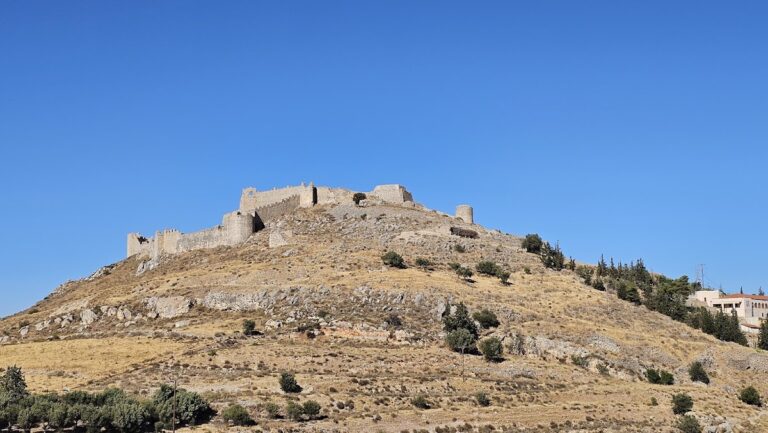
The ruins occupy the summit and the western and southwestern slopes of Mouchli Hill, a naturally defensible height about 914 metres above sea level. The hill stands north of Mount Partheni, which rises to about 1,215 metres, and south of Mount Ktenia, which reaches about 1,598 metres. Mouchli lies between Achladokampos to the east and Agiorgitika to the west, on the edge of the Partheni Basin between the Tegean plain and the Argolid.
The principal fortifications date from the late thirteenth or early fourteenth century. The acropolis, the fortified upper part of a settlement, occupied the summit. Below it, two successive defensive lines enclosed the western slope and part of the southern slope, including the more vulnerable side of the hill. The fortifications and settlement extended across the hilltop and its western and southern slopes, creating a defended complex on several levels. Building materials were reused from Nikli and ancient Tegea.
Terraced settlement and church
The settlement was arranged on three levels divided by walls. The upper town lay below the acropolis and contained secular buildings. The lower town included churches, numerous houses, and other structures. These remains spread across the defended slopes rather than occupying the summit alone, reflecting the separation between the fortified upper area and the inhabited parts of Mouchli.
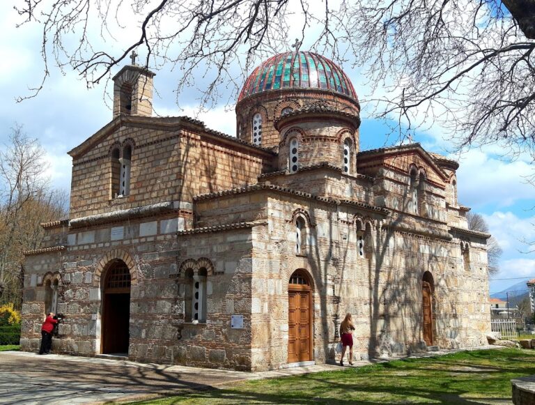
The ruins of the Church of the Virgin of Mouchli survive within the site. The church is also associated with one proposed origin for the settlement’s name. Together with the walls and scattered buildings, it forms part of the remains of the Byzantine town that developed around the hilltop stronghold.