Motul de San José: An Ancient Maya City and Political Centre in Guatemala
Site at a Glance
- Rating
- 4.9
- Popularity
- Very Low
- Country
- Guatemala
- Primary era
- Medieval
- External website
- Open
- Eras represented
- Iron Age, Classical, Medieval
- Civilizations
- Maya
- Site type
- City
On this page32 sections
History
Motul de San José is an ancient Maya city in northern Guatemala, about 3 km north of Lake Petén Itzá. Its first settlement dates to the Middle Preclassic, one of the broad archaeological periods used to trace changes in Maya settlement and political life, around 600–300 BC. The city expanded substantially in the Late Preclassic, about 300 BC–AD 300, becoming a major centre around the lake. Population and building activity peaked in the Late Preclassic and Late Classic, while occupation continued into the Early Postclassic, to about AD 1250. In antiquity, the city was known as Ik’, a name interpreted as ‘Windy Water’.
Regional rule and conflict
Motul’s rulers navigated changing relationships with powerful neighbours. The city acknowledged Tikal as an overlord in the late fourth century AD, came under Calakmul’s dominion in the seventh century, and returned to Tikal’s sphere in the early eighth century. An AD 711 record names Jasaw Chan K’awiil I of Tikal as Motul’s overlord, perhaps reflecting an earlier Tikal claim.
By the eighth century, Motul was a powerful kingdom, although its rulers shared influence with elites at nearby settlements. Its ruler used the high-ranking Maya title kaloomte, whose authority could vary by context. Motul’s court pursued influence through political marriages, warfare, economic relationships, and elite feasts. Its territory lay between Tikal and the Petexbatún, a political region in southwestern Petén whose rival kingdom was a vassal of Calakmul.
In the mid-eighth century, Motul came under Petexbatún power before aligning again with Tikal. A lord of Motul had been captured by a ruler of Machaquila before AD 731, and Machaquila attacked the city in 740. Dos Pilas Stairway 3 records the capture of a Motul lord by K’awiil Chan K’inich of Dos Pilas in 745. Motul appears to have fallen under Dos Pilas later in the century. Ik’-style ceramics continued to carry records of the city’s history after its defeat.
Motul’s relationships with Yaxchilan combined marriage and military conflict. Yaxun B’alam IV of Yaxchilan married Lady Wak Tuun and Lady Wak Jalam Chan Ajaw, both from Motul. A 755 inscription on Yaxchilan Lintel 41 shows Lady Wak Jalam Chan Ajaw preparing her husband for battle. Yaxchilan Lintel 25, dedicated in 723, uses imagery associated with Motul’s X-ray artistic style, in which a masked figure’s face is shown beneath the mask. Later in the eighth century, Yaxchilan Hieroglyphic Stairway 5 records a defeat of Motul’s lord by Itzamnaaj B’alam III.
Rulers, trade, and daily life
Ik’-style vessels preserve names and details about Motul’s rulers. One identifies Chuy-ti Chan as the son of Sak Muwaan, a divine lord of Motul who ruled about 700–726. Chuy-ti Chan is described as an artist and ballplayer and appears to have acted as an ambassador to Maan. The vessels also name Yajawte’ K’inich and Lamaw Ek’. Lamaw Ek’ appears to have succeeded Yajawte’ K’inich, though he was not his son. One vessel may record Yajawte’ K’inich’s death in 755; another gives Lamaw Ek’s death as 779.
Motul’s economy relied on nearby farmland and resources from surrounding communities. Its connections reached cities on the Pasión and Usumacinta rivers and across the Petexbatún, including Seibal, Altar de Sacrificios, Dos Pilas, and Aguateca. The lake settlement of La Trinidad de Nosotros served as a port through which goods came in and local products, including chert and ceramics, went out. High-quality Ik’-style painted vessels were produced at Motul and nearby settlements around AD 740–800. Elite households used them at feasts and circulated them as gifts that helped strengthen alliances. Their presence in Petexbatún elite tombs may reflect tribute after Motul’s defeat, though this interpretation is uncertain.
Maize grew in fields around the city and near residences, and satellite communities supplied resources not readily available close to the centre. Hunting and fishing added deer, peccary, rabbits, pacas, agoutis, armadillos, turtles, and freshwater snails to the diet. Deer remains are especially associated with elite residents, while freshwater snails occur more often in evidence of lower-status diets. Small felines and crocodiles appear more closely connected with ritual or economic activity.
Decline and modern interpretation
An inscription from Seibal dating to about 849 names Kan Ek’ as Motul’s ruler and places the city among four paramount polities of the mid-ninth century, alongside Calakmul, Tikal, and Seibal. Between about 830 and 1000, Motul’s population and construction declined sharply, though activity continued at its principal centres. Occupation and building during the Early Postclassic, about AD 1000–1250, continued on a more moderate scale than in earlier periods.
Local Maya called the ruins Motul. Teoberto Maler visited in May 1895, described a stela, and added ‘de San José’ to distinguish the site from another Motul in Yucatán. Ian Graham mapped and photographed parts of the centre in the 1950s, recording five monuments, and Arlen Chase also mapped part of the core. The Motul de San José Archaeological Project investigated the city and nearby settlements from 1998 to 2008, including work at Akte and La Trinidad de Nosotros.
Before Motul Ecological Park was established, maize cultivation took place at the site. Uncontrolled burning of field stubble caused fires in 1986, 1987, and 1998; the 1998 fire badly damaged stelae in the centre. Guatemala’s Institute of Anthropology and History protects the archaeological site as a national park. It also forms part of Motul Ecological Park, which covers about 2.2 km² and is administered by the institute, the University of San Carlos of Guatemala, and the communities of San José and Nuevo San José.
Remains
The remains extend across a limestone hill and include a ceremonial centre of plazas, pyramids, temples, and palace complexes, surrounded by residential areas. Five principal architectural groups, labelled A–E, each contain at least one pyramid and palace-type buildings. Construction includes both well-cut stone blocks, which may belong to earlier work, and thin, flat stones associated with the site’s Terminal Classic occupation.
Setting and settlement plan
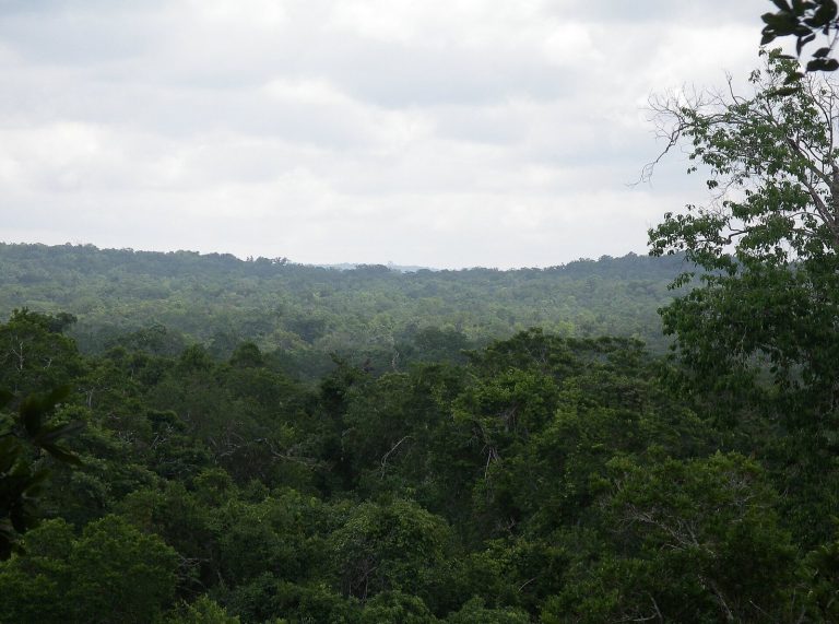
Motul stands on a hill about 180 m above sea level, at the northern edge of the fault depression beneath the central lakes of the Petén Basin. Lake Petén Itzá lies roughly 3 km to the south, while the seasonal Kantetul River passes about 2 km north of the centre. Ridges in the area generally run east–west or northeast–southwest, with clay-soil lowlands between them. Ancient and modern agricultural terraces line a riverbank at a similar distance from the core.
The estimated site covers 4.18 km², of which about 2 km² had been mapped, including approximately 230 structures. The ceremonial centre occupies about 0.4 km² and contains more than 144 structures; residential areas extend across a further 1.2 km², with settlement continuing north and east. Thirty-three plaza groups have been mapped. A broad clay-soil depression separates the North Zone from the core and may have served as a reservoir. Quarries lie along its northern and southern edges, while low ground between the principal groups may have supported intensive cultivation. Estimated building densities decline from 250 structures per km² in the monumental centre to 125 in the suburban zone and 79 in the periphery.
Groups A and B
Group A
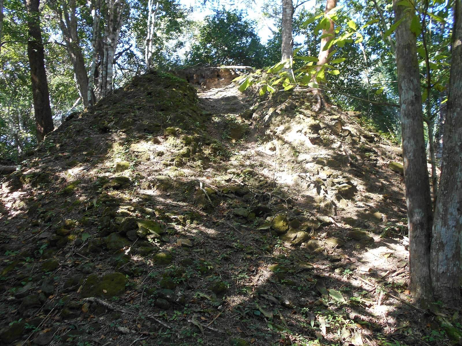
Group A is the largest architectural group west of the core. Its 5.5 m-high pyramid has looters’ pits on the summit and all four sides; the pits were later refilled by Guatemala’s Institute of Anthropology and History. Six rectangular palace-type buildings, reaching 5 m in height, stand to the west. A stairway gives access to a plaza between the pyramid and one palace. Another plaza southeast of the palace is bordered on three sides by palace-type buildings.
Group B pyramid and palace complex
A 7.7 m-high pyramid stands about 90 m south of a palace complex arranged around two small plazas. The pyramid was looted, and its pits were refilled. The palace’s tallest building, on the south side of the western plaza, is 4.5 m high. The complex resembles one at Dos Pilas, and its stairways resemble those found in the Petexbatún region. Looting damaged the complex, including the destruction of a small structure beside the eastern plaza. Several smaller Late Classic residential groups lie north of Group B.
Wall and Stela 2
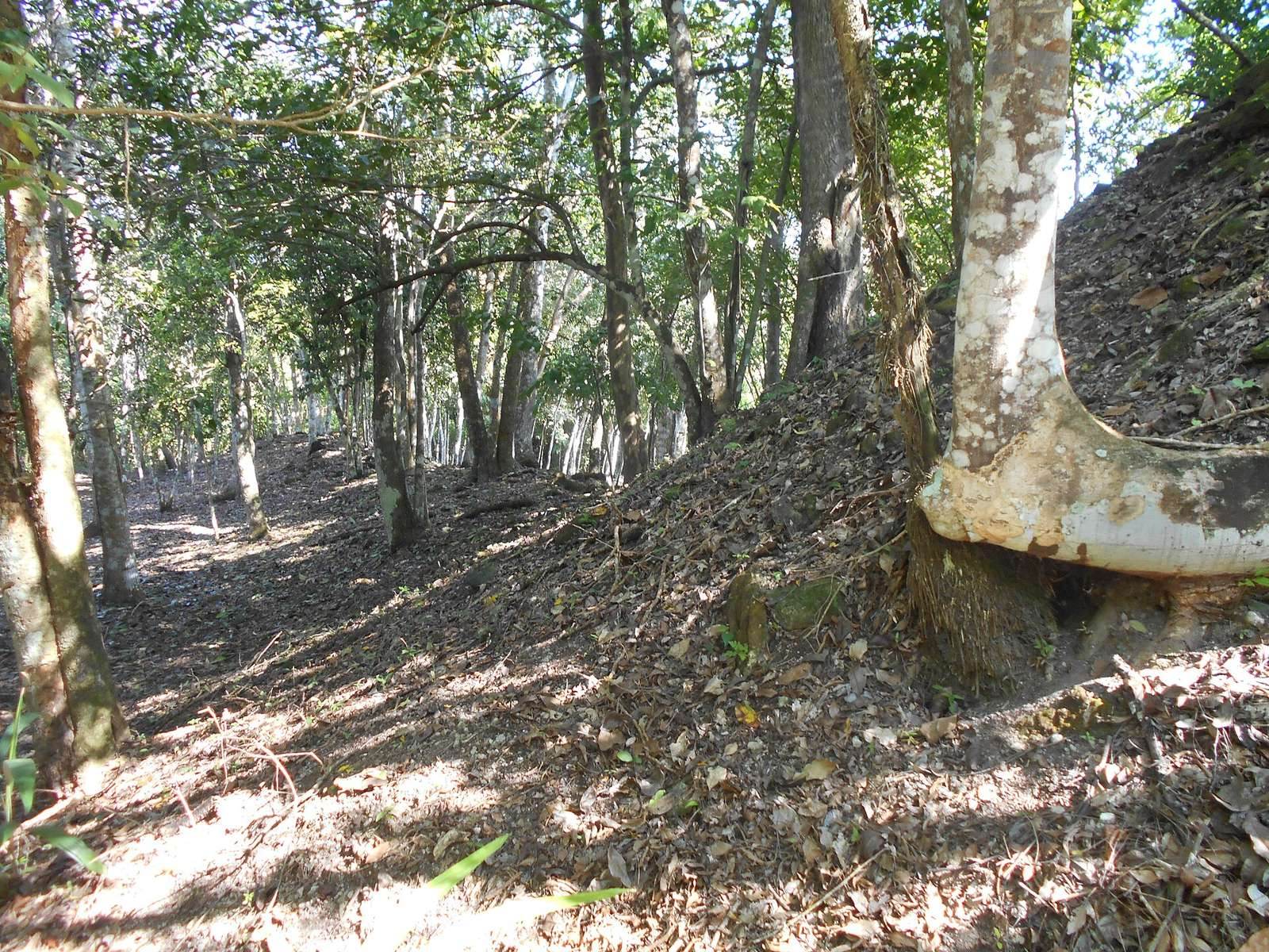
A low wall runs 120 m north from the northeast corner of Group B’s eastern plaza. It is 0.3–0.5 m high and 0.5 m wide, ending at a platform that supports several structures. The wall may have divided parts of the settlement or marked the edge of an avenue. Stela 2 stands on a low platform west of the main pyramid, in Plaza B before a small temple.
Group C and the central plaza
Main Plaza
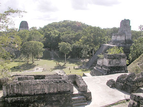
Group C is Motul’s principal architectural group. Its Main Plaza measures about 100 by 200 m and covers more than 11,000 m². The palace complex known as the Acropolis borders the plaza to the north and west, twin pyramids stand to the east, and the South Pyramid closes its southern side. A lower pyramid on the west side is 7.8 m high and has been looted; an eroded stela was found near it.
Acropolis
The Acropolis is a palace complex enclosing six small plazas and covering more than 83,000 m². It is thought to have served as the royal palace. Two buildings immediately south of its central plaza rise 10.8 m and 8.7 m. Excavation in the northwest exposed plaster floors, ceramics, worked stone, obsidian (volcanic glass), bone, shell, painted vessels, three-legged vessels, a flute, and a drum. Late Classic ceramics appeared at all excavated levels. Fill behind the western building of the northwest plaza contained material dating as far back as the Late Preclassic and Early Classic, while a fragment of a Terminal Classic plate came from the northern end of the complex.
South Pyramid
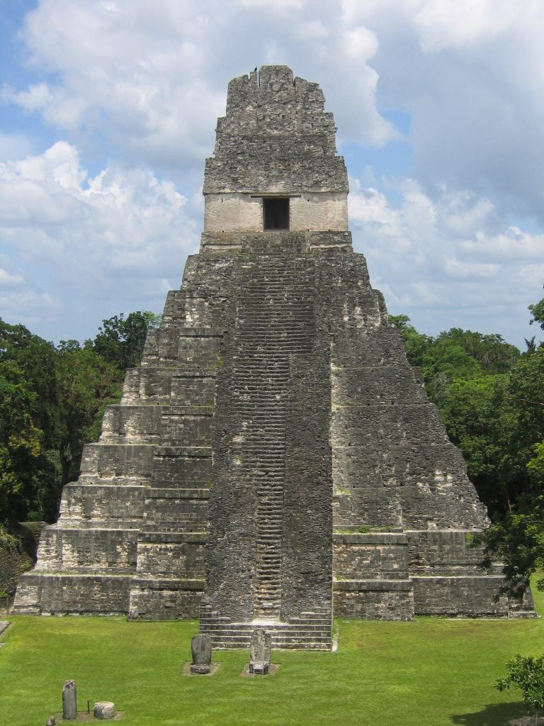
The South Pyramid, on the plaza’s southern edge, is Motul’s highest structure at 20 m. Its summit retains remains of a shrine, possibly including parts of its roof and roof comb, the raised architectural crest above a Maya roof. Thin, flat stones in its surviving masonry are associated with the Terminal Classic occupation. Stela 6 was uncovered on the pyramid’s plaza-facing north side.
Twin Temples
The Twin Temples stand on a shared platform at the eastern side of the Main Plaza. They rise 17 m and 18 m, and may have been topped by roof combs. Twin stairways climb their western faces from the plaza. Stelae 3, 4, and 5 stood in a line before the temples, and the southern pyramid has suffered some looter damage.
Sculpted monuments
Stela 1
A stela is an upright stone monument, often carved with images or hieroglyphic writing. Six are known from Motul, all from Group C. Eighth-century Stela 1, on the west side of the Main Plaza, retains the site’s best-preserved hieroglyphic text. It records a local ruler’s accession under the supervision of Jasaw Chan K’awiil I of Tikal and helps identify Motul with the Late Classic Ik’ political community. Its text includes the earliest known use of the title ‘Divine Lord of the Itza’, a designation for a ruler accorded sacred status.
Stela 2
Stela 2 depicts Yajawte’ K’inich. Dancing figures appear on its east face; on the west, a masked figure is shown in X-ray style, an artistic convention that reveals the face beneath the mask. The glyph on the monument was first read as a political title for Ik’, but later analysis identified it as a place-name.
Stelae 3–5
Stelae 3, 4, and 5 stood in a north–south line east of the Main Plaza, in front of the Twin Temples. Stela 4 depicts Yajawte’ K’inich dancing with one foot raised. Stela 3 stood to its north and Stela 5 to its south.
Stela 6
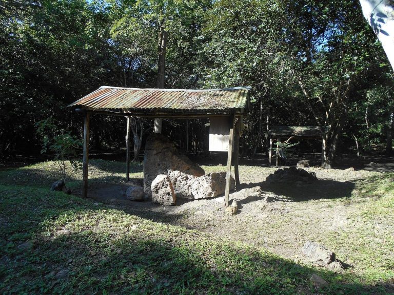
Stela 6 stood south of the Main Plaza and north of the South Pyramid. Discovered in 1988, it had broken into many pieces after falling, apparently after the city was abandoned. Its base remained in place, two large fragments lay on the surface, and more than 100 smaller pieces were collected. The north and south faces were carved. A partial reconstruction of the north face shows a richly dressed ruler dancing with one foot raised and holding a God K sceptre, a royal object bearing the image of the Maya deity K’awiil. The ruler’s figure is estimated at 2.5–3 m high. The monument appears to have been a late addition and is assigned to the Late Postclassic.
Residential complexes
Group D
Group D, northeast of the Acropolis and north of the Twin Temples, is a residential complex around a plaza. It includes two palace buildings and a 5 m-high pyramid on the plaza’s east side. A looters’ tunnel through the pyramid exposed earlier construction made with well-cut stone and a looted high-ranking or royal tomb. The burial contained painted vessel fragments, jade and shell beads, jade, shell, and pyrite mosaic pieces, a shell necklace, and a stingray spine; the human bones had been painted red. The tomb may indicate that the palaces housed royals or priests involved in rites for a deceased king.
Group D was occupied from the Middle Preclassic to the Terminal Classic. A deposit placed before the south entrance of its northern building included rubbish, apparently from the group, and objects connected with weaving and papermaking. The building may then have been burned and was abandoned. The southern structure has a patio with two circular columns, a form characteristic of the Terminal Classic.
Group E
Group E, west of Groups C and D, is the site’s second-largest group. Its two looted pyramids rise 7 m and 4 m, with the taller one to the north. Nearby residential groups consist of three or four low rectangular buildings arranged around small plazas. Two investigated palaces have doorways with projecting corners. The western palace contains a vaulted room with a central bench and a cross-shaped bench outside; its walls survive to 1 m. The northern palace’s walls reach 0.5 m, and upright stone slabs divide its western room into two. It has no interior benches.
North-South Avenue
A 200 m-long avenue runs through Group E from a small temple at its north end to Plaza B at the south. Residential groups line its eastern side, while a 1 m-high wall borders the western side.
Craft remains
Painted vessels
Ik’-style pottery is linked to Motul through its emblem glyph, archaeological comparison, and chemical analysis. The vessels include painted plates and cylindrical forms, with pink or pale-red hieroglyphs, masked dancers, and unusually lifelike images. More than 30 intact examples are known, with subjects including diplomacy, feasting, bloodletting, warriors, and the sacrifice of war captives. X-ray-style imagery appears on at least nine painted vessels associated with Motul and on Stela 2. A vessel bearing the Ik’ emblem and depicting Lamaw Ek’, found at Altar de Sacrificios, was identified by chemical analysis as a Motul product.
Figurines and stoneworking
By 2003, excavations at Motul, its outskirts, and nearby settlements had recovered about 1,800 figurine fragments, including 239 heads or complete figures. Workshops or production areas lay in the Acropolis, a Group B palace complex, an elite plaza in Group E, and two northern elite plazas. A chert-working area was found in the northern part of the site. Chert, a hard stone used for making tools, was also worked at nearby Chak Maman Tok’.
Satellite settlements and the lake
La Trinidad de Nosotros
La Trinidad de Nosotros lies 2.6 km southeast of Motul on Lake Petén Itzá’s northern shore, at the nearest point on the lake to the city. Its hilltop core, about 40 m above the water, includes at least 80 structures arranged around five plazas. A second settlement area extends along the shore and hillside. The site has more than 115 structures across 35 hectares, and its full extent may reach 55 hectares. Plaza V accounts for about half the combined area of the core plazas. The plazas were resurfaced repeatedly between the Late Preclassic and Late Classic.
Temple and ballcourt
La Trinidad’s main temple, Structure A-1, is a 12 m-high pyramid with stairs on several sides. Other buildings include an elite residence and structures that may have served as elite and sub-elite homes. The ballcourt in Group F was built for the Mesoamerican ballgame. It is T-shaped, with sides 25 m long, a closed northern end, and a small temple beside its east side. Its final construction phase dates to the Late Classic. Deposits associated with the court contained 21,000 pottery sherds, 239 obsidian pieces, 155 figurine fragments, and 84 stone tools.
Port works
Retaining walls, a possible breakwater, and a quay formed part of La Trinidad’s port area, which appears to have been partly enclosed by an artificial peninsula. The settlement’s monumental buildings, port, and ballcourt mark it as an important centre in Motul’s surrounding community network.
Akte and other nearby communities
Akte lies 7.1 km northwest of Motul. Its 35-hectare centre has 32 structures on a landscaped hill overlooking the Akte and Kantetul rivers. A main residential complex rests on a 3–5 m platform and has three patios, with a small temple on the northern patio’s east side. Seven sculpted monuments have been found there. Buena Vista, 3 km southwest of Motul, has 13 mapped structures around a small plaza and a 2.5 m-high Late Classic funerary pyramid. Nearby Chak Maman Tok’ was a centre for high-quality chert-tool production. To the east, Chakokot has 59 structures and a 10 m-high temple; 14 bottle-shaped underground chambers there are thought to have stored dry goods. Chachaklum, also to the east, extends over more than 2 km² and contains over 141 structures.