Mokissos: A Byzantine Settlement and Ecclesiastical Center in Turkey
Site at a Glance
- Popularity
- Medium
- Country
- Turkey
- Primary era
- Medieval
- Eras represented
- Classical, Medieval
- Civilizations
- Byzantine, Roman
- Site type
- Settlement
- Remains
- City
On this page13 sections
History
Mokissos is the name commonly assigned to a Byzantine settlement whose ruins lie near Helvadere in Turkey, although the identification has not been conclusively established. The settlement may have been refounded under Anastasius I (491–518), then rebuilt under Justinian I (527–565) and renamed Justinianopolis. Around 535, it became the metropolitan center of Cappadocia III, an ecclesiastical province.
Early references and possible refoundation
The settlement’s name appears in several forms, including Mokisos and Mokison, and the Roman forms Mocisus, Mocissus, and Mocisum. Stephanus of Byzantium gives Moukissos, while the Synekdemos, a list of cities in the Roman Empire, records Rhegemoukisos and a second, apparently mistaken form, Rhegekoukisos.
During a campaign against Pharnaces I of Pontus, forces allied under Eumenes II of Pergamon and Ariarathes IV of Cappadocia camped at Mocissus. The two kings learned there that Roman envoys had arrived to mediate the conflict and seek a settlement. Mokissos is also known from the reign of Anastasius I and appears in the Synekdemos in 527/528. It may have been refounded under Anastasius, perhaps in response to a Sabir incursion into Asia Minor in 515, although that connection is uncertain.
Rebuilding and ecclesiastical role
The sixth-century historian Procopius describes the rebuilding under Justinian of a decayed earlier fortress at a defensible site in the nearby mountains. His account names a great wall, churches, inns, and public baths among the new works. The settlement was then called Justinianopolis, a name that remained in use until Byzantine rule ended.
Around 535, Mokissos became the metropolitan seat of Cappadocia III. A metropolitan was a senior bishop who oversaw an ecclesiastical province. Cappadocia III was formed from parts of Cappadocia II, a Roman civil province, but Mokissos’s new authority was religious rather than political. Its jurisdiction extended south of the Halys River, now called the Kızılırmak, and included the bishoprics, or dioceses, of Nazianzos and Koloneia. Metropolitans of Mokissos attended councils or synods in Constantinople in 536, 553, and 692.
After the sixth century, references to the city appear mainly in lists of bishops and in De thematibus, a work associated with the Byzantine emperor and scholar Constantine VII that drew partly on older information.
Decline and the survival of the diocese
Arab forces probably destroyed Mokissos in the seventh century. Its metropolitan may later have lived among the ruins or at a nearby monastery. Building activity diminished after the early seventh century; a repair to one church may have taken place later, though its date is uncertain. In the tenth and eleventh centuries, churches and monasteries in the surrounding area were probably built with stone taken from Mokissos.
As Turkish forces conquered Asia Minor from 1071 onward, many bishops fled to Constantinople. Metropolitans of Mokissos are recorded there around 1170 and 1265, and Ioannikios, the last known metropolitan, was appointed in 1370. Mokissos survives as the formal name of an inactive Greek Orthodox diocese in the records of the Patriarchate of Constantinople, a historic center of Orthodox church administration.
Identification and archaeological study
The identity of the ruins has been debated. In 1842, William Hamilton identified them as Nazianzos. J. G. C. Anderson later associated them with the fortress of Nora or Neroassos mentioned by the ancient geographer Strabo, while Mokissos was sought near Kırşehir. Ernst Honigmann proposed identifying the ruins as Mokissos in 1939, and the identification gained broad acceptance, but the question remained unresolved in 2021. Nineteenth-century travelers and scholars in the early twentieth century brought the remains to wider attention.
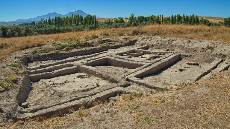
An investigation carried out in 1994–1996 and associated with German Byzantine scholar Albrecht Berger estimated that the settlement had about 1,000 residences. The archaeological site has been restored.
Remains
Valley setting and layout
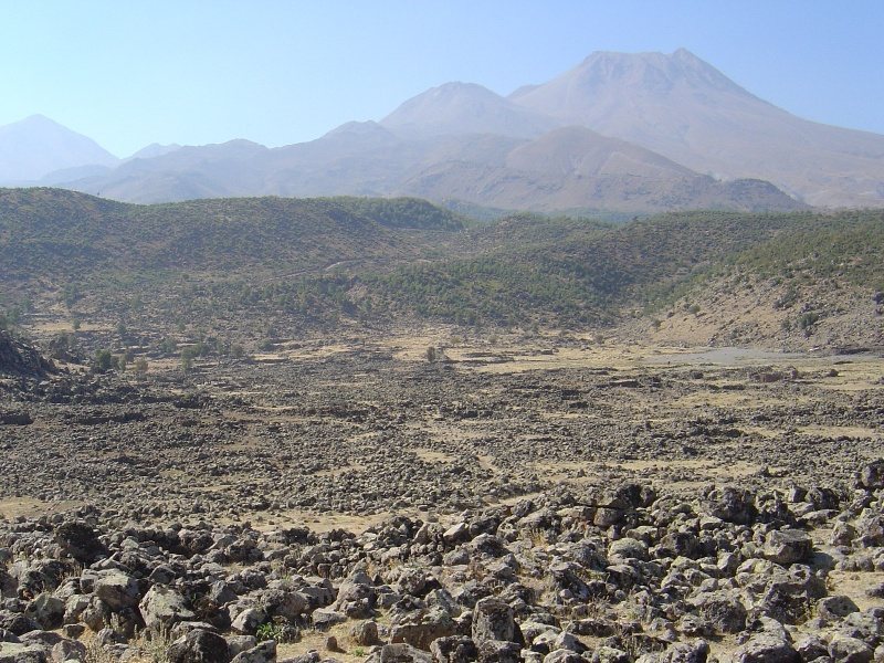
The remains occupy an extensive high valley near Helvadere, about 30 km south of Aksaray and roughly 1,500 m above sea level. The valley formed as natural erosion filled one of Hasan Dağı’s secondary craters. Three narrow approaches reach it from the west, east, and north; steep slopes and surrounding hills provide a natural defensive barrier. The settlement’s buildings are made of stone masonry and are concentrated on slopes facing the valley floor.
Acropolis and defenses
Fortifications enclose the acropolis, the fortified upper part of the settlement. Castle ruins also form part of the remains.
Buildings and burials
Churches
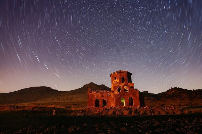
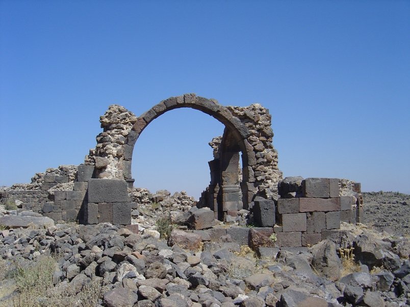
The site contains remains of 32 church structures, including a metropolitan church and a three-aisled basilica, a long building with a central aisle and two side aisles. The surviving churches date to the sixth and early seventh centuries. Their walls use dressed blocks of local dark stone, and some include horseshoe arches, which curve inward below the points where they begin.
Cisterns
Twenty cisterns survive among the settlement’s remains.
Private houses
The surviving homes are simple stone structures built from unworked boulders.
Roman burial ground
The settlement was built over a Roman cemetery. Burial mounds from it remain among the houses.