Meninx: A Phoenician and Roman Coastal City in Tunisia
Site at a Glance
- Rating
- 3.9
- Popularity
- Very Low
- Country
- Tunisia
- Primary era
- Classical
- Eras represented
- Classical, Medieval
- Civilizations
- Byzantine, Phoenician, Roman
- Site type
- City
On this page24 sections
History
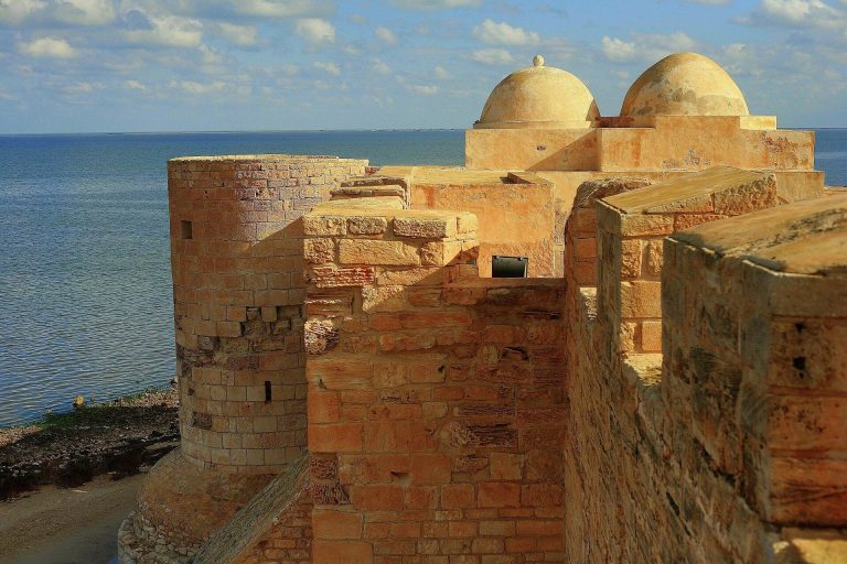
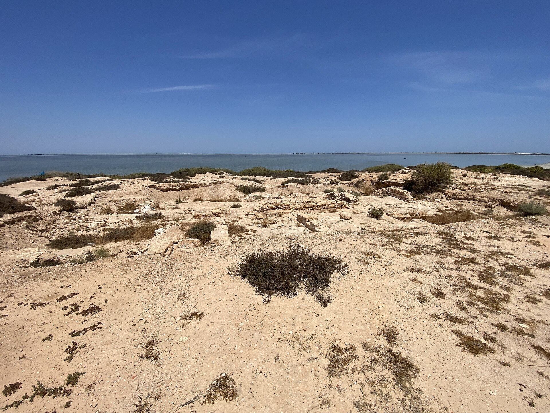
Meninx is an ancient Phoenician-founded trading settlement at El Kantara on the southeastern coast of Djerba, Tunisia. It appears in the archaeological record around the mid-4th century BC and later became the island’s administrative centre during the Roman period. Extending for approximately 2 km along the coast and up to 800 m inland, the city occupied a maritime position shaped by sandbanks and deep submarine channels. Part of the ancient settlement was probably submerged by the sea.
Phoenician foundation and Punic commerce
Meninx was established at the end of the route linking Djerba with the mainland. Its position beside a channel running for almost 2 km along the coast allowed seagoing vessels to enter the gulf without an artificial harbour. Navigation probably depended on local pilots, who knew the shifting channels and sandbanks. Earlier harbour activity and purple-dye production had taken place at nearby Guellala or Haribus before Meninx emerged as the principal settlement.
The early economy combined maritime trade with purple-dye production, agriculture, fishing, and pastoralism. The murex, a marine mollusc whose glands produced costly purple dye, was collected elsewhere on Djerba because the shallow waters around Meninx did not support it. Animal remains, especially those of male sheep, indicate wool production, while spinning probably took place outside the city. These activities supplemented the city’s commercial role and connected its coastal exchange with the resources of the island.
During the late Punic period, modest houses clustered around the area that later became the forum. Local amphorae of Punic type were produced in kilns at Souk el Guébli and Henchir Tawrirt. They held wine, garum, salted fish products, and probably olive oil. After the fall of Carthage, Meninx also received Italian wine and tableware from Naples, Etruria, and Sicily, indicating the city’s participation in wider Mediterranean exchange.
Roman administration and urban transformation
Under Roman rule, Meninx became the administrative centre of Djerba. The island and the city were also known as Girba or by related forms, and the name Girba gradually replaced Meninx during the 3rd century AD. Ancient writers connected Meninx with highly valued African purple dye and referred to two cities on the island, Meninx and Thoar or Troas.
During the early Roman period, the settlement was reshaped according to Roman urban models. Punic houses were replaced by monumental buildings, while a forum and public sanctuaries established new civic and religious centres. The transformation gave the city an urban identity integrated into the political and architectural culture of the Roman Empire.
Meninx developed rapidly under the Flavian emperors, who ruled from AD 69 to 96, and under Trajan. Its coastal economic infrastructure expanded through the construction or enlargement of markets, warehouses, cisterns, quays, and industrial installations. These works supported the exchange and processing of goods arriving by sea and linked commercial activity to the city’s public buildings.
Under Hadrian and the later Antonine emperors of the 2nd century AD, the forum was extensively remodelled. A monumental marble temple replaced an earlier structure, a large basilica was built on the southeastern side, and the porticoes were renewed. The northern temple, first established under Augustus, was redecorated and connected directly to the square. This phase strengthened the forum as the political and ceremonial centre of the city.
Late antique change and abandonment
From the 4th and 5th centuries AD, new Christian monumental buildings appeared outside the earlier urban centre. At the same time, the forum, temples, market, and sanctuaries were progressively stripped of building materials. Streets accumulated sand and refuse, and the baths lost their original function before being partly converted into housing and abandoned by the 5th century.
During the 6th and 7th centuries, domestic buildings continued to be modified while the city’s economic base contracted. The end of purple-dye production brought the disappearance of murex deposits. Livestock raising shifted toward consumption, imported agricultural products became more important, and the population declined sharply. Some inhabitants moved inland. Meninx was completely abandoned at the end of the 7th century AD, although ceramic fragments from the former sanctuary may indicate occasional visits by fishermen in the early 8th century.
Reuse and archaeological investigation
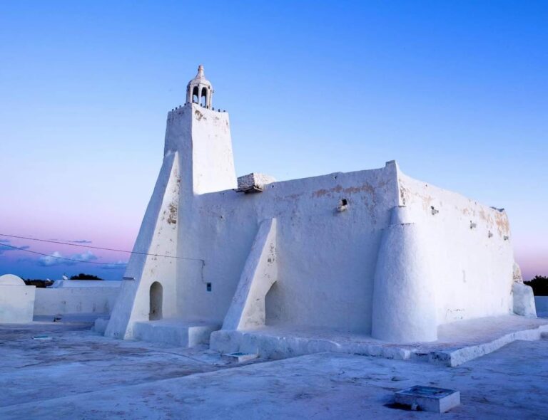
After abandonment, the ruins supplied building stone for nearby mosques, including el Guemir, el Hara, Fouzer, Moghzal, and el Hajar. The submarine channel was reused as a navigable route from the 16th century, while the causeway joining Djerba to the mainland retained strategic importance during the Middle Ages. A coin dated 1890–1891 probably relates to the later passage of French travellers or soldiers.
Edmond Pellissier de Reynaud described the ruins in 1853. The Ben Ayed family later excavated the site for stone and marble needed to build Ksar Ben Ayad. These works exposed part of a large structure interpreted as a temple or palace, two headless colossal marble statues of an emperor and empress, architectural marble, and an inscription. Victor Guérin described the site in 1860, recording an enclosure with a perimeter of about 5 km, a fortified building, cisterns, columns, and statues. He also reported the removal of valuable marbles by foreign visitors and their reuse in the palace of Saïd Ben Ayed.
In 1882, Marie Henry Charles Hussenet reported excavations by the 78th Infantry Regiment under Lieutenant Le Hello. The work investigated a basilica at the eastern end of the site, about 1,500 m from a large temple, and identified two Christian buildings assigned to the Roman or Byzantine period. A marble inscription found by Hartmayer in a mosque at Sedouikech records the cives Meningitani, the inhabitants of Meninx. It probably refers to Lucius Minicius Natalis, consul in AD 106 and legate of the Third Augustan Legion between AD 103 and 105. This is the only known text that explicitly names the people of Meninx.
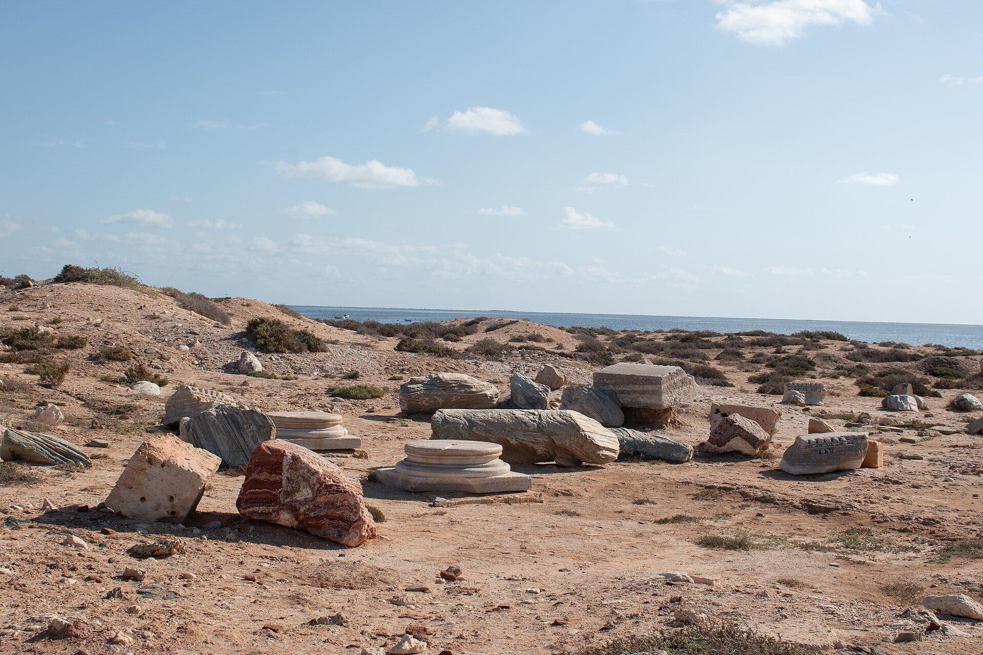
Paul Gauckler probably carried out the first systematic excavations between 1892 and 1904. Eugène Sadoux investigated the main basilica, a second Christian church, Roman hydraulic installations, and a large rock-cut funerary chamber that he considered possibly Punic. Paul-Marie Duval resumed investigations in 1942, identifying two bath complexes, an amphitheatre about 400 m from the city, two previously cleared basilicas, and a large esplanade probably associated with the forum. He also recorded sculpted pillars, columns, cornices, and architectural fragments, including figures probably representing barbarians.
Tunisian-American surveys and test excavations between 1996 and 2001 clarified the ancient occupation of the city, its agriculture, and its purple-dye production. Since 2015, a Tunisian-German project has combined geophysical surveys with archaeological excavation. Cooperation between LMU Munich and Tunisia’s National Heritage Institute led to a site-development and archaeological-park project beginning in 2018.
Remains
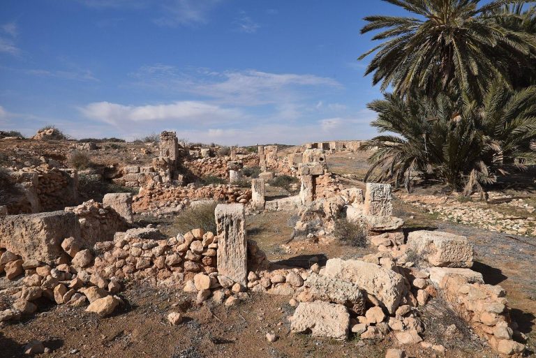
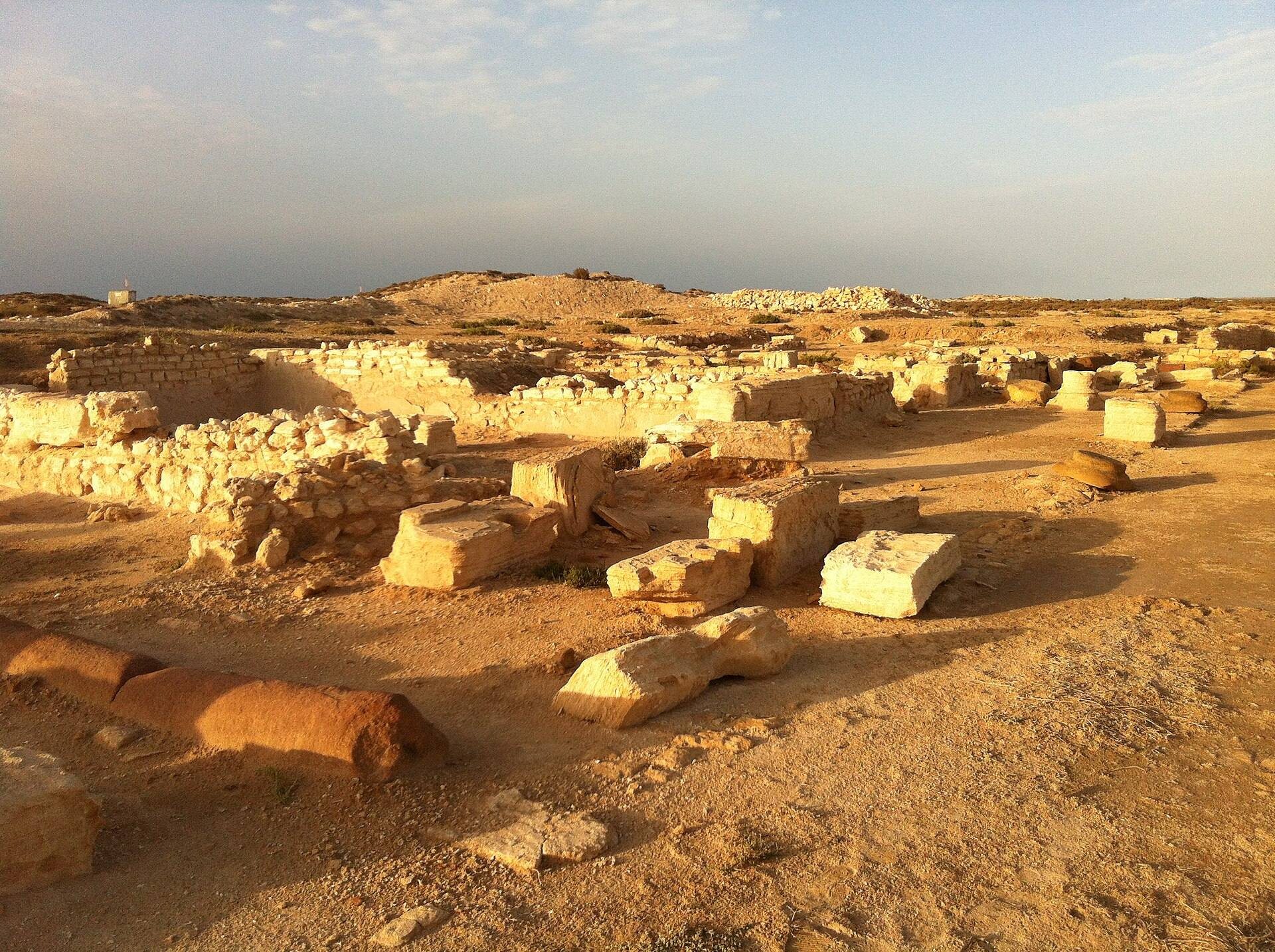
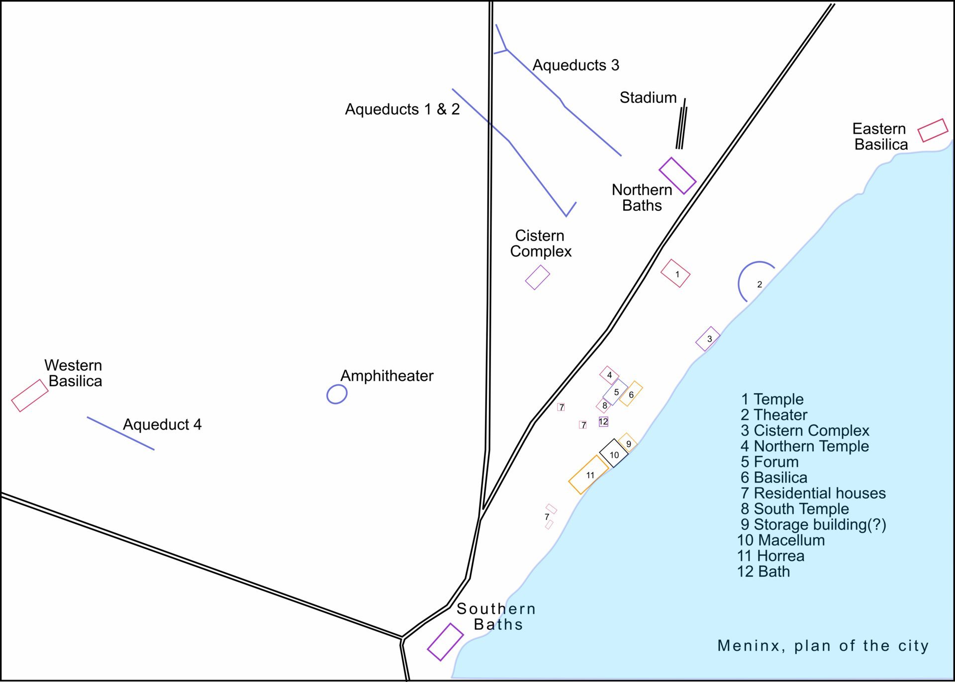
Meninx had an elongated coastal plan organized by several major roads running parallel to the shoreline. The coastal zone contained the forum basilica, sanctuaries, a monumental southwestern temple, baths, storage buildings, cisterns, workshops, and other structures. Inland, dense housing occupied irregular streets with internal courtyards, alongside a smaller bath complex, public buildings, and a possible second public square. The shoreline has altered the ancient landscape, and the market is partly submerged below the present sea level.
Forum and civic centre
Forum
The forum was a rectangular space measuring approximately 36 by 55 m and oriented from southwest to northeast. Porticoes stood along two sides. The northeastern portico, built during the Augustan period, was about 6.20 m deep and was later paved and faced with marble. A later portico beside the basilica was narrower, measuring no more than 3.80 m in depth. Around thirty marble fragments were found in the forum area, including a head of Antoninus Pius and pieces of a colossal statue of Serapis, a Greco-Egyptian deity whose cult spread through Roman-period cities.
Forum Basilica
The Forum Basilica had a rectangular plan measuring about 48 by 24.70 m. It rose two storeys and contained three aisles. Its architectural decoration used Proconnesian and cipollino marble, with paired heart-shaped corner columns and a richly ornamented entablature. The roof was probably double-pitched and covered with Italian tiles.
Northern sanctuary
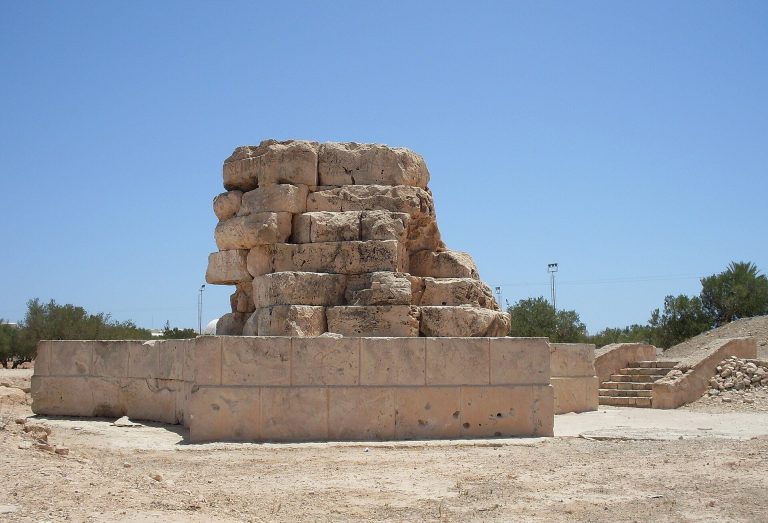
The northern sanctuary measured approximately 30 by 25 m and followed the templum cum porticibus plan, an inner temple surrounded by a porticoed courtyard. Built during the Augustan period, it was refurbished in the 2nd century and linked to the forum by a staircase. A monumental marble temple occupied the southwestern end of the forum, and its façade may have reached about 17 m in height.
Markets, warehouses, and water installations
Market
The market, or macellum, stood about 60 m south of the forum. This type of Roman market was arranged around a courtyard with shops and porticoes. Built between the late 1st and early 2nd centuries AD, the Meninx market measured approximately 60 by 60 m. It included a paved courtyard, a central circular platform probably belonging to a rotunda, columned porticoes, and shops for foodstuffs.
Coastal warehouse complex
A coastal warehouse complex stood about 300 m south of the forum and covered more than 2,800 square metres. Its central street was 65 m long and 5.25 m wide. For approximately four centuries, the complex stored salted fish products, garum, purple dye, wine, and materials associated with dye production. From the 4th century AD, some rooms were used to produce garum, while several basins probably served purple-dye production. Fifteen tombs show that the complex was later reused for burials.
Major cistern complex
A major cistern complex about 250 m northeast of the forum covered approximately 500 square metres. Its principal building measured about 20 by 21 m and contained six rectangular basins with semicircular ends. The basins were about 2.40 m deep and had an estimated combined capacity of approximately 450 cubic metres. Nearby, three cisterns were arranged in a clover-leaf pattern, although their function remains uncertain. Other cisterns served artisanal, domestic, commercial, and cultic purposes.
Aqueducts
Two aqueducts ran from northwest to southeast. Ceramic evidence places the first probably in the mid-2nd century AD and the broader second aqueduct in the early 3rd century. A third aqueduct may have supplied the northern baths, while a transverse conduit linked the second and third. The dates and relationships of these additional structures remain uncertain.
Sanctuaries and Christian buildings
Seafront sanctuary
Another sanctuary had a quadrangular plan measuring about 40 by 40 m and faced the sea. Geophysical surveys identified a porticoed courtyard, a temple against the rear wall, and a central structure probably used as an altar. A fragmentary sculpture showing uraeus serpents and a solar disk indicates a cult of Isis, an Egyptian goddess whose worship spread through the Hellenistic and Roman Mediterranean.
Christian basilicas
Christian basilicas stood on the seafront and at Henchir Bou Merdès. The larger church followed the African basilical type, with three aisles, an apse flanked by two sacristies, and mosaic floors. Its nearly square baptistery contained an eastern semicircular niche with four large columns in front of it.
The baptismal font, now reconstructed in the Bardo Museum, was made from eight large marble blocks. Four were cross-shaped and four formed the corners, creating an equal-armed cross around an unusually square interior. The baptistery chapel also had polychrome marble paving and elaborate geometric mosaics.
Baths and residential buildings
Bath complexes
Meninx contained two bath complexes, including the large northern baths and a smaller establishment near the forum. The northern baths were probably built in the 3rd century AD. The forum complex had a central corridor, small rooms, mosaics, two unheated pools, a frigidarium or cold-water room, a heated room with a hypocaust system for circulating hot air beneath the floor, an elevated reservoir, and a large cistern. It was probably a private or small neighbourhood bathhouse.
Six headless statues of Pentelic marble were found in the semicircular pool. They included a woman wearing a peplos, a seated Jupiter, and two pierced fountain statues. The baths were abandoned in the 5th century AD.
Residential quarters
One house was organized around an almost square courtyard measuring approximately 5.5 by 6–6.5 m. Narrow rooms surrounded the courtyard, and the building had a waterproof opus signinum floor and a buried cistern. A second residential complex contained small rooms, vaulted underground cisterns, a well, a painted panel, a basin, and a hearth.
Meninx I included an L-shaped courtyard and two cisterns that may indicate a purple-dye workshop. Meninx II had a square courtyard, plaster fragments, a fragment of a coffered ceiling, wall plaster, and a column shaft with capitals.
Entertainment buildings and coastal structures
Theatre and amphitheatre
The theatre had a cavea, or tiered seating area, approximately 105 m in diameter. Its construction remains undated because it has not been excavated, but it probably belonged to the monumental development of the coastal sector under the Flavian emperors. The amphitheatre stood on the outskirts of the city and had an arena measuring about 40 by 25 m.
Possible circus
A southern structure about 150 m long resembles a circus in aerial imagery, although its function remains uncertain. Reports from 1860 and 1885 also described foundations and surviving sections of an enclosure, while Paul-Marie Duval offered a different assessment in 1942. The evidence has therefore left the extent and character of any city wall unresolved.