Maasilinna Castle: A Livonian Order Fortress in Estonia
Site at a Glance
- Rating
- 4.5
- Popularity
- Very Low
- Country
- Estonia
- Primary era
- Medieval
- Eras represented
- Medieval, Early Modern
- Civilizations
- Crusader, Livonian Order
- Site type
- Military
- Remains
- Castle
On this page13 sections
History
Maasilinna Castle, also called Maasi Castle or Soneburg, is a medieval Livonian Order fortress in Estonia, built in 1345 on the shore of the Väike Väin Strait. The Catholic Livonian Order controlled territories across medieval Livonia, and the castle became its administrative centre on Saaremaa and the surrounding islands, as well as a defensive stronghold beside a formerly navigable crossing.
Foundation after the St George’s Night Uprising
The castle was established after the suppression of the St George’s Night Uprising, a major revolt against foreign rule in Estonia from 1343 to 1345. Saare Islanders had destroyed the Order’s stronghold at Pöide in 1343. Maasilinna followed in 1345 as a punitive or compensatory fortress, and its German name, Soneburg, has been associated with the meaning “fortress of retribution” or “punishment fortress.”
Livonian Order Master Burchard von Dreileben initiated the construction. The devastated region could not initially support extensive building works, so the earliest structures were probably wooden. Goswin von Herike later directed the construction of the stone fortress. Building continued into the fifteenth century and was completed only in subsequent centuries. A Livonian chronicle credits Burchard with establishing the stronghold and Brother Goswin with enlarging it.
The Maasi vogtship
Maasilinna became the centre of the Maasi vogtship. A vogt was an administrative and judicial official who governed a territorial district for the Livonian Order. The Maasi district administered all of the Order’s possessions on Saaremaa, creating a substantial economic unit before the Livonian War. It included Maasi Manor, Uuemõis, Saaremõis, Muhu Suurmõis, Pühalepa Manor on Hiiumaa, and Pajumõis in Kihelkonna, together comprising 690 farms.
A survey apparently made in 1451 lists nine inhabitants at the fortress, including Vogt Dietrich von der Dornburg and his associate. The garrison’s supplies and weapons included nine guns, two of them firing stone shot, half a barrel of gunpowder, four barrels of arrows, 60 dried sheep, and 30,000 salted herrings. A description from 1488 presents Maasilinna as a well-guarded, well-provisioned, and well-armed fortress.
Danish and Swedish possession
In May 1562, King Frederick II of Denmark acquired the Maasilinna lands, which became a frontier territory between Denmark and Sweden. Danish forces occupied the castle on 28 May, and Vogt Heinrich Lüdinghausen-Wulf became the king’s deputy administrator. A proposed agreement in 1564 to transfer the Order’s Saaremaa territories was not approved or implemented, although the castle and its associated lands passed to Denmark that year.
The Danes destroyed Maasilinna in 1566 because they could not defend both it and Arensburg, the present Kuressaare Castle. The fortress was soon repaired or re-equipped, but Swedish forces captured it in 1568 and again in 1575, using it as an important strongpoint on Saaremaa. After the capture in 1575, Magnus of Saxe-Lauenburg, serving Sweden, also took Muhu before withdrawing.
To prevent Maasilinna from becoming a Swedish base again, Frederick II ordered its destruction by explosion on 11 August 1576. The castle was not rebuilt after the Treaty of Brömsebro in 1645, the peace settlement that ended the Danish-Swedish war and transferred western Estonian islands to Sweden. It thereafter remained in ruins.
Investigation and conservation
The first known archaeological fieldwork took place in 1904 under the Saaremaa Research Society. Later architectural studies by Armin Tuulse and Kalvi Aluve contributed to the interpretation of the fortress. During the Soviet period, the former castle served as a collective-farm potato store.
The ruins entered Estonia’s national register of cultural monuments on 23 February 1999. Orissaare Municipality acquired the site that year and became its legal owner on 14 July 2000. Excavation and conservation began in December 2001 with municipal support. Work between 2001 and 2004 revealed the cellar, cleared soil from the building, opened an entrance, and placed the surviving main-building section beneath a protective roof. Further archaeological work continued in the twenty-first century, including eight excavations in 2019. Since 1 October 2018, the site has belonged to Saaremaa Municipality after the administrative reorganization that replaced Orissaare Municipality.
Remains
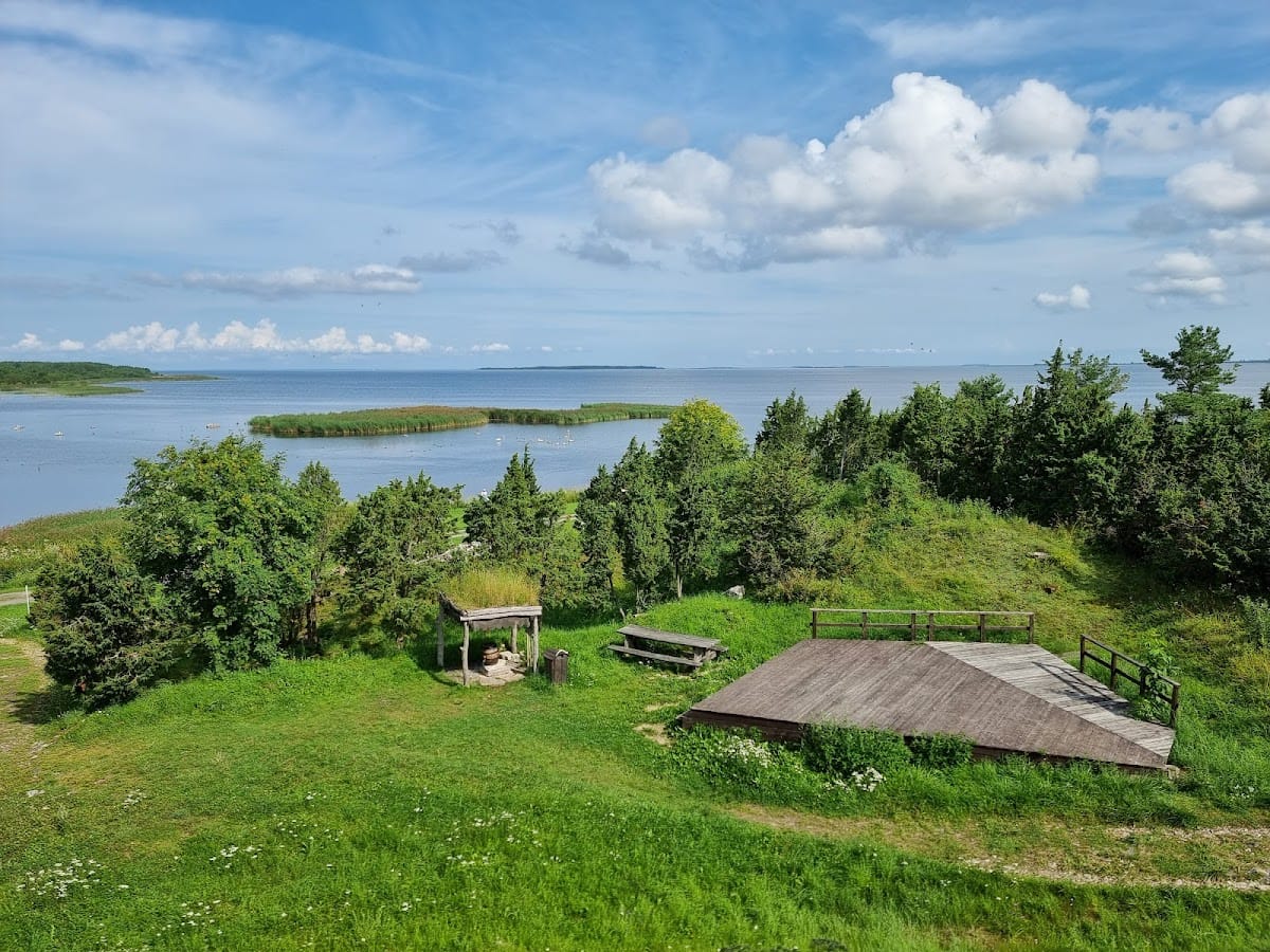
Maasilinna was a compact mixed-type fortress, combining a small courtyard-based convent arrangement with a castellated castle. Its principal building stood within an irregular quadrilateral circuit wall. The fortress occupied the corner of a silted inlet beside the Väike Väin Strait, where the Maasijõgi once entered the strait. A small settlement and harbour developed near it. The strait is now crossed by a causeway, and its water is much shallower than during the medieval period.
Main castle building
Older castellated core
The east-west main building measured approximately 46.9 to 47 metres in length and 12 to 13 metres in width. Its older western section was about 20.8 metres long and included two piers. This part formed a castellated building with corner towers and an elongated heated residential tower, or kemenaat, measuring about 12.2 by 20.8 metres. A kemenaat was a heated living section of a medieval fortified building.
The entrance and heating installations were placed in the south wall. The residential tower contained a hypocaust, an underfloor or wall-based system that circulated hot air from a furnace, together with a large hooded mantle chimney. Its first floor held three vaulted reception rooms, while the ground floor and attic served economic and defensive purposes. The older building was probably three storeys high, with stairways against the outer wall connecting the floors.
Later extension and surviving rooms
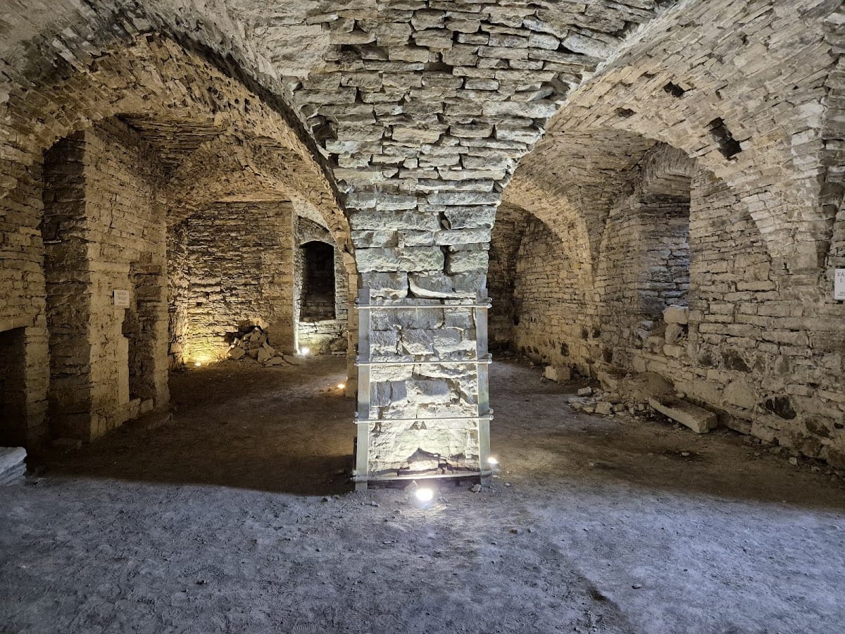
A later building stage added an approximately 26.1-metre-long, two-room extension of similar width. The extension’s walls were about 2.7 to 3 metres thick, compared with 2.1 to 2.3 metres in the older section. Both parts were originally three storeys high. Each cellar room had a central pillar and a heating installation in its southern wall.
The 1576 explosion destroyed the upper part of the residential building, probably after a charge was placed on the third floor. The collapse reached the vaulted supports of the second floor, while fallen masonry protected the lower levels. The entire vaulted ground floor, much of the walls, parts of the first-floor interior, and fragments of the second floor survive. Approximately 7.5 to 8 metres of the building remains.
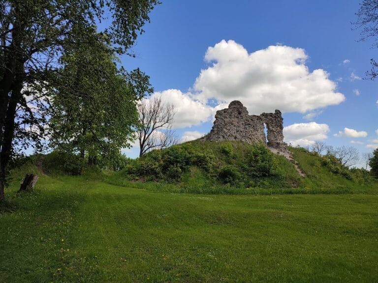
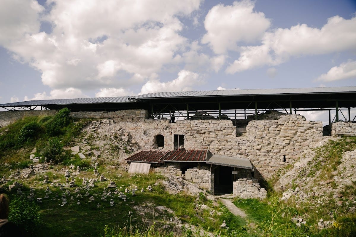
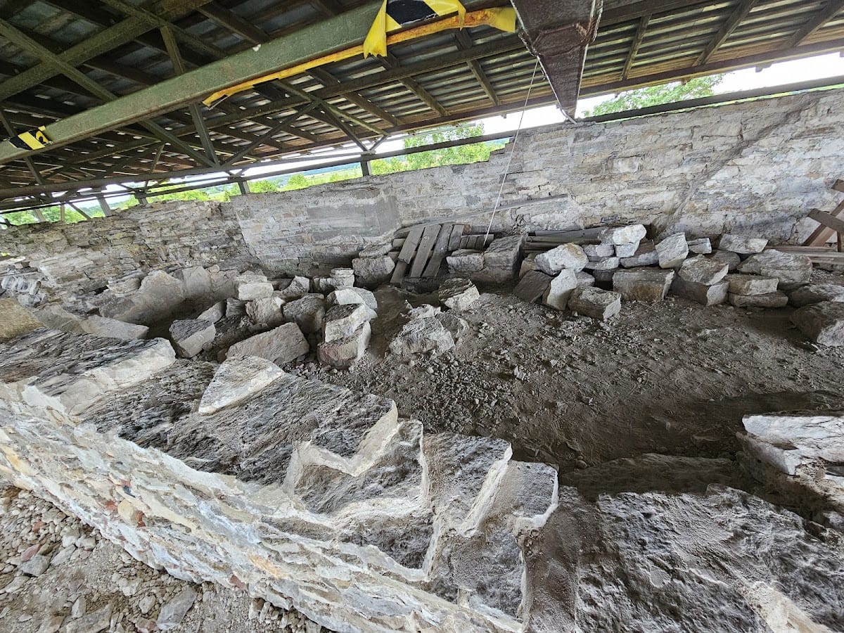
Conservation work exposed and cleaned the cellar, revealed structural walls, opened a doorway, and covered the surviving section with a roof. The northeastern room on the second floor retained temporary wooden supports that later shifted, leaving its vaulting unstable. Partial collapse and major masonry cracks followed. A doorway in the lower part of the older building also remained temporarily supported. The ruins include an entrance, stairways, vaulted spaces, the cellar, and parts of the first and second floors.
Enclosure and outer defences
Circuit wall and courtyard buildings
The original castle was enclosed by a circuit wall measuring approximately 53 by 41 metres. A circuit wall is a continuous defensive wall surrounding a fortified site. Its gate was probably on the western side, while the later enlarged enclosure had its entrance elsewhere. Additional buildings were constructed against the northwestern, northeastern, and southeastern sides.
After the circuit wall was completed, a corner tower measuring about 21 by 13 metres was enlarged. The two-room wing extending eastward from its western side and the later south wing completed the surviving main-building complex. In the early sixteenth century, the fortress acquired an irregular outer ward, an external fortified enclosure around the principal castle. Part of this outer fortification was probably built around 1518 under Vogt Tonys Ubelacker. As the larger enclosure developed, the earlier castellated tower became part of a central three-part main building.
Bastions and moat
The latest additions probably date from the middle of the sixteenth century. Renaissance-style carved stone and decorative elements were found nearby. Before and during the Livonian War, the walls were heightened and strengthened. Lime used in the rebuilding may have arrived by ship, mainly from Hiiumaa, because local lime kilns could not meet the demand.
The enlarged enceinte included two artillery towers, or bastions, probably positioned on the more vulnerable southern side. Bastions are projecting fortifications designed to let firearms cover adjoining walls. These structures had open-topped forms adapted for guns, and economic buildings stood within the walls. A moat surrounded the castle and connected with three large fishponds south of the fortress.
The surviving defensive landscape includes the circuit wall, towers, outer ward, earthworks, moat, and associated fishponds. Most external walls and towers have disappeared, while other sections are covered by the ruin mound. The northwestern, seaward wall survives near the road at about two metres high. On the northeastern side, the wall or bank rises approximately 5 to 6 metres above the bottom of the moat.
Surviving towers and finds
One bastion remains remarkably intact apart from limited natural deterioration. The northeastern tower survived sufficiently to serve as a maritime warning mark for centuries, and it was last shown on a map of the Muhu Strait in 1804. Its later removal is traditionally associated with inhabitants of Muhu. A late-eighteenth-century border-guard service may also have used the tower to monitor smuggling.
Large quantities of stone were probably quarried from the walls and tower ruins between 1894 and 1896 for the Väike Väin causeway and Maasi Manor, contributing to the loss of the remains. Sculptures of Adam and Eve found among the ruins are displayed in the Saaremaa Museum exhibition at Kuressaare Castle.