Luponiai Hillfort: A Medieval Defensive Site in Lithuania
Site at a Glance
- Rating
- 4.3
- Popularity
- Very Low
- Country
- Lithuania
- Primary era
- Medieval
- External website
- Open
- Eras represented
- Medieval
- Civilizations
- Grand Duchy of Lithuania
- Site type
- Military
- Remains
- Castle
On this page9 sections
History
Luponiai hillfort is a fortified elevated settlement site in Lithuania, near Kužiai, tentatively identified as one of the castles of the medieval Šiauliai land that existed before the fourteenth century. Its wooden castle may have provided refuge for local inhabitants during internal conflicts and wars with the Teutonic Knights, a medieval military-religious order that controlled territory in the eastern Baltic and fought the region’s pagan and Christian states. Historians regard it as one of the principal castles in northern Lithuania’s defensive system against that order.
Medieval Castle and Local Traditions
The hillfort is also known as Perkūnkalnis, Perkūno kalnas, and Raganų kalnas. Its historical identity remains tentative, but the settlement around it preserves evidence of substantial occupation. Local tradition connects the hill with a sunken church. A hole at the end of the rampart was said to allow stones to be dropped into the hill, and one child reportedly lowered through it saw a church, a priest, and kneeling worshippers. A fragment of a church bell was also reportedly ploughed up on the hill.
Other traditions concern stones near the site. Local residents said that a stone bearing a devil’s footprint was broken up before the war, while a cup-marked stone from a nearby homestead later disappeared.
Archaeological Investigation
Luponiai hillfort entered archaeological literature in the late nineteenth century. The archaeologist Liudvikas Kšivickis surveyed it in 1900 and 1901, and the Institute of Lithuanian History carried out another survey in 1968. In 1997, an expedition from the institute led by archaeologist Romas Jarockis investigated part of the settlement at the foot of the hillfort.
The 1997 work revealed a substantial settlement layer and recovered traces of a burned building, animal bones, pottery, and small tools and fittings. The investigation helped establish that occupation extended around the hillfort, rather than being confined to its summit.
Remains
Hillfort and Defensive Earthworks
Summit Plateau and Rampart
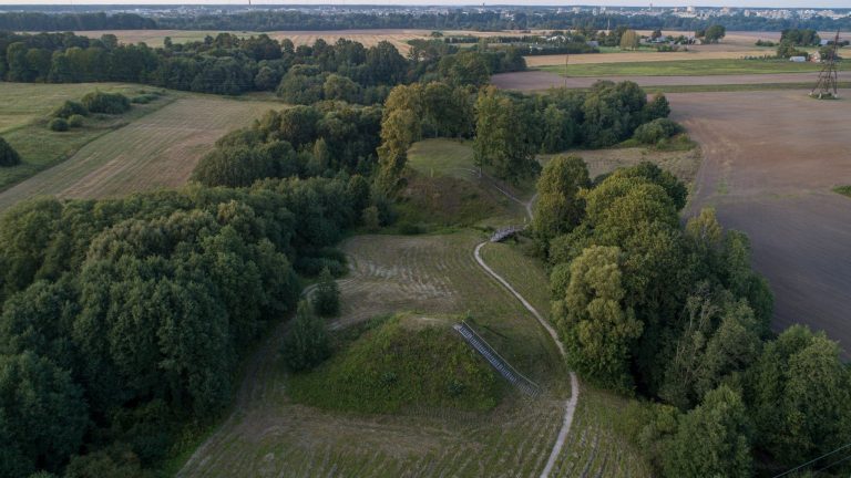
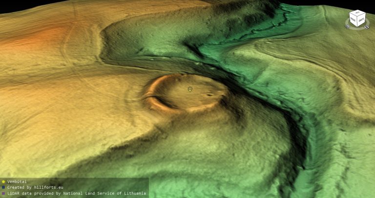
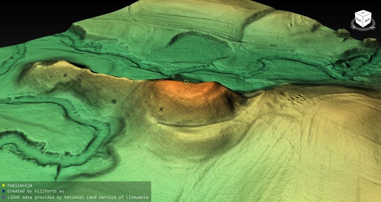
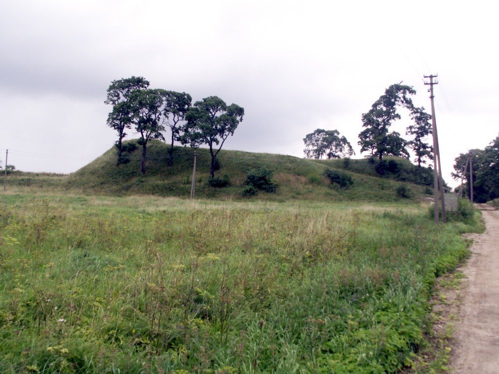
The hillfort occupies an isolated hill. Its northeastern, southeastern, and southwestern slopes are steep and rise 8 to 9 metres, while the lower northwestern side meets a terrace about 30 by 35 metres in area and roughly 4 metres high. The oval summit plateau runs from southeast to northwest and measures 45 by 33 metres. It was formerly ploughed.
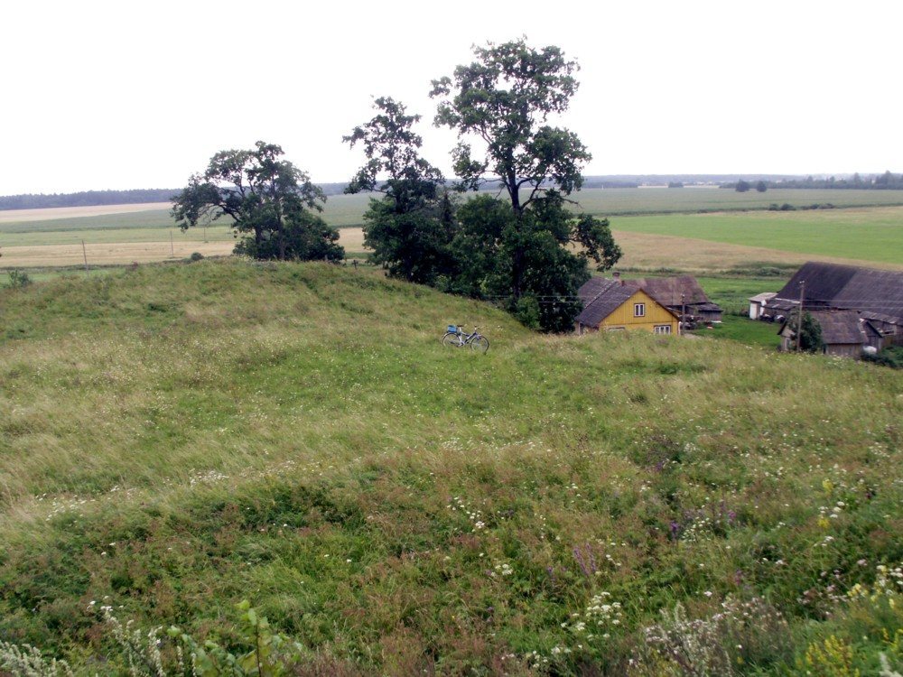
A severely damaged rampart extends for 22 metres along the northwestern edge of the summit and rises 3 metres. Trenches cut into the earthworks during wartime damaged the ramparts, while a topographic tower was later erected on the hill. A survey benchmark was installed in the northwestern rampart, and a levelled quadrangular area for outdoor gatherings was created at its base on the side facing the summit. The hillfort is now covered by grassland, with several maple trees growing on its slopes.
Forework and Terraces
A forework, a secondary fortified area below the main enclosure, lies on the northwestern slope, 4 metres below the summit. Its triangular platform follows the same southeast to northwest orientation and measures 30 by 35 metres. The forework’s slopes are moderately steep and 4 to 5 metres high.
On the southwestern slope, 2 metres below the summit, a terrace 5 metres wide has an outer slope 2 metres high. The forework was damaged when a road was built across it, and construction of a homestead cut away its western corner. Grassland covers the forework, while shrubs grow on its slopes. The road leading toward the summit also deformed the southwestern slope and may have followed a route dating from the period when the castle stood there.
Settlement and Archaeological Deposits
A settlement occupies about 3 hectares at the southeastern and eastern foot of the hillfort. Its cultural layer, an archaeological deposit containing traces of past occupation, reaches 50 centimetres in thickness and dates from the tenth to the thirteenth centuries. Roughly surfaced handmade pottery suggests that settlement may have begun earlier.
In 1997, archaeologists opened twelve test pits measuring 1 by 1 metre and a separate excavated area of 9 square metres, investigating 21 square metres altogether. An intensive and continuous layer containing abundant charcoal and fragments of clay daub survives 40 to 50 metres from the hillfort in all directions, including beside the village cemetery. In most places, it lies beneath a 30 to 40 centimetre deposit associated with the nineteenth- and twentieth-century village of Luponiai.
The settlement produced remains of a burned building, numerous animal bones, an iron socketed spearhead, an iron awl, and a stone whetstone. Other finds included a blank for a bone handle, a bronze ferrule from a wooden handle, and wheel-thrown pottery decorated with wavy lines. Handmade rough-surfaced pottery and further wheel-thrown pottery were also found in fields southeast and south of the hillfort.
Surrounding Landscape
Two homesteads stand north of the hillfort, and another lies to the southwest beside a path and an ancient cemetery. Southeast of the hillfort, beyond the village street on the remaining part of the hill, are an ancient cemetery and a village cemetery. The regulated Luponė stream flows farther southwest.