Lu Brandali Nuragic Complex: A Bronze Age Settlement in Sardinia
Site at a Glance
- Popularity
- Medium
- Country
- Italy
- Primary era
- Bronze Age
- Eras represented
- Bronze Age, Early Modern
- Civilizations
- Nuragic
- Site type
- Military
- Remains
- Fort
On this page14 sections
History
The Lu Brandali nuragic complex is an ancient fortified settlement at Santa Reparata, in Santa Teresa Gallura, Sardinia, Italy. Associated with the Nuragic civilization, Sardinia’s Bronze Age culture, it was occupied from the fourteenth to the tenth century BCE, spanning the Late Bronze Age and the beginning of the Final Bronze Age.
Nuragic community
The community’s economy combined small-scale cereal cultivation with livestock keeping, dairying and fishing. Enclosures for animals stood beside the village, while objects and food remains found there reflect these activities.
A collective tomb formed part of the settlement during its Nuragic-period use. Burial took place in stages, with some earlier remains moved within the chamber to make space for further interments.
Later reuse and investigation
During the Second World War, the remains of the central tower were adapted for use as a lookout. Agriculture continued around the tomb until the early 1960s, and plowing disturbed part of its forecourt.
A survey took place in 1967, followed by excavations at the tomb in the early 1980s. The excavations revealed burials and associated archaeological material.
Remains
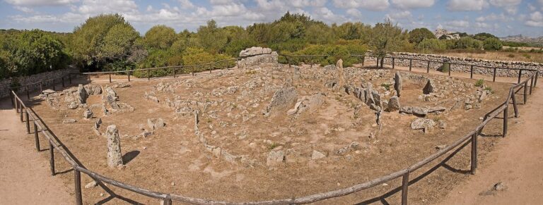
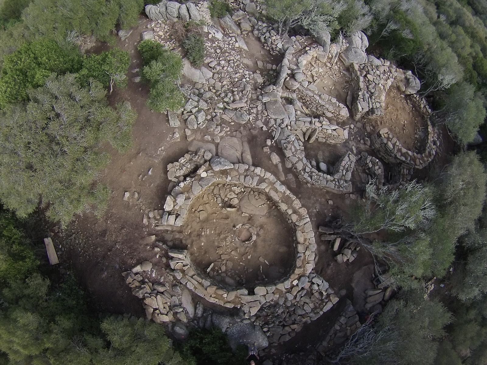
The complex covers about 30,000 square metres and includes a fortified centre, a settlement, a tomb of the giants (a collective prehistoric funerary monument in Sardinia), rock shelters and graves in natural cavities. Its buildings make use of a granite landscape, incorporating outcrops into walls and structures.
Nuraghe and defensive enclosure
Main tower and enclosure
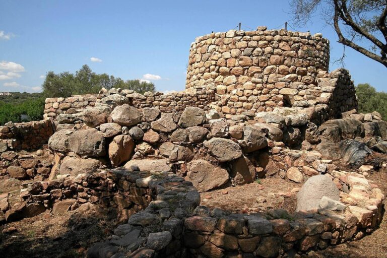
The fortified centre occupies a rounded granite rise. Its nuraghe, a prehistoric stone tower or fortified complex, is classed as a protonuraghe, an early form that combines corridors with a circular chamber whose stone courses project inward. The main tower stands at the summit. From the natural terrace, the sea lies to the west and south, while the inland plain extends to the east.
A defensive wall with several towers follows broad granite outcrops, and its monumental entrance is on the northwestern side. In places, raised rock forms the base for watchtowers. Collapse obscures the arrangement of spaces inside the enclosure, though surviving wall sections indicate that its defensive structures followed the rock in staggered levels. Rubble on the southern slope covers a possible stairway or rising ramp, whose course is uncertain. Heavy masonry on the lower western side points to another tower, now almost entirely collapsed.
Southern tower
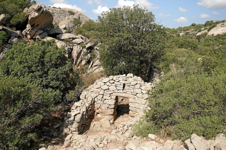
A second tower south of the main one was refitted in the post-medieval period, with new inner and outer facings that turned it into a partly underground chamber. Its reddish walls and the condition of the clay mortar indicate prolonged heat exposure. Together with the quantity of limestone found over the area, these features point to its reuse as a lime kiln.
Village and rock shelters
Huts and layout
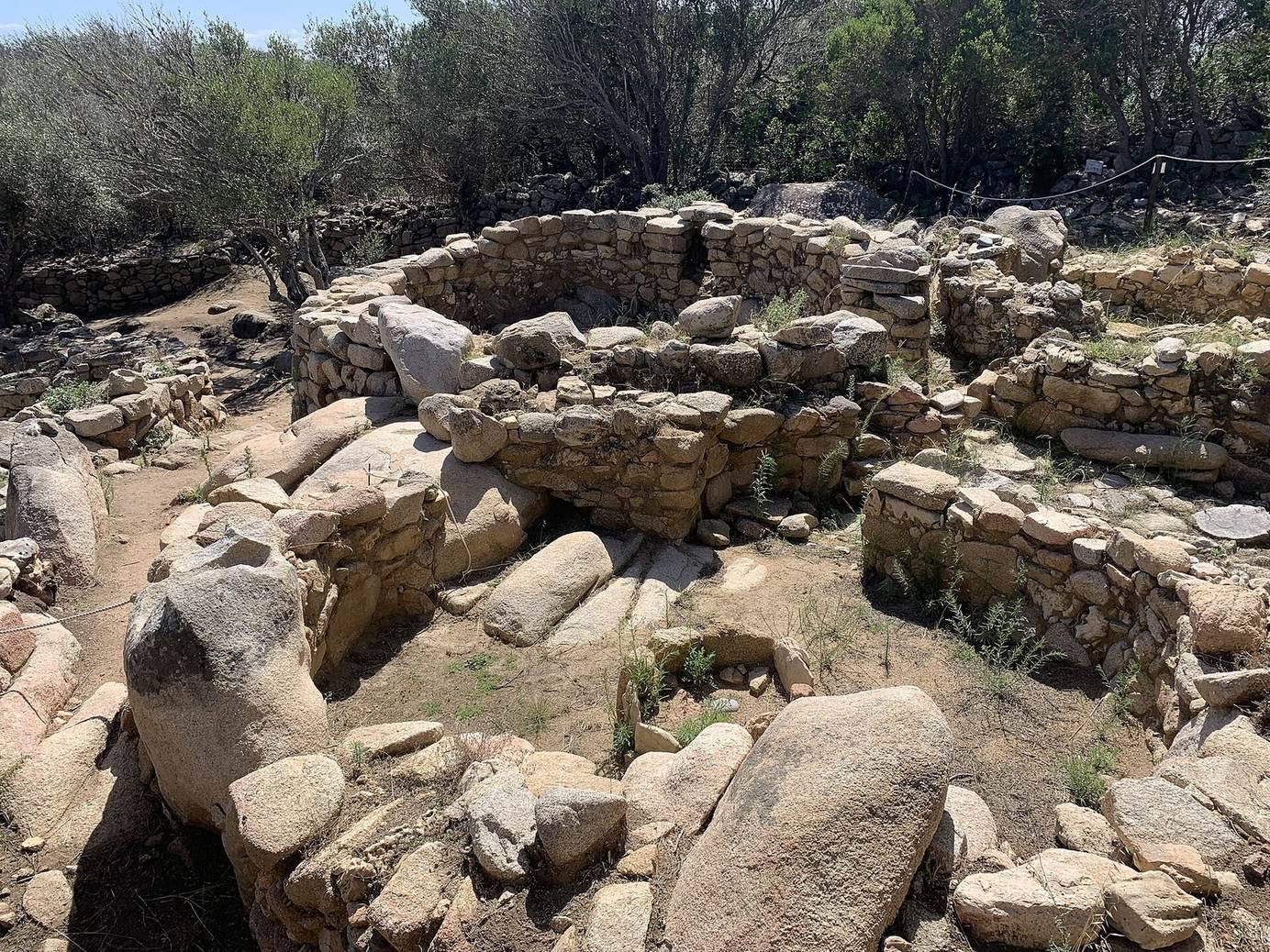
The village lay beyond the defensive wall, on slopes and flatter ground to the east and south. A 1967 survey recorded at least 36 huts. Most were circular, and masonry huts spread across the sunnier eastern and southern slopes. Another circular structure stands at the far southern end of the complex.
The huts formed irregular clusters, sometimes joined and sometimes divided by narrow, occasionally dead-end passages. Their shapes adapted to the terrain. Builders used two-faced stone walls bonded with earth mortar, setting them against and around natural rock. Squared cuts in some outcrops mark places where blocks were detached; loose stones of different sizes also came from the immediate area. Floors combined packed earth with exposed bedrock.
Overlapping walls show that rooms were reshaped and their internal spaces redistributed over time. Some smaller rooms may have served as household work areas, and one contains traces of pottery making. Larger rooms were accompanied by smaller spaces with separate uses.
Domestic activity and food remains
Finds from the settlement include large containers for storing food, obsidian pieces from sickles, and vessels used to process milk into cheese. Cooking equipment included flat plates, sometimes impressed to mark bread, pans in several sizes, boiling pots with broad handles and opposing grips, large bowls, fire pots and perforated supports for meat spits.
Small rubbish pits outside individual huts contained bones from cattle, sheep or goats, and birds. Shellfish remains, mainly limpets, occurred alongside fish bones. Identified fish include black and comber wrasses, moray eel, gilthead seabream and dentex. A vertebra from a mackerel-family fish, identified as a small tuna or a related type, had five growth rings and was judged to indicate that the fish died after winter. Other finds include a vertebra from a beaked whale and a boar tusk that formed part of a Mycenaean boar-tusk helmet, made from overlapping pieces of tusk.
Tafoni and rock shelters
The survey recorded 18 tafoni, cavities formed by weathering in granite. On the steep western and southwestern slopes, these cavities and fissures in the rock served as shelters or dwellings. Smaller cavities were used as graves.
Tomb of the giants
Forecourt and outer structure
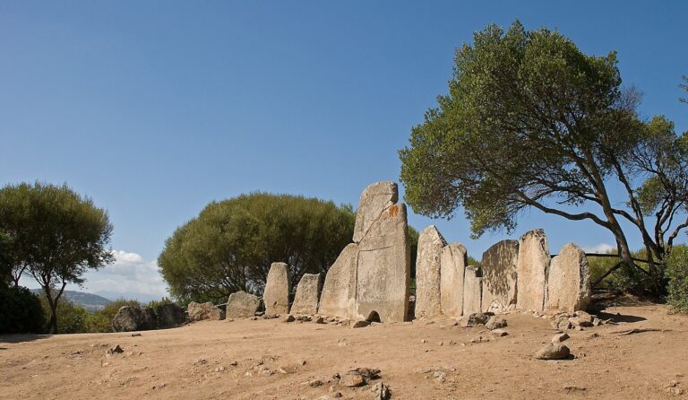
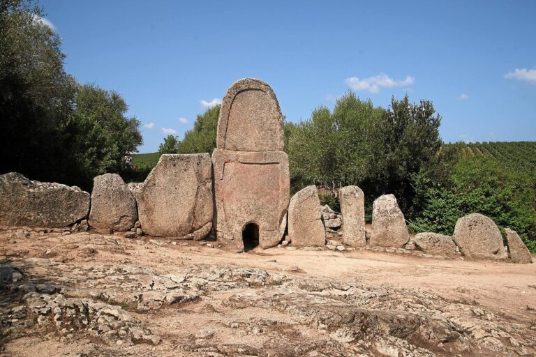
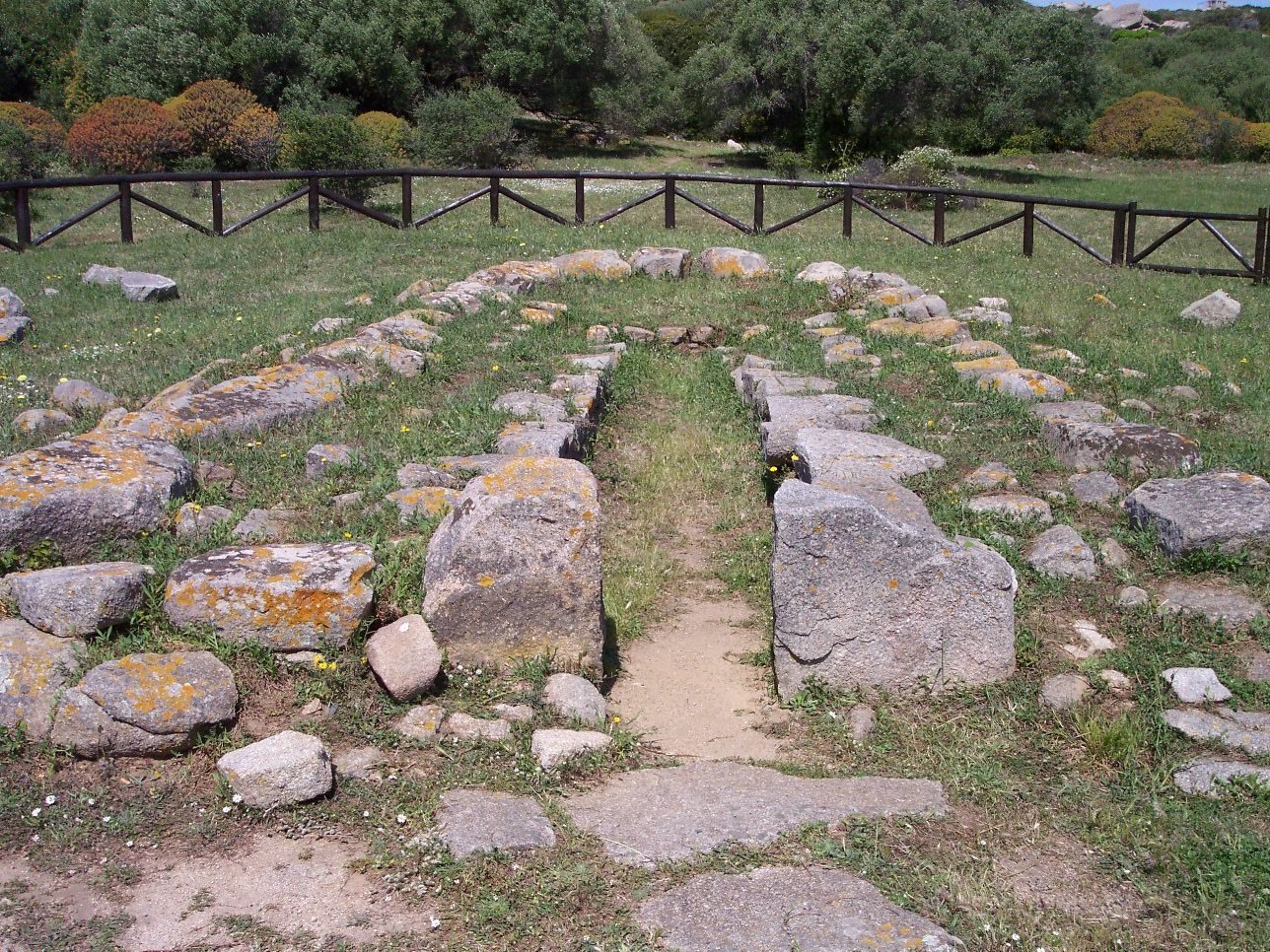
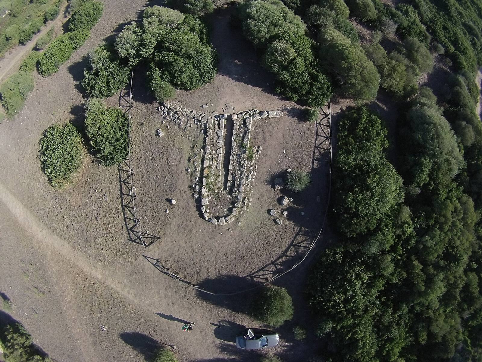
The ruined tomb stands in the southeastern part of the complex. Its surviving form identifies it as a megalithic monument. The exedra, the open forecourt before the burial chamber, has a basal course remaining on its right wing. This masonry suggests that the façade and wings were built in stonework rather than with large upright slabs. The base may have supported a bench.
Three flat slabs pave the forecourt immediately before the entrance; smaller stones form a rougher surface elsewhere. Lentisk roots and plowing have disturbed parts of the paving. Around the tomb, a foundation course of large squared blocks marks the outer perimeter. Reconstructions of the masonry above it use large polygonal granite blocks, but that form remains uncertain. Stones arranged around the structure may have supported its upper part. An earthen mound is considered unlikely, and the exterior may instead have remained visible.
Entrance, chamber and burials
The entrance faces southeast and is framed by two unequal jambs. A lintel probably rested across them; an elongated block lying to the left of the tomb may have served this purpose. The trapezoidal burial chamber measures 6.10 metres long, with widths of 1.10 and 0.85 metres. Its surviving walls rise for two courses and use squared blocks in two-faced masonry.
Excavation revealed bodies buried intact across the chamber, with bones still connected in anatomical order. The remains represent about fifty people, making the tomb a rare example of primary burial in a tomb of the giants. At the chamber’s rear, a disordered pile of bones, some still connected, shows that earlier remains were shifted during the tomb’s Nuragic use to make room for later burials.
Grave goods were modest and included a few amber beads, a pendant, a bronze ring and other bronze fragments. Pottery pieces lay among the bones at the rear. Three bowls with angular shoulders, found beside the entrance jambs, may have held food offerings. Numerous pottery fragments from the forecourt may relate to funerary rites; their scattered arrangement suggests that vessels were broken after use.