Libarna Archaeological Area: A Roman City and Commercial Centre in Italy


Site at a Glance
- Rating
- 4.4
- Popularity
- Low
- Country
- Italy
- Primary era
- Classical
- External website
- Open
- Eras represented
- Classical
- Civilizations
- Roman
- Site type
- City
On this page17 sections
History
Libarna Archaeological Area in Italy preserves part of a Roman city at Serravalle Scrivia, founded as a colony in the mid-second century BC along the Via Postumia. The settlement developed from a pre-Roman landscape associated with the Liguri Dectunini and became a prosperous urban and commercial centre during the imperial period, especially in the first and second centuries AD.
Pre-Roman settlement and Roman foundation
The Liguri were an ancient population of northwestern Italy, and the Dectunini were a Ligurian group associated with Libarna before Roman colonization. Activity on the surrounding hills belongs particularly to the sixth and fifth centuries BC, while people had already frequented the wider area during the Neolithic, in the fourth to third millennia BC. Livy states that fifteen settlements surrendered to the Roman consul Quintus Minucius Rufus in 191 BC, and Libarna may have been among them.
The Via Postumia, opened in 148 BC between Genua on the Ligurian coast and Aquileia in northeastern Italy, passed through the settlement and encouraged its expansion. Libarna was probably established as a Roman colony in the middle of the second century BC, perhaps with Roman army veterans settled among the local population. Rome granted the inhabitants Latin citizenship in 89 BC, a legal status that provided certain civic rights without initially conferring the full rights of Roman citizenship. The city later became a Roman colony, probably during the first century AD.
Urban prosperity and regional administration
Libarna reached its greatest economic and social prosperity during the imperial period. It was an autonomous capital governing a broad territory between Velleia to the east, Genua to the south, Aquae Statiellae to the west, and Dertona to the north. Its economy drew on viticulture, timber cultivation, cattle breeding, pottery, brickmaking, agriculture, and commerce. The Via Postumia brought traders and other transient people through the city, encouraging contact between Roman and indigenous Gallic communities.
Artefacts and urban remains show that Roman customs were adopted selectively alongside local practices. This interaction is also reflected in a small marble statue from the second half of the first century AD. It depicts a reclining man on a dining couch, combining a Gallic-style moustache with Roman and Etruscan dining imagery. The figure has been interpreted either as a Roman adopting Gallic fashion or as a Gaul adopting Roman practices.
Religious life included devotion to Jupiter, Diana, and Hercules. Votive inscriptions also attest the imperial cult, the group of religious practices honouring the Roman emperor and imperial household. The city’s religious buildings remain uncertain in their identification, but these inscriptions demonstrate that traditional Roman worship and imperial observance formed part of Libarna’s civic life.
Decline, abandonment, and rediscovery
During late antiquity, the period covering the later Roman and early post-Roman centuries, Libarna declined as the Via Postumia lost importance and barbarian invasions affected the region. The city was progressively abandoned during the fourth and fifth centuries. In 452, its inhabitants moved to existing or newly established communities, including Precipiano, Serravalle, Arquata, and Novi Ligure. The fortified settlements of Serravalle and Arquata offered better-defended locations and helped draw population away from the ancient city.
Libarna continued to appear in documents connected with the monastery of Precipiano and in the Varinella land register of 1544. Its location was later forgotten or disputed, and from the eighteenth century the ancient city was mistakenly identified with several places in the Bobbiese and Tortonese areas.
The site was rediscovered by accident when ancient remains emerged during construction of the Strada Regia dei Giovi between 1820 and 1823. Further discoveries followed the construction of the Turin to Genoa railway in 1850 to 1852 and the Genoa to Milan railway in 1911 to 1912. The antiquarian Giuseppe Antonio Bottazzi helped establish Libarna’s historical and topographical identification during the nineteenth century.
Excavation and archaeological research
Excavations and rescue investigations continued as modern development exposed additional parts of the ancient city. Silvana Finocchi investigated two city blocks during the 1970s and 1980s, excavating them to the beginning of the imperial period while preserving earlier settlement phases below. Her records and artefact collection became an important basis for later research.
Beginning in 2015, the Libarna Urban Landscapes Project, associated with Boise State University, combined earlier excavation records, maps, and artefacts with new geophysical research. Three survey seasons between 2016 and 2018 used ground-penetrating radar, which detects buried structures through reflected radio waves, electrical-resistivity survey, which maps differences in underground resistance, and drone reconnaissance. The work confirmed some excavated structures, clarified the position of others, and added nearly eight hectares of information about the ancient city without immediate excavation.
The project identified an apparent public building that may be a macellum, a purpose-built marketplace, potentially the first building of this type identified in Piedmont. It also corrected the previously uncertain location of the forum basilica. Drone evidence places the basilica north of the forum beside what was probably one of two temples, rather than south of the forum. The research further examined cultural and economic change under Roman rule through new investigation of the site and earlier finds.
The Italian state owns the archaeological area, which is preserved as an archaeological park under the state heritage superintendency. Artefacts from Libarna are preserved or displayed in the museum section of the municipal building in Serravalle Scrivia, the Museo di Antichità in Turin, and the Museo di Archeologia Ligure in Genoa.
Remains
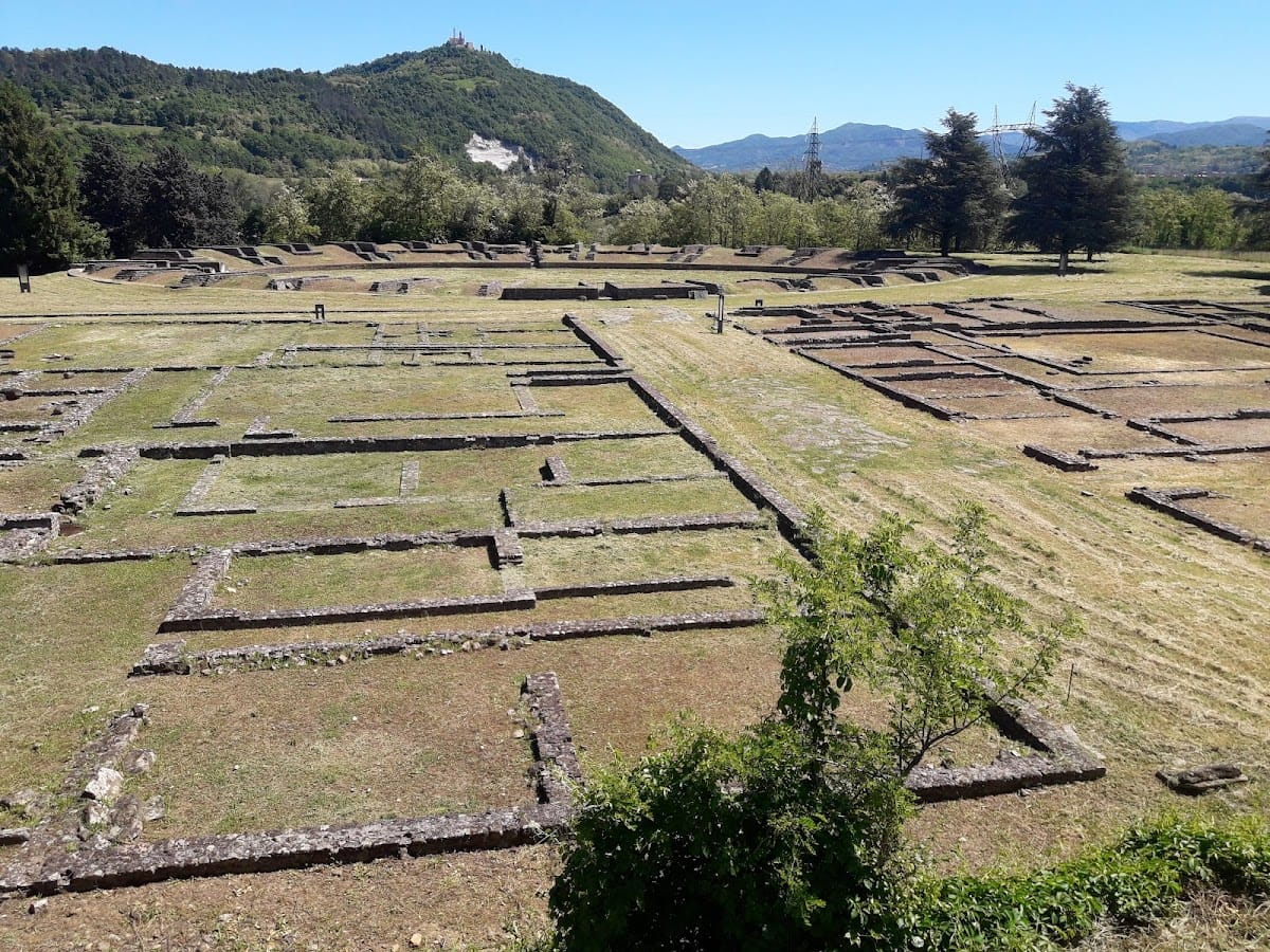
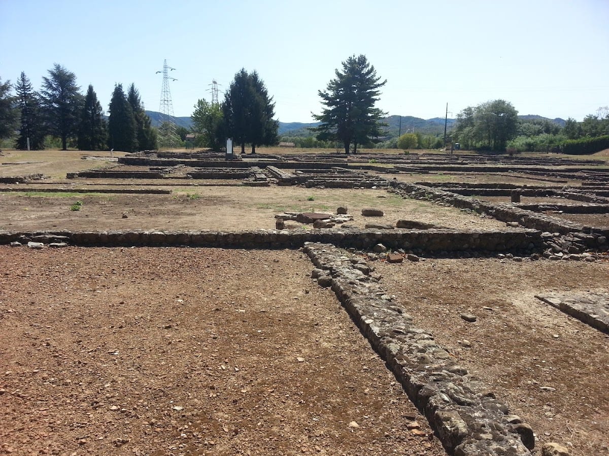
Libarna occupied flat, fertile land on the left bank of the Scrivia, in a water-rich area surrounded by hills. The excavated archaeological area covers approximately 54,000 square metres, about one-tenth of the estimated ancient city. The surviving layout combines a regular street grid, public buildings, residential blocks, entertainment venues, and bathing facilities. Archaeological surveys and aerial photography have revealed further buried roads, walls, paved surfaces, column bases, individual paving stones, internal divisions, and crop marks produced by structures below the soil. Some remains lie more than one metre beneath the present ground level.
Streets and civic centre
Urban roads
Libarna followed an orthogonal plan in which straight paved streets divided the city into blocks of varying sizes. The Via Postumia crossed the settlement from northwest to southeast and formed its principal axis. A decumanus, a major Roman city road conventionally aligned roughly east to west, crossed it at right angles and led towards the amphitheatre. Drainage channels or collectors carried water towards the Rio della Pieve. An aqueduct supplied the city, while springs, wells, and fountains provided additional water.
Forum and basilica
The forum stood where the two principal roads intersected. This public square had a broad paved surface, porticoes, and other buildings, and has been explored only in part. Its basilica, a large public building probably used for law courts and civic business, lay north of the forum beside what was probably one of two temples. Geophysical and aerial surveys helped establish this position and connected the visible remains with structures still below ground.
Residential blocks
Two excavated residential blocks, or insulae, stand near the amphitheatre. Each measured approximately 60 by 65 metres. Their houses were first built from the end of the first century BC and were altered during later centuries. Rooms were arranged around central courtyards or gardens, sometimes enclosed by a portico, a covered walkway supported by columns.
The buildings included modest dwellings and more elaborate residences within the same urban area. Small rooms opening onto the streets may have served as rented shops. Some larger houses had marble-slab floors and mosaic pavements, including a major mosaic showing the myth of Lycurgus and Ambrosia. A house near the amphitheatre also yielded Roman surgical implements, including a copper-alloy handle for a scalpel blade. The assemblage may indicate that the house belonged to a doctor, although that interpretation remains uncertain.
Entertainment and bathing buildings
Amphitheatre
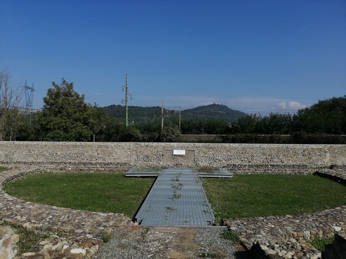
The amphitheatre was probably constructed during the second century AD. This oval venue for public spectacles could accommodate approximately 7,000 spectators. Its construction substantially altered one residential block, where shops and an inn were opened. Walls around the building helped control crowds and protect nearby houses, while three structures along one side may have been shops selling food, drinks, and alcohol.
Theatre
The theatre was probably built during the first century AD and could hold approximately 3,800 spectators. Its surviving elements include the orchestra, the space between the audience and the stage, the stage itself, and part of the cavea, the banked seating area. The theatre stood near the amphitheatre and bath complex as part of Libarna’s group of public buildings.
Bath complex
A bath complex near the theatre and amphitheatre contained hot, cold, and tepid bathing rooms. The tepid bath was probably the largest space and was comparable in scale and function to a modern swimming pool. The priest Gianfrancesco Capurro excavated the complex in the mid-nineteenth century. Later geophysical survey reassessed the remains and confirmed the accuracy of the structural plan he had recorded.
Gates, inscriptions, and artefacts
Monumental entrances
Monumental gateways marked the northern and southern ends of the city. These formal entrances belonged to the city’s planned architectural framework. Their remains are considered alongside buried roads, walls, floors, and other structures revealed by archaeological survey.
Objects and inscriptions
Libarna has produced pottery, oil lamps, keys, bronze objects, marble statues, figured amber, mosaics, and everyday and specialized artefacts. Votive inscriptions name Jupiter, Diana, and Hercules and refer to the imperial cult. Together, these materials illuminate domestic activity, religious practice, craftsmanship, and cultural exchange within the Roman city.
Several important finds are preserved or displayed in Turin, Genoa, and Serravalle Scrivia. Among them is the marble dining figure with its combination of Gallic facial fashion and Roman and Etruscan imagery. The object offers a tangible example of the varied cultural identities represented in Libarna’s material remains.