Laraghirril Court Tomb: A Prehistoric Chambered Tomb in County Donegal
Site at a Glance
- Popularity
- Very Low
- Country
- Ireland
- Primary era
- Stone Age
- Eras represented
- Stone Age, Bronze Age
- Civilizations
- Unclassified
- Site type
- Burial
- Remains
- Tomb
On this page10 sections
History
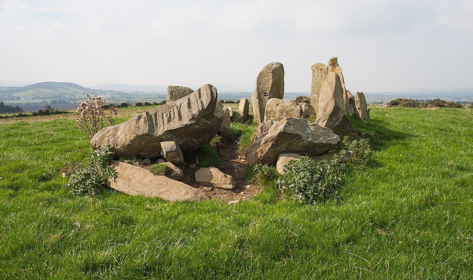
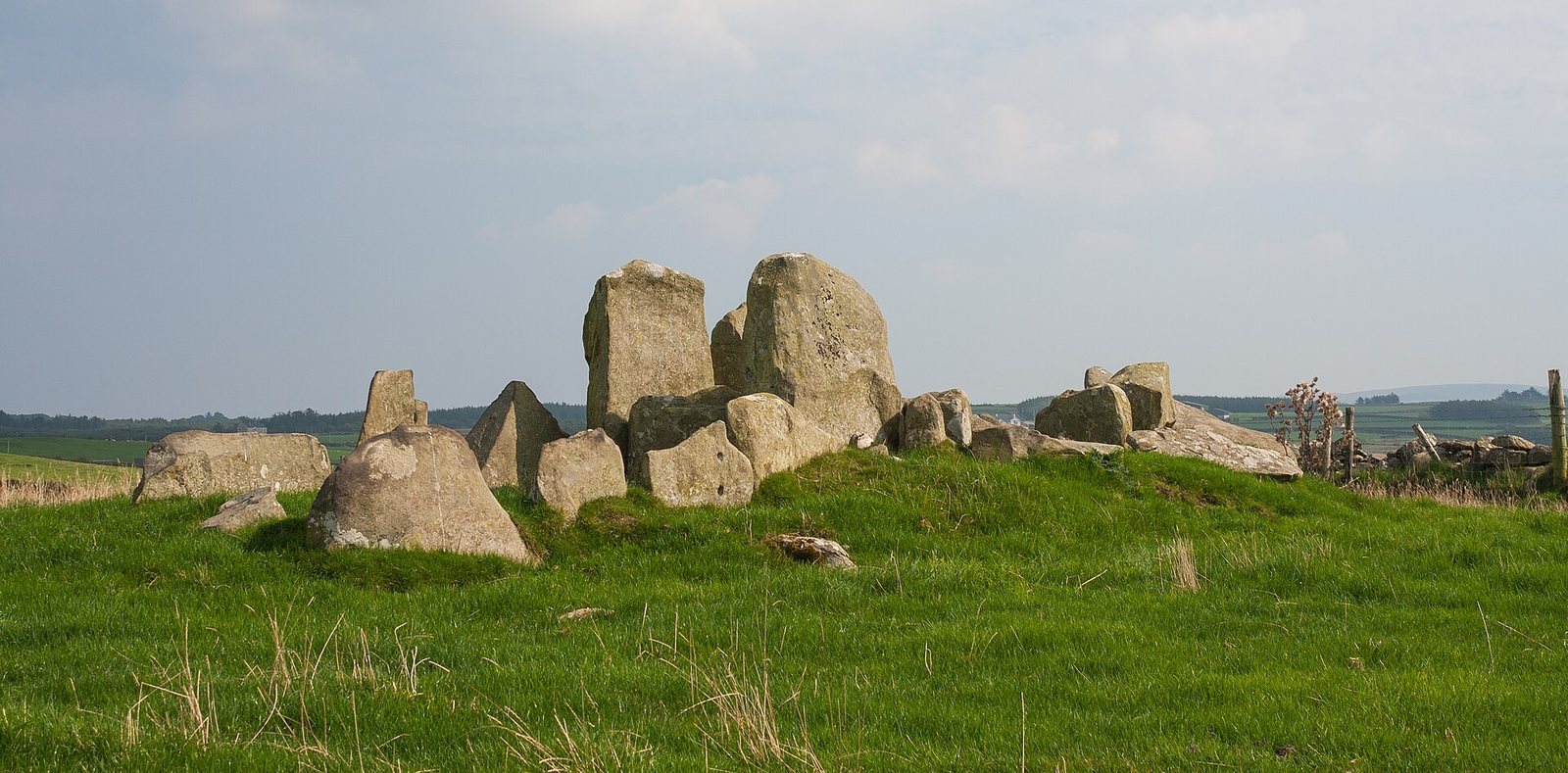
Laraghirril Court Tomb is a prehistoric chambered tomb in Laraghirril, County Donegal, Ireland. It is classified as a court tomb, a kind of megalithic chamber tomb found almost entirely in Ulster, the historic northern province now divided between Ireland and Northern Ireland. Court tombs are generally assigned to the Neolithic, the later Stone Age associated with farming, but Laraghirril’s date is uncertain. Similar excavated tombs have yielded Neolithic finds, while Laraghirril itself had not been excavated by 2014. The monument was also included in a proposed Bronze Age grouping.
Regional grouping
The proposed “Bronze Age triangle” brought Laraghirril together with the Bocan stone circle to its northwest and a prehistoric field system farther east, in the townlands of Kindroghed and Knockergrana. This grouping describes a regional interpretation rather than establishing a date for Laraghirril itself.
Local names and traditions
The name “Temple of Deen” refers to Deen, the eastern part of Laraghirril townland, and reflects an earlier belief that the tomb was a Druid temple. Druids were associated with ancient Celtic religious practice. An Ordnance Survey map from 1900 called the monument “Druid’s Altar,” a name that likewise expresses an interpretation rather than a confirmed original function.
Another local name, “the Bed of Diarmuid and Gráinne,” connects the tomb with the Fenian Cycle, a body of Irish heroic stories about Fionn mac Cumhaill and the Fianna, a band of warriors. Diarmuid and Gráinne are characters in one of its tales.
Remains
The tomb stands on a flat plateau of the Black Hill ridge in northeastern Inishowen, about 2 km south of Culdaff and southwest of the Bocan stone circle. The ridge descends toward the Culdaff River and its tributary, the Thraboy River, to the north, west, and south. The site has broad views north over Culdaff Bay and west toward the Raghtin More massif; Mass Hill, about 1 km to the northeast, limits the view in that direction.
Gallery and chambers
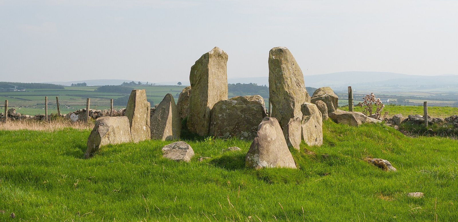
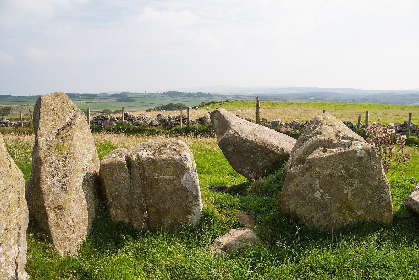
The monument is aligned southeast to northwest and contains an 8.5-metre gallery divided by a passage with two threshold stones. Two tall stones flank the passage and rise above the rest of the structure. The entrance is thought to have been on the southeastern side of the eastern chamber, where paired stones frame a passage.
Eastern chamber
The eastern chamber measures 3 m long and 2.4 m wide. Three upright stones, 1.1 to 1.55 m high, form its northern side, while two lower stones stand along the southern side.
Western chamber
The western chamber is 3.5 m long and reaches up to 2.5 m across at its middle. It narrows toward the west, a shape interpreted as indicating that it is the end chamber, and remains open to the northwest. That opening was once suggested to form a very small court, but this interpretation is now considered unlikely.
Mound and surrounding stones
Former mound
The raised ground beneath the tomb provides an estimate of the former mound’s dimensions: about 0.6 m high, 20 m long, and 6 m wide.
Stone circle
A description from 1867 placed a stone circle 64 m in diameter around the tomb.