Knowlton Circles: A Neolithic Henge Complex in Dorset
Site at a Glance
- Popularity
- Medium
- Country
- United Kingdom
- Primary era
- Stone Age
- Eras represented
- Stone Age, Bronze Age, Medieval, Early Modern
- Civilizations
- British, English
- Site type
- Religious
- Remains
- Sanctuary
On this page17 sections
History
Knowlton Circles is a complex of prehistoric enclosures and later monuments at Knowlton in Dorset, United Kingdom. Its three Neolithic henges, circular or oval enclosures with a ditch inside an outer earth bank, form part of a landscape used from prehistory through the Roman period and the Middle Ages. The concentration of burial mounds has been interpreted as evidence that Knowlton was an important religious centre.
Neolithic foundations and later prehistory
The three henges date to the Neolithic. The wider complex developed over a much longer period, with monuments and other features associated with the Bronze Age, Iron Age and Roman period. The number of burial mounds has informed interpretations of Knowlton’s religious importance, while some features have been taken to indicate that ceremonial and burial activity continued into the Iron Age and Roman period.
Early medieval and Christian use
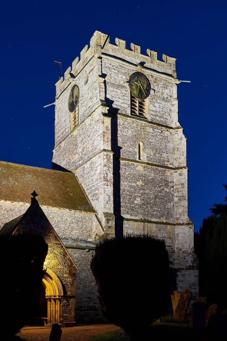
A burial ground east of Church Henge points to activity during the mid-to-late Anglo-Saxon period, the early medieval era before the Norman Conquest. It came to light in 1958. Knowlton Church, built within Church Henge, represents the transition from pre-Christian to Christian worship at the site.
Abandonment and modern study
Knowlton village was abandoned in 1485 after bubonic plague killed its inhabitants. The church was abandoned in 1747, and its roof collapsed later in the 18th century.
In the dry summer of 1995, changes in vegetation in a pea field revealed traces of buried features. Bournemouth University brought aerial photographs of the complex together in a 2001 monograph, and excavations have focused on the henges and Great Barrow. The monument group was designated a scheduled monument in 1924, a form of legal protection for places of archaeological or historic importance. The designation covers the henges, related round barrows, the Anglo-Saxon cemetery and the church ruins, which were listed Grade II* in 1955, a category for particularly important buildings below Grade I.
Remains
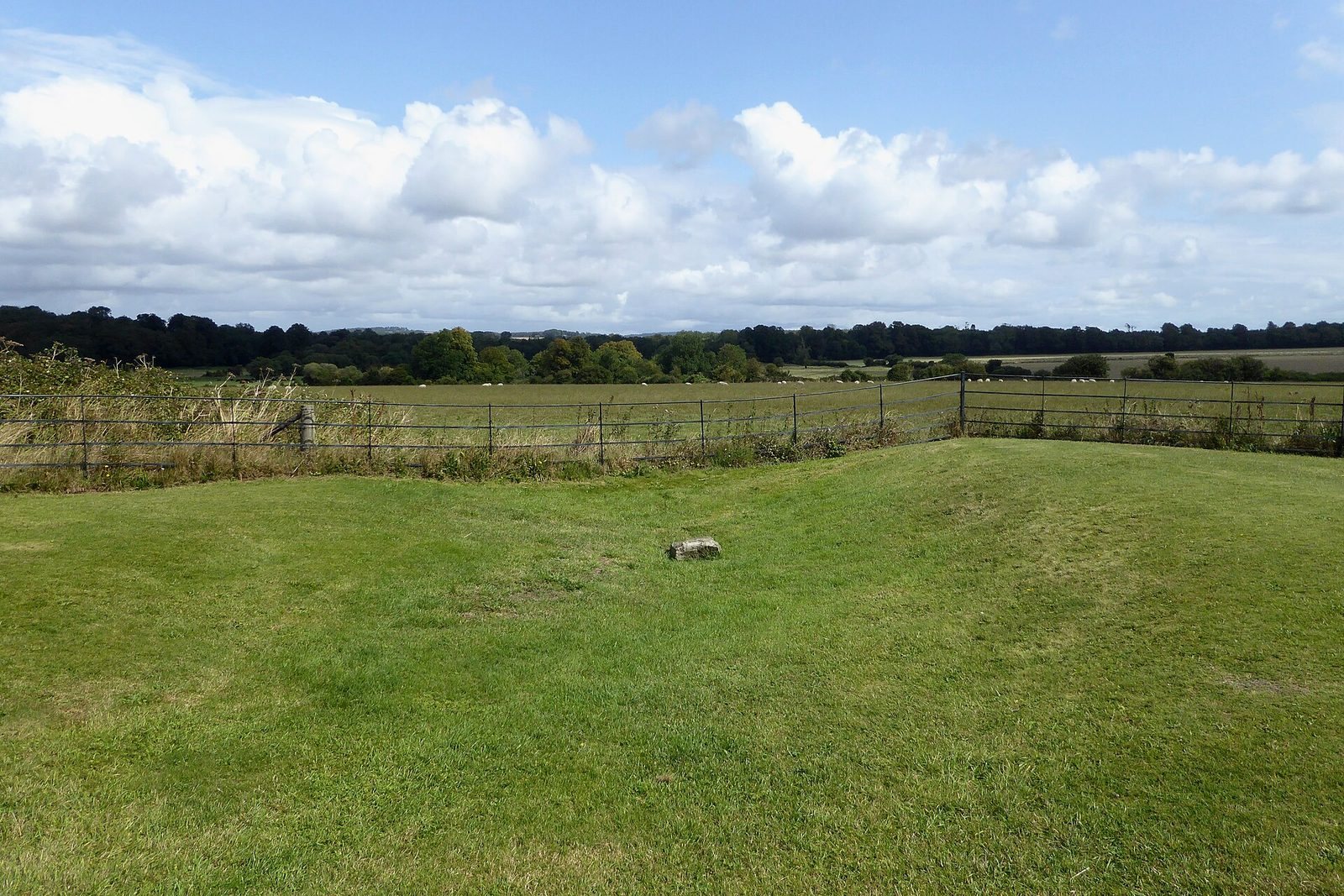
The complex comprises three henges and a fourth, differently shaped enclosure. Church Henge is the best preserved; Knowlton North lies to its northwest, while Knowlton South is the largest of the three. Old Churchyard is southwest of Knowlton North. Some earthworks remain visible, while ploughing has levelled others, whose outlines can be seen as cropmarks, changes in vegetation that reveal buried features.
Enclosures
Church Henge
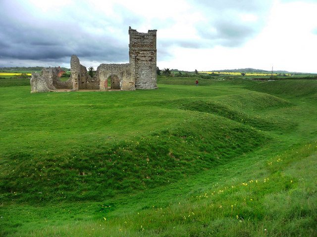
Church Henge, also called the Central Circle, is an oval enclosure about 106 by 94 metres, aligned roughly northeast to southwest. Its ditch is about 10 metres wide and up to 1 metre deep. Outside it, a bank about 10 metres wide rises to 1.75 metres. The bank follows straight stretches joined by rounded corners.
Three openings break the bank, on its southwest, east and northeast sides. The eastern gap is considered likely to be an original entrance. The western entrance was altered later, possibly after the church was built.
Knowlton North
Northwest of Church Henge, Knowlton North has been largely levelled by ploughing and is mainly visible through cropmarks. These traces suggest an elongated oval enclosure running roughly northwest to southeast, with a maximum diameter of 94 metres. A ditch and an external bank enclosed it, and a large entrance lay on its southeast side.
Knowlton South
Knowlton South measures around 250 metres across. It survives partly as an earthwork, although ploughing has damaged it and some sections show more clearly as cropmarks. The Cranborne-to-Wimborne road crosses the enclosure, and farm buildings cover part of its western side. A ditch and outer bank define the circuit, separated by a berm, a level strip between a bank and a ditch. The bank appears to consist of straight stretches linked by shorter curved sections.
On the best-preserved northwest side, the bank is about 13 metres wide and 1.2 metres high. A berm around 3.5 metres wide separates it from the ditch, which is about 15 metres across and 1.5 metres deep.
Old Churchyard
Old Churchyard is roughly square, with rounded corners, and measures about 60 metres across. A low bank and an external ditch enclose it. Ploughing has almost levelled the feature, which is now visible as a cropmark; its origin and function remain uncertain.
Church and burial remains
Knowlton Church
The church ruins stand at the centre of Church Henge. The oldest parts are the 12th-century chancel, the area around the altar, and nave, the main body of the church. Additions and alterations followed in the 15th and 18th centuries.
Anglo-Saxon cemetery
The cemetery east of Church Henge contained 16 graves cut into chalk; some were aligned east to west. The ditch around Church Henge may also have marked the boundary of a cemetery, though that burial ground could belong to a later period.
Barrows and other features
Great Barrow
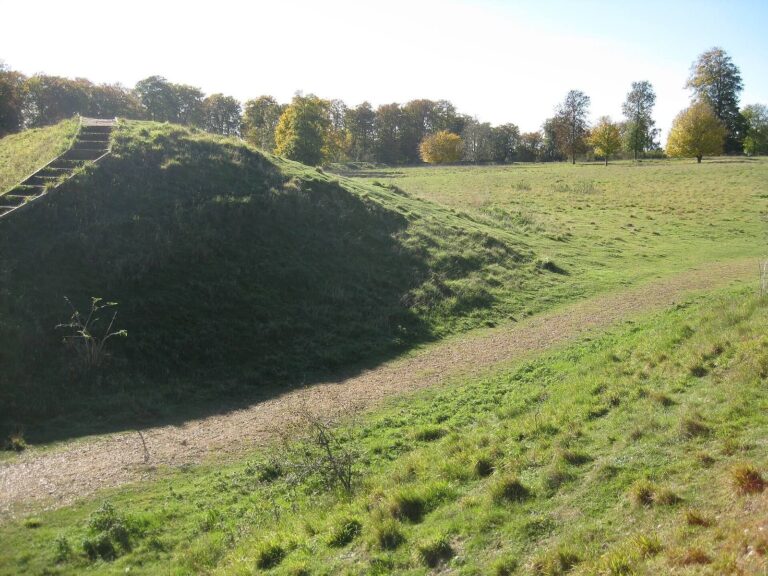
East of Church Henge, Great Barrow is a mound about 40 metres in diameter and 6 metres high, crowned by a clump of trees. It probably dates to the Late Neolithic or Early Bronze Age and is Dorset’s largest barrow. Two circular ditches surround it, both largely levelled by ploughing. A berm about 5 metres wide separates the mound from the inner ditch. The outer ditch measures 10 metres across and 1.5 metres deep, and the circle it defines is 120 metres in diameter.
Round barrow groups
At least 35 round barrows, or circular burial mounds, are known in the Knowlton Circles Barrow Group, including Great Barrow. Most are visible as cropmarks, though some can be seen southwest of Knowlton South. They occur in three clusters: south and southwest of Knowlton South, north of it and around Church Henge, and northeast of the henges. In the wider Knowlton area, aerial photographs have identified 178 barrows described as Bronze Age. They lie on a northwest-facing slope overlooking the River Allen, with concentrations at both ends of the area.
Levelled archaeological features
Aerial photographs show levelled traces that may include three burial grounds and a long barrow. Parallel ditches outline a small cursus, a long, narrow prehistoric monument marked by parallel ditches. Other features may be long barrows.