King John’s Palace: A Medieval Royal Residence in England


Site at a Glance
- Rating
- 4.3
- Popularity
- Very Low
- Country
- United Kingdom
- Primary era
- Medieval
- Eras represented
- Medieval
- Civilizations
- English
- Site type
- Domestic
- Remains
- Palace
On this page16 sections
History
King John’s Palace in England, United Kingdom, is the surviving remnant of a medieval royal residence established by the English monarchy at Kings Clipstone in Nottinghamshire. The main building phase took place between 1176 and 1180 during the reign of Henry II, and the surviving chamber retains Romanesque features, a medieval style marked by heavy masonry, rounded arches, thick walls, and buttressing. The palace stood within Sherwood Forest and served as a royal residence for more than two centuries, although its association with King John is uncertain because he spent only nine days there in total.
Foundation under Henry II
The earliest reference to the residence, then called the King’s Houses, dates to 1164, during Henry II’s reign. Between 1176 and 1180, Henry ordered £500 to be spent on the buildings and established a deer park at Clipstone. A deer park was an enclosed hunting preserve that also supplied game for feasting and provided a setting for royal and administrative activity.
Clipstone’s position within Sherwood Forest shaped the purpose of the residence. A medieval royal forest was a legally defined territory governed by forest law, which regulated hunting and protected the king’s deer and their woodland habitat. By the thirteenth century, Sherwood Forest extended from the River Trent to the River Meden and from Wellow to Sutton-in-Ashfield. The palace and its park therefore formed part of a wider royal landscape rather than an isolated residence.
A centre of royal activity
Monarchs continued to visit Clipstone throughout the thirteenth and fourteenth centuries. Henry II was there in 1181 and 1185, Richard I in 1194, and King John in 1200, 1201, 1205, 1210, and 1215. John’s visits included an overnight stay on 19 March 1200. Henry III visited in 1244, 1251, and 1255, while Edward I came in 1279, 1280, 1284, 1290, and 1300. Edward II visited in 1307, 1315, 1316, 1317, 1318, and 1320, Edward III in numerous years between 1327 and 1363, and Richard II in 1387 and 1393.
These visits brought political and diplomatic activity to the residence. In 1194, Richard I arranged a meeting at Clipstone with William, King of Scots. Edward I convened Parliament there in 1290, and Queen Eleanor, his first wife, became ill at the palace before being moved to Harby in Nottinghamshire. During John’s reign, the chapel of Saint Edwin received an endowment in 1205. John is also said to have held a parliament at the nearby Parliament Oak during one of his visits.
Expansion, resources, and conflict
The royal park expanded during the reigns of Edward II and Edward III. Inhabitants of Clipstone, Warsop, and Mansfield Woodhouse petitioned against the loss of access to building timber, fencing timber, ferns and leaves used for manure, and pasture. These customary forest-law rights included husbote, timber for building, and haybote, timber for fencing or hedging. Edward III later reversed most of Edward II’s changes to the park and maintained the administration of the deer preserve.
Edward I ordered a stable for 200 horses in 1282. It may have been intended for the whole royal entourage or for use as a royal stud. Edward II also constructed a peel at the castle, meaning a fortified or defensible enclosure or tower. Its exact form is uncertain, but its construction belonged to a period of pressure for additional agricultural land and political difficulty surrounding Edward I’s wars with Scotland and his conflicts with Thomas, 2nd Earl of Lancaster.
In 1340, Robert de Mauley received custody of the manor and park. He was almost certainly Robert de Morley, 2nd Baron Rodyn, who later served as Constable of the Tower of London from 1355 to 1359. The men of Clipstone and Warsop were permitted to use woodland resources within the park in 1341. Extensive building and repair followed in 1348 and 1349, when the knight’s chamber, great hall, king’s kitchen, queen’s hall and kitchen, great chamber, several named chambers, chapels, the long stable, and the great gateway were repaired or rebuilt. Further work took place between 1360 and 1363 and from 1367 to 1375.
Decline of the royal residence
A map of Sherwood Forest made around 1400 shows Clipstone Park as an enclosed area bounded by a pale fence. It also records Clipston Peel, the dam at the head of the Great Pond, Clipston Park, and the River Maun. The manor later passed to George, Duke of Clarence, but returned to the Crown after his execution in 1478.
Royal interest declined during the fifteenth century as the monarchy concentrated increasingly on residences in south-east England and favoured fewer, larger palaces. A survey in 1525 described decay in the high chamber, chapel, kitchen, roofs, plasterwork, stonework, and unfinished chimneys. By the middle of the eighteenth century, the complex had been reduced to the ruin visible today.
Private ownership and physical reduction
The manor and park left royal ownership permanently on 11 October 1603, when James I granted them to Charles Blount, Lord Mountjoy. The estate was sold to Gilbert Talbot, Earl of Shrewsbury, in 1604 and purchased by William Cavendish, Earl of Newcastle, in 1630. Clipstone Hall had been established before 1609, and palace stone was probably reused in building projects in the village and on the estate.
The park suffered extensive destruction during the English Civil War and the Protectorate, the period when England was governed as a republic after the execution of Charles I. Cavendish supported the Royalist cause and went into exile in 1644. During his absence, the park’s pale fence and trees were used for charcoal and fuel, while the deer population declined. Margaret, Duchess of Newcastle, estimated the losses at £20,000 and described the depleted park in 1665. In 1677, the antiquarian Robert Thoroton recorded that almost none of the King’s old house remained apart from a piece of thick stone wall.
Clipstone passed to William Bentinck, 2nd Duke of Portland, in 1734 through his marriage to Lady Margaret Cavendish-Harley. In the nineteenth century, William Bentinck, 4th Duke of Portland, developed an irrigation scheme for flood meadows along 7.5 miles (12.1 kilometres) of the River Maun. Completed in 1844, the scheme appears to have caused further disturbance and removal of palace fabric. Four antiquarian images made between 1772 and 1790 preserve views of the surviving ruins.
Archaeology and conservation
During the twentieth century, the ruin stood in an arable field known as Castle Field. The land remained part of the Welbeck Estate until Fred and Molly Bradley purchased it in November 1945. It has remained in the Bradley family and has been used as an arable field and, more recently, pasture.
The ruin became a scheduled monument, a legally protected archaeological or historic site considered of national importance in England, on 5 August 1954. Conservation work in 1991 underpinned a structurally unstable section with precast masonry on a concrete lintel after archaeological investigation. In 2009, the ruin was consolidated through repointing, grouting, pinning back, under-building, and soft-capping.
Archaeological investigation has included Philip Rahtz’s excavation in 1956, further work in 1991 and 2011, geophysical surveys in 2004 and 2010, building surveys from 2004 to 2007, and a condition survey in 2008. Rahtz opened more than 700 feet (210 metres) of trenches and identified a medieval complex covering about two acres. Later geophysical surveys revealed buried walls, robber trenches, ditches, a possible enclosure, a probable courtyard, a possible boundary, a road, and other structures.
Remains
The surviving Romanesque chamber
The visible ruin is part of a stone chamber dating to around 1180. Its Romanesque construction supports an early date within the building programme associated with Henry II, although it has also been attributed to the building phase of Henry III. A large, centrally placed doorway with buttresses provided entry. The chamber had a timber upper floor and ornately carved windows overlooking the deer park. Its rubble-core walls belonged to a building that appears to have been at least two storeys high.
The wider palace complex
Royal halls and chambers
The surviving chamber formed only a small part of a large, multi-phased complex. Documentary evidence and archaeological investigation indicate a gatehouse, a great hall, a great chamber, individual halls and chambers for the king and queen, Rosamund’s Chamber, Robert de Mauley’s Chamber, a treasurer’s chamber, and a chamber for Lionel, the king’s son. The complex also contained a great chapel and a chapel beside the king’s chamber.
Kitchens, stables, and service buildings
Other recorded buildings included the king’s kitchen, the queen’s kitchen, a pantry, a buttery, a knight’s chamber, a great gateway, and the king’s long stable. The knight’s chamber was timber-framed above a stone ground wall, while the more important buildings were built of stone and roofed with Mansfield slate. The palace stables could accommodate 200 horses. A Great Pond supplied 100 pike and 1,600 roach during Edward II’s visit in December 1315.
Boundaries, roads, and buried structures
Courtyard and approach road
Andy Gaunt’s 2010 resistivity survey, which measured differences in the ground’s electrical resistance, identified a large rectangular area probably representing a courtyard surrounded by buildings and enclosed by a wall or palisade. The survey also detected a substantial building represented by a sub-rectangular spread of rubble. A road with drainage ditches on both sides of a metalled surface may have led to a northern gateway.
Boundary ditch and enclosure
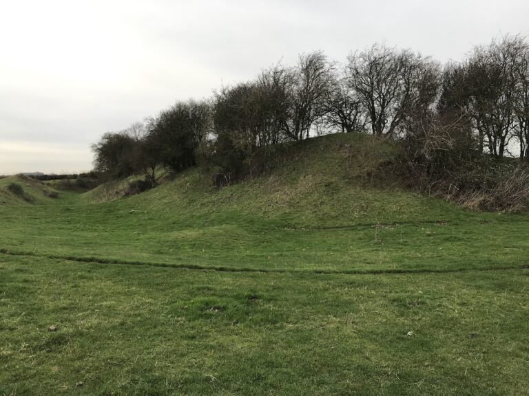
Excavation in July 2012 exposed a ditch approximately 5.5 metres (18 feet) wide, together with an internal bank and a buried soil horizon. Pottery sealed within the deposits dates to the thirteenth and fourteenth centuries. The findings indicated an enclosed area of approximately 7.5 acres (3.0 hectares). Surveys also identified a large linear feature interpreted as either a rubble-filled ditch or a wall marking the edge of the manorial complex, as well as a possible rectangular enclosure around the lodge.
Surviving fabric beyond the ruin
The physical extent of the palace continued beyond the standing chamber. William Senior’s 1630 estate map shows woodland called “The Shroges” and “fless-greave wood,” together with open areas called “Launds,” which have been interpreted as survivals of an ornamental medieval landscape. The map also depicts a house north-west of the ruin, a rectangular enclosure probably representing the village pinfold, and another property farther east along the village street.
The eastern property may occupy the location of the palace gateway. Modern Brammer Farm House and Maun Cottage contain substantial stone walls more than one metre thick, with fabric similar to that of the surviving ruin. Carved and chamfered medieval and post-medieval stone fragments found in the gardens of both properties in 2007 include material at Maun Cottage that may relate to the gateway. Stone foundations, cellars, and walls in other parish properties may also derive from the removal and reuse of palace masonry.
In February 2013, a standing-building survey of Brammer Farm House and Arundel Cottage suggested that the palace boundary wall survives within both properties up to first-floor level, along with bonded return walls and a splayed window. In November 2014, a fragment of high-status window tracery was found in a hedgerow about 100 metres south-east of the ruin. Made of Mansfield White stone, it preserves a glazing channel, the cusps beneath trefoil-headed openings, and a central mullion rising between the springers.