Kerloas Menhir: A Neolithic Standing Stone in France
Site at a Glance
- Popularity
- High
- Country
- France
- Primary era
- Stone Age
- Eras represented
- Stone Age
- Civilizations
- Unclassified
- Site type
- Civic
- Remains
- Megalithic Monument
On this page8 sections
History
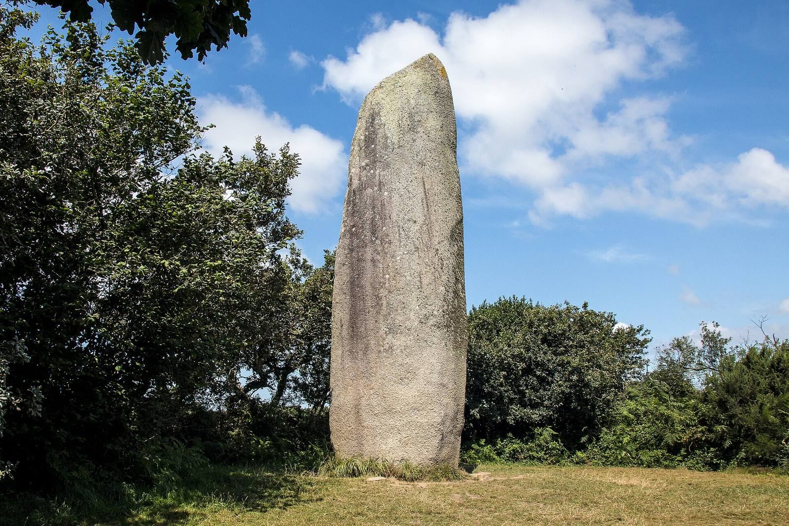
The Kerloas menhir, a large upright stone monument dating to the Neolithic, the later part of the Stone Age, stands at Plouarzel in France. It became a notable landmark for navigators, although its original purpose remains uncertain.
Origins and proposed purpose
Interpretations of the stone’s purpose include a place for meetings or worship, a landmark, a fertility symbol, or an astronomical marker. Some scholars have proposed that the large menhirs in western Léon formed part of an astronomical system. These ideas remain interpretations rather than an established explanation of why the stone was raised.
Historical records and changing accounts
The menhir appears in regional writing from the early eighteenth century. After a tour of the department in 1794–95, Jacques Cambry put its height at 30 feet, or about 10 metres, and attributed the loss of six feet at the top to lightning. Later estimates differed: the Chevalier de Fréminville described it as nearly 40 feet high in 1832, Adolphus Trollope gave a figure of 40 French feet in 1839, Jean-Baptiste Ogée estimated about 13 metres, and Paul du Châtellier gave 11 metres. The cause of the missing upper part remains uncertain.
Local accounts held that pieces detached from the stone were kept as sacred objects on a neighboring farm. The lost tip may have been reused as a trough. An illustration made by Auguste Hervieu in 1839 shows a cross at the summit.
Local traditions and protection
Nineteenth-century traditions linked the menhir with fertility and marriage. Newlyweds were said to rub their stomachs or navels against its raised projections: men hoped for sons, while women sought authority in the household. In another version, a bride brought her husband to kiss the stone to secure that authority. Other couples were said to visit at night before marriage and rub against it in hopes of having beautiful children.
In an early twentieth-century form of the custom, couples visited on the second night after their wedding and kissed opposite sides of the stone. If their lips met at the same level, they believed it foretold sons. Rubbing an ailing body part against the stone was another reported practice. Further local stories said that the menhir could grow, concealed treasure, or had been made by Gargantua, a giant from French literary and folkloric tradition. The monument was classified as a historic monument in 1883, a protected historic site under French law.
Remains
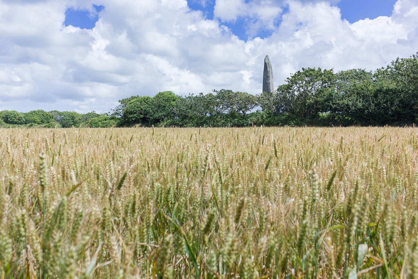
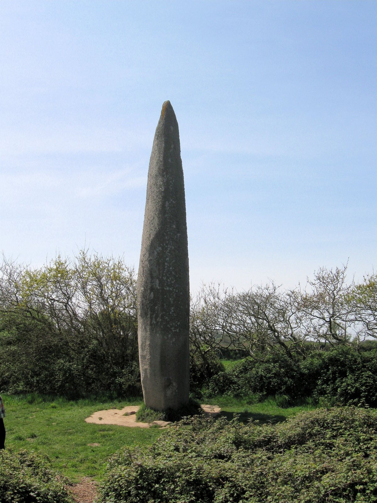
The menhir stands alone on a ridge at an elevation of 132 metres, about 200 metres west of Kerloas farm. It is a single granite stone with two broad faces and two narrower sides. The Kerloas and Kergadiou menhirs lie on a northwest alignment that may once have continued as a longer row.
Dimensions and stoneworking
The stone rises 9.50 metres above ground, is 2.20 metres wide and averages about 1.35 metres in thickness. Its bulging form has an estimated mass of roughly 150 tonnes, and it may extend about two metres below the ground. It is made of Aber-Ildut granite. The nearest outcrops are at least two kilometres away, while the likely extraction area has been placed about three kilometres from the site and nearly 100 metres below it. The surface was shaped almost entirely by pecking, a method of forming stone through repeated blows.
Carved and worn surfaces
Two rounded projections in low relief, each about 30 centimetres across, rise from opposite sides roughly a metre above ground. They have been interpreted as phallic symbols, and may have been carved later than the main stone. The surface is worn and polished around belt height, consistent with accounts of rubbing customs. Seven small cup-shaped marks appear on the western face between 2.50 and 4.50 metres above ground. Two crosses can also be seen on that face in low-angle light, while very eroded engravings remain visible on the northern face.
Base and archaeological evidence
Stones packed around the base stabilize the monument. Treasure hunters damaged them through illicit digging, during which pottery fragments also came to light. The pottery dates to the Bronze Age, the period after the Neolithic associated with the use of bronze, and is dated to around 1700 BCE. Archaeologist Charles-Tanguy Le Roux identified paving around the menhir at a depth of 0.60 metres, extending for about 20 metres.