Kassope: An Ancient Greek City in Epirus
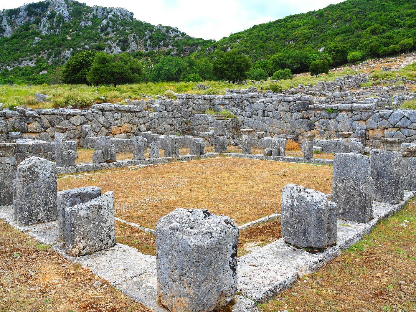
Site at a Glance
- Popularity
- Medium
- Country
- Greece
- Primary era
- Classical
- Eras represented
- Classical
- Civilizations
- Ancient Greek
- Site type
- City
On this page27 sections
History
Kassope was an ancient Greek city in Preveza, Greece, generally dated to about 340 BCE. It became the political center of the Kassopaeans, a Thesprotian community of Epirus, and later developed into a prosperous city with its own coinage and public buildings.
Early settlement and regional role
The site’s earliest settlement dates to the Paleolithic, the earliest part of the Stone Age, and finds suggest that a smaller community preceded the city. An older foundation in the eighth or seventh century BCE by settlers from Arcadia and Elis has been proposed, but the city itself is generally associated with the mid-fourth century BCE. Its formation brought scattered local settlements together.
By the late fifth century BCE, Kassope had become an administrative and political center. Its position near a shared tribal sanctuary, on north-south trade routes and within reach of ports on the Ambracian Gulf and Ionian Sea, supported its growing influence. During the Peloponnesian War, the conflict between Athens and Sparta, Kassope sided with Sparta while other Epirote communities supported Athens.
Macedonian rule and Epirote federations
In 343 BCE, Philip II of Macedon took control of Kassope and neighboring cities and transferred them to Alexander I of Epirus. Philip also dissolved the League of the Elaeans, an association that had included Kassope. The city subsequently joined an association of nearby communities centered on the sanctuary of Aphrodite. Later, the Macedonian general Lyciscus captured the cities and installed garrisons; Epirus then aligned with Macedonian policy.
Kassope took part in an Epirote federation formed after Alexander I’s death and dated to 329 to 325 BCE. Its leaders met in the city’s small covered theatre, the Odeion. Olympias, the mother of Alexander the Great, is also credited with establishing a voluntary federation of Epirote cities. Kassope later belonged to the longer-lived Koinon of the Epirotes, another federation of Epirote communities.
In 312 BCE, Kassope was involved in the conflict between Cassander, a Macedonian king, and Alcetas II, king of Epirus. Around 220 BCE it joined the Aetolian League, a federation of Greek city-states, and continued to prosper.
Aetolian prosperity and Roman rule
Kassope reached its greatest prosperity in the third century BCE. Crafts and maritime trade grew in importance alongside farming, livestock raising, and fishing. Kassopean ships carried wine, oil, olives, fruit, nuts, and textiles to destinations including Carthage, Rome, Brundisium, Massalia, the Adriatic and Aegean regions, Asia Minor, the Black Sea coast, and Egypt. Timber from the region continued to support shipbuilding into the nineteenth century. In 1435, Cyriac of Ancona described the area’s oak and kermes oak, whose processed dye was used in textiles.
Roman forces under the consul Aemilius Paullus destroyed Kassope in 168 to 167 BCE. The city was later reoccupied. In 31 BCE, following the Battle of Actium, a decisive naval victory that established Octavian’s supremacy in Rome, Octavian ordered the inhabitants to move to Nicopolis. A small settlement remained at Kassope until about AD 100.
Rediscovery and excavation
William Martin Leake identified the ruins as ancient Kassope, and his plan of the site was published in 1835. Archaeologist Sotiris Dakaris excavated there from 1952 to 1955 for the Archaeological Society. Work resumed from 1977 to 1983 in cooperation with the University of Ioannina and the German Archaeological Institute.
Remains
Kassope occupies a high plateau on the slopes of Mount Zalongo, at an elevation of roughly 550 to 650 metres. The site overlooks the sea, the Ambracian Gulf, and fertile land to the south. Its planned streets and buildings lie within a setting of mountain ridges and steep cliffs that provided natural protection, especially to the north and west.
Urban plan and housing
Street grid and city sectors
The city followed a regular street grid. At least 20 parallel streets, generally running north to south and measuring about 4 to 4.4 metres wide, were crossed by broader east-west streets. The resulting plan comprised roughly 60 blocks, some of them long and further divided by narrower cross-streets. The southern sector measured about 64 by 152 metres; the central sector was roughly square, about 126 metres on each side; and the northern sector extended for about 70 metres.
Housing and drainage
The built-up area inside the walls covered about 300,000 square metres, with another 370,000 square metres occupied outside them. Estimates place the population at 5,000 to 10,000 and the number of houses at roughly 600. Most houses had two storeys, faced south, and occupied plots of about 225 to 230 square metres. Standard blocks could contain 10 to 16 houses. A shared drainage channel and a covered sewer carried wastewater and stormwater.
One excavated house northeast of the Katagogeion had a central courtyard and forecourt, a reception room used for male dining, a principal room with a kitchen, a bathing room, and service spaces. The house was destroyed in 167 BCE and crudely repaired soon afterward.
Fortifications and hilltop citadels
Defensive walls
A polygonal circuit of local limestone enclosed the city and its two fortified hilltop citadels. The walls were built from stone blocks fitted into polygonal shapes and included regularly spaced projecting sections. The circuit has been estimated at about six kilometres long; its walls generally measured three to five metres thick and reached up to ten metres in height. Where the southern wall crossed steep rock, it measured about 0.8 metres thick. On level ground to the west, a separate measurement gives a thickness of about 3.6 metres and a height of six metres.
At the southwest, an additional defensive wall stood in front of the main circuit on level ground, helping to keep siege engines away. The city’s southwestern extension had walls with towers. Natural cliffs strengthened the city’s northern and western defenses.
City gates
The principal entrances stood to the east and west, alongside smaller entrances. At the eastern gate, a socket cut into the rock survives for a large metal gate. The western gate is about three metres wide and stands nearly a metre above the main street. Its arched upper structure, built from large stones, is well preserved and dates to before 350 BCE.
Acropoleis and cisterns
Two fortified hilltops, known as acropoleis, occupied the northern heights, at elevations of about 748 and 682 metres. Each contained large water cisterns cut into the rock.
Agora and civic buildings
Agora
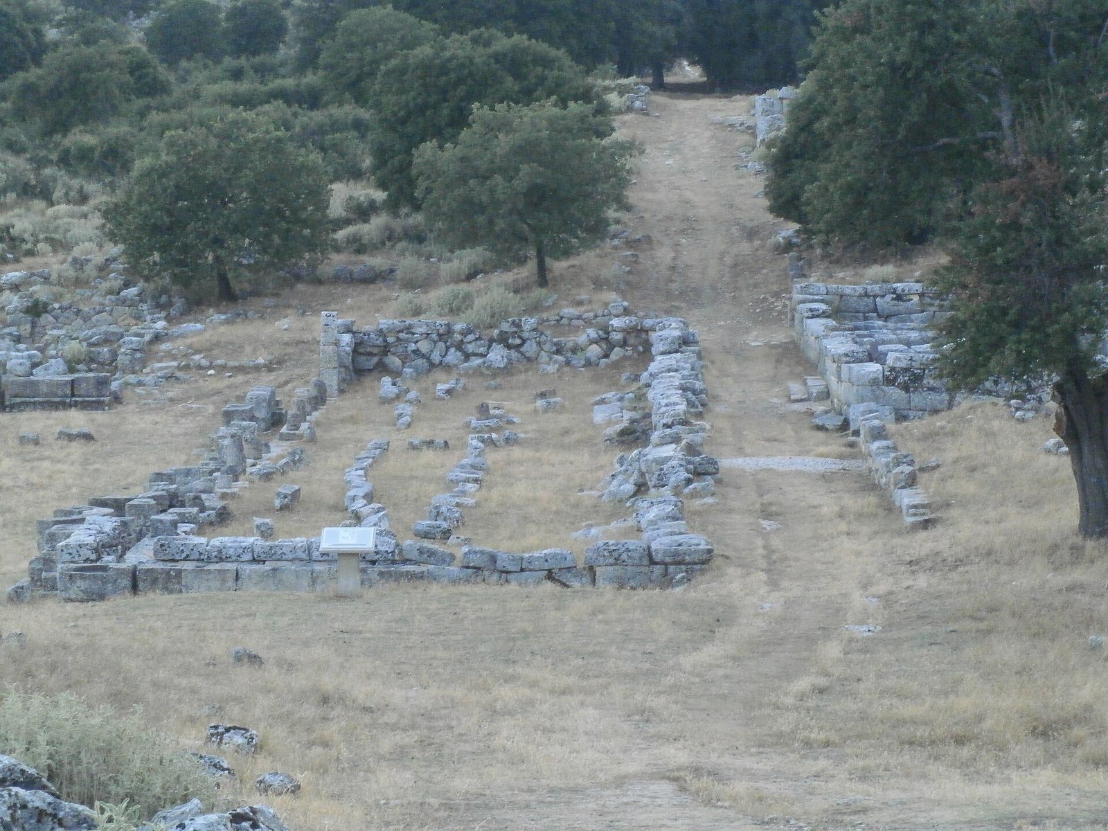
The agora, the city’s public civic and commercial gathering place, occupied the southern sector and measured about 100 by 70 to 80 metres, or roughly 8,000 square metres. It connected directly with a principal street and a city gate and could hold hundreds of people. In the third century BCE, covered colonnades called stoas gave the space a more monumental form.
North Stoa
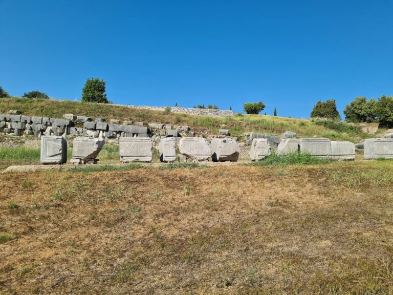
The North Stoa was built during the period of the Koinon of the Epirotes. Its base was made of polygonal stone, while the upper structure used brick reinforced with timber. Seventeen projecting supports stood along its north side. Stone bases in front of the building carried inscriptions or civic decrees dating from the third and second centuries BCE.
West Stoa
The West Stoa stood between the sanctuary precinct and the Prytaneion. It included a colonnaded courtyard with three rows of four columns, six rooms around it, and a further row of 13 columns on its eastern side. These columns followed the Doric style, a Greek form with plain capitals.
Prytaneion
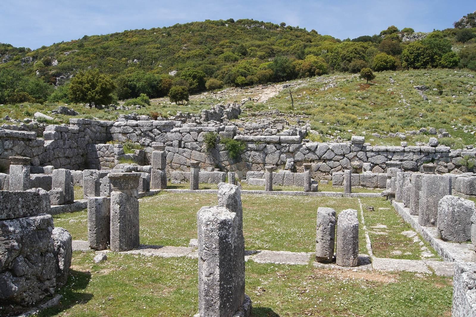
The Prytaneion, a civic building associated with the city’s officials, stood beside the West Stoa. It measured about 33 by 30.3 metres and contained roughly eight rooms around a rectangular courtyard. Twenty-six octagonal stone supports with Doric capitals held the surrounding colonnade, while three similar supports marked the southern entrance. Rooms opening onto the courtyard had hearths and benches used for meals by the prytaneis, the city’s officials. Large timber elements alternated with brickwork in the walls. The building was destroyed in the second century BCE, shortly after Rome defeated Macedon at Pydna in 168 BCE.
Katagogeion
The Katagogeion, a public building that may have served as lodging or as a commercial center, measured 33 by 30.3 metres and dates to about 400 to 350 BCE. Its central courtyard measured 14 by 12 metres and was surrounded by four colonnades supported by octagonal stone piers arranged in rows of seven and eight. Rooms behind the colonnades opened onto them rather than connecting directly to one another. The building had two storeys on three sides and one on the fourth, which was lower to let sunlight reach the courtyard.
Of its 31 rooms, 18 were on the ground floor and 13 upstairs. An internal wooden staircase led to a second-floor gallery, and its stone bases survive. Roof tiles remain and may have been made at nearby Ambracia. An earlier fourth-century BCE building lay beneath the Katagogeion.
Theatres
Small theatre or Odeion
The small theatre, also called the Odeion, stood in the southeastern part of the city. It was partly cut into natural rock, with stone seating and an estimated capacity of about 300 to 500 people. A rectangular enclosure supported the roof over the covered building, and the stage measured 15.4 by 7.6 metres. The venue may have hosted musical and literary events or served as a council chamber. A possible altar to Apollo, a god associated with music and prophecy, stood in front of it. Part of the supporting rock has collapsed.
Large theatre
Built in the third century BCE, the large theatre lay northwest of the city against a hillside. Its seating rested on the slope, and the stage building had six shallow rectangular supports. Its estimated capacity ranges from about 2,500 to 6,000 people. Rockfalls have damaged the structure, including a boulder weighing about 30 tonnes that came to rest in the middle of the stage.
Sanctuaries, tombs, and cemeteries
Aphrodite’s altar and temple
An altar to Aphrodite, the Greek goddess of love, beauty, and fertility, stood in the forecourt of the sanctuary precinct beside the West Stoa. A separate temple dedicated to the goddess stood outside the city, about 200 metres to the east beside the road toward Mount Zalongo. The temple was surrounded by columns, with six across its front, and measured 17.2 by 10.15 metres. A terracotta figurine of Aphrodite was found there.
Southwestern underground tomb
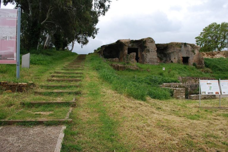
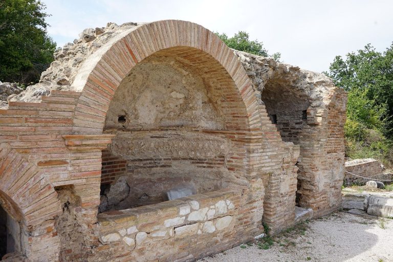
An underground chamber tomb in the Macedonian style lay at the southwestern edge of the acropolis. Worn steps led to a corridor measuring 10.5 by 1.44 metres and then to a main chamber measuring 3.02 by 2.29 by 3.30 metres. The chamber has plastered and painted walls that have deteriorated, and a carved-stone arched ceiling pierced by a hole made by looters. The tomb has been interpreted as the burial place of an important Kassopean noble, possibly an ally of Macedon, or as a shrine for a hero, perhaps the city’s founder.
Northeastern underground tomb
A second underground tomb lay inside the northeastern city wall, separated from other buildings by a projecting defensive structure. A corridor nearly six metres long led to a burial chamber with a semicircular arched ceiling. A small number of remains survive from the structure that stood above the chamber to mark the grave. The tomb may have been a memorial for a local hero, perhaps Amino, proposed as the ancestor figure of the Aminos-Casopians.
Cemeteries
Four cemeteries have been partly excavated. Grave goods recovered from them are held at the Archaeological Museum of Ioannina.