Karpień Castle: A Medieval Frontier Fortress in Poland


Site at a Glance
- Rating
- 4.1
- Popularity
- Low
- Country
- Poland
- Primary era
- Medieval
- Eras represented
- Medieval
- Civilizations
- Holy Roman Empire, Kingdom of Bohemia
- Site type
- Military
- Remains
- Castle
On this page11 sections
History
Karpień Castle is a medieval fortified knightly seat in Poland, above Lądek-Zdrój, established in the fourteenth century to secure the Bohemian frontier against the Neisse ecclesiastical principality. First mentioned in 1346, it became the administrative and principal seat of the Karpień lordship. The castle controlled an old trade route from Moravia through the Platzenberg Pass into the County of Glatz, a historical territory of the Bohemian Crown centred on present-day Kłodzko. Its lords collected tolls from travellers and guarded routes through the upper Biała Lądecka valley, including one later known as the Salt Road. Together with Homole and Rychleby castles, Karpień formed part of a wider defensive system in this area of Silesia.
The Glubos Lords and the Bohemian Crown
The castle’s name came from the Glubos family, whose coat of arms showed a golden carp on a blue field. Thamo the Elder of Glubos, who died in 1337, was the first known lord of Karpień. His son, Thamo the Younger, died in 1345. In 1346, King John of Luxembourg granted the castle and its lordship as a fief, meaning an estate held under the conditions of a superior lord, to the brothers Otto, Reinczko, and Nickel of Glubos. Debt soon changed the castle’s ownership. Karpień passed in 1352 to Frisco of Talewitz and then to Mersan of Parchwitz.
With financial support from towns, nobles, and knights, the future Emperor Charles IV recovered the castle and lordship in 1353. He declared that they should never again be separated from the Bohemian Crown. In 1354, however, he granted them to his brother John Henry, Margrave of Moravia, as an indivisible hereditary fief that could not be sold or pledged. After John Henry’s death in 1378, Charles IV granted Karpień to his nephew Jobst of Moravia for usufruct, the right to receive an estate’s benefits without unrestricted ownership. In 1400, Jobst enfeoffed the brothers Konrad and Eberhard of Nymancz. The fief probably reverted to King Wenceslas around 1408, while the Schaffgotsch family is recorded as its owner in 1412.
War and Destruction
In 1431, King Sigismund granted the Karpień lordship for usufruct to Puta the Younger of Častolowitz, captain of the County of Glatz. After Puta’s death in 1434, the estate passed to his widow, Anna of Kolditz. She sold her possessions in 1440 to the Bohemian nobleman Hynek Kruschina of Lichtenburg and married him that same year. Hynek held Karpień as a pledge-holder of the County of Glatz and became its last usufructuary.
The Hussite Wars, fifteenth-century religious and political conflicts in the Bohemian lands associated with the followers of Jan Hus, had already brought devastation to the surrounding region. A Hussite attack damaged or burned Karpień in March 1428, and another attack three years later caused further destruction. During Hynek Kruschina’s rule, the castle was also used to hold captives and as a base for raids and plundering in the episcopal principality of Neisse, a territory governed by the bishops of Breslau. In 1442, Hynek’s forces attacked and plundered the monastery at Henryków. Forces led by Breslau Bishop Konrad of Oels and allied Silesian princes captured and destroyed Karpień on 15–16 June 1443. The castle was not rebuilt.
Abandonment and Later History
The partly ruined castle remained a refuge for robbers until 1513, when townspeople from Landeck expelled them and levelled the remaining structures. Local inhabitants later reused stone from the ruins as building material. The Karpień lordship was dissolved after the destruction, and its villages became royal chamber villages of the Bohemian Crown. The former territory was subsequently known as the Landeck District, corresponding broadly to much of the modern municipalities of Lądek-Zdrój and Stronie Śląskie.
The settlement below the castle was established between 1571 and 1578 and was first called Kratzdorf. Other chamber villages founded in the former district during the sixteenth and early seventeenth centuries included Karpenstein, Heidelberg, Bielendorf, Wilhelmsdorf, Johannesberg, Kamnitz, Klessengrund, Mühlbach, Neumohrau, and Heudorf. In 1684, the Bohemian Chamber sold the district’s chamber villages to various owners. The city of Landeck acquired the castle ruins that year, having already owned the forest below them since the beginning of the sixteenth century. From the seventeenth century, the ruins became an attraction for visitors to the developing spa at Landeck.
Excavation and Protection
Initial excavations took place in 1847. More extensive work began in 1882 with the support of the Landeck Beautification Association and the Glatzer Mountain Association. German archaeologists exposed walls, passages, and door openings and recovered coins, daggers, horseshoes, and other antiquities. The remains were opened for inspection, and a viewing tower was erected beside them in 1885. The latest recorded archaeological excavations took place in 2009–2010. Karpień is protected as a cultural monument in Poland under registration A/4283/1330, dated 3 August 1965.
Remains
Mountain Setting and Layout
The castle ruins occupy the summit of Karpiak in the Golden Mountains, at approximately 782 metres above sea level. The projecting spur has steep drops on three sides, while the western approach was defended by a deep ditch and rampart. Entry was made through a gate on the north side. Stables and accommodation for the garrison and servants stood outside the main castle.
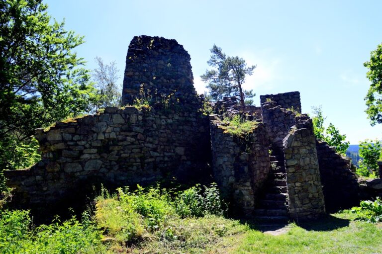
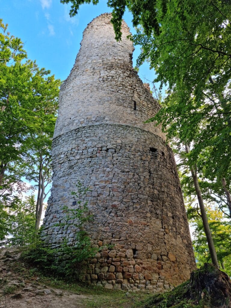
The surviving layout shows three principal divisions: an inner castle containing a tower and courtyard, an outer defensive wall, and an outer settlement or bailey. Today the site consists chiefly of foundations and scattered stones, and the exposed remains continue to deteriorate.
Castle Structures
Inner Castle
The inner castle formed the central fortified area. Its remains include the foundations of a tower and the outline of a courtyard. A boulder in the courtyard bears a plan of the castle carved for tourists in 1883. A stone bench dating from before the Second World War also survives there.
Outer Defences and Bailey
The outer defensive wall enclosed the central area, while the outer settlement or bailey extended beyond it. The western ditch and rampart strengthened the exposed approach, and the northern gate provided access to the castle. A wooden viewing tower was erected on the former outer bailey in 1885 and demolished in 1899.
Condition and Archaeological Evidence
Excavations in 1882 revealed walls, passages, and door openings and brought coins, daggers, horseshoes, and other antiquities to light. The present remains are largely fragmentary foundations and loose stones. The ruins lie within the State Forests and are not secured against further deterioration. Occasional cleaning campaigns have been organized by Polish scouting and the Polish Tourist and Sightseeing Society, but regular conservation work is not carried out.