Kamiishizu Misanzai Kofun: A Keyhole-Shaped Imperial Burial Mound in Japan


Site at a Glance
- Rating
- 3.9
- Popularity
- Low
- Country
- Japan
- Primary era
- Classical
- External website
- Open
- Eras represented
- Classical
- Civilizations
- Yamato
- Site type
- Burial
- Remains
- Burial Mound
On this page13 sections
History
Kamiishizu Misanzai Kofun is a keyhole-shaped burial mound in Sakai, Osaka, Japan, built in the late fourth or early fifth century during the Kofun period. The Kofun period, conventionally dated from about the third to the sixth centuries, was an era when monumental burial mounds were constructed in Japan. Kamiishizu Misanzai Kofun stands in the southern part of the Mozu Kofun Group and is generally dated to approximately 381–400, with its construction associated with the beginning of the fifth century. It is considered earlier than Daisenryo Kofun.
Imperial identification and early history
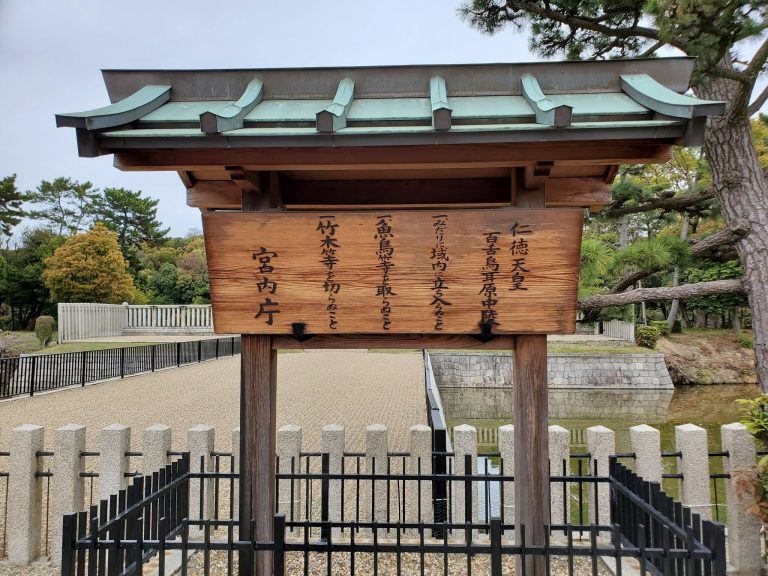
The person buried at Kamiishizu Misanzai Kofun has not been identified. The Imperial Household Agency, the Japanese institution responsible for designated imperial tombs, administers it as Mozu Mimihara Minami Mausoleum, traditionally regarded as the tomb of Emperor Richu, the seventeenth emperor of Japan. Maps from the Edo period already identified the mound as Emperor Richu’s tomb. The name “Misanzai” is thought to derive from misasagi, a term meaning an imperial mausoleum.
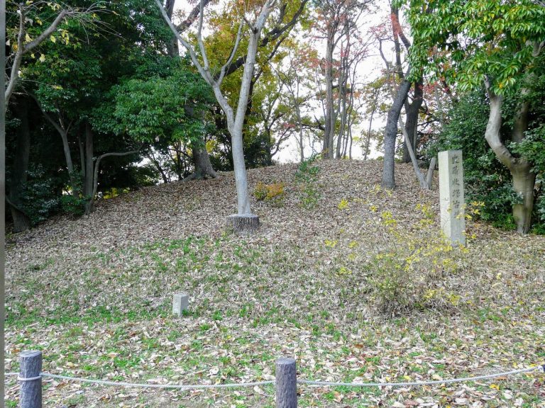
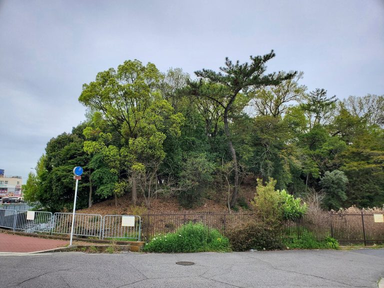
The mound was part of a group of approximately ten smaller satellite mounds. Satellite mounds are burial mounds associated with a larger tomb and are often interpreted as related burial or funerary installations. Shichikannon Kofun and Terayama Minamiyama Kofun survive, and both are thought to have been built at approximately the same time as Kamiishizu Misanzai Kofun. The now-lost Shichikanzan Kofun produced a large quantity of grave goods and may have been used chiefly for depositing funerary objects.
Another mound, called Dozuka and known by several variant names, once stood near the present location of Uenoshiba Station, southeast of the front section. It was approximately 90 meters long and had a keyhole plan with its front section facing west. Its status as a satellite mound remains uncertain.
Investigation, protection, and heritage status
The mound, its inner moat, and its embankments are managed by the Imperial Household Agency. Residential zoning and a scenic district outside that managed area restricted large-scale development. As a result, archaeological work has mainly taken place through surveys before construction and monitoring during building and sewer installation.
Between 1988 and 2004, successive investigations identified sections of the outer moat and examined areas around the eastern, southern, western, and southwestern sides of the mound. Later construction, road formation, pond alteration, moat infilling, and earthmoving had changed parts of the ground, leaving the western and southwestern arrangements difficult to reconstruct. A 2001 investigation behind the rear section found part of the outer moat between Shichikanzan Kofun and the inner moat. The position of the two mounds raises the possibility that they shared a moat.
A publicly funded investigation in 2008 examined five areas along the western side, including Midorigaoka Park and the former site of municipal housing. Park construction, an industrial-water pipeline, and later grading had substantially altered the ground. One area produced a section that might represent embankment fill, but the evidence was insufficient to reconstruct the western embankments or outer moat securely. The investigation also showed that the park had been extensively changed after antiquity. A long pond known as “His Majesty’s Pond” occupied the first three excavation areas, while rice fields once reached the Imperial Household Agency’s embankment near the fifth area.
In 1986, haniwa were illicitly removed from near the summit of the rear circular section, although all the objects were recovered. Haniwa are fired clay objects placed on or around burial mounds, including representations of buildings, weapons, containers, and other forms. Edo-period records describing a large depression at the center of the rear section suggest that the burial facility may already have been robbed. On July 6, 2019, Kamiishizu Misanzai Kofun became a constituent asset of the Mozu Kofun Group within the UNESCO World Heritage property “Mozu-Furuichi Kofungun: Ancient Mound Tombs of Japan.”
Remains
Mound form and construction
Keyhole-shaped mound
Kamiishizu Misanzai Kofun occupies the western edge of a plateau approximately 15 to 22 meters above sea level. Its circular rear section lies to the north, while the rectangular front section faces south. The principal axis is thought to have been aligned parallel to the former coastline so that the mound could be seen from Osaka Bay.
The mound measures approximately 365 meters in length. Its rear circular section is about 205 meters in diameter and 27.6 meters high, while the front section is approximately 235 meters wide and 25.3 meters high. Both sections were constructed in three stepped tiers. Platforms project from either side of the narrow central connection. The eastern platform has deteriorated and appears smaller; it becomes visible when the moat’s water level falls.
Summit mounds and burial facilities
Recent airborne laser surveying identified separate circular earthen mounds on the summits of both the rear circular section and the front section. The summit mound on the front section has two levels, an arrangement for which no parallel is known. A burial facility is conjectured within this two-level mound. The burial facility and its structure in the rear section, together with its grave goods, remain unidentified.
Moats and embankments
Inner moat
A shield-shaped inner moat surrounds the main mound. It is approximately 62 meters wide in front of the rectangular section and about 70 meters wide behind the circular rear section. A substantial earthen embankment was constructed along the western side.
Outer moat
The site now has a single visible moat, but investigations have established that a second outer moat once encircled the mound. Its estimated width was generally 11 to 25 meters, and its depth was about 0.6 to 1.3 meters. The deposits point to a dry moat, with clay-rich layers and no water-bearing layer or evidence of continuous standing water.
On the eastern side, the outer moat measured approximately 11 meters across and 0.9 to 1.3 meters deep. Its bottom was flat, and clay deposits formed an inner shoulder descending in two gentle steps. In front of the mound’s rectangular section, an associated cut reached 1.2 to 1.4 meters in depth. Its slopes were not preserved, but comparison with a former field boundary suggests a width of approximately 18 meters.
Behind the rear section, a stretch between Shichikanzan Kofun and the inner moat was approximately 12 meters wide and 0.6 meters deep. Another feature to the northeast measured about 12.6 meters across and 0.5 meters deep and may also represent the outer moat. Ground cutting probably accounts for its interruption in an adjacent area. On the western side, a north-south depression shown on an earlier map may represent the moat, while a 17-meter-wide depression near the southwestern corner may instead have been a later elongated pond. Earthworks in this area indicate substantial filling and raising of the ground after the moat was abandoned.
Haniwa and investigated embankments
Figurative haniwa
A large group of figurative haniwa included umbrella-shaped, house-shaped, and quiver-shaped examples. The quiver-shaped haniwa represented a container for arrows. Although parts of it were missing, the object was exceptionally large, measuring approximately 1.4 meters high and up to 1.1 meters wide.
Western embankment areas
The five western investigation areas illustrate how later land use affected the surviving mound edges. The first lay within the estimated outer-moat zone, where removal of the moat slope limited the evidence for reconstructing the moat and embankment. The second was near the transition from the rear section to the central connection, on the inner-moat side of the presumed inner embankment. Park fill and industrial-water-pipeline construction had removed the original ground surface.
The third area, near the transition from the central connection to the front section, had been cut into steps toward a road. Sand-mixed clayey soil may represent embankment fill. The fourth and fifth areas had each been levelled by approximately 30 centimeters and contained fill interpreted as former cultivated soil. These surviving deposits preserve evidence of later alteration around the mound, while the original western layout remains difficult to reconstruct.
Nearby sites