Kalich: A Hussite Gothic Castle in Czechia


Site at a Glance
- Rating
- 4.8
- Popularity
- Low
- Country
- Czechia
- Primary era
- Medieval
- External website
- Open
- Eras represented
- Medieval
- Civilizations
- Holy Roman Empire, Kingdom of Bohemia
- Site type
- Military
- Remains
- Castle
On this page18 sections
History
Kalich is a ruined Gothic castle in Czechia above Třebušín, founded by Hussite forces in 1421 under Jan Žižka as a family seat and military strongpoint. Construction began in May, before the Hussite siege of Litoměřice, and the castle was intended partly to shield the besieging forces from Catholic nobles in northwestern Bohemia, especially the Vartenbergs. Jan Žižka was a leading Hussite commander and political figure, while a hetman was a military commander or regional military governor.
Foundation and Žižka’s family
A possible thirteenth-century predecessor linked with the Teutonic Order was once proposed, but archaeological work found no earlier fortification on the summit. It also overturned the former interpretation of a circular rock depression as the castle’s main fortified tower, or bergfried. This term describes a principal defensive tower of a medieval castle.
Zikmund of Vartenberg unsuccessfully besieged Kalich in 1421. From 1422, Žižka used the territorial designation “of Kalich,” identifying him with the place where he held authority or residence. The castle’s name was also associated with the Hussite chalice, a symbol of the movement’s demand that laypeople receive communion in both bread and wine.
After Žižka died in 1424, Kalich probably passed to his brother Jaroslav of Kalich. Following Jaroslav’s death around 1428, the holders included Žižka’s sister Anežka and another relative, Anna. Žižka’s daughter also lived at the castle. Its garrison is thought to have taken part in smaller military actions in northwestern Bohemia and probably fought at the Battle of Ústí in 1426.
Conflicts and rebuilding
Kalich was probably captured during the conflicts of 1437. Emperor Sigismund acquired it from Zikmund of Vartenberg, or exchanged property with him, then ordered its demolition. He placed the Bečkovice estate in pledge to Heník of Valdštejn, who apparently refused to carry out the order and joined Jan Řitka of Bezdědice. Řitka may have protected Anežka after the Battle of Lipany and commanded Kalich’s defenders in 1437. A provincial force led by Zbyněk Zajíc of Hazmburk subsequently besieged the castle without success.
After 1438, Vilém of Ilburk became Kalich’s holder. He certainly possessed it by 1444 and substantially rebuilt the fortress. Kalich appears to have served him chiefly as a military strongpoint rather than as a comfortable residence. After Vilém opposed King George of Poděbrady, the castle was probably captured or surrendered to the royal army during its campaigns in 1467.
Decline and later history
Soon afterward, King George granted Kalich in pledge to Petr Kaplíř of Sulevice, who lived mainly at Vimperk and used Kalich only as a fortress. Ješek Svojanovský of Boskovice held it from 1471 to 1488, but did not reside there and probably failed to maintain it. Václav of Vartenberg incorporated the castle into the Litýš estate in 1489. Kalich was no longer listed in the property exchange between Václav and his cousin Kryštof in 1532.
The castle was still habitable during the late fifteenth century, but it had been abandoned by the end of that century and later fell into ruin. Its appearance during the period of use cannot now be reconstructed precisely from the surviving remains.
In 1868, an attempt was made to remove a foundation stone from Kalich for the National Theatre. The governor of the Litoměřice district prohibited the removal. The stone was instead taken to Lounky and used in 1893 as the gravestone of the politician Václav Kratochvíl, who had initiated the project.
A viewing pavilion and restaurant were built at the castle in the 1880s, although the restaurant closed soon after 1886 because of the small number of visitors. Since 2015, the Hrady Českého středohoří association has leased and maintained the ruin. Archaeological research in 2017 included reconstruction of a dry-laid-stone bastion. Kalich has been protected as a cultural monument since 1964.
Remains
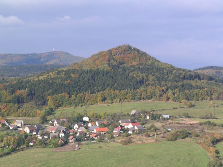
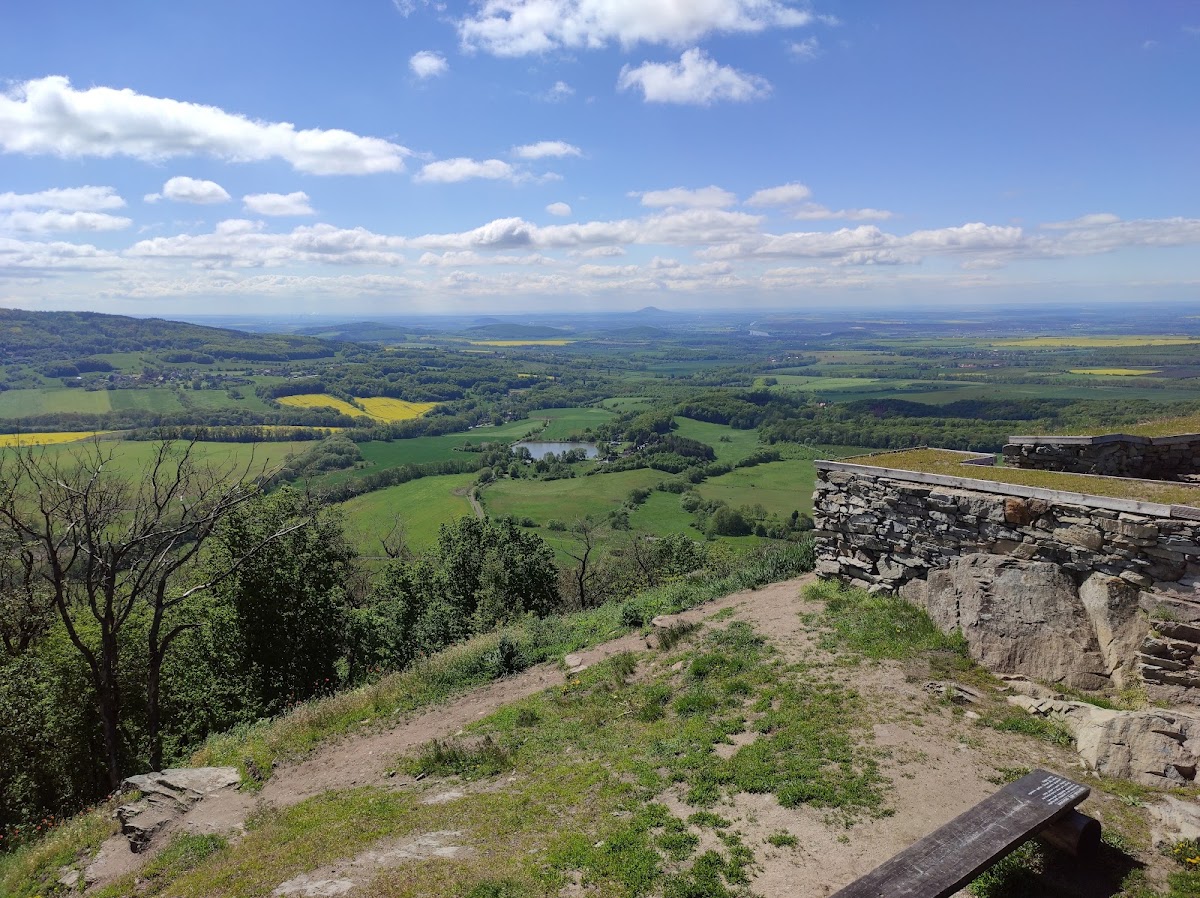
Kalich occupies the summit plateau of Kalich Hill in the Central Bohemian Uplands, at about 530 to 536 metres above sea level. The summit is marked by prominent vertical phonolite cliffs, roughly 40 metres high. Phonolite is a volcanic rock that commonly forms steep, resistant outcrops. The castle core was arranged among northern, western, and southwestern rock formations, while outer defenses occupied the approaches to the summit.
Approaches and outer defenses
Approach routes
The probable approach from Třebušín toward Zababeč and Hlupice followed the line of the present asphalt road before turning toward the castle. It then probably climbed the eastern and northeastern slope to the northern saddle. Weaker evidence indicates a possible route along the western slope as well.
First division
The first division of the castle was a lightly fortified forward position protecting the junction of the approach routes. Its surviving earthworks include an outer rampart and ditch on the eastern and northwestern sides. The northwestern ditch is about 2 metres wide and 0.5 metres deep. A platform in the northern part contains slight traces of a sunken structure measuring at least 3.7 by 3 metres.
Northern bastion
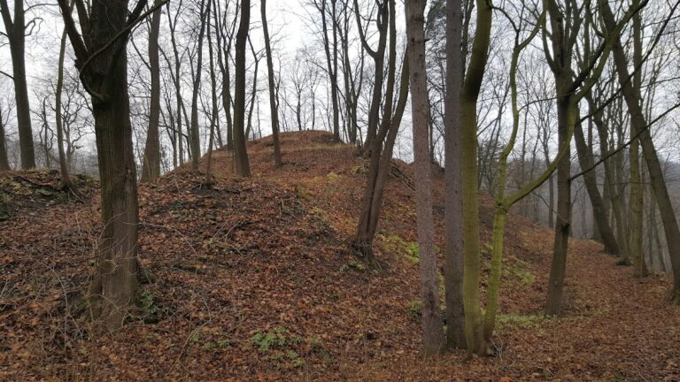
A second gate stood where the narrow neck linking the northern bastion to the summit rocks began. This advanced fortification formed a second division, consisting of a polygonal bastion and a narrow connecting corridor that controlled and defended the approach. The bastion survives as an approximately ten-sided artificial mound faced with dry-laid stones. Its upper diameter is about 12 metres, and its entire body was built from stone.
A wooden upper structure probably stood on the mound. Its boarded or chambered construction used stones laid without mortar. The access corridor narrows to about 5 metres and is protected on both sides by ramparts approximately 3 metres wide. A dry-laid wall is built without mortar, relying on the arrangement and weight of the stones for stability.
Castle core and gates
Outer fortifications
The core was divided across several height levels. Its northwestern outer fortification connected with the second gate and included a wall at least 3.7 metres wide in its surviving form, together with an inner ditch. The wall itself now survives as a rampart. A similar outer fortification protected the southeastern side of the core.
Third and fourth gates
Entry into the core continued through three further gates. The third gate survives only in slight traces. Beyond it, the route ran along the eastern side of the rock beside a wall about 1 metre wide, preserved only to a small height. The stones were bonded with clay. In front of the wall was a berm with a parapet wall, a level strip of ground supporting the defensive edge. After about 20 metres, the route narrowed at the presumed fourth gate before continuing toward the fifth.
Fifth gate
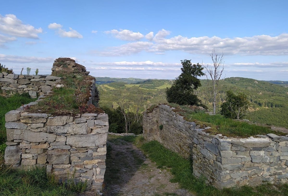
The partially preserved fifth gate has a rectangular plan measuring 8.3 by 6.7 metres. It was built from local trachyte, a fine-grained volcanic building stone, set with lime mortar and occasional bricks. Its single entrance was approximately 1.9 metres wide. A fragment of the gate building shows that a wall once extended from it along the eastern side of the core.
Buildings within the core
Northern rock structures
A better-preserved short wall extends from the northern corner of the fifth gate and curves around the edge of the northern rock. Historical descriptions placed the supposed bergfried in this area, but the circular depression visible in the rock belongs instead to a rectangular building measuring 7.8 by 5.6 metres. This structure was built over the remains of an earlier building that was partly made from small gravel.
Southwestern tower
A structure on the southwestern rock has been interpreted as a rectangular residential tower measuring 13.3 by 8.9 metres. Its ground floor was divided by a partition into two rooms. The circular foundation surviving at this location, however, is the remains of a pavilion built in the late nineteenth century.
Palace and water supply
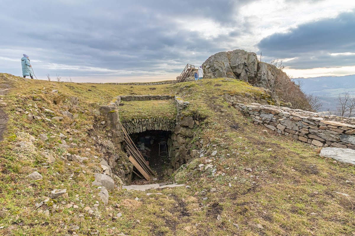
A palace occupied the central part of the core between the northern and western rocks. It measured 34 by 9 metres externally. Its principal surviving remnant is part of a vaulted cellar, which was adapted in the nineteenth century for storing beverages.
North of the palace stood a well or cistern, protected on its northern side by a strong wall. Slight remains of two structures between the gate and palace probably date from the nineteenth century. The collapsed well is visible as a distinct crater.
Construction and preservation
The original defenses relied on embankments with an outer sloping face of dry-laid stones and an inner vertical wall. Some stones may have been bonded with clay, while many ramparts now survive only as loosened stone. Wooden structures, probably boarded or chambered, stood on the stone lower sections. Dry-laid construction increased resistance to bombardment by firearms. The lower stonework probably could not support a stone parapet, while a palisade would have been difficult to anchor.
Surviving walls, ramparts, gate remains, rock-cut or rock-based structures, and other earthworks preserve the organization of the fortress, but they do not allow its original appearance to be reconstructed with precision.