Julliberrie’s Grave: A Neolithic Long Barrow near Chilham
Site at a Glance
- Popularity
- Medium
- Country
- United Kingdom
- Primary era
- Stone Age
- Eras represented
- Stone Age, Iron Age, Classical
- Civilizations
- Roman
- Site type
- Burial
- Remains
- Burial Mound
On this page13 sections
History
Julliberrie’s Grave is an unchambered long barrow, an elongated prehistoric earthen mound, on Julliberrie Downs near Chilham in Kent, United Kingdom. Farming and herding communities probably built it during the fourth millennium BCE, in Britain’s Early Neolithic period, when farming was becoming established after earlier hunter-gatherer lifeways. Its precise date and original purpose remain uncertain.
The Neolithic monument and its later use
The barrow belongs to a group of three monuments associated with the River Stour. Julliberrie’s Grave and Shrub’s Wood Long Barrow lie east of the river, while Jacket’s Field Long Barrow is to the west. The three stand within eight kilometres of one another on the North Downs between Canterbury and Ashford. Together, they represent a local form of the wider European tradition of Neolithic long barrows. Unlike Kent’s Medway Megaliths, a group of chambered Neolithic monuments, the Stour examples were built of earth. Sarsen, a naturally occurring hard sandstone found in parts of southern England, was available in the area, so the choice not to use stone may have been deliberate. Paul Ashbee also proposed a typological link between Julliberrie’s Grave and long barrows on the Sussex chalk downs, more than fifty miles away.
The monument’s role is not settled. It may have served as a territorial marker rather than a burial place, although human remains could have been placed in its northern end, which was later destroyed. The barrow’s form and the polished axe found within it led Stuart Piggott to suggest a date late in the Early Neolithic. During the Iron Age, a hearth was made in the western ditch. In the Romano-British period, meaning Britain under Roman rule, the area around the mound was used for burials and other activity.
Local traditions and antiquarian interpretations
By the twentieth century, local stories described the mound as the grave of a giant or as the burial place of one hundred men and one hundred horses killed in battle. In the latter version, the dead were too numerous for Chilham churchyard. One resident recalled being warned not to climb the mound because standing on a grave was disrespectful. The site was also called the Giant’s Grave and the Grave. The ending of Julliberrie may derive from Old English words for an artificial mound or hill. The first part may refer to a personal name or to a belief that jewels were buried there. Etymologist J. K. Wallenberg suggested that antiquarian speculation may have contributed to the name.
William Camden proposed that the mound was the grave of Laberius Durus, whom he identified as a tribune, a Roman office that could include military command. Camden associated him with Julius Caesar’s second invasion of Britain in 54 BCE. This was an antiquarian theory, not an established identification. William Lambarde, Richard Kilburne, and Thomas Philipott repeated or accepted it in works published in 1576, 1650, and 1659.
John Aubrey visited around 1671 and mentioned the site in a manuscript on British antiquities. Heneage Finch excavated the mound in 1702 with encouragement from Thomas Thynne. He cut a shaft through its centre and extended the work into a trench along the mound. Finch described a chalk cap over dark earth and found bones he considered non-human. He concluded that the mound had been used for burial, but could not determine whose burial it was or when it had taken place. His work is regarded as one of England’s earliest organised barrow excavations.
William Stukeley visited in 1722, 1724, and 1725 and made drawings that Elisha Kirkall later turned into engravings. William Gostling included the barrow on maps in editions of his guide to Canterbury and its surroundings published between 1774 and 1825.
Investigation, damage, and protection
By the early nineteenth century, a fence had been placed around the mound to deter trespass; it had disappeared by the mid-1930s. Chalk quarrying heavily altered the monument, and the northern end was lost. Ronald Jessup considered quarrying the likely cause, while Ashbee proposed that a meander of the river might instead have eroded it. By the mid-1930s, the nearby chalk pit had been inactive for about a century. Rainwater from overhanging trees and ploughing also affected the earthwork.
John Thurnam identified the monument as a long barrow in 1868. Flinders Petrie listed it among Kent’s earthworks in 1880, and O. G. S. Crawford examined and recorded it in 1924. Sir Edmund Davis, the landowner, commissioned and funded excavations directed by Jessup in 1936 and 1937. The eight-week investigation in 1937 chiefly sought evidence for dating. The excavations confirmed the Neolithic long-barrow classification and established the extent of later activity; a report appeared in 1939. After the first excavation, the team filled rabbit holes and removed thorn bushes that were damaging the mound.
Julliberrie’s Grave became a Scheduled Monument in 1981, a designation that provides legal protection for an archaeological or historic site in Britain.
Remains
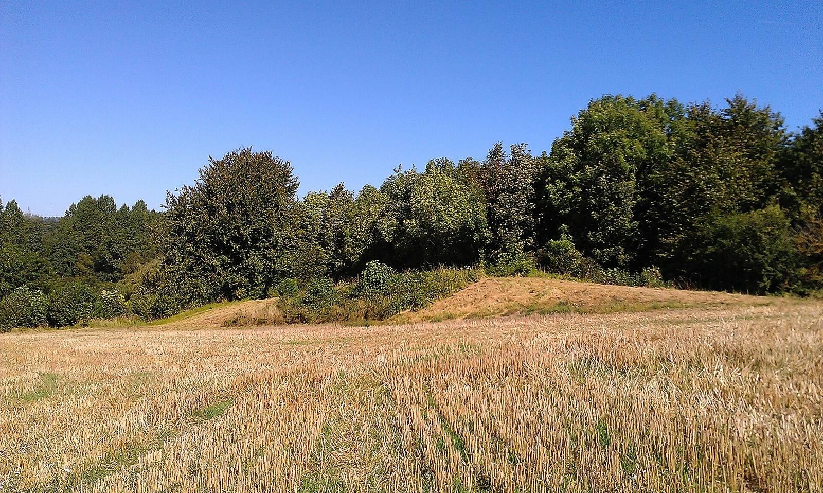
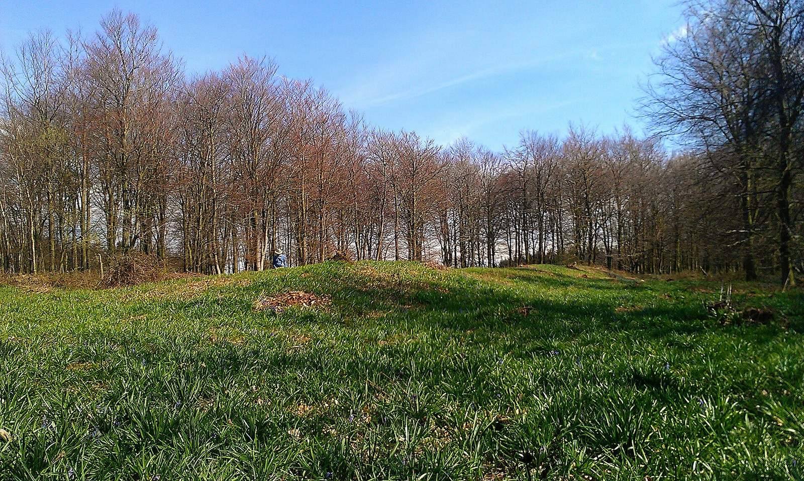
The surviving earthwork stands on a shoulder of downland east of the River Stour, overlooking the river and surrounding landscape. It is a trapezoidal earthen mound aligned north-northwest to south-southeast and classified as an unchambered long barrow. In the mid-1930s, the surviving mound measured about 43.9 metres long, 14.6 metres wide at the north end, and 12.8 metres wide at the south end. Its highest point was about 2.1 metres. A ditch follows the sides and southern end; its course around the lost northern end is uncertain. An antiquarian letter from 1703 gave an earlier length of more than 54.8 metres and a maximum width exceeding 12.1 metres. The mound survives in ruinous condition and has been affected by weathering and ploughing.
Neolithic deposits
Polished axe
Excavators found a broken, polished axe deep in the original turf core at the southern end of the mound. Made from cream-coloured flint, it has been interpreted as a deliberate ritual deposit. Piggott noted similarities to axes from the Netherlands, northern Germany, and Scandinavia. Ashbee suggested that its placement might reflect ritual veneration of axes.
Western pit
A rectangular pit on the mound’s western side measured 4.7 metres from east to west and 2.3 metres from north to south. It reached at least 1.5 metres below the mound surface. Its careful cutting and refilling, together with lumpy chalk and unidentified organic material at the bottom, suggest that something was placed there. Land-snail shells indicate that the pit was broadly contemporary with the barrow. Jessup thought it was probably dug shortly after the mound was built, perhaps to receive a ritual offering.
Iron Age activity
A hearth in the western ditch dates to the Iron Age, a period marked by widespread use of iron. Fragments beside it came from two pots. One was made from friable reddish-brown clay with large flint pieces mixed through it; the other was sandy brown, smooth on the inside, and tempered with fine flint.
Romano-British remains
Burials south of the mound
Four burials dating to the middle of the first century CE were recorded south of the barrow. Burial I was an uncremated child, about five to seven years old, laid on its back with its feet pointing northeast. A bronze brooch used to fasten a shroud, a bronze bracelet on the right arm, and a pottery dish and cup were found with the child. Burial II was an uncremated female, about seventeen years old, laid on her back with her feet pointing west; a dish and cup accompanied her. Between the two, greasy yellow chalk was considered possible evidence of an infant burial.
Burial III included six pottery vessels: a flagon, a beaker, two small cups, a dish, and a wide-mouthed bowl. The bowl held cremated remains from the cranium, thorax, and long bones of a young adult. It lay above six adjoining neck vertebrae and a severed hand. Burial IV was the cremation of an adult, accompanied by an urn and a dish. Evidence pointed to two further burials, but weather halted excavation before they could be investigated.
Southeastern hearth and deposit
A hearth on the monument’s southeast side was later used for a deposit of animal bones, oyster shells, a fragment of a glass cup, and pottery, most of it dating to the first century CE. The pottery included Samian ware, a distinctive class of Roman fine pottery. Large chalk flints covered the deposit. Excavators interpreted it as a rubbish dump and suggested that some of the stones might have come from a collapsed memorial cairn associated with nearby burials.
Other Roman finds
Worn Roman pottery came from the mound’s northwest corner, including a fragment of a second-century Samian cup about 15 centimetres below the turf. Other Roman pottery fragments came from the upper level of the ditch. Eight coins were found beneath the turf at the southern end during the 1930s excavations. Two were illegible and the rest dated to the fourth century; they may have been dropped when a pot of coins from the reign of Constantine was found during nineteenth-century work at the barrow. A separate coin of Magnus Maximus was recovered from ploughsoil.
The 1936–37 excavations yielded 153 worked flint pieces, Iron Age and Roman pottery fragments, and animal bones identified as piglet, fox, cattle, red deer, and sheep. A separate tally for the 1937 work recorded 75 flint flakes as well as the polished axe.